
Robson Valley Timber Supply Area
The Robson Valley Timber Supply Area (TSA) is in east-central British Columbia, covering about 1.46 million hectares and including the communities of Valemount, McBride, Tete Jaune Cache, Crescent Spur-Loos, Dunster and Albreda.
It's bordered to the west by the Wells Gray and Bowron Lake Provincial Parks. To the east are the Willmore Wilderness Area, Jasper National Park, and Mount Robson and Mount Terry Fox Provincial Parks.
The TSA is administered by the Prince George Natural Resource District office in Prince George and a field office in McBride.
On May 22, 2014, an AAC for the Robson Valley TSA was set at 400,000 cubic metres. This AAC includes a partition of 355 000 cubic metres for the more accessible areas.
Adjusted Allowable Annual Cut (AAC)
Effective February 1, 2021, the Robson Valley TSA allowable annual cut (AAC) is 337,574 cubic metres, accounting for First Nation Woodlands Licence (FNWL) N3C adjustment.
In-Progress Timber Supply Review
Current Timber Supply Review
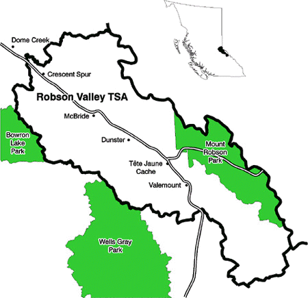
Abutting the Rocky Mountains in east-central B.C., the Robson Valley TSA covers about 1.46 million hectares and includes Valemount and McBride.
Contact information
Feedback is welcome on any issue related to the timber supply review for the Robson Valley TSA. Public input is vital to the timber supply review process.