
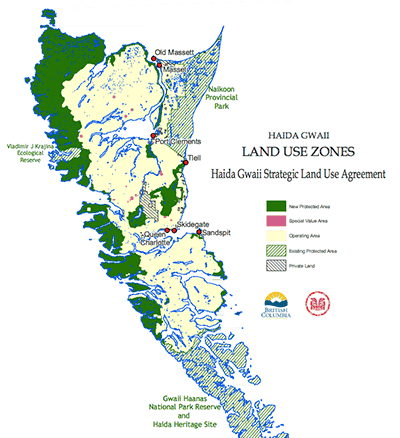
Haida Gwaii Timber Supply Area
The Haida Gwaii Timber Supply Area (TSA), formerly known as the Queen Charlotte TSA, lies entirely within Haida Gwaii, a group of about 150 islands approximately 90 kilometres west of British Columbia’s north coast.
There are two main islands: the larger Graham Island to the north, and the smaller Moresby Island to the south.
Haida Gwaii communities include Masset, Old Masset, Port Clements, Skidegate, Queen Charlotte City and Sandspit. The TSA covers roughly 308,000 hectares of land, and is administered by the Haida Gwaii Natural Resource District.
Effective October 27, 2020 the allowable annual cut (AAC) for the Haida Gwaii TSA was 398,000 cubic metres. Under Section 8(5)(a) of the Forest Act, the volume of red- and yellow-cedar must not exceed 145,000 cubic metres.
Adjusted Allowable Annual Cut (AAC)
Effective September 28, 2021, the AAC for the Haida Gwaii TSA is 272,061 cubic metres due to First Nations Woodland Licence (FNWL) N1G.
Current Timber Supply Review
The Haida Gwaii TSA comprises about 308,000 hectares of land located entirely within Haida Gwaii.
Contact information
Public input is a vital part of the timber supply review process. Feedback is welcome on any issues related to the timber supply review for the Invermere TSA.