
Fort St. John Timber Supply Area
The Fort St. John Timber Supply Area (TSA) covers about 4.6 million hectares in northeastern British Columbia. It includes the communities of Fort St. John, Trutch, Pink Mountain and Taylor and is administered by the Peace Natural Resource District.
In the western portion of the timber supply area, the Muskwa-Kechika Management Area contains protected areas and special management zones that maintain wilderness and wildlife habitat areas.
Partition
Under Section 8(5) of the Forest Act the chief forester in determining an AAC can specify a portion of the AAC that is attributable to certain types of timber, terrain, or areas of the TSA.
The current allowable annual cut will include two partitions:
- 1,200,000 cubic metres per year for coniferous species trees, with a maximum of 672,000 cubic metres annually coming from the core area — the southern and central part of the TSA. Within the core area, spruce should comprise no more than 50% of the conifer volume.
- 915,000 cubic metres for deciduous species trees, with a maximum of 512,000 cubic metres annually coming from the core area — the southern and central part of the TSA.
The partitions address public and First Nations concerns that timber harvesting is concentrated in the core area of the TSA and impacts wildlife habitat.
Current Allowable Annual Cut (AAC)
The Fort St. John TSA’s allowable annual cut (AAC) is 2,115,000 cubic metres, effective May 10, 2018.
News release
Fort St. John TSA cut level remains the same (PDF, 517KB)
Reference # 2018FLNRO112-000874* Released on May 10, 2018
Current Timber Supply Review
- Rationale for AAC Determination (PDF, 1.2MB) May, 2018
- Discussion Paper (PDF, 785KB) November, 2016
- Data Package (PDF, 793KB) May, 2015
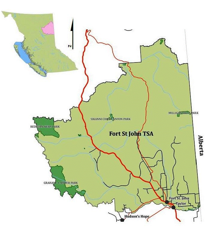
The Fort St. John TSA encompasses about 4.6 million hectares in northeastern B.C.
Contact information
Feedback is welcome on any issues related to the timber supply review for the Fort St. John TSA. Public input is vital to the timber supply review process.