Sea to Sky Natural Resource District Road Safety Information
All users are advised to check local weather and safety advisories, drive to the condition of the road, watch for hazards, and expect industrial traffic. 4WD is highly recommended on all Forest Service Roads. Please report any unsafe issues to the Sea to Sky Natural Resource District office (604-898-2100).
On this page
- Road Closures
- Interactive Map
- Bridge Information
- Traffic Information on FSRs
- Contractor Information & General Resources
- Road Deactivation
Go to the Road Conditions in the Sea to Sky District page for more specific information about road conditions.
Road Closures
Wildlife Act Closures
| April 1 - June 15 |
July 15 - October 31 |
September 16 - November 30 |
Year Round |
|---|---|---|---|
| Ashlu River (PDF, 4.2MB) |
Tenquille Creek (PDF, 1.99MB) |
Lillooet South FSR (PDF, 7.9MB) |
Ryan River (PDF, 8.3MB) |
| Birkenhead River (PDF, 3.9MB) |
|||
| Haylmore Creek (PDF, 5MB) |
|||
| Lillooet South FSR (PDF, 7.9MB) |
|||
| Phelix Creek (PDF, 3MB) |
|||
| Sims Creek (PDF, 3.9MB) |
|||
| Sloquet Creek (PDF, 4.1MB) |
See Region 2 Motor Vehicle Closed Areas and Region 3 Motor Vehicle Closed Areas for a complete list of Wildlife Act closures.
Land Act Closures
See Crown Land Closures.
- Maps (FTP) - georeferenced PDF maps for each winter non-motorized zone defined in the Sea to Sky Land & Resource Management Plan (LRMP)
- 3D Map of Non-Commercial Winter Recreation Zones – Including non-motorized zones and non-motorized with air access zones - 2023 (KMZ, 0.6MB)
- December 1 - May 31: Winter closures in effect: see Winter Non-Motorized Recreation Zones in the Sea to Sky (PDF, 6.4MB).
Public Safety Notices
In-SHUCK-ch FSR
- October 2025 - mid 2026: Catiline Creek Debris Flow Mitigation Project in progress at 7.5km. See SLRD Road and Construction Updates for further details.
- February 17 – March 13, 2026: Between 6km – 7.5km, expect minor delays and high volumes of industrial traffic due to a road realignment project. Construction will be active Monday to Friday, 7am to 5pm. Follow direction of flaggers and signage and drive with caution.
Lillooet River FSR
- Keyhole Hot Springs and the Keyhole-Líl̓watátkwa7 Trail are closed until further notice.
- Meager Creek FSR is closed indefinitely due to land slide; no vehicle or land access to the hot springs via Lillooet River FSR.
Lillooet South FSR
- See Wildlife Act Closures for details on seasonal closures at 2km.
Mamquam River FSR
- January 6, 2026: Branch 03 (Skookum Creek - Access to Watersprite Trailhead) closed to all vehicle traffic due to road reconstruction works.
Squamish River FSR
- September 5, 2025: Road closed at 21km (Mud Creek) due to washout.
Stawamus/Indian River FSR
- August 30, 2024 - December 31, 2026: Road closed to all users at gate at 3km due to construction activities. Expect delays 0 - 3km. Access through Indian Arm not permitted.
See Forest Service Road Conditions in the Sea to Sky District for more details on the above closures.
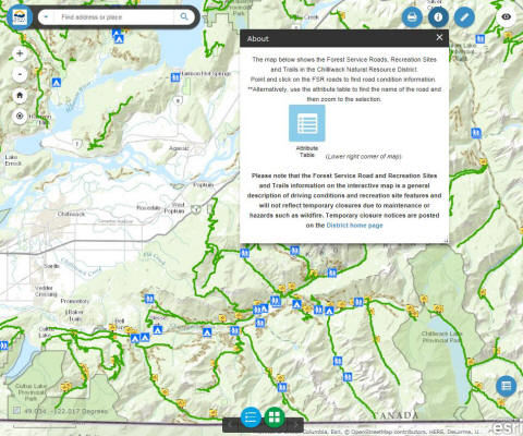
Interactive Map
This interactive map shows the Forest Service Roads (FSRs) in the South Coast Region of BC.
View FSR road access and condition information as well as safety alerts and backcountry information.
Bridge Information
- DSQ Bridge Map (KMZ, 17 KB)
- Bridge Inspection Summary Lookup Table
- Bridge Inspections:
- Forest Bridge Capacity Signage - A Technical Review of Bridge Load Rating (PDF, 1.2 MB)
Traffic use on FSRs
Contractor Information & General Resources
- Sea to Sky District Road Permitting Information
- Volcanic Landslide Risk Management, Lillooet River Valley, BC (PDF, 4.6 MB)
- Weather Thresholds and Operational Safety Planning, Turbid Creek, Mount Cayley, Squamish River Valley, BC (PDF, 4.6 MB)
- Flood Warnings and Advisories - BC River Forecast Centre
- Notice to Contractors - SAFE Certification (PDF, 135 KB) (Effective April 1, 2017)
Road Deactivation
Under Section 121 (9) of the Forest Act, please find notice of the deactivation or transfer of selected Forest Service Roads within the Sea to Sky Natural Resource District.
- Updated January 27, 2025: Complete notification list (PDF, 150KB)
- For additional information, contact Malcolm Schulz
Important Resources
Safety Related Links
Contact information
Please report any road safety issues to the Sea to Sky Natural Resource District office.
604 898-2100

