
Chilliwack Natural Resource District road safety information
On this page
- Road Notices and warnings
- Road closures and restrictions
- Structure information
- Work in progress/upcoming works
- Road deactivation
Road notices and warnings
Due to severe wildfires in the region, some areas have decreased tree-cover resulting in greater amounts of surface runoff during increased precipitation (rain and snow). This may be exacerbated by hydrophobic soils leading to additional runoff which could overwhelm natural and man-made drainage features. Landslides, debris flows, and debris floods can result, threatening public safety and damaging infrastructure. All resource road users are advised to check local weather and safety advisories. Drive to the condition of the road and watch for hazards if heading into the backcountry. For more information on post-wildfire natural hazard risks:
Information Kiosk - Summer 2026
The Ministry of Forests, BC Wildfire Service, in partnership with Natural Resource Officers and local First Nations, are hosting an information kiosk at the intersection of Hicks Lake Road and Harrison East Forest Service Road. The kiosk will provide information on campfire safety, fire prohibitions, reporting illegal activities, safe travel, and respectful use of the area.
For information on the kiosk contact: BCWS.COFCCommunications@gov.bc.ca
Dates:
- Thursday, July 2 – Saturday, July 4, 2026
- Friday, July 31 – Sunday, August 2, 2026
- Friday, September 4 – Sunday, September 6, 2026
Francis Lake FSR 6314.02 (May 12, 2026)
Please drive with caution. The road is narrow at approximately 1. 3 km due to a rock boulder.
Harrison East FSR 5748.01 (July 6, 2021)
“Please be aware of Rockfall Hazard – No Stopping” warning signs located at approximately 13.0 km. For further details see the District Manager Notice.
Liumchen East FSR 5127.4 (December 22, 2025)
Please drive with caution. Tension cracks are present in the road surface at 3.9 km and 4.7 km
Mount Cheam FSR 5127.33 (September 24, 2021)
Please drive with caution due to several deep cross-ditches along the FSR. High clearance vehicle is highly recommended.
Tamihi FSR 5127.06 (April 20, 2026)
“Please be aware of Rockfall Hazard – No Stopping” warning sign located at approximately 3.0 km due to unstable cutslope.
Road closures and restrictions
Wildfire Activity Closure Notice (July 21, 2026)
Notice is given under Section 22.2(3) of the Forest and Range Practices Act, the July 13th, 2026 closure has been amended, the following Forest Service Roads are CLOSED until further notice due to V10755 and V10742 wildfire activity: NAHATLATCH RIVER (6996.01), SCUZZY CREEK (8127.01), MOWHOKAM CREEK (9019.02), EAST ANDERSON (7972.02), NORTH AINSLIE CREEK (8019.01), SOUTH AINSLIE CREEK (9703.01), NORTH BEND (7549.01). Read the notice (PDF, 195KB)
American FSR 8123.01 (February 10, 2026)
Road is closed at approximately 3.5 km and 5.0 km due to a rockfall and a road washout. See further details below:
Anderson 13000 FSR 8074.07 (December 17, 2021)
No access at 0 km, impassable.
Bear Creek FSR 5748.03 (December 17, 2021)
No access past 4.8 km due debris torrent plugged culvert. Entire crossing is washed away. 4.6km Failed culvert. 4.9km tension cracks in the road surface. 12.8 km erosion of the road grade.
Bench FSR 5127.10 (December 16, 2025)
Road is closed between 3.9 km and 13 km due to road washouts, unstable terrain conditions and impacted bridge infrastructure. For further details see the FSR Road Closure Notice December Storm Damage (PDF, 305KB).
Bench FSR 5127.10 (December 10, 2025)
Road closed at approximately 16 km due to unstable conditions and debris across road. For further details see the District Manager Notice (PDF, 235KB).
Bucklin FSR 8013.01 (November 8, 2019)
Road closed at approximately 0.8 km due to a condemned bridge. Structure CK-2231 is downrated to 0 tonnes. For further details see the District Manager Notice.
Cantelon FSR 8124.01 (December 17, 2021)
No access at 0 km due to being blocked by multiple slides.
Chipmunk Creek FSR 5127.12 (December 16, 2025)
Road is closed at 0.0 km due to several slides. For further details see the FSR Road Closure Notice December Storm Damage (PDF, 305KB).
Dewdney FSR 7995.01 (December 17, 2021)
No access at 0 km, impassable.
East Anderson FSR 7972.02 (April 24, 2026)
No access beyond 6.0 km due to a road washout. For further details see the District Manager Notice (PDF, 225KB).
Eaton FSR 7462.01 (December 17, 2021)
No access at 10 km due to washout.
Emory 4100 FSR 8147.02 (December 17, 2021)
No access at o km due to washout.
Eureka FSR 8111.01 (December 17, 2021)
No access at 10 km, impassable.
Foley Creek FSR 5127.04 (December 16, 2025)
Road is closed at 0.0 km due to a road washout. For further details see the FSR Road Closure Notice December Storm Damage (PDF, 305KB).
Fleetwood FSR 8241.08 (May 5, 2020)
No vehicle access beyond 5.0 km on Fleetwood FSR due to a road washout.
Garnet FSR 7558.01 (June 18, 2025)
Road access is restricted at 0.0 km due to environmental concerns. Please contact the Skawahlook First Nations office at 604-796-9129 to enquire about gate access.
Hale FSR 6314.047 (December 17, 2021)
No access at 0 km due to two washed out culverts.
Harrison East FSR 5748.01 (December 17, 2021)
Use caution at 2 km and 13 km due to erosion of the road. Use caution at 16.1 km due to landslide. Use caution at 21.3 km, 22.1 km, 22.6 km, and 22.8 km due to debris across the road. NO ACCESS PAST 55 KM THROUGH TO KOOKIPI FSR.
Hemlock Valley FSR 6314.04 (December 17, 2021)
No access at 0 km due to four washed out culverts.
Hunter Creek FSR 6086.01 (December 16, 2025)
Road is closed at approximately 2.0 km due to impacted bridge infrastructure, CK- 2157 is CLOSED. For further details see the FSR Road Closure Notice December Storm Damage (PDF, 305KB).
Kookipi FSR 6996.02 (December 17, 2021)
No access at 0 km, impassable.
Liumchen FSR 51427.02 (December 18, 2025)
Road is closed at approximately 0.3 km due to flooding. For further details see the District Manager Notice (PDF, 161KB).
Mowhokam East FSR (8019.03) (February 25, 2025)
Notice is given under Section 22.2(3) of the Forest and Range Practices Act, The Mowhokam East Forest Service Road is CLOSED at approximately 6.3km until further notice. The bridge CK-2210 has been downrated to 0 tonnes. District Manager Notice.
Mowhokum FSR 8019.012 (December 17, 2021)
No access at 10 km, impassable.
Mystery 5500 FSR 6314.17 (December 17, 2021)
No access past 0km, washout at 2.0km, cross ditches are not drivable with a pickup at start of FSR.
Mystery 8100 FSR 6314.19 (December 17, 2021)
No access at 1km, road is not drivable.
Nahatlatch FSR 6996.01 (February 11, 2025)
Road is impassable at 21 km due to washout.
Peers FSR 8126.01 (August 8, 2022)
Closed to traffic at 0 km, impassable. Maintenance works ongoing. For further details see the District Manager Notice (PDF, 315KB).
Silverhope FSR 8148.01 (December 17, 2021)
No access at 10 km due to washout at 10km, 12km, and 17km.
Slollicum FSR 5748.04 (December 17, 2021)
No access at 2 km due to washout. Only drivable for the first 2 kms up to washout.
Spuzzum FSR 8128.01 (July 14, 2026)
No access beyond 16km due to tree blowdown and road washouts.
Squeah FSR 6092.01 (September 28, 2020)
Road closed at 0km. District Manager Notice
Tamihi FSR 5127.04 (December 16, 2025)
Road is closed at 3.0 km due to a fillslope failure. For further details see the FSR Road Closure Notice December Storm Damage (PDF, 305KB).
Tshileuh FSR 7978.01 (November 6, 2017)
No vehicle access beyond 4.4 km.
Utzlius FSR 7972.01 (December 17, 2021)
No access due to bridge out at 8km.
Structure information
Please see this table for recent notifications regarding downrated structures in the Chilliwack Natural Resource District.
Structure inspection reports
Structure inspection reports for the Chilliwack Natural Resource District are available to view and download from this FTP location. Please be advised that road users must inspect and ascertain for themselves the condition of the structure prior to use.
Work in progress/upcoming works
Due to the 2021 atmospheric river storm events many forest service roads in the Chilliwack Forest District were damaged. Some may have unmarked hazards, unscheduled delays, have no access or will be closed at short notice. For specific enquiries please refer to the list of road closures and restrictions and visit the Chilliwack District FSR Access Map. As always it is advised to drive with caution and watch for hazards if heading into the backcountry.
Hunter Creek FSR 6086.01 (July 14, 2026)
Upcoming bridge replacement works for CK-2157 at 2.2 km from July 15, 2026 to September 30, 2026. Road is CLOSED to public vehicle access. For more information read the Hunter Creek FSR Variance to Closure notice (PDF, 310KB)
Engagement with First Nations for road maintenance activities
When ground disturbance is expected to happen while carrying out road maintenance activities on Forest Service Roads (i.e. new road construction, road re-alignment, road deactivation) and the ground disturbance may pose a potential impact to Indigenous Interests, Licensees are advised to notify the District Manager (DM) of the proposed/ongoing road maintenance activities. Please see the latest Road Use Permit (RUP) Obligations and Expectations Letter.
Forest Service Road renaming project
For information on FSR names that have been renamed please see the Chilliwack Forest District FSR Renaming Part 1. A final list of the remaining new names will be posted as Part 2 at a later date.
Road deactivation
Anderson 7300 FSR 8074.02 (April 1, 2025)
Road has been retired from 0+000 to 0+209. For further details see the FSR Discontinue and Closure Information.
Anderson 7500 FSR 8074.03 (April 1, 2025)
Road has been retired from 0+000 to 0+322. For further details see the FSR Discontinue and Closure Information.
Anderson 7400 FSR 8074.04 (April 1, 2025)
Road has been retired from 0+000 to 0+378. For further details see the FSR Discontinue and Closure Information.
Anderson 7600 FSR 8074.05 (April 1, 2025)
Road has been retired from 0+000 to 0+794. For further details see the FSR Discontinue and Closure Information.
Anderson 8900 FSR 8074.06 (April 1, 2025)
Road has been retired from 0+000 to 0+222. For further details see the FSR Discontinue and Closure Information.
Cantelon 8400 FSR 8124.03 (December 13, 2024)
Road has been retired from 0+000 to 1+861. For further details see the FSR Discontinue and Closure Information.
Cypress Lake FSR 8337.01 and Radium FSR 5127.19 (January 7, 2019)
The Cypress Lake and Radium Forest Service Roads have been retired. For further details see the FSR Discontinue and Closure Information for Cypress Lake FSR and Radium FSR.
Eight Mile 5700 FSR 8144.02 (December 13, 2024)
Road has been retired from 0+000 to 0+700.For further details see the FSR Discontinue and Closure Information.
Eleven Mile FSR 9352.01 (December 13, 2024)
Road has been retired from 0+000 to 3+580. For further details see the FSR Discontinue and Closure Information.
Fifteen Mile FSR 10452.01 (February 13, 2025)
Road has been retired from 0+000 to 0+517418. For further details see the FSR Discontinue and Closure Information.
South Ainslie Two FSR 9703.02 (December 13, 2024)
Road has been retired from 0+000 to 2+418. For further details see the FSR Discontinue and Closure Information.
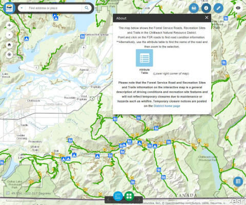
Access the Chilliwack District Forest Service Road Access Information map. This map shows the Forest Service Roads, structure locations and recreation sites and trails in the Chilliwack Natural Resource District. General road information is available by clicking on the road line.
Important resources
Contact information
Please report any road safety issues to the Chilliwack Natural Resource District office.
604-702-5700