
Thompson Rivers Natural Resource District road safety information
 Last updated on September 15, 2026
On this page
- Road notices and warnings
- Work in progress/upcoming works
- Road closures and restrictions
- Bridge information
- Road deactivations
- Road use permit application process
- Research road channel updates
Road notices and warnings
For information on motor vehicle prohibited areas due to Wildfires visit Motor Vehicle Prohibitions - Province of British Columbia (gov.bc.ca)
For information on local hunting restrictions visit Hunting & Trapping Regulations Synopsis - Province of British Columbia (gov.bc.ca)
Work in progress/upcoming works
Bleeker FSR 8631.01 (September 28 - October 31, 2026)
Planned road upgrade between 0km to 2.3km scheduled for September 28 and October 31, 2026. No Access during that time.
Otter Creek FSR 0564.03 (September 19, 2026)
Planned railway crossing work by CN Rail at 0.3km September 19, 2026. Work will commence at1800hrs. No access during the work.
Scottie Creek FSR 5451.01 (September 1 - September 25, 2026)
Road repair is planned for Scottie Creek FSR from September 1 to September 25, 2026 at 4km to 5km. There will be no access through the worksite between 7am and 6pm. No detour available.
Road closures and restrictions
Adams Lake West FSR 7458.01 (September 19, 2023)
Road heavily impacted by wildfire from 0km to 18km. Do NOT stop between 0 and 18km. NO ACCESS during rain events.
Albreda FSR 8421.01 (November 04, 2020)
Closed at 5.85 km due to sink hole and fill slope failure.
Arrowstone FSR 8735 (May 2, 2018)
Closed at 1.5km until further notice due to washout.
Avery-Jones FSR 3631.02
Closed at 5.7 km due to a failed log box culvert.
Battle Creek FSR 8452.01
Permanently closed from 3km to 5km.
Caribou Mountain FSR 9137.01 (November 13, 2025)
The box culvert at 20km failed and will be removed in November 2025. There is no access crossing the 20km section anymore but there is access from the West and South to the FSR section past the 20km section.
Criss Creek FSR 7529.01 (June 12, 2026)
Road closed and deactivated between 8 and 10km due to a large landslide. No Access.
Dixon Creek FSR 7458.01 (April 22,2025)
Road closed for industrial traffic between 1.6km - 4.6km.
Home Cabin Lake FSR 8553.21
Closed at 7.8km until further notice due to a washout.
Oliver Creek FSR 5072.10
Closed until further notice due to land side.
Raft-Raft River FSR 8397.01 (June 2, 2026)
Washout at 60km - No Access. Alternate route to the other is side is through Berry Creek FSR (8410.01).
Road 6 FSR 7669.06 (October 18, 2023)
Road 6 Forest Service Road is permanently closed at 15km (approximately 1km past Moira Lake) due to a collapsed box culvert. There is no replacement planned at this time.
Rogers Range FSR 8412.11 (February 19, 2025)
Closed at 1.4km due to unsafe bridges
Roundtop FSR Branch 3 - 10185.03 (December 1, 2023)
The road section from 6.1km to the end of the FSR is closed due to terrain stability concerns.
Russel Creek Br. 04 - 8534.04 (May 27, 2024)
3km Bridge closed due to unsafe bridge.
Saskum Lake FSR 0562.05
Closed until further notice beyond the Saskum Lake Recreation Site at 33.7km due to an unsafe structure.
Bridge information
Information and inspection records can be accessed through the Corporate Bridge Register. If you do not already have access to this tool, please contact the Thompson Rivers Resource District at DTR.Engineering@gov.bc.ca.
Road deactivation
Discontinued and Closed FSRs with BCTS (Updated Regularly)
Planned Deactivations
Chappel FSR 5923.01 – 0km to 11.8km (Fall 2026)
Planned deactivation Fall 2026. Quad access available.
Dixon FSR 0622.01 - 2.1km to 4.6km (Fall 2026)
Planned deactivation Fall 2026. Quad access available.
Durand FSR 9018.01 – 0km to 7.7km (Fall 2026)
Planned deactivation Fall 2026. Quad access available.
Lempriere FSR – 1.3km to 19.1km (Fall 2026)
Planned deactivation Fall 2026. No access available.
Sargent FSR (8704.01) 2.1897 km to 9.6962 km (Fall 2026)
Planned deactivation fall 2026. Quad access available.
Road use permit application process
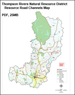
Research road channel updates
Important resources
Contact information
Please report any road safety issues to the Thompson Rivers Natural Resource District office.