
Highway 3 - Hartley Creek Bridge
 Last updated on September 11, 2026
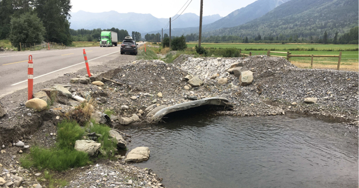
Project site at Highway 3, existing condition May 2023
The Hartley Creek Bridge project, located on Highway 3, approximately 6 km east of downtown Fernie will replace a culvert with a bridge structure to provide a more reliable, resilient, and safe highway crossing.
Traffic impacts
For up-to-date information, visit www.DriveBC.ca
Project overview
Highway 3 is a critical transportation corridor through Fernie and the Elk Valley, supporting daily commuters, commercial goods movement, tourism, emergency services, and regional connectivity between southeastern British Columbia and Alberta.
The existing Hartley Creek crossing has experienced repeated sedimentation and debris accumulation over several years. These issues have required multiple emergency response efforts and have affected the safe and reliable operation of Highway 3, resulting in traffic delays, emergency maintenance activities, and disruptions for residents, businesses, travelers, and commercial transport operators.
Despite repeated operational interventions these concerns persist. After reviewing options and evaluating long-term solutions, replacing the existing culvert with a bridge was chosen.
The project will include:
- Replacing the existing crossing by removing the culvert and building a new single-span steel bridge in the same location
- Installing deep steel pile foundations, abutments at each end, steel girders, and a concrete driving surface with safety barriers
- Rebuilding and paving the roadway to provide smooth and safe bridge approaches and connections
- A more climate resilient structure through improved flood protection and drainage by adding rock armouring, slope stabilization, and a sediment basin to reduce erosion and manage high water flows
- Protecting and restoring the environment with sediment control measures, improvements to fish habitat and planting of vegetation
Status and schedule
The project is in the final stages of technical analysis and detailed design. Work is underway to complete traffic management planning, environmental approvals and procurement activities.
Construction tender is anticipated in 2026.
Project benefits
- Improved highway safety and reliability
- Sustainable and resilient crossing that reduces sedimentation and debris accumulation
- Increased water flow capacity ensuring climate resiliency
- Reduced maintenance and emergency response requirements
- Environmental upgrades including improving fish passage, protecting water quality, and restoring the surrounding habitat
Community updates
Subscribe
Enter your email address to subscribe to updates of this page.
Plan Your Trip
Contact information
Friendly url for this page:
gov.bc.ca/hartleycreekbridge
For specific information about this project, contact:
H3.Hartley@gov.bc.ca