
Dease-Liard Sustainable Resource Management Plan
A land and resource management plan has not been completed for the Dease-Liard sustainable resource management area meaning there is no strategic direction to follow. The Dease-Liard Sustainable Resource Management Plan (SRMP) is primarily a technical process that builds on the draft Dease-Liard area assessment technical document.
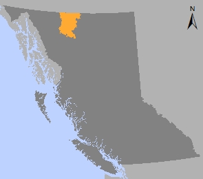
The Dease-Liard Sustainable Resource Management Plan (SRMP) provides resource management direction within the Dease-Liard landscape unit. It was developed in two phases.
The first phase, with a focus on biodiversity, wildlife and timber, was approved in 2004 and a sub-set of objectives was legally established under the Forest Practices Code of B.C. Act. The second phase, approved in 2012, added chapters on minerals and aggregates, oil, gas and energy, tourism and recreation, access and climate change.
The two plans together result in management direction for the full spectrum of resource values in the plan area and a new protected area - Ne'ah Conservancy. Both plans were built on the Dease-Liard Area Assessment technical document developed between 1999 and 2001.
The Dease-Liard is within the asserted traditional territory of the Kaska Dena, Tahltan and Teslin Tlingit First Nations. The majority of the plan area falls within the traditional territory of the Kaska Dena First Nation. The sustainable resource management plans were developed in partnership with the Kaska Dena First Nation and accommodates the Kaska Dena interests. Both the Tahltan Central Council and Teslin Tlingit Council were invited to participate in the planning process. Although the Tahltan Central Council chose not to participate, they did provide input on the second phase of the plan.
Agreements with First Nations
Plans & Plan Maps
- Dease-Liard Sustainable Resource Management Plan: Phase 2 - 2012 (PDF)
- Dease-Liard Sustainable Resource Management Plan: Phase 1 - 2004 (PDF)
Maps 2012
- Map 1 Plan Area
- Map 2 First Nations
- Map 3 Identified Watersheds
- Map 4 Protected Areas
- Map 5 Mining
- Map 6 Oil and Gas
- Map 7 Tourism
- Map 8 GuChaDuga
Maps 2004
- Map 1 - Plan Area (PDF)
- Map 2 - Biogeoclimatic Zones and Ecosections (PDF, 1.4MB)
- Map 3 - First Nations Traditional Territories (PDF, 3.1MB)
- Map 4 - Caribou Winter Habitat Zones (PDF, 1.3MB)
- Map 5 - High Value Moose Winter Habitat (PDF, 1MB)
- Map 6 - High Value Mountain Ungulates Habitat (PDF)
- Map 7 - High value Grizzly Bear Habitat (PDF)
- Map 8 - Fire Management (PDF, 1.2MB)
- Map 9 - Community Use Zones (PDF)
- Map 10 - Heritage Trails (PDF)
- Map 11 - Protected areas and areas proposed by the Kaska for protection (PDF)
- Map 12 - Timber (PDF, 2.2MB)
- Map 13 - Resource Management Emphasis (PDF)
- Map 14 - Visual Quality (PDF)
- Map 15 - Dease-Liard Area Assessment zones (PDF, 1MB)
Legal Direction & Orders
Decision Support Reports
Plan Type: Sustainable Resource Management Plan
Plan Status: Approved, some phase 1 objectives legally established
Plan Area: 2,378,924 hectares
Natural Resource Region: Skeena
Natural Resource District: Skeena Stikine
Timber Supply Area: Cassiar (Dease-Liard Timber Supply Block)
Contact information
Contact us if you have questions about sustainable resource management in the Dease-Liard area.