
Lakes District Land & Resource Management Plan
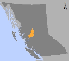
The Lakes District Land and Resource Management Plan (LRMP) provides broad direction for the sustainable use of Crown land and resources in the most eastern extent of the Skeena Region in northwestern B.C.
The planning process began in 1994 and ended in 2000 when a final plan was approved for the entire Lakes timber supply area (formerly part of the Lakes District).
A higher level plan order in 2000 legally established some of the resource management zones and objectives from the Lakes District LRMP. Although Objectives 1 - 5 and 7 were cancelled in 2009 and replaced, Objective 6 regarding management of the Lindquist and Chikamin mineral/wildlife management zone, is still in effect.
Following the Lakes District LRMP, two separate land use planning processes were completed – one for the southern portion of the timber supply area in 2003 (Lakes South SMRP) and one for the northern portion of the timber supply area in 2009 (Lakes North SRMP). Both plans provide specific watershed-scale direction to legally implement objectives from the Lakes District Land and Resource Management Plan.
In addition, changes were made to the visual quality objectives for scenic areas in the Lakes District LRMP to ensure that the visual impacts of harvesting are better managed.
Plan & Plan Maps
- Lakes District Land and Resource Management Plan - 2000 (PDF)
- Visual Landscape Inventory of Nadina Forest Lakes Timber Supply Area (PDF, 16.4MB)
- Figure 1 Lakes Plan Area (PDF)
- Figure 2 Ecosections (PDF)
- Figure 3 Visual Inventory (PDF)
- Figure 4 Biological Ecosystem Network (PDF)
- Figure 5 Resource Management Zones (PDF)
- Figure 6 Intensive Timber Management Areas Sub-Zone (PDF)
- Figure 7 Back Country Lakes Sub-Zone (PDF)
- Figure 8 Recreation Emphasis Sub-Zone (PDF)
- Figure 9 Caribou Migration Corridor Sub-Zone (PDF)
- Figure 10 Ungulate Winter Habitat Sub-Zone(PDF)
- Figure 11 Babine Lake Boating Sites (new protected area) (PDF)
Legal Direction & Orders
Decision Support Reports
Implementation & Monitoring Direction
Plan Type: Land and Resource Management Plan
Plan Status: Approved, some objectives legally established
Plan Area: 1,577,481 hectares
Natural Resource Region: Skeena
Natural Resource District: Nadina
Timber Supply Area: Lakes