
Kalum Land & Resource Management Plan
The Kalum Land and Resource Management Plan (LRMP) was approved by Cabinet in 2001. In 2006, the Kalum SRMP implemented some of the Kalum LRMP objectives and strategies by legally establishing them under a Land Use Objectives Regulation Order for the Kalum LRMP area (excluding the Kowesas landscape unit).
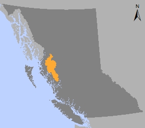
The Kalum LRMP provides land and resource management direction for:
- Kalum TSA
- TFL 1 - Skeena Cellulose
- TFL 41 – Skeena Sawmills (including the communities of Terrace, Kitimat, Kitimaat Village and other surrounding rural communities)
The plan was amended in 2006 to reflect changes resulting from the Nisga’a treaty. In 2012, a Government Action Regulation Order was made for mountain goat ungulate winter range and in 2015 an order for moose ungulate winter range was made.
Plan & Maps
Implementation & Monitoring Direction
Decision Support Reports
Plan Type: Land and Resource Management Plan
Plan Status: Approved, not legally established
Plan Area: 2,178,289 hectares
Natural Resource Region: Skeena
Natural Resource District: Coast Mountains (formerly Kalum)
Timber Supply Area: Kalum and portions of the Pacific and Cascadia TFLs 1 & 41
Contact information
Contact us if you have questions about land and resource management in the Kalum area.