
Kispiox Land & Resource Management Plan
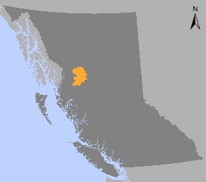
The Kispiox Land and Resource Management Plan (LRMP) covers 1.2 million hectares in west central B.C. The plan was approved in 1996 then amended in 2001 to incorporate land use decisions for the Upper Kispiox and Seven Sisters planning areas.
The Kispiox LRMP provides management objectives and strategies for biodiversity, water, fisheries, riparian areas, roads, cultural heritage resources, protected areas, range and agriculture, recreation, scenic areas, timber, tourism, wildlife, minerals, petroleum and natural gas, and botanical forest products.
In 1996, the Order declaring the Kispiox LRMP to be a higher level plan declared the provisions regarding resource management objectives and zones in sections 6 and 7 of the Kispiox LRMP to be a higher level plan under the Forest Practices Code of BC Act where applicable to operational plans. See district manager letter, below:
To clarify management objectives due to the transition from the Forest Practices Code to the Forest and Range Practices Act, two new orders were approved in 2006 to represent the functional interpretation of the Kispiox LRMP objectives for biodiversity, wildlife and visual quality under the Forest and Range Practices Act:
- Order to Establish the Kispiox Landscape Units and Objectives
- Scenic Areas (outside of Gitanyow and West Babine SRMP areas)
Both orders are in the Kispiox LRMP Higher Level Plan Objectives for Biodiversity, Visual Quality and Wildlife - 2006 under the Kispiox SRMP.
The 2006 Order Establishing the Kispiox Landscape Units and Objectives established all of the landscape units in the Kispiox LRMP area outside of the West Babine landscape unit (Cranberry, Kispiox North, Kispiox South, Lower Skeena, Middle Skeena North, Middle Skeena South, Upper Skeena, Gitseguecla, Suskwa and Babine).
In addition, objectives, indicators and thresholds/measures were established for biodiversity and wildlife for all of these Landscape Units except for Cranberry (which later became part of the Cranberry SRMP in 2012).
Other plans in the Kispiox area include:
- Mill Creek Sensitive Area Plan (legally established 1998)
- Telegraph Trail Plan, May 2000 non-legal)
- Botrychium Basin Sensitive Area Plan, legally established in 2002 by Order to Establish a Sensitive Area and Objectives, pursuant to section 5 of the Forest Practices Code of BC Act)
- Babine River Local Resource Use Plan - 1992
Legal Direction & Order
Implementation & Monitoring Direction
Babine River Plan & Map
Plan Type: Land and Resource Management Plan
Plan Status: Approved, legally established
Plan Area: 1,224,830 hectares
Natural Resource Region: Skeena
Natural Resource District: Skeena Stikine
Timber Supply Area: Kispiox