Durrell Road

Permanently closed. Access route available via Dale Lake Road.
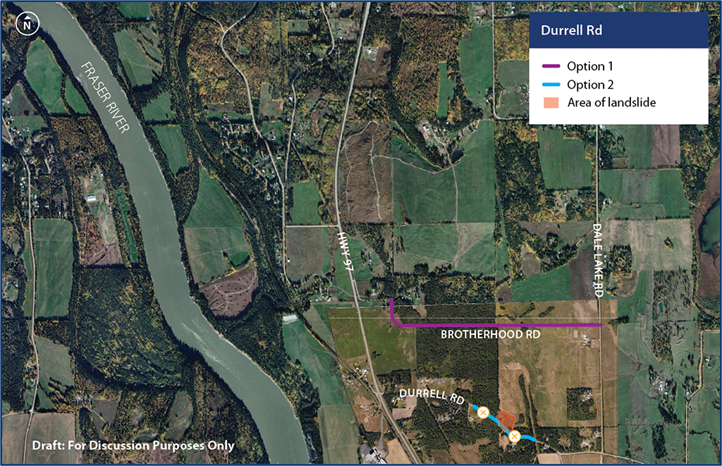
Location map

Durrell Road is located approximately 14 km south of Quesnel.
Status
Following investigation, planning, and options analysis across multiple project disciplines, the Ministry is proceeding with work to permanently close a 400-metre segment of Durrell Road. This portion of Durrell Road has been closed to the public since 2021 due to slide activity that made the road impassable.
Dale Lake Road, which has been used as the primary detour route since 2021, has now become the permanent access route to Highway 97 east of the slide area.
Traffic impacts
Durrell Road remains closed at the slide area and is not accessible to traffic. Concrete barriers remain in place to block vehicle access.
Notification of on-site activities will be posted on this page in advance.
Scope
Work was completed in December 2025 to decommission the closed section of Durrell Road.
The remaining project scope in 2026 includes:
- Drainage improvements and construction of turnarounds at both ends of the closed road segment.
- Resurfacing sections of Durrell Road and Dale Lake Road.
Public engagement
You can share your feedback with the project manager. Use the subscribe feature to be informed of opportunities for public engagement and updates to this page.
Archive
Progress updates
December 2025
Decommissioning work on the closed section of Durrell Road was completed.
April 2025
The Ministry announced the permanent closure of a 400-metre segment of Durrell Road following investigation, planning, and options analysis. Dale Lake Road was confirmed as the permanent access route.
August 2024
Crews adjusted the placement of concrete barriers on Durrell Road.
March 2022
A program-wide engagement period was held to introduce the public to the projects, providing context and an overview of the background, process, and short-listed options being explored.
February 2022
Door-to-door visits to approximately 100 local residences. Feedback on the project was gathered.
November 2021
An in-person drop-in session at Kersley Hall was held to provide updates on the Durrell Road Project.
Spring 2021
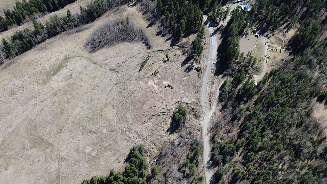
During the spring freshet, a landslide occurred along Durrell Road. The existing road moved 3 to 4 m vertically and 10 to 12 m horizontally and is geotechnically unstable. The road was closed, and alternate routes to Highway 97 for residents on either side of the slide area were identified.
News
Road Projects Improve Safety, Reliability in the Cariboo - April 30, 2025
BC’s Historic Landslides - What They Are and How We Manage Them - May 3, 2022
Notifications
November 2025
Starting the week of November 24, decommissioning work on the closed section of Durrell Road will begin and is expected to take approximately one to two weeks to complete. Ensuring public safety remains the Ministry’s top priority. The work is being undertaken now to improve drainage and reduce future slide impacts.
Looking ahead, further work, including construction of turnarounds and drainage improvements, is anticipated in 2026. Resurfacing of sections of Durrell Road and Dale Lake Road is expected once the turnaround and drainage work is complete.
August 2024
Crews will be on-site to adjust the placement of concrete barriers on Durrell Road. To ensure the public's safety, we ask residents to stay away from work areas.
Photo gallery
Subscribe
Enter your email address to subscribe to updates of this page.
