
Water data and tools
Discover scientific data, information and tools that assist in planning and protecting our water resources.
Groundwater science and tools
Groundwater quantity and quality is assessed by the Province to support the sustainable management of British Columbia’s aquifers. Groundwater science is conducted to help inform decisions and support environmental assessments.
- Visit the Groundwater Science and Data page for links.
Water rights information
Search the databases for detailed information about authorized water use in B.C.
- BC Water Tool
Access information about water availability, existing water users and monitoring data with easy to use, map based tools.
- Community Watershed Tool
Access information about community-held water licences for drinking water purposes.
- Water Licence Query Tool
Use a variety of search terms, including stream name, water use purpose and water licence number, to find information about authorized water use in B.C.
Monitoring and reporting data
Provincial and federal monitoring and reporting provides information about water quantity and quality and other environmental conditions in B.C. and across Canada.
-
British Columbia Regional Streamflow Inventory Reports
B.C. regional inventories of streamflow are developed including 30-year normals. The inventory datasheets present various hydrological characteristics that can be used directly in water resource applications and studies. -
Environmental Monitoring Data System (EnMoDS) is designed to store results from discrete water, air, soil and biological samples collected from ambient and permit monitoring sites throughout the province.
-
Environmental Reporting BC
Access environmental data and learn how it relates to British Columbians. You can track environmental conditions and trends over time and study the connections between the environment, human well being and the economy. -
Provincial Hydrology Program
The program manages the collection of provincial surface water quantity data, primarily river levels and surface water flow. -
Real-time Water Data
A browser-based information and data presentation system that allows timely access to snow and water monitoring data. -
Snow survey data
Download real-time and historical snow data. -
Surface Water Monitoring Sites (Update coming soon)
View the location of Surface Water Monitoring Sites and download analytical results saved within the Environmental Monitoring System. -
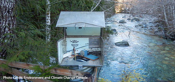
Surface Water Quantity
Access real-time and historical hydrometric data from the Canada-British Columbia Hydrometric Network. These data are collected and reported following National Hydrometric Standards.
Flood and drought information
Learn about areas at risk for flooding or drought in B.C.
- Drought map
This map is updated regularly during spring, summer and fall to show areas of the province at risk of or experiencing drought conditions.
- Flood advisories and warnings
Discover flood warnings and advisories, stream and lake runoff condition forecasts, water supply and low stream flow advisories and snow data information.
- Floodplain maps
Find out more about flood hazards and conditions and areas susceptible to flooding in B.C. It’s part of what we’re doing to help minimize flood damage.
Mapping tools
BC Water Resources Atlas, iMapBC and HabitatWizard are mapping applications that allow you to create your own layers for mapping waterbodies, water related infrastructure and fish habitat.
- BC Water Resources Atlas
Discover water-related data through the BC Water Resources Atlas. The Atlas is an iMapBC application with enhanced query functionality to enable the display of detailed water related data, including watersheds, water quantity and quality monitoring sites, aquifers, water wells and flood protection works. This tool is designed for use with Internet Explorer and may not work as well in other web browsers.
- HabitatWizard
Access detailed fish and fish habitat information using this map based tool.
- iMapBC
The current version of iMapBC allows the user to view and analyze the thousands of geographic datasets stored in the B.C. Geographic Warehouse, upload their own map data and print or email the results of their work.
Climate tools
Discover long-term weather station data.
DataBC
Sharing your water data will support a greater understanding of our water resources, and enable sound, science-based decisions, as well as track changes to our water resources over time.