
Nass South Sustainable Resource Management Plan
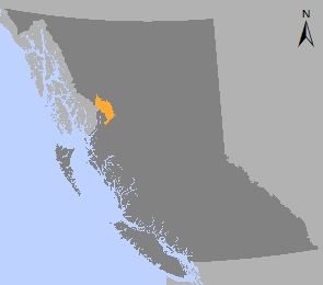
The Nass South Sustainable Resource Management Plan (SRMP) is a landscape level plan that addresses sustainable management of land, water and resources in the southern portion of the Nass timber supply area.
The Nass SRMP was approved by government in 2012 after it development in partnership with forest industry stakeholders, the Gitanyow First Nation (as part of the Huwilp Recognition and Reconciliation Agreement), the Nisga’a Lisims government, and the B.C. government.
In 2016, many of the objectives, measures and targets from the plan were established as legal objectives under the Land Act respecting forest and range activities. Old growth management areas were also legally established under the Oil and Gas Activities Act respecting oil and gas activities. The remainder of the plan is government policy.
Plan & Plan Maps
- Nass South Sustainable Resource Management Plan - 2012 (PDF, 3MB)
- Map 1 Nass South Plan Area (PDF, 5.2MB)
- Map 2 Landscape Units (PDF, 5.2MB)
- Map 3 BEC (PDF, 4.3MB)
- Map 4 Vegetation Cover (PDF, 4.7MB)
- Map 5 Timber Harvesting Land Base (PDF, 5.2MB)
- Map 6 Visual Quality Objectives (PDF, 5.1MB)
- Map 7 Gitanyow (PDF, 5.2MB)
- Map 8 Nisga' a (PDF, 3.7MB)
- Map 9 Equivalent Clearcut Areas (PDF, 5.1MB)
- Map 10 Old Growth Management Areas (PDF, 5.2MB)
- Map 11 Ecosystem Network (PDF, 3.4MB)
- Map 12 Moose Winter Range (PDF, 5MB)
- Map 13 Goat Winter Range (PDF, 5MB)
- Map 14 Grizzly Bear Specified Areas (PDF, 5.1MB)
- Map 15 General Wildlife Habitat (PDF, 5MB)
- Map 16 Goshawk Habitat (PDF, 5.4MB)
- Map 17 Gitanyow Treaty Offer (PDF, 5.2MB)
- Map 18 Water Management Units (PDF, 5.2MB)
- Map 19 Protected Areas (PDF, 5.2MB)
- Map 20 Hanna-Tintina Protected Area (PDF, 3.1MB)
Legal Direction & Orders
Gitanyow House Territory Maps
Socio-Economic Assessment
Plan Type: Sustainable Resource Management Plan
Plan Status: Approved, some ob legally established
Plan Area: 662,495 hectares
Natural Resource Region: Skeena
Natural Resource District: Coast Mountains (formerly Kalum)
Timber Supply Area: Nass
Contact information
Contact us if you have questions about the Nass area.