
Kalum Sustainable Resource Management Plan
The Kalum Land and Resource Management Plan (LRMP) was approved by Cabinet in 2001. In 2006, the Kalum SRMP implemented some of the Kalum LRMP objectives and strategies by legally establishing them under a Land Use Objectives Regulation Order for the Kalum LRMP area (excluding the Kowesas landscape unit).
The Kalum SRMP area contains legally established wildlife habitat areas for coastal tailed frogs, and ungulate winter range for mountain goats and for moose (UWR 6-009) for the Kalum timber supply area and TFL 1 and TFL 41.
Part of the Kalum SRMP area is within the southern boundary of the Nass and Nass wildlife area. The Kalum SRMP recognizes that the Nisga’a Final Agreement establishes a number of joint Nisga’a/provincial/federal committees to facilitate the planning of certain activities in those areas.
In December 2017, two amendments were made to the 2006 Land Use Objectives Regulation Order associated with the Kalum SRMP. One amendment. consisting of several objectives, was made to fulfill the Gitanyow Recognition and Reconciliation Agreement (2012) between the B.C. government and the Gitanyow Hereditary Chiefs; the other was made to Objective 10 of the Order to better protect the Skeena Islands and bring into force the best management practices for the area as directed by the Kalum SRMP. Also, old growth management areas were established under the Oil and Gas Activities Act to be consistent with those already established for the purposes of the Forest and Range Practices Act.
Plan & Plan Maps
- Kalum Sustainable Resource Management Plan - 2006 (PDF)
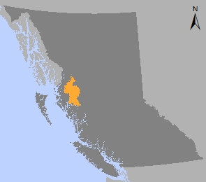
- Map 1: Plan Area (PDF, 3.4MB)
- Map 2: Biogeoclimatic Zones (PDF, 6MB)
- Map 3: Landscape Units and Undeveloped Watersheds (PDF, 3.1MB)
- Map 4: Old Growth Management Areas (PDF, 6.3MB)
- Map 5: Wildlife Connectivity Corridors (PDF, 3.1MB)
- Map 6: Skeena Islands Rare Ecosystems Conservation Value Ranking (PDF, 1MB)
- Map 7: Grizzly Bear Identified Watersheds (PDF, 3.3MB)
- Map 8: Area Specific Management (PDF, 3MB)
- Map 9: Community Watersheds (PDF, 2.9MB)
- Map 10: Tailed Frog WHA and Mountain Goat UWR designations (PDF, 3MB)
Legal Direction & Orders
- An Order to Amend OGMA Objectives in the Kalum SRMP under the Environmental Protection and Management Regulation – 2019 (PDF)
- An Order to Amend OGMA Objectives in the Kalum SRMP under the Land Use Objective Regulations – 2019 - (PDF)
- Amendment to Land Use Objectives in the Kalum SRMP - December 2017 (Kiteen area only) (PDF 3MB)
- Spatial Data: Kiteen LUOR Dataset
- Amendment to Land Use Objectives in the Kalum SRMP - December 2017 (Skeena Islands only) (PDF)
- Spatial Data: Skeena Islands Dataset
- Environmental Protection and Management Regulation Order Kalum SRMP - December 2017 (PDF)
- Spatial Data: Kalum OGMAs
- Order to Amend OGMA Objectives in the Kalum SRMP Area - 2008 (PDF)
- Order to Amend OGMA Objectives in the Kalum SRMP Area - 2007 (PDF)
- Order Establishing Land Use Objectives in the Kalum SRMP Area - 2006 (PDF)
- Order Designating Community Watersheds - 2006 (PDF)
OGMA Map Updates & Amendments
Plan Type: Sustainable Resource Management Plan
Plan Status: Approved, objectives legally established
Plan Area: 1,642,270 hectares
Natural Resource Region: Skeena
Natural Resource District: Coast Mountains (formerly Kalum)
Timber Supply Areas: Kalum and portions of the Pacific and Cascadia TFLs 1 and 41
Contact information
Contact us if you have questions about land and resource management in the Kalum area.