McTaggart-Cowan/nsək’ɬniw’t Wildlife Management Area
AREA CLOSED:
Notice is hereby given that the McTaggart-Cowan/nsək'łniw't Wildlife Management Area, located in the traditional territory of the syilx people, is (i) closed to mushroom picking, camping and motor vehicle use throughout, and (ii) closed to public access within the Christie Mountain Fire and Thomas Creek Fire burn perimeter effective October 15, 2021 by order made under the authority of section 7(4) of the Wildlife Act ([RSBC 1996] CHAPTER 488).
This order aims to reduce impacts to wildlife habitat and cultural values within the WMA as a result of public use. Penticton Indian Band and the Province are working collaboratively to assess and monitor public use in the WMA following the wildfire.
Date Designated: March 19, 2013
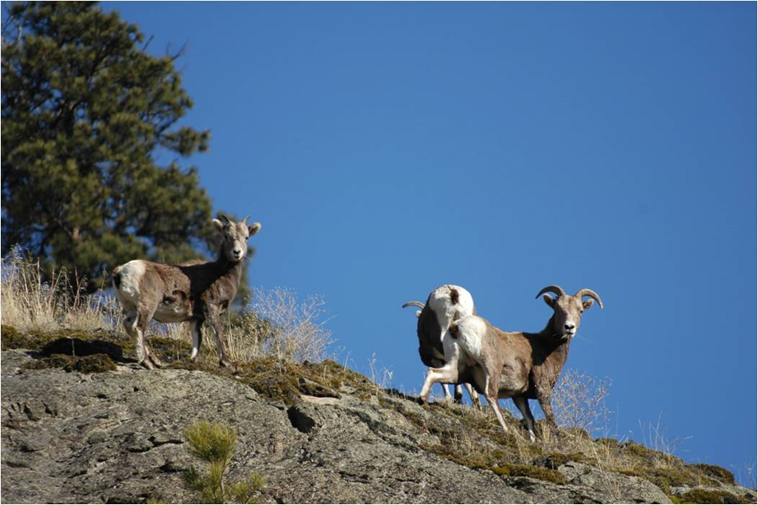
Purpose: Management of all habitat types required for California Bighorn Sheep.
Size: 6,491 hectares
Region: Thompson/Okanagan
Nature and culture
Fish and Wildlife: This WMA has regionally significant habitat values for wildlife. It contains a large area of contiguous, generally non-roaded habitat, which includes lambing areas, escape terrain, and winter and spring foraging areas for California Bighorn Sheep. The WMA also provides winter habitat for Mule Deer, Elk, and Mountain Goat. Predators, such as Cougar and Coyote, are fairly common because of the year-round presence of these ungulates. One can also find habitat for smaller wildlife species such as raptors, songbirds, small mammals, reptiles and amphibians.
Physiography, Climate and Vegetation: The area ranges in elevation from 700 metres to 1,260 metres and is within very dry biogeoclimatic zones. The topography is characterized by rock outcrops, steep cliffs, and grasslands. There are also Douglas-fir and Ponderosa pine forests at the lower elevations, Lodgepole pine and Larch forests in the upper elevations, and a mixture of Cottonwood and Water Birch stands within the riparian areas. Two conservation properties that are owned by The Nature Trust of British Columbia have been incorporated into the WMA.
Cultural Heritage: The name of the WMA honours long-time conservationist Dr. Ian McTaggart-Cowan and the Penticton Indian Band. The word, nsək’ɬniw’t, is roughly translated from the Syilx language as “a gash on the side” and refers to a trail that was used by First Nations for travel, trade, and access to medicine-gathering areas.
Planning and management
Information on management direction and possible restrictions on visitor activities are available from the Conservation Lands regional contacts.
Management Partners:
Image
The Mctaggart-Cowan/Nsək’ɬniw’t WMA lies southeast of Penticton and east of Skaha Lake.

