Columbia Wetlands Wildlife Management Area
Date Designated: April 30, 1996
Purpose: Conservation and management of fish and wildlife habitats and landscape connectivity so that the Columbia River Wetlands continues to function as a floodplain ecosystem with a complex biological community governed by natural fluvial and ecological processes.
Size: 16,969 hectares
Region: Kootenay/Boundary
Nature and culture
Fish and Wildlife: The Columbia Wetlands provide habitat for a diverse range of wildlife, including numerous species at risk. The areas is a vital component of the Pacific Flyway, a waterfowl migration route which stretches from nesting areas on the Arctic Ocean to wintering grounds in South America. The wetlands provide nesting, feeding and resting sites which are used intensively by a wide variety of birds, including great blue heron, osprey, kingfisher and bald eagle. bighorn sheep, moose, elk and other ungulates live here, especially in winter. Cougar, wolf, coyote, black bear, grizzly bear, badger, beaver, muskrat and many small mammals use the area, along with a number of imperilled and critically-imperilled species. The Columbia Wetlands are critical for maintaining regional populations of several species of amphibians and reptiles, including the leopard frog, painted turtle and rubber boa. In addition, a variety of fish species occur, including Westslope cutthroat trout and bull trout.
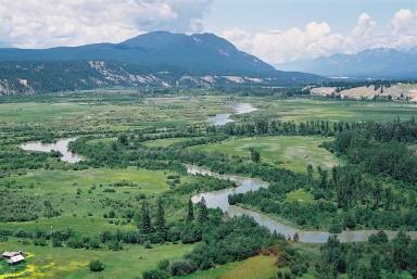
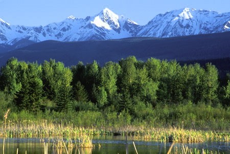
Physiography, Climate and Vegetation: The Columbia Wetlands are located in the Rocky Mountain Trench, a long, wide valley between the Rocky Mountains to the east and the Purcell Mountains to the west, within the Interior Douglas-fir and the Interior Cedar-Hemlock biogeoclimatic zones. The Trench is 3 to 5 kilometres wide with sloping benches on either side of the valley floor. The Columbia River floodplain is very flat and varies from 1 to 2 kilometres in width. The area consists primarily of riparian and wetland habitat along the floodplain of the Columbia River, including lakes, marshes, ponds, swamps, and flowing and standing water. Vegetation on levees and in some slightly drier benchland areas includes trees such as hybrid white spruce, black cottonwood, and aspen, along with grasslands and shrubs such as willow, alder, rose and red-osier dogwood. On the flood-plain itself there is a mosaic of emergent species, including hardstem bulrush, cattail, horsetail and sedges and a variety of submergents and other aquatic plants such as bladderwort, bondweed, yellow water lily and arrowhead.
Cultural Heritage: The Columbia River system has a long history of occupation by First Nations. Prior to the development of hydro-electric projects downstream from the WMA, the Columbia River was a major salmon-producing stream and vital food source. There are numerous important First Nations archaeological and traditional-use sites in the wetlands and surrounding area, some dating back more than 12,000 years. Camps and settlements of the K'tunaxa people, as well as dozens of underground pit houses of the Shuswap people have been identified.
Planning and management
Information on management direction and possible restrictions on visitor activities are available from the Conservation Lands regional contacts.
Image
The Columbia Wetlands WMA encompasses the Columbia River, extending 180 km from the headwaters of Columbia Lake near Canal Flats to the head of the Mica Reservoir just north of Donald in the Rocky Mountain Trench.


