
Roberts Bank Wildlife Management Area
Date Designated: September 7, 2011
Purpose: Management of critical habitat for fish, waterfowl, shorebirds, raptors, and other species.
Size: 8,770 hectares
Region: South Coast
Nature and culture
Fish and Wildlife: The Roberts Bank WMA provides critical wintering grounds for the highest number of waterfowl and shorebirds found anywhere in Canada, including at times up to eight per cent of the entire North American population of Dunlins, four per cent of its Trumpeter Swans, and three per cent of its Black Bellied Plovers. American Wigeon, Northern Pintail, Mallards, Green-winged Teal, Wrangel Island Snow Geese, and Black Brant can often be seen in the thousands. In addition to shorebirds and waterfowl, Great Blue Herons, Barn Owls, Short-eared Owls, Virginia Rails, American Bitterns, Soras, Northern Harriers, Bald Eagles, Red Tailed Hawks and Peregrine Falcons are found here. In some places in the expansive mud flats more than1,000 invertebrates have been recorded in a 10-centimetre diameter core of mud. On the mud surface, a “biofilm” is produced as diatoms and bacteria settle out of the seawater and bind to the mud, providing extraordinary amounts of nutrient-rich forage for huge flocks of sandpipers. The WMA is also a main entry channel into the Fraser River for one of the largest salmon runs in the world, where more than 800 million Sockeye, Chum, Chinook, Pink and other salmon migrate through each year, using the tidal marshes for food, shelter and acclimatization to salt water. Other fish drawn to Roberts Bank include White Sturgeon, Green Sturgeon, Steelhead and anadromous Cutthroat trout. Visiting herring, eulachon, flounders and sculpins are a food source for diving and wading birds. Sea mammals such as endangered Killer Whales, Harbour Seals, California Sea-lions, Muskrat and Beaver, and terrestrial mammals such as Creeping Vole, Townsend's Vole, Eastern Cottontail, Striped Skunk and Coyotes also frequent the WMA.
Physiography, Climate and Vegetation: The Roberts Bank WMA contains both intertidal and nearshore subtidal lands. Salt marsh occurs near the high-tide level as a vegetated bank of flat-to-hummocky muddy sediment. This gives way to a gently sloping platform mantled with sand and divided by tidal channels and hydraulic bedforms. The dominant vegetation species include a variety of saltwater and freshwater marsh grasses. The climate is strongly influenced by the surrounding mountains. During the winter, low pressure systems move in from the Pacific Ocean and lead to heavy precipitation; long periods of warm, sunny weather occur from April to September due to large, high pressure systems.
Cultural Heritage: Heritage sites in this WMA include a historic fishing cannery and a former First Nations village.
Planning and management
Information on management direction and possible restrictions on visitor activities are available from the Conservation Lands regional contacts.
Image

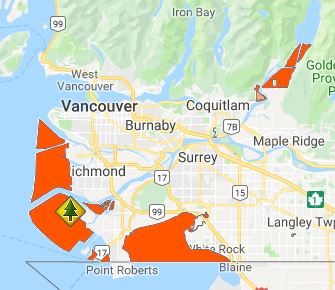
The Roberts Bank WMA is located at the delta front of the Fraser River estuary, encompassing intertidal, nearshore subtidal and salt marsh environments.