
Cluxewe Wildlife Management Area
Date Designated: April 6, 2001
Purpose: Conservation of a unique isolated salt marsh and estuary habitats in close proximity, providing an important wetland complex for waterfowl.
Size: 137 hectares
Region: West Coast
Nature and culture
Fish and Wildlife: Many songbird species reside in the WMA through the summer, while hundreds of waterfowl inhabit the area from fall through spring. The Cluxewe River provides excellent spawning and rearing habitats for six salmonid species. Shellfish, herring and groundfish inhabit the area. Typical of the rich diversity of east coast Vancouver Island estuaries, black bear, black-tailed deer, nesting songbirds and many seasonal waterfowl like trumpeter swan, green-winged teal, mallard, pintail, surf scoter and harlequin duck can be found.
Physiography, Climate and Vegetation: The WMA is comprised of a rare combination of river estuary and salt marsh in close proximity. It is located in the Hecate Depression within the Coastal Western Hemlock biogeoclimatic zone, which is one of the wettest in British Columbia. The salt marsh is protected behind a natural berm and a small channel allowing intertidal flow. Gleysolic, fluvial soils made up of silts and sandy loam overlaying gravel dominate the area.
Cultural Heritage: Traditional First Nations activities and uses of this area still occur.
Planning and management
Information on management direction and possible restrictions on visitor activities are available from the Conservation Lands regional contacts.
Management Partners:
Image


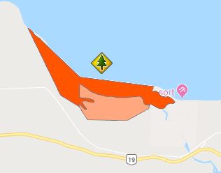
The Cluxewe WMA lies along the Cluxewe River, 10 km west of Port McNeill on northeast Vancouver Island.