Government of B.C.
  • Skip to main content
  • Skip to main navigation
  • Accessibility Statement

Find information

  • Employment, business and economic development
  • Data
  • Education and training
  • Birth, adoption, death, marriage and divorce
  • British Columbians and our governments
  • Farming, natural resources and industry
  • Driving and transportation
  • Health
  • Environmental protection and sustainability
  • Family and social supports
  • Law, crime and justice
  • Housing and tenancy
  • Public safety and emergency services
  • Sports, recreation, arts and culture
  • Taxes and tax credits
  • Tourism and immigration

More

  • Careers & MyHR
  • Services
  • Forms
  • News
  • Contact us
Home/Environmental protection and sustainability/Plants, animals and ecosystems/Wildlife/Wildlife Habitats/Conservation Lands/Wildlife Management Areas/Alphabetical List

More topics

  • Wildlife Management Areas
    • Alphabetical List
      • Bert Brink
      • Boundary Bay
      • Chilanko Marsh
      • Cluxewe
      • Columbia Wetlands
      • Coquitlam River
      • Cranberry Marsh/Starratt
      • Dewdrop-Rosseau Creek
      • East Side Columbia Lake
      • Green Mountain
      • Hamling Lakes
      • Lazo Marsh-North East Comox
      • Lhá:lt/Harrison-Chehalis
      • Mctaggart-Cowan/Nsək’ɬniw’t
      • Midge Creek
      • Parksville-Qualicum Beach
      • Pemberton Wetlands
      • Pitt-Addington Marsh
      • Quatse Estuary
      • Roberts Bank
      • S’amunu
      • Serpentine
      • Skwelwil'em Squamish Estuary
      • South Arm Marshes
      • South Okanagan
      • Stellako River
      • Sturgeon Bank
      • Swan Lake
      • Todagin
      • Tofino Mudflats
      • Tranquille

WMAs Alphabetical List

Last updated on December 5, 2024

Bert Brink
Boundary Bay
Chilanko Marsh
Cluxewe
Columbia Wetlands
Coquitlam River
Cranberry Marsh/Starratt
Dewdrop-Rosseau Creek
East Side Columbia Lake
Green Mountain
Hamling Lakes
Lhá:lt/Harrison-Chehalis
Lazo Marsh-North East Comox
McTaggart-Cowan/Nsək'łniw't
Midge Creek
Parksville-Qualicum Beach
Pemberton Wetlands
Pitt-Addington Marsh
Quatse Estuary
Roberts Bank
S'amunu
Serpentine
Skwelwil'em Squamish Estuary
South Arm Marshes
South Okanagan
Stellako River
Sturgeon Bank
Swan Lake
Todagin
Tofino Mudflats
Tranquille

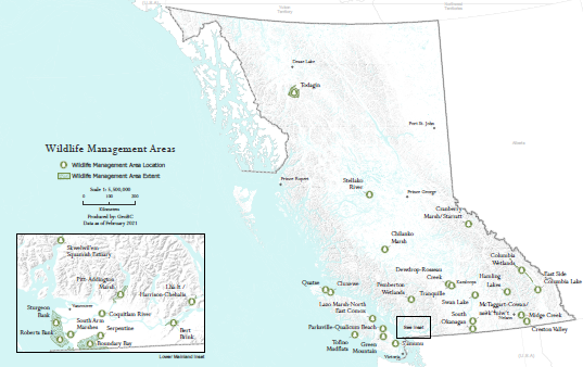
Provincial Map of all WMAs (PDF, 5.7MB)

WMA map of lands

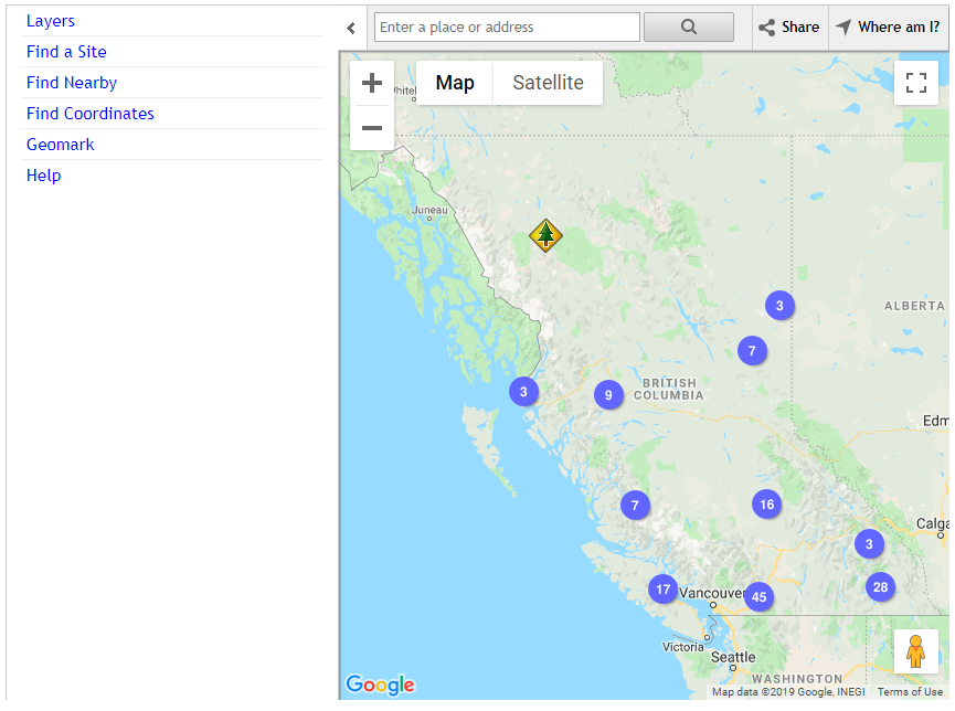
Interactive Conservation Lands Location Map

WMA Interactive map


Did you find what you were looking for?

The B.C. Public Service acknowledges the territories of First Nations around B.C. and is grateful to carry out our work on these lands. We acknowledge the rights, interests, priorities, and concerns of all Indigenous Peoples - First Nations, Métis, and Inuit - respecting and acknowledging their distinct cultures, histories, rights, laws, and governments.

Government of B.C.

We can help in over 220 languages and through other accessible options. Call, email or text us, or find a service centre

More info

  • Home
  • About gov.bc.ca
  • Disclaimer
  • Privacy
  • Accessibility
  • Copyright
  • Contact us
© 2025 Government of British Columbia