
Cranberry Sustainable Resource Management Plan
The Cranberry Sustainable Resource Management Plan (SRMP) is a landscape level plan that addresses sustainable management of land, water and resources in the Cranberry landscape unit within the Kispiox timber supply area.
Plan & Plan Maps
- Cranberry Sustainable Resource Management Plan (2012) (PDF, 1.5MB)
- Ministerial Approval Letter (PDF)
- Map 1 Plan Area (PDF, 3.8MB)
- Map 2 Locator (PDF, 4.4MB)
- Map 3 Ecosections Biogeoclimatic Ecosystem Classification Label (PDF, 5.5MB)
- Map 4 Cranberry Timber Harvesting Land Base (PDF, 4.4MB)
- Map 5 Cranberry Visual Quality Objectives (PDF, 3.8MB)
- Map 6 Cranberry Mineral Potential and Tenures (PDF, 4MB)
- Map 7 Nisgaa Nation Ownership Interest (PDF, 3.8MB)
- Map 8 Gitanyow Claimed House Territory Treaty Offer (PDF, 3.9MB)
- Map 9 Watersheds with Equivalent Clearcut Area Thresholds (PDF, 3.7MB)
- Map 10 Old Growth Management Area (PDF, 10.8MB)
- Map 11 Ecosystem Networks (PDF, 4MB)
- Map 12 Moose Winter Range (PDF, 4MB)
- Map 13 Mountain Goat (PDF, 3.9MB)
- Map 14 Grizzly Bear (PDF, 4MB)
- Map 15 Goshawk (PDF, 3.9MB)
- Map 16 General Wildlife (PDF, 3.9MB)
- Map 17 Gitanyow Cedar Stand Reserves (PDF, 3.9MB)
- Map 18 Water Management Units (PDF, 4.5MB)
- Map 19 Cranberry Parks and Landscape Units (PDF, 3.9MB)
Legal Direction & Orders
Decision Support Reports
Gitanyow Wilp Maps
Geospatial Data
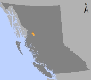
Cranberry Area
Plan Type: Sustainable Resource Management Plan
Plan Status: Approved, most objectives legally established
Plan Area: 205,119 hectares
Natural Resource Region: Skeena
Natural Resource District: Skeena Stikine
Timber Supply Area: Kispiox (includes former Cranberry TSA)
Contact information
Contact us if you have questions about sustainable resource management in the Cranberry area.