
Prince George Land & Resource Management Plan
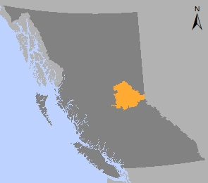
The Prince George Land and Resource Management Plan (LRMP) is a strategic land use plan that provides strategic direction for land use and resource development on Crown land within the plan area. The Prince George LRMP plan area consists of 3.4 million hectares within the Prince George Natural Resource District.
The Prince George LRMP was built through participation by more than 100 citizens, stakeholders and government agencies that strived to provide land use certainty for resource based industries and safeguard environmental and recreational values. The Prince George LRMP land use plan was approved in 1999.
The Prince George LRMP divides the plan area into 54 resource management zones (RMZs) based on five different categories:
- Enhanced Resource Management (36% of plan area)
- General Resource Management (23% of plan area)
- Special Management (21% of plan area)
- Settlement/Agriculture (11% of plan area)
- Protected Areas (8% of plan area)
Learn more about sustainable resource management planning in the Prince George area.
Plan & Plan Maps
Implementation & Monitoring Direction
Plan Type: Land and Resource Management Plan
Plan Status: Cabinet approved, non-legal policy plan
Plan Area: 3,396,704 hectares
Natural Resource Region: Omineca
Natural Resource District: Prince George
Timber Supply Area: Prince George
Spatial Data
Related Links
Contact information
Contact FrontCounter BC for more information about land and resource management planning in the Prince George area.
250 561-3479