
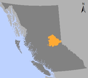
Prince George Sustainable Resource Management Plan
The Prince George Sustainable Resource Management Plan (SRMP) is a consolidated and coordinated approach to a planning at the landscape level for specific values on Crown land in the Prince George area.
Sustainable resource management plans are a tool for the B.C. government to implement strategic land use plans, identify economic opportunites and conserve environmental values. The goal of SRMPs to provide objectives that will be site specific, results-based and operationally relevant. The scale of SRMPs occurs at various scales from 1:10,000 to 1:100,000.
The Prince George LRMP plan area has sustainable resource management plans for:
- Spatial locations and objectives for scenic areas and visual management
- Delineation of specific areas for agriculture land development
- Objectives for the management of old forest and biodiversity
Old Growth Forest & Biodiversity Management
Conserving old growth forest is an important component of the Prince George LRMP and a critical element in the management of biodiversity at the landscape scale. The Prince George LRMP provides direction to ensure the protection of old-growth forests into the future. Old growth forests in the Prince George LRMP planning area are managed by:
- Prince George TSA Landscape Biodiversity Order
- Draft, Non-Legal Landscape Biodiversity Areas (LBA) in the A4 Unit of the Prince George TSA Biodiversity Order
- Spatial Old Growth Management Areas (OGMA) in the Slim, Dome and Humbug Landscape Units
- Guidance Document in the Interior Cedar Hemlock Ecosystem
Visual Management
The Prince George LRMP provides guidance on the management of the visual landscape to ensure scenic quality is maintained through the designation of scenic areas and visual quality objectives. The Prince George SRMP for visual management was a technical process that assessed the landscape visual sensitivity and determine appropriate level of visual alterations.
Agriculture Land Development
The Prince George LRMP identifies agriculture and range as an important socio-economic value in the plan area. The Prince George LRMP provides general management direction to promote agriculture expansion and minimize the conflict between agriculture and grazing with other resources uses. The Prince George LRMP is complementary to the Prince George Crown Land Plan (1984) and the Agriculture Land Reserve (ALR)]
The Prince George SRMP – Agriculture Development Areas (ADAs) was a planning process within the Prince George Crown land plan area to legally designate specific parcels of crown land for agriculture development and settlements reserves areas
Plan & Plan Map
Legal Direction & Orders
- Order Establishing Dome and Slim Landscape Units and Objectives - 2002 (PDF)
- Order Establishing Humbug Landscape Units and Objectives - 2003 (PDF)
- Order Establishing Visual Quality Objectives in Prince George District - 2005 (PDF)
- Order Establishing Agriculture Development Areas and Settlement Reserve Areas - 2006 (PDF)
- Order Establishing Visual Quality Objectives in the Bobtail Lake Area (PDF)
- Order Establishing Scenic Areas in the Prince George District (PDF)
- Order Establishing an OGMA in the Ancient Forest Trail Area of the Prince George LRMP Area - 2009 (PDF, 23.1MB)
- Order Establishing Agriculture Development Areas and Settlement Reserve Areas - 2006 (PDF)
Maps
- Visual Quality Objectives Map (PDF)
- Bobtail Lake Visual Quality Objectives Map (PDF)
- Prince George Crown Land Plan Area (PDF, 5.2MB)
- Maps of Slim Landscape Unit OGMAs (PDF)
- Map of Dome Landscape Unit OGMAs (PDF)
- Map of Humbug Landscape Unit OGMAs (PDF)
- Map of Interior Cedar Hemlock Guidance OGMAs (PDF)
Decision Support Reports
Herrick Creek Local Resource Use Plan
The Herrick Creek Local Resource Use Plan (LRUP) is a consensus plan developed in 1995. The Herrick LRUP recommends specific land use management for water, fisheries, wildlife and habitat, old growth forest, recreation opportunities, scenic management and commercial timber in the watershed of Herrick Creek, about 120 kilometres northeast of Prince George. Highlights of the plan include:
- Identification of three types of units: reserves, special management areas and commodity
- Creation of a landscape corridors and rorest ecosystem networks in the northern portion of the watershed
- Designation of non-motorised recreation area
- 450m forest cover to forest cover distance
- Visual management plan
Plan & Map
Plan Type: Sustainable Resource Management Plan
Plan Status: Approved, legally established
Plan Area: Varies across
Natural Resource Region: Omineca
Natural Resource District: Prince George
Timber Supply Area: Prince George
Spatial Data
Related Links
Contact information
Contact FrontCounter BC for more information about sustainable resource management planning in the Prince George area.
250-561-3479