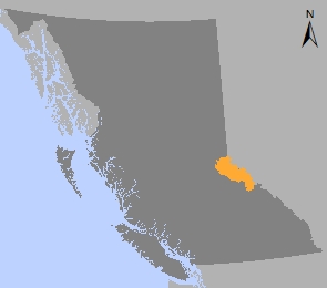
Robson Valley Land & Resource Management Plan
The Robson Valley Land and Resource Management Plan (LRMP) is a strategic land use plan that provides broad direction for the management of crown land values within the plan area. The plan was approved in 1999.
The Robson LRMP area consists of 1.2 million hectares within the Robson Valley Timber Supply Area (TSA) and adjacent Mount Robson and Mount Terry Fox provincial parks. The plan was built through the participation of more than 30 sectors to provide greater land use certainty for resource-based industries such as forestry and commercial tourism and preservation of important ecological, natural and spiritual areas.
The Robson Valley LRMP designated 10 new protected areas in addition to the existing Mount Robson and Mount Terry Fox.
The Robson Valley LRMP divides the plan area into 23 resource management zones (RMZ) based on five different categories:
- Resource development emphasis (31% of plan area)
- General resource management (19% of plan area)
- Special management (24% of plan area)
- Settlement / agriculture (4% of plan area)
- Protected areas (20% of plan area)
The Robson Valley LRMP participation table demonstrated that diverse interests can work together to reach consensus on the majority of the crown land within the plan area. However, there were specific areas where consensus between conservation and resource development could not be reached. In these cases, the B.C. government created subzones that emphasize the environmental concerns within those specific areas (i.e. Upper Goat area).
Learn more about sustainable resource management planning in the Robson Valley.
Plans & Plan Maps
Plan Maps
- Robson Valley LRMP Map (PDF)
- Biogeoclimactic Unit (PDF)
- Class A Fish Habitat (PDF)
- Forest District (PDF)
- Forest Heliski District (PDF)
- Grizzly Density (PDF)
- Medium/High Capability Sites for Backcountry Tourism (PDF)
- Mineral Potential (PDF)
- Operability (PDF)
- Recreation (PDF)
- Round Table Fisheries Inventory (PDF)
- Scenic Areas Visual Quality Objectives (PDF)
- Sensitive Wildlife Areas (PDF)
- Timber Harvesting Land Base and Exclusions (PDF)
- Timber Harvesting Land Base (PDF)
- Timber Supply Analysis Gross Land Base - 1994 (PDF)
- Timber Supply Analysis Harvesting Land Base - 1994 (PDF)
Implementation & Monitoring Direction
Data BC
Related Links
Contact information
Contact FrontCounter BC for more information about land and resource management planning in the Robson Valley area.
250-561-3479

