
South Chilcotin Sustainable Resource Management Plan
A key part of implementing the Cariboo-Chilcotin Land Use Plan (CCLUP) was the completion of seven sustainable resource management plans (SRMPs) covering the entire Cariboo region. The South Chilcotin SRMP was endorsed by government and stakeholders in 1999.
The SRMPs address CCLUP strategies and targets at a sub-regional scale through detailed objectives and strategies for the management of natural resources and environmental values. The SRMPs provided a foundation for the order made under the Land Use Objectives Regulation of the Land Act for the Cariboo Region in 2010. The South Chilcotin SRMP remains as non-legal guidance.
- South Chilcotin Sub Regional Plan - 1999 (PDF)
- Map 1: Geographic location (PDF)
- Map 2: Base map (PDF)
- Map 3: Big basin - no harvest (PDF)
- Map 4: Biodiversity landscape units (PDF)
- Map 5: Range units (PDF)
- Map 6: Mineral placer tenure (PDF)
- Map 7: Backcountry (PDF)
- Map 8: Recreation corridors (PDF)
- Map 9: Visuals (PDF)
- Map 10: Viewpoints - Viewsheds (PDF)
- Map 11: Lake Classification (PDF)
- Map 12: Wildlife Habitats (PDF)
- Map 13: Bull Trout (PDF)
- Map 14: Access Management (PDF)
- Map 15: Sheep Habitat (PDF)
Plan Status: Approved, legally established
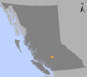
Plan Area: 170,407 hectares
Natural Resource Region: Cariboo
Natural Resource District: Cariboo-Chilcotin
Timber Supply Area: Williams Lake
Contact information
Contact us if you have questions about land use planning in the South Chilcotin SRMP area.
250-302-4339