
Sediment

Managing sediment issues as a result of the ARE
Sediment sites with issues caused by the ARE are assessed and managed in two levels.
1. A localized level looks at the site where sediment build-up is present, or damage has occurred.
2. A holistic level considers the impact on communities, the waterway and the watershed.
A site must meet the program criteria to receive an assessment. Recovery recommendations use a phased risk-based approach.
To view a list of all active sediment sites, visit the Current Projects.
Frequently asked questions
What are the associated risks?
Public health and safety risk
Risk created by the ARE at the concerned site that could impact the health and safety of the public.
River capacity risk
Risk created by the ARE at the concerned site that could impact the river capacity to contain flow.
Environmental risk
Risk created by the ARE at the concerned site that could impact unique, rare or endangered habitat, species, landscapes or culturally valued sites.
Infrastructure risk
Risk created by the ARE at the concerned site that could impact critical public infrastructure in the area.
How are sites identified?
Debris and sediment sites are identified using these methods:
- Regular discussions with residents and community leaders in areas affected by the ARE
- Technology, such as aerial drones, reconnaissance flights and GPS imaging, and
- An online public reporting tool was used to allow residents in affected areas to report and upload pictures of potential debris and sediment sites
What's the process for addressing a sediment site?
Each sediment site is addressed using a 3-phase approach.
Phase One: Assessment
A Qualified Professional (QP) is retained to complete a preliminary engineering review and risk assessments and provide recommendations for next steps using a prioritized approach considering:
- The level of risk to safety of people and property, critical public infrastructure and considerations to the environment
- First Nations and communities with limited access to resources and funding
- The scale and nature of the hydraulic restrictions and damage to marine works and practical timelines for implementation of the phased works, and
- Infrastructure ownership and responsibility
A site, or group of sites, within a watercourse system meeting the program impact criteria of having been impacted by the ARE will be moved forward as a proposed prioritized project using a phased repair approach:
- Phase 2: Emergency work
- Phase 3: Solutions in accordance with current provincial and federal codes and standards resulting from continued detailed assessments
Project development and implementation will be prioritized based on the preliminary engineering and risk assessments and in consultation with QPs, the Ministry of Environment and Climate Change Strategy (ENV) and Emergency Management BC (EMBC) with feedback from communities on site-specific aspects.
Phase 2: Emergency work
Phase 2 (if approved) includes:
- Planning
- Engineering
- Permitting
- Procurement
- Field engineering services, and
- Construction of the emergency work to pre-ARE conditions, including continued detailed assessments
This phase may also include (if approved):
- Planning
- Site investigations
- Surveys
- Engineering and environmental studies
- Preliminary and detailed design
- Permitting
- Development of work packages of Phase 3
Phase 3: Solutions
Phase 3 includes field engineering services and construction implementation of immediate measure and/or solutions to meet current standards and codes developed in Phase 2.
How are sites assessed?
A Qualified Professional (QP) has considerable expertise in fluvial geomorphology, or the science of how rivers shape their environment through the interaction of sediment, water, vegetation and local geography.
They're licensed to practice under direction of the Professional Governance Act and will examine the site using the following screening criteria.
Flood damage criteria and identification
Flood damage and adverse impacts to the watercourses must be a result of, or primarily exacerbated by, the ARE.
Damages and adverse impacts can be:
- Large amounts of accumulated sediment or debris reducing flood conveyance capacity of river or creek, clogging drainage paths such as bridges and culverts
- Waterway bank, riprap, berm and dike damage, or failure
- Waterway channel changes
- Damage to bridges, culverts, riprap and culvert embankments
- Road damage
- Loss of land, and
- Large sediment sources, such as landslides
Waterway systems damaged by the ARE are also at increased risk of being further adversely impacted, and with the damage exacerbated, by upcoming seasonal rainstorms and snowmelt run-off events.
Risk identification
Identify the risk categories that apply to the observed damage.
Damage must relate to one or more of the following:
- Public health and safety
- Future flooding or eroding of developed areas, residences, buildings could impact life
- River capacity
- Reduction in watercourse
- Critical Infrastructure
- Roads, highways, bridges, flood protection infrastructure, pipelines, water, sewer, electrical utilities, communication lines, pathways, trails, etc., and
- Environmental
- Heritage, cultural and sacred resources and sites, with considerations to critical vegetation and potential loss of fish habitat
Within or out of scope
If damages do not present risks to criteria one to 4 above, it's considered out of scope.
The purpose of identifying sites is to identify projects to restore river systems and flood protection works to pre-flood conditions.
What are the costs associated with sediment sites?
Administration cost
B.C. government and project management costs to administer the sediment management work.
Qualified Professionals (QP) cost
Professional engineers, environmental professionals and specialists and any other qualified professionals (for example, land access agents) contracted to develop and implement preliminary and detailed assessments, planning, design, permitting, procurement, field services and contract administration for the emergency work and solutions.
Engineering and planning cost
The engineering, design and planning services required to develop and execute the assessments, emergency work and solutions for the sediment sites.
Construction cost
Cost of contractor (including labour, equipment and materials) to remove sediment, rebuild, repair or construct the waterway system.
First Nation support costs
First Nations monitors to oversee project work and protect cultural, traditional, and archaeologically important sites during the construction work on sediment sites, support for attendance at project meetings, and support access to sites.
Other project management costs
Contracted project managers that coordinate, mobilize, monitor and report on the sediment management project.
How does the B.C. government fund these works?
Funding for these works comes largely through funding transfers from the federal government.
In the event of a large-scale natural disaster, the Government of Canada provides financial assistance to provincial and territorial governments through the Disaster Financial Assistance Arrangements (DFAA), administered by Public Safety Canada (PSC).
When response and recovery costs exceed what individual provinces or territories could reasonably be expected to bear on their own, the DFAA provides the Government of Canada with a means of assisting provincial and territorial governments.
Through the DFAA, assistance is paid to the province or territory, not directly to affected individuals, small businesses or communities. A request for reimbursement under the DFAA is processed following receipt of the required documentation of provincial or territorial expenditures and a review by federal auditors.
What happens if a site is not eligible under DFAA?
Sites not eligible for reimbursement under DFAA may still apply under relevant provincial and federal legislation to review and consider authorization of the proposed works.
DFAA funding is not necessarily a prerequisite for work to take place. However, independent funding would be required to support those application processes.
All above criteria would still be applicable to those applications. Memos outlining the rationale and urgency of the work, and its linkages to the ARE event, should be submitted with the applications so they can be reviewed in a timely manner.
Will all sediment sites be actioned as a result of the ARE?
All ARE sites submitted through the provincial permitting process will be reviewed and considered. However, not all sites meet the requirements as priority to address, nor can they be guaranteed to receive permits.
Urgent works must demonstrate clear risks (as defined above) and that those risks outweigh the potential damages that may incur from the works. For example, sediment removals can be detrimental to the aquatic ecosystem if removals are done during inappropriate times of year or in specific locations within a stream that has sensitive environmental values.
Without a full understanding of the watershed hydraulics, sediment removal can result in re-deposition of sediment or erosion elsewhere along the watercourse.
Some proposed works may take longer to review and come to a resolution based on the watershed implications and or First Nations cultural values present.
There's a process to review all application types. Provincial staff will support applicants through the process.
Application submissions are encouraged as soon as possible to facilitate these discussions.
What's the timeline for addressing the identified sediment issues?
Due to the scope and scale of ARE sediment issues, a definitive end date cannot be predicted at this time. However, the ministry is committed to completing the project.
While we're confident that most of the sediment sites as a result of the ARE have been identified, QPs and crews will continue to assess waterways for any remaining issues that could be a risk to public safety, critical infrastructure and environmental and cultural impacts.
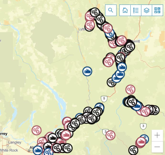
Our interactive debris map shows real-time location and debris removal caused by the Atmospheric River Event (ARE).