
Clayburn Creek

Area: Matsqui Prairie
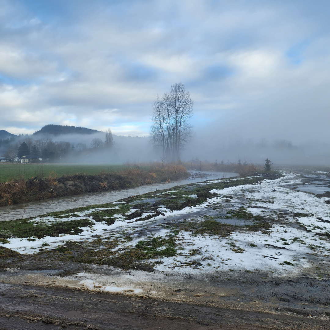
The atmospheric river event caused erosion issues in the area. Sediment flowed downstream into the Matsqui Prairie plain which is next to Clayburn Village and agricultural lands.
Clayburn Creek watershed is 2250 hectares with many tributaries. Clayburn Creek drains through Matsqui Slough into the Fraser River. It is a mountainous watershed with headwater elevations as high as 530 meters. Some areas are steep, exceeding 35% slope.
The upper watershed has active landslides and erosion sites. that the atmospheric river event exacerbated and created new sites. The lower watershed flattens into the Matsqui Prairie lowlands. Sediment accumulates in the creek next to Clayburn Village agricultural lands. There are several sediment traps that need ongoing sediment management.
Projects Details
Total Budget:
$17 Million
Projected Completion Date:
December 2026
February 2024 Open House Materials
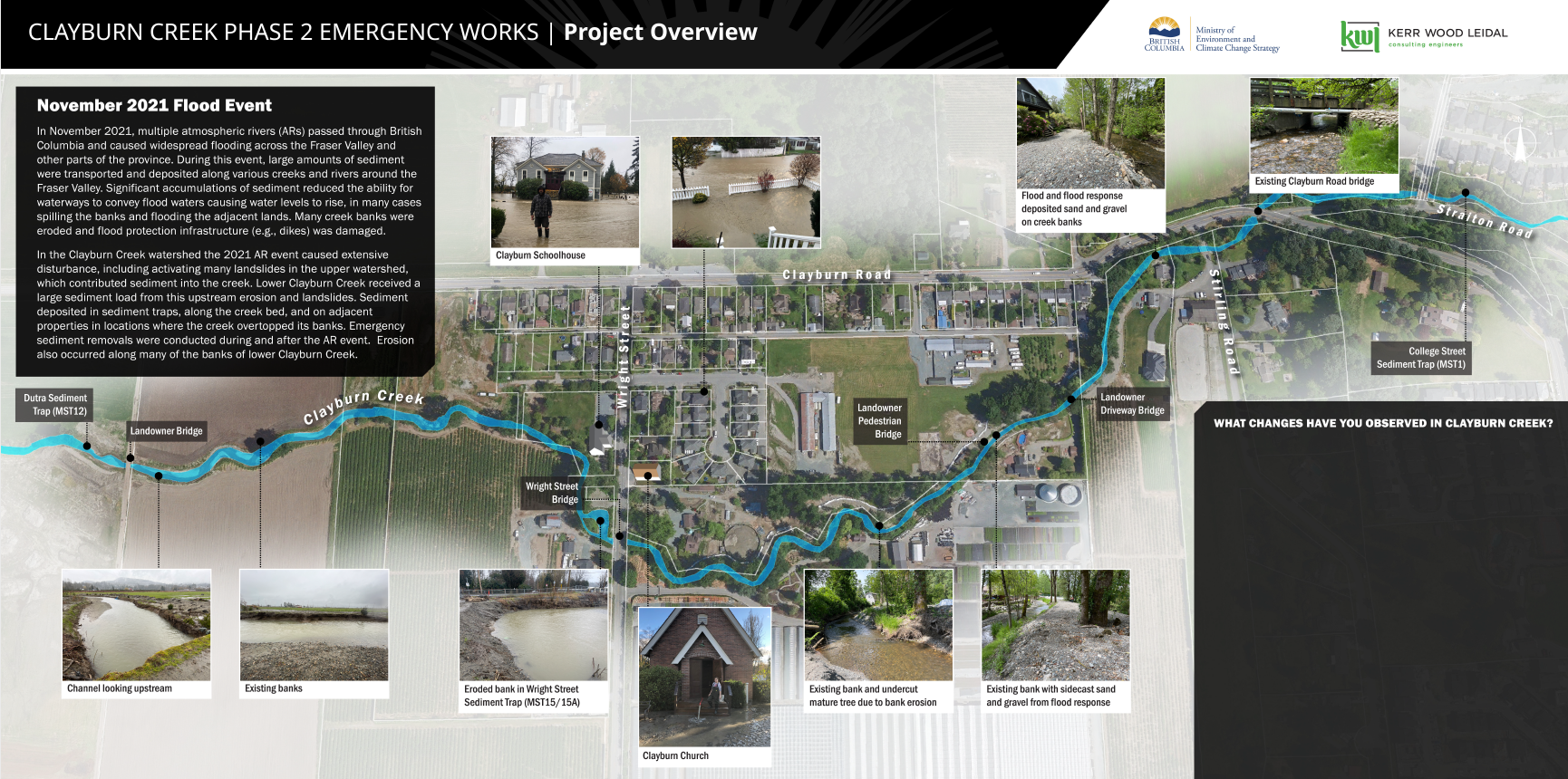 Above image: Project Overview
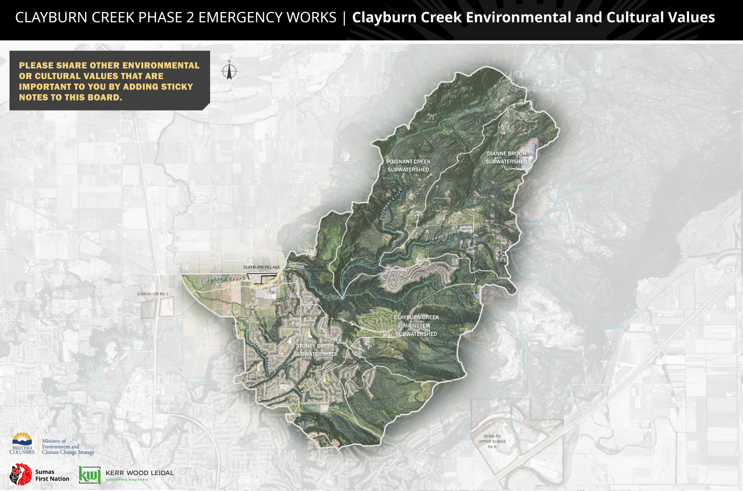
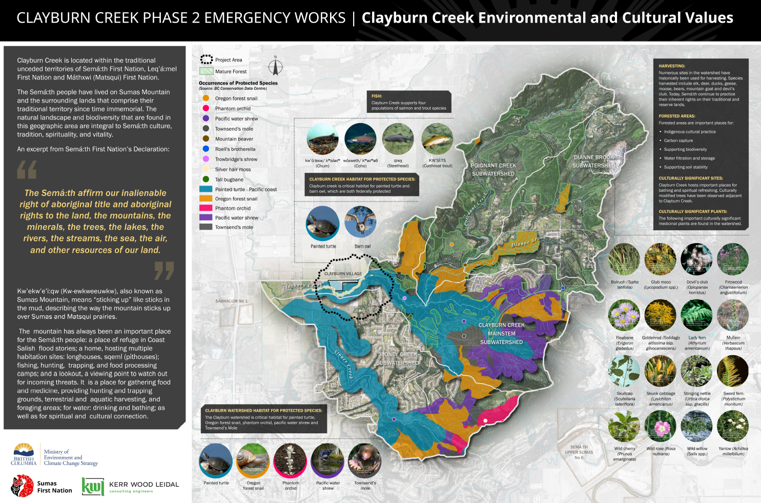 Above image: Cultural values
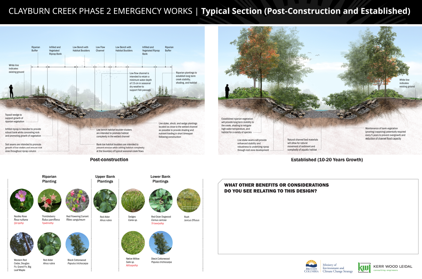 Above image: Post construction and established
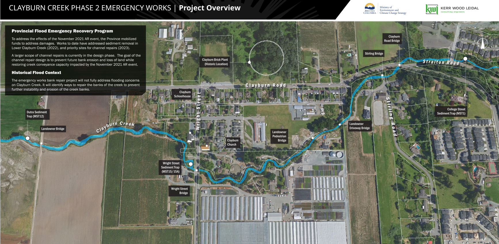 Above image: Project Overview
 Above image: Cultural values
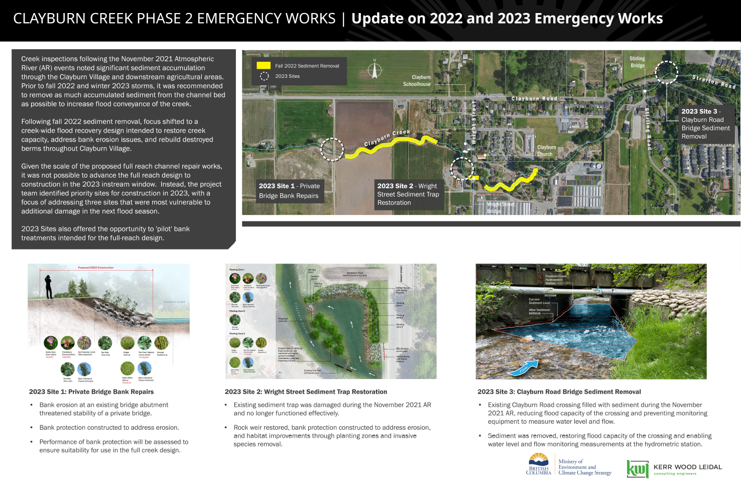 Above image: Emergency works overview
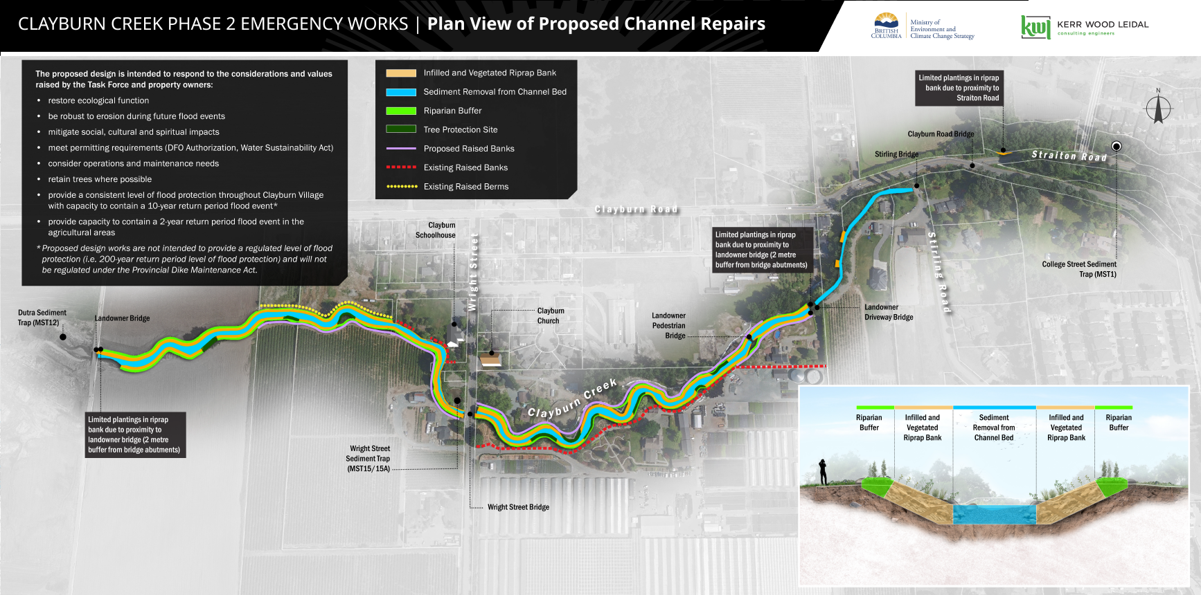 Above image: Proposed channel repairs
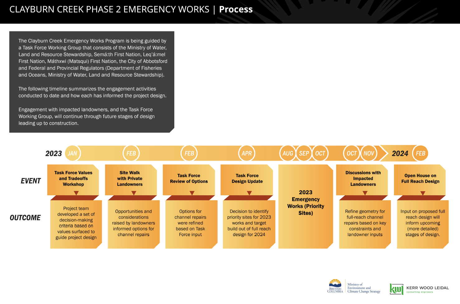 Above image: Process timeline
Community & Taskforce Members
- City of Abbotsford
- Sumas First Nation
- Matsqui First Nation
- Ministry of Environment and Climate Change Strategy
- Ministry of Forests
- Ministry of Emergency Management and Climate Readiness
- Ministry of Water, Land and Resource Stewardship
- Kerr Wood Leidal
- Jakes Construction Ltd.
- Mission Contractors
Videos
Images
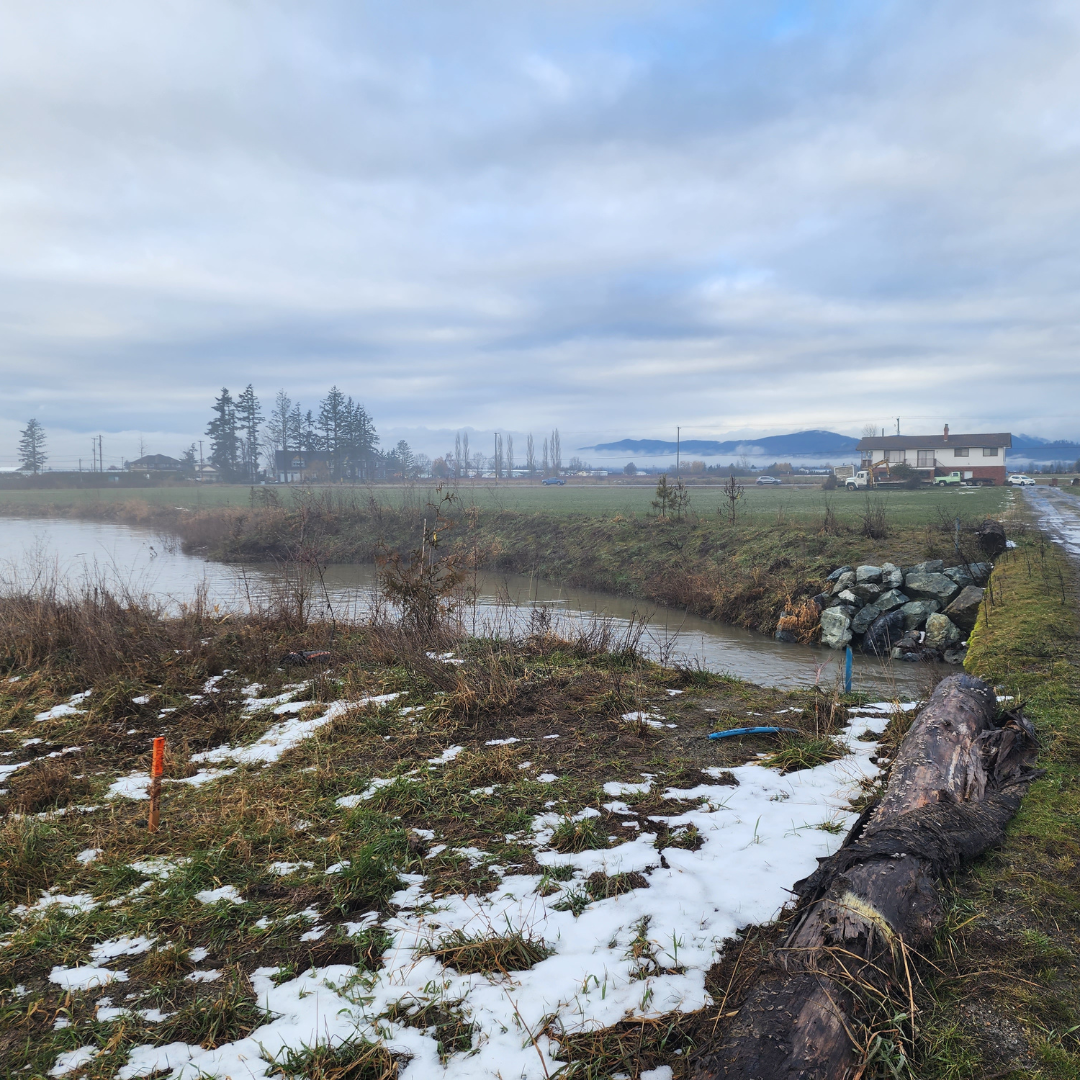 Above image: From site tour January 2024
 Above image: From site tour January 2024. Completed bank repair.
 Above image: Before sediment removal
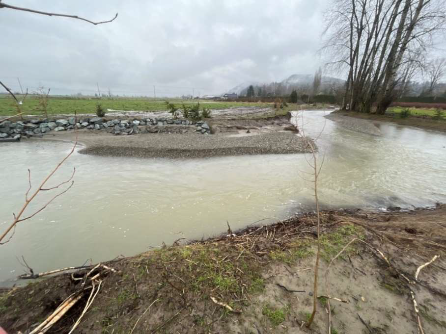 Above image: Sediment bar
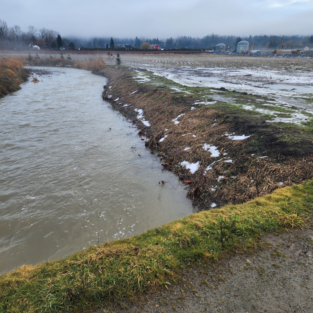
 Above image: From site tour January 2024
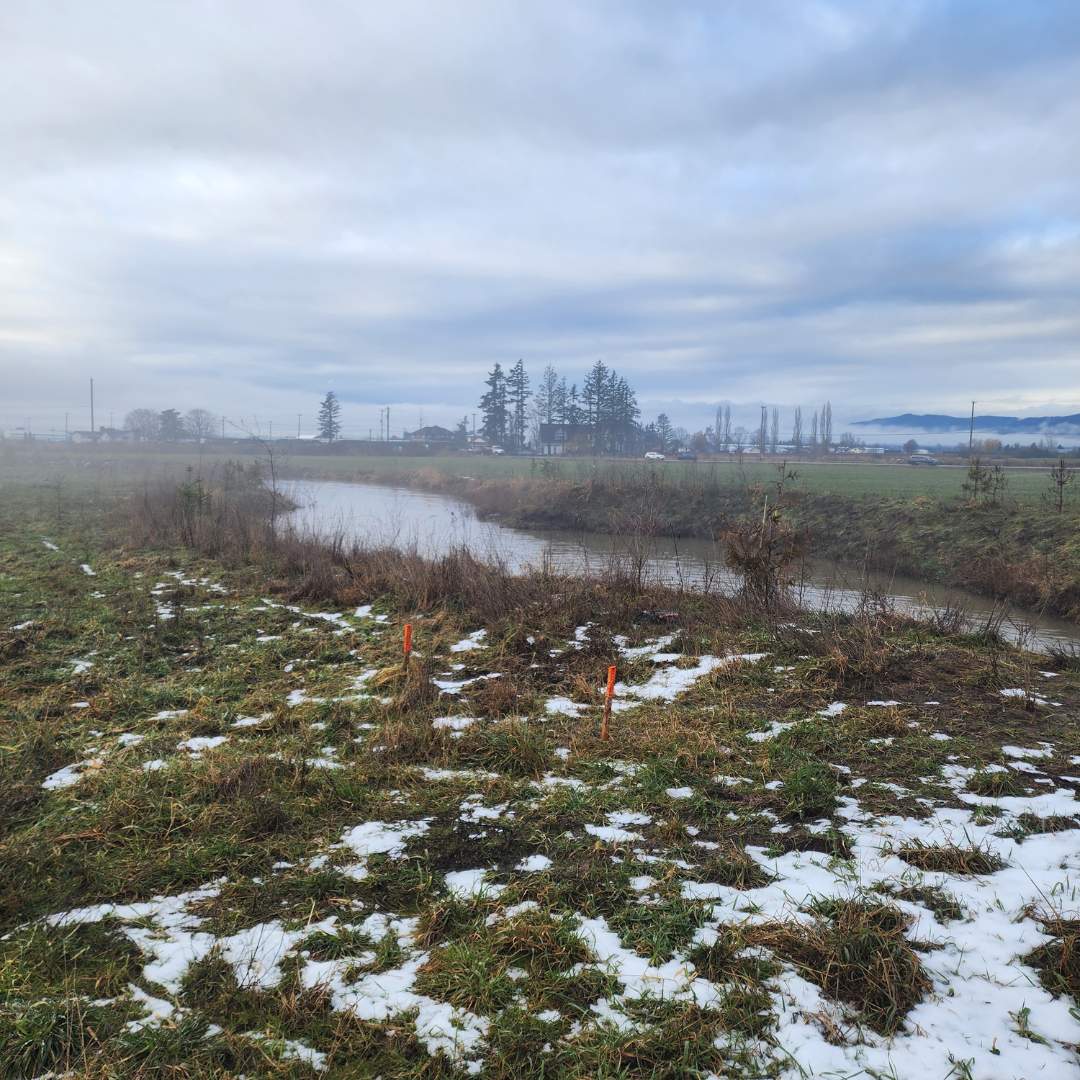
 Above image: From site tour January 2024
 Above image: After sediment removal
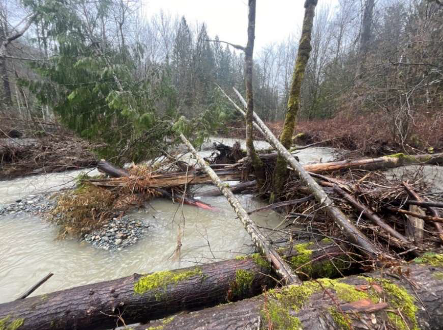 Above image: Woody Debris to be removed
Risk Evaluation
Public Health and Safety
Erosion at upper Clayburn Creek has affected residential property, trails and pedestrian bridges. Lower Clayburn Creek has limited flood capacity and poses a flood risk to Clayburn Village, agricultural fields and Clayburn Road. Eroded banks could pose a hazard to members of the public who access riparian areas.
River Capacity
Clayburn Creek floods are not governed by freshet but winter storm events. Sediment accumulation could restrict flood conveyance. The creek banks are in poor condition. If they are not repaired, further bank and toe erosion will happen. Which in turn will cause more sediment accumulation that restricts flood conveyance.
Environmental
Damage to the riparian vegetation was noted. Damage to fish habitat is likely but is not expected to be high.
Infrastructure
Two pedestrian bridges in Upper Clayburn Creek have been destroyed and three more have undermined abutments. Slope instabilities and erosion putting a sewer main crossing at risk.
Contact information
sec.info.epd@gov.bc.ca
Subscribe
Enter your email address to subscribe to updates of this page.