
Musqueam Creek
Area: Musqueam First Nation
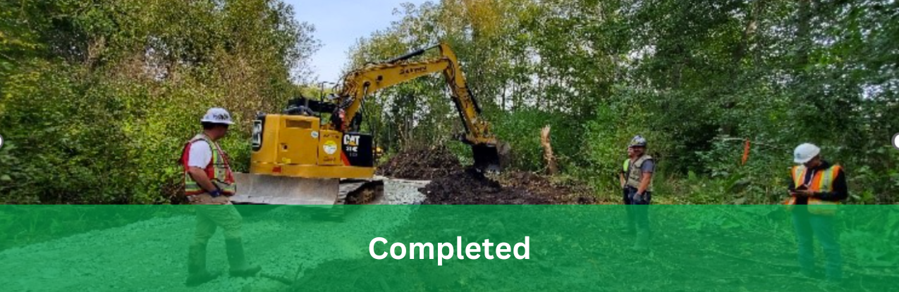
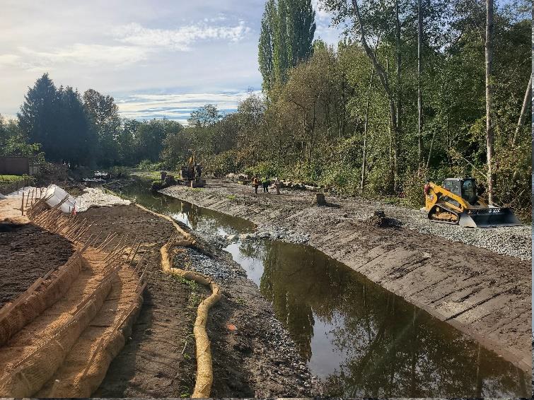
Works at this site include riverbank recovery, stabilization, and protection against future flooding events.
Musqueam Creek is one of the last salmon-bearing creeks in Vancouver. Musqueam people have been stewards of Musqueam Creek for thousands of years. Musqueam IR2 has been a village site for more than 3500 years. So, the recovery works along Musqueam Creek need to be led by the Musqueam community, Administration, leadership, and Indigenous Knowledge Keepers.
Musqueam Creek flows from its headwaters in the University of British Columbia Endowment Lands and Pacific Spirit Regional Park through City of Vancouver and Musqueam IR2. Musqueam Creek flows generally southeasterly and southerly and discharges through a tide gate into the Fraser River. The average gradient is 2%, with a flat lowland area at the mouth of the creek on Musqueam IR2. Sedimentation and flooding occur in the lowland area. Developed areas within the watershed drain through storm sewers, two enclosed sections of creek, outfalls, and culverts. The overall drainage area in the Musqueam Creek watershed is 595 hectars.
Project Details
Total Budget:
$5 Million
Projected Completion status:
Complete
Community & Taskforce Members
- Musqueam First Nation
- Indigenous Services Canada
- Fisheries and Oceans Canada
- Ministry of Environment and Climate Change Strategy
- Ministry of Forests
- Ministry of Emergency Management and Climate Readiness
- Kerr Wood Leidal
- Southwest Contracting Ltd
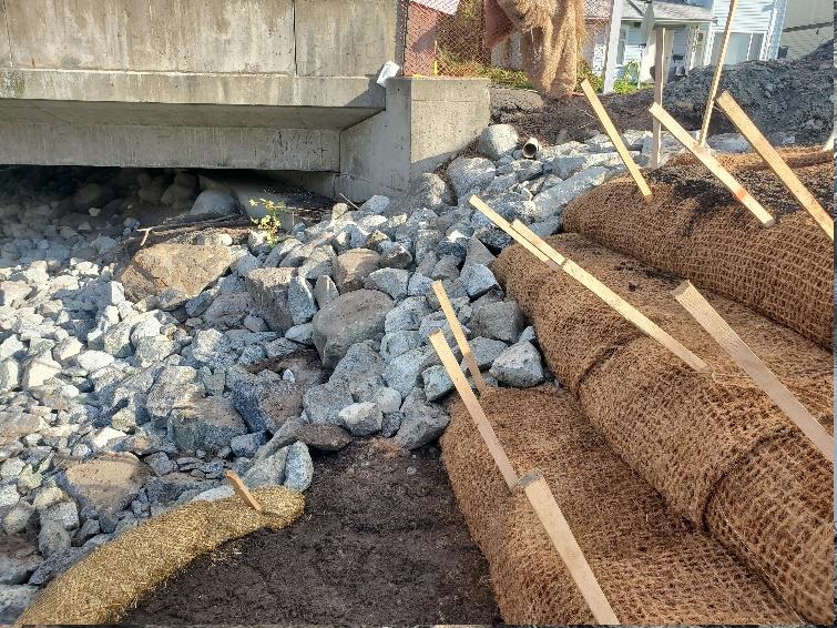
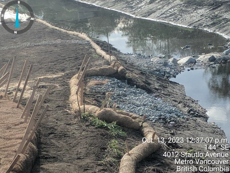
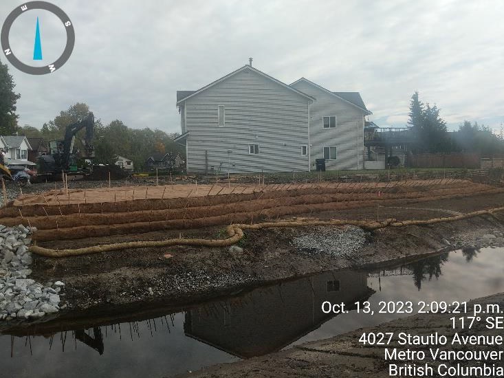
Images
Soil Wrap transition into Stautlo ave Bridge (looking upstream)
Gap closed in straw wattles.
Soil wrap progress
Fisheries Officer arrives on site
Risk Evaluation
Public Health and Safety
Risk is unacceptable medium-term. Risk reduction plan must be developed and implemented in a reasonable time frame. High water may provide substantial disruption for a few by flooding their homes and not allowing access. Presently the sedimentation of the stormwater infrastructure is causing flooding to a few homes during less intense rainfall events.
River Capacity
Risk is unacceptable medium-term. Risk reduction plan must be developed and implemented in a reasonable time frame. It is understood that sedimentation is causing partial avulsion and erosion and scour damage to properties along Musqueam Creek between Stautlo Avenue and 51st Avenue. Bridge capacity is a concern for Stautlo Avenue and 51st Avenue.
Environmental
Risk is unacceptable short-term (before next flood season). Risk reduction required. Musqueam Creek is one of the last remaining salmon-bearing streams in the area. Damage to fish habitat is understood to be high. In addition, Musqueam Creek contains culturally valued sites, and it is understood that sedimentation could result in permanent loss or deterioration of these sites.
Infrastructure
Risk is unacceptable short-term (before next flood season). Risk reduction required. Sediment infilling has impacted stormwater infrastructure and is exacerbating flooding of homes and Thellaiwhaltun Avenue. Homes in the area are flooding during typical annual rainstorm events. Sedimentation is impacting bridge conveyance and has caused the creek to partially avulse in the area of the Metro Vancouver sewer main manhole. There is concern over contaminants entering the creek at this location.
Contact information
sec.info.epd@gov.bc.ca
Subscribe
Enter your email address to subscribe to updates of this page.