
Vancouver Island Land Use Plan
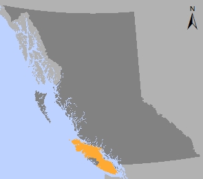
The Vancouver Island Land Use Plan (VILUP) represents the first time that comprehensive land use planning was done on a regional scale in B.C.
The Vancouver Island regional planning process began in 1992 with the work of the Commission on Resources and Environment (CORE). CORE was tasked with making land use recommendations for three regions of the province, including Vancouver Island. CORE decided to formulate these recommendations using regional planning tables. Despite achieving several products, the Vancouver Island table was unable to reach consensus on recommendations. CORE staff used the deliberations and products of the table to develop a recommended Vancouver Island Land Use Plan. The three-volume report was presented to Cabinet and publicly released in February 1994.
In June 1994, the B.C. government formally responded to CORE’s recommendations with the Vancouver Island Land Use Plan Decision. The B.C. government endorsed final boundaries for new (Goal 1) protected areas in 1995 and decided on the selection of new (Goal 2) special features protected areas in 1996.
In 1997, the B.C. government released three reports (which were key to implementation) for public review:
- Resource Management Zones for Vancouver Island
- Planning Framework Statements for Vancouver Island’s Special Management Zones
- Planning Framework Statements for Vancouver Island’s Marine Planning Units
Public feedback on these reports led to several changes and the final outcomes were incorporated into the Vancouver Island Summary Land Use Plan (2000). Selected resource management zones and objectives were legally established in a ministerial order, the VILUP Higher Level Plan Order (2000). Additional legal direction, such as old growth and wildlife tree retention objectives, was established in subsequent landscape unit orders.
Plan and plan maps
- An Overview of the Vancouver Island Summary Land Use Plan - 2000 (PDF, 29KB)
- Vancouver Island Summary Land Use Plan - 2000 (PDF, 1.4MB)
- Map 1: Vancouver Island Location Map (PDF, 63KB)
- Map 2: Vancouver Island Land Use Plan Area (PDF, 58KB)
- Map 3: Ecological Classification of Vancouver Island (PDF, 145KB)
- Map 4: Vancouver Island Forest Cover (PDF, 131KB)
- Map 5: Minerals and Energy (PDF, 134KB)
- Map 6: Selected Fish and Wildlife Resources (PDF, 131KB)
- Map 7: Pre Decision Land Use Patterns (PDF, 125KB)
- Map 8: Land Use Designations (PDF, 143KB)
- Map 9: Regional Planning Priorities (PDF, 112KB)
- Map 10: Visual Resources in Special Management Zones (PDF, 110KB)
- Figure 1: Components of Strategic Plan Development for Vancouver Island (PDF, 55KB)
- Appendices (PDF, 487KB)
Plan Type: Regional land use plan
Plan Status: Approved, legally established
Plan Area: 3,253,593 hectares
Natural Resource Region: West Coast
Natural Resource Districts: South Island, Campbell River, North Island - Central Coast
Timber Supply Areas: Arrowsmith, Strathcona, Kingcome, Pacific
Contact information
WCR.LUP@gov.bc.ca