
Campbell River District Landscape Unit Plans
Landscape unit plans provide direction for managing old growth forest, wildlife trees and other values important for sustaining biological diversity in the West Coast region.
Sayward Landscape Unit Plan
Plan and maps
- Sayward Landscape Unit Plan - 2003 (PDF)
- Sayward Landscape Unit Biodiversity and Wildlife Map (PDF, 1.9MB)
- Sayward Landscape Unit Harvesting Constraints for Recreation Values Map (PDF, 1.7MB)
- Sayward Landscape Unit Non-Constraint Areas Map (PDF, 2.5MB)
- Sayward Landscape Unit Recreation Resource Units Map (PDF, 1.8MB)
- Sayward Landscape Unit Visual Quality Objectives Map (PDF, 1.9MB)
- Sayward Landscape Unit Lakeshore Management Map (PDF, 2.1MB)
- Sayward Landscape Unit Lakes and Stream Classification Map (PDF, 1.7MB)
- Sayward Landscape Unit Drinking Water Map (PDF, 2.1MB)
- Sayward Raw Data (ZIP, 61MB)
Legal direction and orders
Johnstone Straits Landscape Unit Plan
Plans and maps
Sensitive Areas
Nootka Trail
Legal direction and order
Maps and raw data
Heriot Ridge
Hyacinthe Point
Legal direction and order
Maps and raw data
Saltwater Lagoon
Legal direction and order
Maps and raw data
Area and location
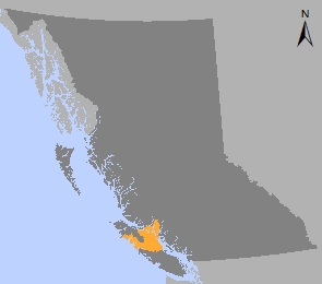
Area: 1,472,972 hectares
Natural Resource Region: West Coast
Natural Resource District: Campbell River
Timber Supply Areas: Strathcona, Pacific
Contact information
Email
WCR.LUP@gov.bc.ca
WCR.LUP@gov.bc.ca
Address
Suite 142 - 2080 Labieux Road, Nanaimo V9T 6J9