
Central Coast Land & Resource Management Plan
Land and resource management plans provide direction for managing old growth forest, wildlife trees and other values important for sustaining biological diversity in the West Coast region.
Plans
- Consolidated Land and Resource Management Plan Completion Table Recommendations (2004) (PDF, 28.9MB)
- Land and Resource Management Plan Completion Table Recommendations (2004) (PDF, 2.4MB) (maps excluded)
- Land and Coastal Resource Management Plan Agreement in Principle Coastal Zone Strategic Plan (2001) (PDF)
Legal Direction
- Great Bear Rainforest Land Use Decision
- Central and North Coast Biodiversity, Mining and Tourism Area Order (Order-In-Council 0002-2009)
- Overview Map of Central Coast Biodiversity, Mining and Tourism Areas (BMTAs) (PDF)
- Adeane Point BMTA Map (PDF)
- Ape Lake BMTA Map (PDF)
- Barer Creek BMTA Map (PDF)
- Bentinck Estuaries BMTA Map (PDF)
- Fish Egg BMTA Map (PDF)
- Inland Cape Caution BMTA Map (PDF)
- King BMTA Map (PDF)
- Kunsoot River BMTA Map (PDF)
- Nekite BMTA Map (PDF)
- Shelter Bay BMTA Map (PDF)
- South Bentinck BMTA Map (PDF)
- Waump BMTA Map (PDF)
- Overview Map of Central Coast Biodiversity, Mining and Tourism Areas (BMTAs) (PDF)
Decision Support Reports
- Land and Coastal Resource Management Plan Mineral Tenures in Protected Areas (PDF, 3.1 MB)
- Economic Opportunities and Barriers (PDF, 1.6 MB)
- Land and Coastal Resource Management Plan Phase I Socioeconomoic Environmental Assessment (PDF)
- Socioeconomic Environmental and Marine Base Case (PDF, 1.7 MB)
- Silviculture Options in the Central Coast (PDF, 2.4 MB)
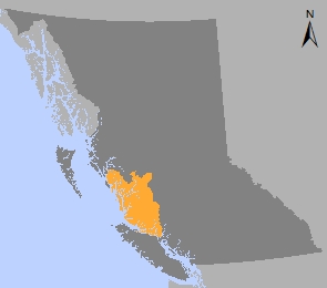
Central Coast area
Plan Type: Land and Resource Management Plan
Plan Area: 4,727,620 hectares
Natural Resource Regions: West Coast, Skeena
Natural Resource Districts: Campbell River, North Island - Central Coast, Coast Mountains
Timber Supply Areas: Strathcona, Kingcome, Mid Coast, North Coast, Pacific
Central Coast News Links
Contact information
Contact us if you have questions about land use planing and the Central Coast region.