
Lillooet Land & Resource Management Plan
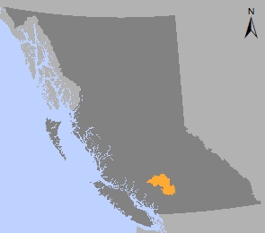
The Lillooet Land and Resource Management Plan (LLRMP) area is approximately 1.1 million hectares, situated in southwestern B.C. The area corresponds to the Lillooet Timber Supply Area (TSA) where forestry continues to be an important activity. Tourism and mining are also important in the area with a strong history of mineral development in Bralorne, Gold Bridge and vicinity. There are 28 First Nations with asserted territory within the plan area.
In 2008, the Province of British Columbia and the Lil’wat Nation finalized a land use planning agreement. In 2017, Lil’wat Nation proposed that an area along Highway 99 and next to the Nlhaxten/Cerise Creek Conservancy, known as Pipi7iyekw, be established to protect old-growth forest and sensitive ecosystems. Pipi7iyekw Old Growth and Sensitive Area was established under Land Use Objectives Regulation of the Land Act in 2020. Indigenous cultural uses and medicinal plant collection are the primary objectives for this area. Commercial timber harvesting is no longer allowed.
First Nations Agreements
Legal Direction
- Order Establishing Provincial Non-Spatial Old Growth Objectives - effective Jun 30, 2004 (PDF, 0.2MB)
- Order Identifying the Nlháxten/Cayoosh Wildland Area as a Cultural Heritage Resource Feature - effective Feb 23, 2012 (PDF, 3.4MB)
- Order Establishing the Pipi7iyekw Old Growth and Sensitive Area - effective Jan 30, 2020 (PDF, 0.3 MB)
Implementation & Monitoring Direction
Plan Type: Land and Resource Management Plan
Plan Status: Recommended
Plan Area: 1,125,025 hectares
Natural Resource Region: Thompson/Okanagan
Natural Resource District: Cascades
Timber Supply Area: Lillooet
Contact information
Contact us if you have questions about land and resource management in the Thompson / Okanagan region.
TOR.LUP@gov.bc.ca