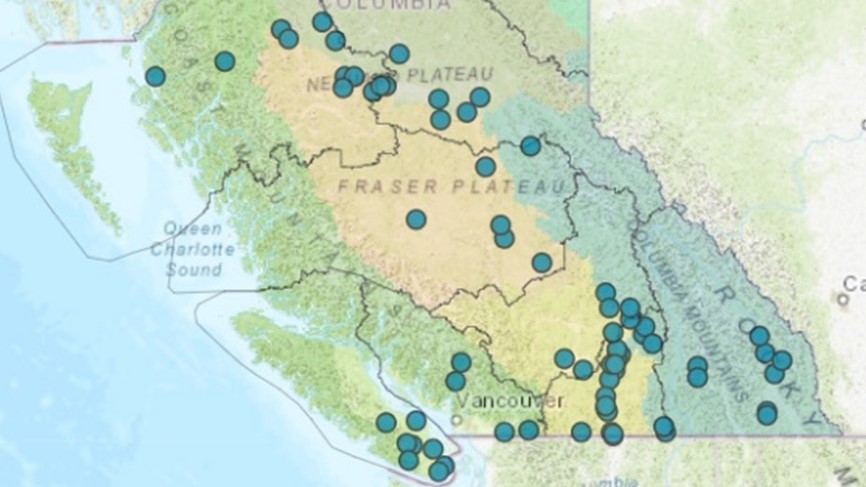
B.C. Lake Monitoring Network
Lakes are complex ecosystems that are sensitive to a wide range of stressors that operate at provincial, regional, and local scales. Lakes are sentinels of environmental change, and long-term monitoring of water quality trends in B.C. lakes allows for inter-annual variation to be distinguished from directional change. Understanding these trends can provide insights into the causes of change, and support effective watershed management.
The B.C. Lake Monitoring Network provides a strategic and coordinated approach to monitoring water quality in lakes across B.C.
General information
Network goals
- Monitor, assess, and report on current water quality conditions of B.C. lakes
- Assess and report on how B.C. lake water quality is changing over time
- Develop an understanding of how human activities are influencing B.C. lake water quality
- Determine how B.C. lake water quality is responding to climate change
- Provide accessible, accurate, timely and scientifically defensible water quality data for network lakes to inform government decision makers, industry, research institutions, Indigenous Peoples and the public
Physical, chemical, and biological information is obtained biannually from a wide variety of B.C. lakes to determine current water quality status and to understand long-term trends. Currently, 61 lakes (82 lake sites) are sampled, which cover various biogeoclimatic zones and span wide gradients of area, depth, and trophic status.
Contact information
Contact us at laketrends@gov.bc.ca for more information about the B.C. Lake Monitoring Network.

