
Highway Exits
A list of highway exits from B.C.'s major highways: Sea-to-Sky Highway 99, Trans-Canada Highway 1, Coquihala Highway 5, Highway 99 South and Highway 91.
Sea-to-Sky Highway 99
Exit number refers to number of kilometres north of Horseshoe Bay.
| 0.0 | Off-ramp from Highway 1 |
| 0.4 | Horseshoe Bay underpass |
| 2.1 | Bottom of Snake Hill |
| 2.6 | Top of Snake Hill |
| 3.2 | Pasco Road |
| 4.3 | Ansell Place |
| 4.8 | Disbrow Creek |
| 5.0 | Sunset Marina |
| 5.2 | Sclufield Creek |
| 5.5 | Montizambert Creek Bridge |
| 6.7 | Strip Creek Bridge |
| 7.3 | Charles Creek Bridge |
| 7.7 | Turpin Creek |
| 8.5 | Newman Creek Bridge |
| 10.5 | South Boundary - Lions Bay |
| 10.8 | Kelvin Grove Intersection |
| 11.1 | Rundle Creek |
| 11.5 | Harvey Creek Bridge |
| 11.8 | Alberta Creek Bridge |
| 13.0 | North Boundary Lions Bay |
| 13.5 | Magnesia Creek Bridge |
| 14.2 | H Creek Bridge |
| 14.8 | Tunnel Point Rest Area |
| 16.7 | Loggers Creek Bridge |
| 17.2 | Deeks Creek Bridge |
| 18.0 | Doodson's Corner |
| 20.5 | Bertram Creek |
| 22.3 | Parking Deeks Lake Trail |
| 22.5 | Kallahne Creek |
| 22.7 | Porteau Camp |
| 24.2 | 24.2 km Creek |
| 24.5 | Porteau Cove Provincial Park |
| 24.6 | 24.6 km Creek |
| 27.0 | Furry Creek Bridge South |
| 27.1 | Furry Creek Bridge North |
| 27.3 | Begin Furry Creek Hill |
| 29.3 | Top of Furry Creek Hill |
| 32.2 | Mining Museum Access |
| 32.8 | Brittannia Creek Bridge |
| 34.6 | South Boundary - Squamish |
| 35.5 | Murrin Park Access |
| 38.6 | Gonzales Creek Bridge |
| 39.7 | Darrell Bay Road Left |
| 39.9 | Shannon Creek Bridge |
| 40.5 | Oleson Creek |
| 41.2 | Stawamus Chief Viewing Point |
| 42.2 | Stawamus Bridge |
| 42.3 | Valley Drive |
| 42.8 | Clark Drive |
| 43.5 | Mamquam Blind Channel Bridge |
| 44.0 | Cleveland Avenue (Downtown Squamish) |
| 45.6 | Squamish Industrial Park |
| 46.8 | Centennial Way |
| 46.9 | Mamquam River Bridge |
| 47.9 | Mamquam Road |
| 48.3 | Garibaldi Way |
| 48.7 | Malgan Creek |
| 49.4 | Hop Ranch Creek |
| 50.2 | Dryden Creek |
| 52.3 | Powerline Crossing |
| 53.8 | Alice Lake/Squamish Valley Road |
| 54.4 | Cheekye Bridge |
| 55.5 | Bottom of Debecks Hill |
| 58.0 | Brohm Lake |
| 62.2 | Swift Creek |
| 63.7 | North Boundary - Squamish |
| 64.4 | Culliton Creek Bridge |
| 67.0 | Conroy Creek |
| 69.7 | Top of Canyon Hill |
| 76.6 | Entrance to Garibaldi Village |
| 77.0 | Rubble Creek Bridge |
| 77.4 | Cheakamus River Bridge |
| 79.5 | Pine Crest Estates |
| 80.6 | Black Tusk Village |
| 81.0 | Widow Creek |
| 84.5 | Brandywine Railway Crossing |
| 84.8 | Brandywine Park Access |
| 85.2 | South Boundary - Whistler |
| 90.6 | Red Bluffs |
| 91.7 | Powerline Hill |
| 94.0 | BCR Railway Crossing |
| 94.5 | Function Junction (Cheakamus Lake Road) |
| 96.1 | Alpha Creek |
| 96.8 | Alta Westside Road |
| 97.3 | Bayshores |
| 98.0 | Lake Placid Road |
| 98.2 | Whistler Road |
| 99.7 | Nordic Estates |
| 101.8 | St. Anton's Way |
| 101.9 | Brio |
| 102.0 | Whistler Overpass |
| 102.1 | Village Gate |
| 102.4 | Whistler Cay Heights |
| 102.7 | Lorimer Road |
| 103.1 | Nester's Road |
| 103.7 | Nester's Road |
| 104.7 | Mons Overhead |
| 105.4 | Golden Dreams Bridge |
| 106.0 | Alpine Way |
| 106.2 | Nineteen Mile Bridge |
| 109.1 | Summer Lane |
| 109.7 | Emerald Drive |
| 113.8 | North Boundary - Whistler |
| 117.3 | Top of Green River Hill |
| 118.2 | Bottom of Green River Hill |
| 118.7 | Green River Railway Crossing |
| 126.2 | Rutherford Creek Bridge |
| 128.1 | Rail Underpass |
| 130.2 | (Nairn Falls) Rail Crossing |
| 131.0 | Nairn Falls Provincial Park |
| 132.8 | South Boundary - Pemberton |
| 133.0 | One Mile Lake Access |
| 133.5 | One Mile Bridge |
| 134.1 | Pemberton Portage Road |
Trans-Canada Highway 1
Exit number refers to number of kilometres east of Horseshoe Bay.
| 1 | Sea-to-Sky Highway |
| 2A | Eagleridge Drive |
| 4 | Caulfeild Drive/Woodgreen Drive |
| 7 | Westmount Road/Westridge Avenue |
| 8 | Cypress Bowl Road |
| 10 | 21st Street/22nd Street |
| 11 | 15th Street |
| 13 | Taylor Way (Highway 1A/99A) |
| 14 | Capilano Road |
| 17 | Westview Drive |
| 18 | Lonsdale Avenue |
| 19 | Lynn Valley Road |
| 21 | Mountain Highway |
| 22 | Fern Street/Keith Road |
| 23 | Dollarton Highway/Main Street |
| 24 | Ironworkers Memorial Second Narrows Crossing |
| 25 | McGill Street |
| 26 | Hastings Street/Rupert Street |
| 27 | First Avenue |
| 28 | Boundary Road/Grandview Highway |
| 29 | Willingdon Avenue |
| 32 | Sprott Street |
| 33 | Kensington Avenue |
| 37 | Cariboo Road/Gaglardi Way |
| 40 | Brunette Avenue |
| 44 | Cape Horn Avenue |
| 48 | 152 Street |
| 50 | 160 Street |
| 53 | 176 Street |
| 58 | 200 Street |
| 66 | 232 Street |
| 73 | 264 Street |
| 83 | Mount Lehman Road |
| 87 | Clearbrook Road |
| 90 | McCallum Road |
| 92 | Sumas Way (Highway 11) |
| 95 | Whatcom Road |
| 99 | Cole Road |
| 104 | No 3 Road |
| 109 | Yale Road West |
| 116 | Lickman Road |
| 118 | Evans Road (Eastbound only) |
| 119 | Chilliwack Lake Road/Sardis |
| 120 | Chilliwack Airport |
| 123 | Prest Road/Rosedale |
| 129 | Annis Road |
| 135 | Route 9 (Agassiz/Harrison Hot Springs) |
| 138 | Popkum Road |
| 146 | Herrling Island |
| 151 | Peters Road |
| 153 | Laidlaw/Jones Lake |
| 160 | Hunter Creek Road |
| 165 | Flood Interchange |
| 168 | Silver Hope Creek |
| 170 | Route 1 Hope Exit |
| 399 | 97 South, Vernon |
| 780 | Golden View Road/Golden Donald Upper Road/Lafontaine Road |
Coquihalla Highway 5
Exit number refers to number of kilometres east of Horseshoe Bay.
| 171 | Third Street |
| 173 | Thacker Road |
| 177 | Hope-Princeton Highway, Route 3 |
| 183 | Othello Road |
| 192 | Sowaqua Creek |
| 195 | Carolin Mine Road |
| 200 | Shylock Road (southbound exit only) |
| 202 | Portia |
| 217 | Zopkios Brake Check (no exit sign northbound) |
| 221 | Falls Lake |
| 228 | Coquihalla Lakes Road |
| 231 | Mine Creek Road (southbound exit only) |
| 238 | Juliet Creek Road |
| 250 | Larson Hill |
| 256 | Coldwater Road (Kingsvale) |
| 276 | Comstock Road |
| 286 | Coldwater Interchange, Routes 97C (Kelowna), 5A (Merritt), 8 (Spences Bridge) |
| 290 | Nicola Interchange, Route 5A (Merritt) |
| 315 | Helmer Road |
| 336 | Route 97D (Logan Lake) |
| 355 | Inks Lake Road |
| 362 | Route 1 Westbound (Cache Creek) |
| 366 | Copperhead Drive |
| 367 | Pacific Way |
| 368 | Hillside Way |
| 369 | Columbia Street |
| 370 | Summit Drive |
| 374 | Highway 5 North (Jasper) |
Highway 99 South
Exit number refers to number of kilometres from the U.S. border.
Northbound
| 2 | 8th Avenue |
| 4 | 16th Avenue |
| 10 | King George Boulevard |
| 16 | Route 91 (Annacis Highway) |
| 20 | Route 10 (Mathews Road) |
| 26 | Route 17 (SFPR) |
| 28 | Route 17A (via Exit 26) |
| 32 | Steveston Highway |
| 36 | Westminster Highway |
| 37 | Route 91 (Richmond Freeway) |
| 39 | Bridgeport Road |
| 41A | Marine Drive East |
| 41B | Marine Drive West |
Southbound
| 39A | Sea Island Way |
| 39B | No. 4 Road |
| 38 | Shell Road |
| 37 | Route 91 (Richmond Freeway) |
| 32 | Steveston Highway |
| 29 | River Road South |
| 28 | Route 17A |
| 26 | Route 17 (SFPR) |
| 23 | 80th Street |
| 20 | Route 10 (Mathews Road) |
| 16 | Route 91 (Annacis Highway) |
| 10 | King George Boulevard |
| 8B | 32nd Avenue/152nd Street (North) |
| 8A | 152nd Street (South) |
| 4 | 16th Avenue |
| 2B | 8th Avenue (West) |
| 2A | 8th Avenue (East) |
| 1 | Beach Road |
Highway 91
Northbound
| 2 | Route 10 |
| 4 | 64th Avenue |
| 6 | 72nd Avenue |
| 8 | Nordel Way |
| 9 | Annacis Island |
| 11 | Route 91A |
| 13 | Westminster Highway |
| 21 | No. 6 Road |
| 22 | Knight Street |
| 23A | Route 99 South |
| 23B | Route 99 North |
Southbound
| 23B | Route 99 North |
| 22 | Knight Street |
| 15 | Nelson Road |
| 13 | Westminster Highway |
| 11 | Route 91A |
| 10 | Annacis Island (via Exit 11) |
| 8 | Nordel Way |
| 6 | 72nd Avenue |
| 4 | 64th Avenue |
| 2 | Highway 10/Ladner Trunk Road |
Did You Know?

Exit numbers are sequential, beginning at “1” from the southern (for N-S highways) or western (for E-W highways) start of the highway.
The numbers represent the distance the exit is in kilometres from the start of the highway. Interchanges with two exits will include letters "A" & "B."
Know Before You Go

Get construction updates, traffic, weather and road conditions.
Super, Natural British Columbia Road Trips - Explore Super, Natural British Columbia
Provincial Rest Areas
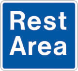
B.C. has more than 200 rest areas available for motorists, many with scenic lookouts and trails. All rest areas are equipped with garbage cans and the majority have picnic tables. All have toilets – ranging from classic rustic pit toilets, to compost toilets, to full-flush facilities.
Stop of Interest Signs

British Columbia’s Stop of Interest signs each tell a story of a person, place or event significant to our provincial history. If you travel in B.C. or live close to a historic site, chances are that you will see at least one of these signs.