The Hat Creek Coalfield
NTS Map Sheets: 92I/13, 12
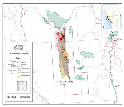
The Hat Creek Coalfield (1:100,000) (PDF, 1.8MB)
A significant resource of lignite to sub-bituminous B coal exists in a graben, 26 kilometres long and 4 kilometres wide, that occupies the Hat Creek Valley. The Tertiary rocks in the graben contain a coal member that is about 1200 metres thick, of which up to 550 metres is coal. This is one of the thickest accumulations of coal in the world. The deposit contains a resource of about 10 billion tonnes, of which approximately 500 million tonnes is proven reserve.
BC Hydro proposed developing a coal-fired power plant in the Hat Creek valley to utilize the coal in the deposit. During the 1970s and 1980s the Hat Creek proposal was the subject of many detailed studies, including on geology, mine feasibility, and potential environmental and societal impacts. The project faced strong public opposition due to concerns about its environmental impacts, especially on the airshed of the Pavilion Creek and Hat Creek valleys, and did not proceed.
The 2007 B.C Energy Plan announced a new Provincial policy that requires zero greenhouse gas emissions from coal thermal electricity facilities, which effectively prevents coal-fired power generation except where carbon capture and sequestration is feasible.
Geology
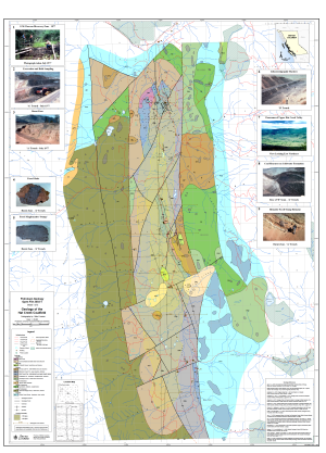
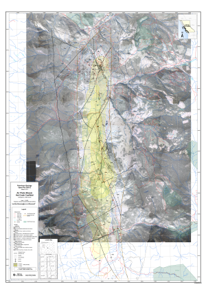
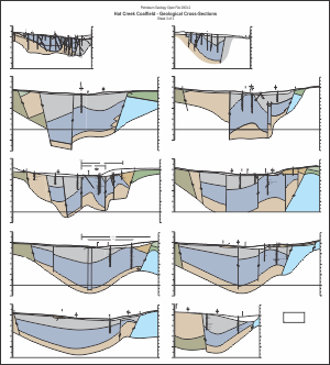
Petroleum Geology Open File 2003-1 (3 Sheets): Geological interpretation by B.N Church; Cartography/GIS by M. Fournier; Computer graphics by Armitage CAD - Computer Drafting; Air photo compilation by Pacific Geomatics Ltd.
View Hat Creek Geology on MapPlace
Collections
Several collections of reports and information on the Hat Creek area have been compiled: Library Reports; BC Hydro Reports; and Miscellaneous BC Hydro Reports. Additional reports on the Hat Creek area are contained in COALFILE.
Selected references
- Campbell, D.D., Jory, L.T., and Saunders, C.R., 1977. Geology of the Hat Creek Coal Deposits. Canadian Mining and Metallurgical Bulletin, V 70, No. 782, pages 99-108.
- Church, B.N., 1975. Geology of the Hat Creek Basin. Geological Fieldwork 1975, B.C. Ministry of Energy, Mines and Petroleum Resources, Paper 1976-1, pages 104-108.
- Church, B.N., 1975. Geology of the Hat Creek Coal Basin; in Geology in British Columbia 1975, B.C. Ministry of Energy, Mines and Petroleum Resources, pages 99-118.
- Church, B.N., 1979. Hat Creek Bocanne-Buchite. Geological Fieldwork 1979, B.C. Ministry of Energy, Mines and Petroleum Resources, Paper 1980-1, pages 97-100.
- Church, B.N., 1980. Further Studies of the Hat Creek Coal Deposit. Geological Fieldwork 1980, B.C. Ministry of Energy, Mines and Petroleum Resources, Paper 1981-1, pages 73-78.

