News

Updates on upcoming events and new publications of the BC Geological Survey. Subscribe to our announcements
New publications
Paper 2026-01, In Press: Geological Fieldwork 2025, a summary of field activities and current research
Paper 2026-02: Mining and Exploration in British Columbia, 2025
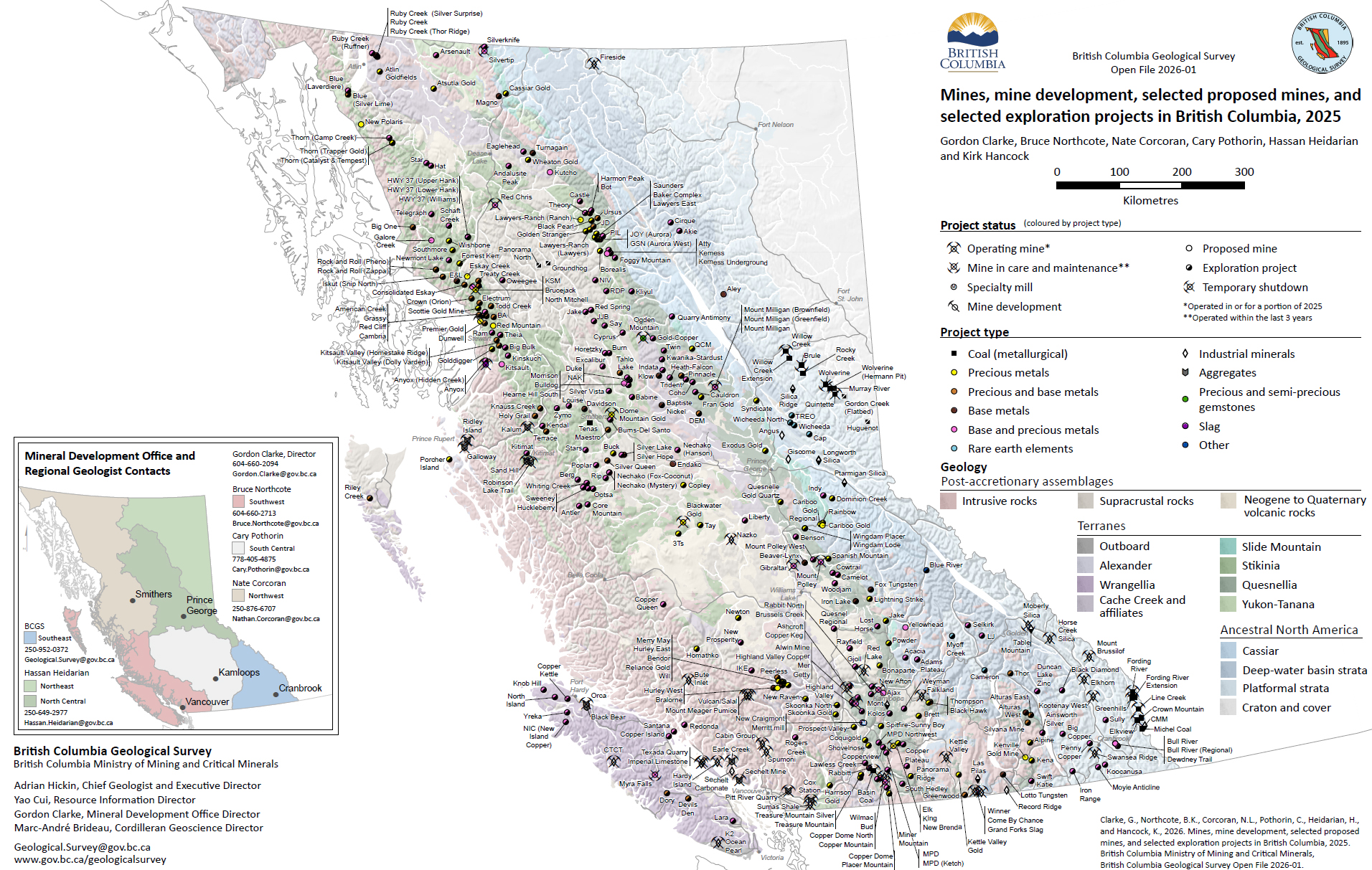
Openfile 2026-01: Mines, mine development, selected proposed mines, and selected exploration projects in British Columbia, 2025
Information Circular 2026-01: British Columbia Geological Survey
Information Circular 2026-02: British Columbia Geological Survey Mineral Development Office
Information Circular 2026-03: Online databases at the British Columbia Geological Survey
Information Circular 2026-04: British Columbia Geological Survey selected publications 2025
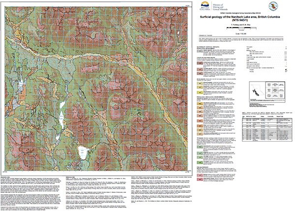
Geoscience Map 2025-02: Surficial geology of the Nanitsch Lake area (NTS 94D/1), British Columbia
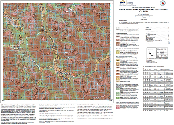
Geoscience Map 2025-03: Surficial geology of the Carruthers Pass area (NTS 94D/8), British Columbia
GeoFile 2026-01: Supplementary data for ‘Critical metal distributions in volcanogenic massive sulphide (VMS) deposits in British Columbia: A progress report’
GeoFile 2026-02: Assessment report-sourced surface sediment geochemistry database: Data update
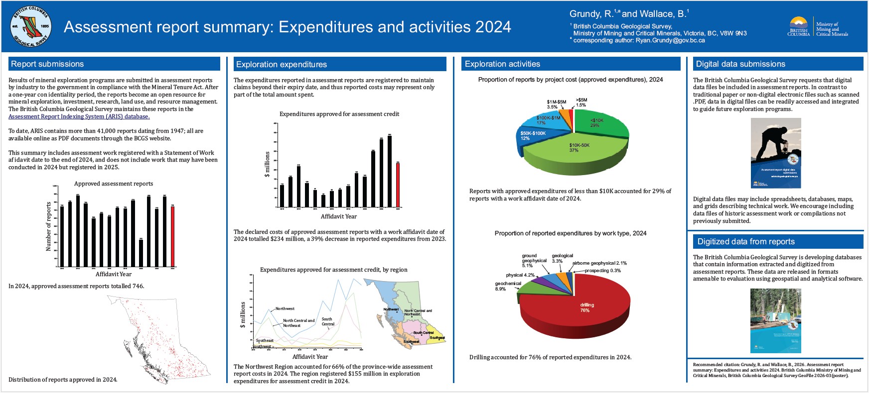
GeoFile 2026-03: Assessment report summary: Expenditures and activities 2024
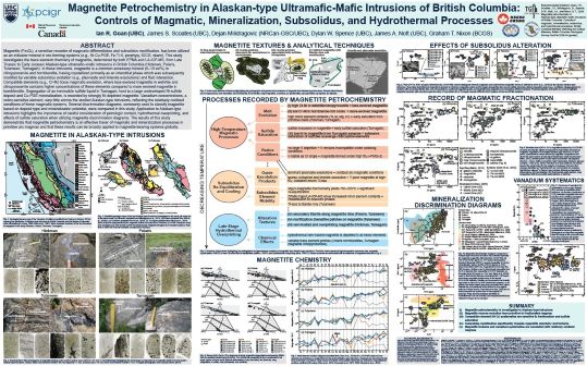
GeoFile 2026-04: Magnetite petrochemistry in Alaskan-type ultramafic-mafic intrusions of British Columbia: Controls of magmatic, mineralization, subsolidus, and hydrothermal processes
Peer-reviewed journals, volume publications and contributions to partner publications, 2025
Peer-reviewed journals and volume publications
Papers
Wearmouth, C., Czertowicz, T.A., Peters, K.J., and Orovan, E., 2024. Mineral potential modelling at the British Columbia Geological Survey: Renewed methods with application to northwestern British Columbia. British Columbia Ministry of Energy, Mines and Low Carbon Innovation, British Columbia Geological Survey Paper 2024-02, 28p.
Hickin, A.S., Cui, Y., Clarke, G., Ootes, L., and van Straaten, B.I., 2025. British Columbia Geological Survey annual program review 2024-2025. In: Geological Fieldwork 2024, British Columbia Ministry of Mining and Critical Minerals, British Columbia Geological Survey Paper 2025-01, pp. 1-15.
Miller, E.A., Ferri, M.D., van Straaten, B.I., and Wall, C., 2025. Stratigraphic framework, structural setting, and timing of VMS, epithermal, and porphyry mineralization in the Kitsault River area, northwest British Columbia. In: Geological Fieldwork 2024, British Columbia Ministry of Mining and Critical Minerals, British Columbia Geological Survey Paper 2025-01, pp. 17-47.
Campbell, R.W., and van Straaten, B.I., 2025. New data on Late Triassic to late Early Jurassic plutonic suites in the northern Golden Triangle region of northwest British Columbia. In: Geological Fieldwork 2024, British Columbia Ministry of Mining and Critical Minerals, British Columbia Geological Survey Paper 2025-01, pp. 49-72.
Orovan, E.A., Ebert, S., Baldazzi, P., Saxton, D., and Goudie, D.J., 2025. Critical minerals at the Berg and Huckleberry porphyry deposits, British Columbia, using scanning electron microscropy-mineral liberation analysis (SEM-MLA). In: Geological Fieldwork 2024, British Columbia Ministry of Mining and Critical Minerals, British Columbia Geological Survey Paper 2025-01, pp. 73-84.
Wang, X., Jiao, R., and Ootes, L., 2025. Apatite fission track data from northern Hogem batholith, Quesnel terrane, north-central British Columbia: A progress report. In: Geological Fieldwork 2024, Ministry of Mining and Critical Minerals, British Columbia Geological Survey Paper 2025-01, pp. 85-91.
Morris, R., Canil, D., and Lacourse, T., 2025. An optimized rapid analytical workflow for applying magnetite as an indicator mineral for porphyry copper deposits. In: Geological Fieldwork 2024, British Columbia Ministry of Mining and Critical Minerals, British Columbia Geological Survey Paper 2025-01, pp. 93-103.
Mihalynuk, M.G., Wall, C., and Zagorevski, A., 2025. Time of deposition refinements for key stratigraphic intervals of the Nicola Group, southern British Columbia. In: Geological Fieldwork 2024, British Columbia Ministry of Mining and Critical Minerals, British Columbia Geological Survey Paper 2025-01, pp. 105-118.
Rukhlov, A.S., Ootes, L., Creaser, R.A., Cunningham, Q.F., de Waal, F.S., and Wenger, D.K., 2025. British Columbia carbonatites revisited: New whole rock Sr-Pb-Nd isotopic insights and drainage prospectivity trends. In: Geological Fieldwork 2024, British Columbia Ministry of Mining and Critical Minerals, British Columbia Geological Survey Paper 2025-01, pp. 119-139.
Graham, A.C., Wearmouth, C.D., Northcote, B., and Ootes, L., 2025. A preliminary assessment of critical companion elements in SEDEX deposits of eastern British Columbia: Examples from the historic Sullivan mine and the Cirque project. In: Geological Fieldwork 2024, British Columbia Ministry of Mining and Critical Minerals, British Columbia Geological Survey Paper 2025-01, pp. 141-152.
Bain, W.M., de Waal, F., and Goudie, D.J., 2025. Co-Te mineralization in iron skarns on Vancouver Island and Texada Island. In: Geological Fieldwork 2024, British Columbia Ministry of Mining and Critical Minerals, British Columbia Geological Survey Paper 2025-01, pp. 153-175.
Rukhlov, A.S., Ootes, L., and Han, T., 2025. British Columbia radiogenic isotope compilation (Sr-Nd-Hf-Pb): Introduction and examples of utility. In: Geological Fieldwork 2024, British Columbia Ministry of Mining and Critical Minerals, British Columbia Geological Survey Paper 2025-01, pp. 177-188.
Piercey, S.J., Pietruszka, D., and Goudie, D., 2025. Critical metals in volcanogenic massive sulphide (VMS) deposits in British Columbia: A progress report. In: Geological Fieldwork 2024, British Columbia Ministry of Mining and Critical Minerals, British Columbia Geological Survey Paper 2025-01, pp. 189-201.
Appendix: British Columbia Geological Survey Publications 2024, including peer-reviewed external papers co-authored by BCGS staff. pp. 203-207.
Geoscience Maps
Sauvé, M., Ward, B., and Ferbey, T., 2025. Surficial geology of the Kinaskan Lake area, British Columbia (parts of NTS 104G/08, 09, 16, and 104H/12, 13). British Columbia Ministry of Mining and Critical Minerals, British Columbia Geological Survey Geoscience Map 2025-01, 1:50,000 scale.
Ferbey, T. and Elia, E.A., 2025. Surficial geology of the Nanitsch Lake area (NTS 94D/1), British Columbia. British Columbia Ministry of Mining and Critical Minerals, British Columbia Geological Survey Geoscience Map 2025-02, 1:50,000 scale.
Ferbey, T. and Elia, E.A., 2025. Surficial geology of the Carruthers Pass area (NTS 94D/8), British Columbia. British Columbia. British Columbia Ministry of Mining and Critical Minerals, British Columbia Geological Survey Geoscience Map 2025-03, 1:50,000 scale.
Open Files
Mihalynuk, M.G., Zagorevski, A., Campbell, R.W., Vaillancourt, A., and Haji Egeh, A., 2024. Geology of the western Gladys Lake area (NTS 104N/13E, 14). British Columbia Ministry of Mining and Critical Minerals, British Columbia Geological Survey Open File 2024-02, 1:50,000 scale.
Wearmouth, C., Czertowicz, T.A., Peters, K.J., and Orovan, E., 2024. Preliminary mineral potential maps for the porphyry, volcanic massive sulphide, and magmatic mafic-ultramafic mineral systems, northwestern British Columbia. British Columbia Ministry of Energy, Mines and Low Carbon Innovation, British Columbia Geological Survey Open File 2024-05, 1:800,000 scale.
Wearmouth, C., Czertowicz, T.A., Peters, K.J., 2024. Preliminary mineral potential maps for the SEDEX and MVT mineral systems, northeastern British Columbia. British Columbia Ministry of Energy, Mines and Low Carbon Innovation, British Columbia Geological Survey Open File 2024-11, 1:500,000 scale.
Clarke, G., Northcote, B.K., Corcoran, N.L., Pothorin, C., Heidarian, H., and Hancock, K., 2025. Mines, mine development, selected proposed mines, and selected exploration projects in British Columbia, 2024. British Columbia Ministry of Mining and Critical Minerals, British Columbia Geological Survey Open File 2025-01.
Höy, T. and DeFields, G.M., 2025. Geology of the Lightning Peak map area (NTS 082E/15). British Columbia Ministry of Mining and Critical Minerals, British Columbia Geological Survey Open File 2025-02, scale 1:50,000.
GeoFiles
Clarke, G., Northcote, B.K., Corcoran, N.L., Pothorin, C., Heidarian, H., and Hancock, K., 2025. Exploration and mining in British Columbia, 2024. British Columbia Ministry of Mining and Critical Minerals, British Columbia Geological Survey GeoFile 2025-01 (poster).
Corcoran, N.L., 2025. Exploration and mining highlights, Northwest Region, 2024. British Columbia Ministry of Mining and Critical Minerals, British Columbia Geological Survey GeoFile 2025-02 (poster).
Heidarian, H., 2025. Exploration and mining highlights, North Central and Northeast regions, 2024. British Columbia Ministry of Mining and Critical Minerals, British Columbia Geological Survey GeoFile 2025-03 (poster).
Pothorin, C., 2025. Exploration and mining highlights, South Central Region, 2024. British Columbia Ministry of Mining and Critical Minerals, British Columbia Geological Survey GeoFile 2025-04 (poster).
Hancock, K., 2025. Exploration and mining highlights, Southeast Region, 2024. British Columbia Ministry of Mining and Critical Minerals, British Columbia Geological Survey GeoFile 2025-05 (poster).
Northcote, B.K., 2025. Exploration and mining highlights, Southwest Region, 2024. British Columbia Ministry of Mining and Critical Minerals, British Columbia Geological Survey GeoFile 2025-06 (poster).
Wallace, B., Grundy, R., and Harrison, D., 2025. Assessment report summary: Expenditures and activities 2022. British Columbia Ministry of Mining and Critical Minerals, British Columbia Geological Survey GeoFile 2025-07 (poster)
British Columbia Geological Survey, 2025. British Columbia radiogenic isotope compilation (Sr-Nd-Hf-Pb). British Columbia Ministry of Mining and Critical Minerals, British Columbia Geological Survey, GeoFile 2025-08, 1 p.
Rukhlov, A.S., Ootes, L., Creaser, R.A., Cunningham, Q.F., de Waal, F.S., and Wenger, D.K., 2025. Supplementary data for British Columbia carbonatites revisited: New whole rock Sr-Pb-Nd isotopic insights and drainage prospectivity trends. British Columbia Ministry of Mining and Critical Minerals, British Columbia Geological Survey, GeoFile 2025-09, 4 p.
Morris, R., Canil, D., and Lacourse, T., 2025. LA-ICP-MS data files for optimized workflow analyses and reproducibility of hydrothermal magnetite as an indicator for porphyry copper deposits. British Columbia Ministry of Mining and Critical Minerals, British Columbia Geological Survey GeoFile 2025-10, 1 p.
Fortin, G., and Silva, P.L., 2025. Assessment report drillhole database: Development and initial data release. British Columbia Ministry of Mining and Critical Minerals, British Columbia Geological Survey GeoFile 2025-11, 9 p.
Piercey, S.J., 2025. Assay data for volcanogenic massive sulfide (VMS) deposit samples from British Columbia. British Columbia Ministry of Mining and Critical Minerals, British Columbia Geological Survey GeoFile 2025-12, 3 p.
Graham, A.C., and Ootes, L., 2025. Geochemical analyses of SEDEX deposits in eastern British Columbia. British Columbia Ministry of Mining and Critical Minerals, British Columbia Geological Survey GeoFile 2025-13, 9 p.
Bailey, L., Kim, R., Takaichi, M., Logan, J., Crowley, J., Friedman, R., Wall, C., van Straaten, B.I., and Campbell, R., 2025. U-Pb geochronological data for intrusive rocks near the Schaft Creek and Galore Creek deposits (southern Telegraph Creek area, NTS 104G), northwestern British Columbia. British Columbia Ministry of Mining and Critical Minerals, British Columbia Geological Survey GeoFile 2025-14, 16 p.
Mihalynuk, M.G., Friedman, R.M., and Wall, C., 2025. U-Pb geochronologic data from samples collected as part of the Southern Nicola Arc Project. British Columbia Ministry of Mining and Critical Minerals, British Columbia Geological Survey, GeoFile 2025-15, 7 p.
Gabites, J.E., and Mihalynuk, M.G., 2025. 40Ar/39Ar geochronologic data from samples collected as part of the Southern Nicola Arc Project. British Columbia Ministry of Mining and Critical Minerals, British Columbia Geological Survey GeoFile, 2025-16, 9 p.
Cordey, F., Zagorevski, A., and Mihalynuk, M.G., 2025. Report on samples collected for radiolaria identification, Atlin area, northwest British Columbia. British Columbia Ministry of Mining and Critical Minerals, British Columbia Geological Survey GeoFile 2025-17, 3 p.
Mihalynuk, M.G., Wall, C., and Zagorevski, A., 2025. Volcanic evolution and refinement of stratigraphy hosting porphyry systems in the southern Nicola arc. British Columbia Ministry of Mining and Critical Minerals, British Columbia Geological Survey GeoFile, 2025-18 (poster).
Northcote, B.K., 2025. Sedimentary hosted lead-zinc deposits in British Columbia. British Columbia Ministry of Mining and Critical Minerals, British Columbia Geological Survey, GeoFile 2025-19, 23 p.
Miller, E.A., van Straaten, B.I., Ferri, M.D., and Hunter, R., 2025. Preliminary bedrock geology of the Kitsault River area, northwestern British Columbia: GIS data. British Columbia Ministry of Mining and Critical Minerals, British Columbia Geological Survey GeoFile 2025-20, 3 p.
Miller, E.A., Ferri, M.D., Wall, C., Creaser, R.A., van Straaten, B.I., and Graham, A.C., 2025. New geochronologic data, Kitsault River area, northwestern British Columbia: Igneous zircons (high-precision CA-TIMS), detrital zircons (LA-ICP-MS), and molybdenite (Re-Os). British Columbia Ministry of Mining and Critical Minerals, British Columbia Geological Survey GeoFile 2025-21, 6 p.
Bacha, R. R. B., 2025. Field trip guidebook to the geology near Merritt, south-central British Columbia, for the Citxw Nlaka’pamux Assembly. British Columbia Ministry of Mining and Critical Minerals, British Columbia Geological Survey GeoFile 2025-22, 14 p.
Graham, A.C., Orovan, E., Wall, C., Goudie, D., Creaser, R., Layton-Matthews, D., and Ootes, L., 2025. Data release from critical mineral studies of the Kitsault, Huckleberry, and Berg porphyry deposits. British Columbia Ministry of Mining and Critical Minerals, British Columbia Geological Survey GeoFile 2025-23, 7p.
British Columbia Geological Survey, 2025. Pan-Canadian workshop on mineral potential modelling, September 23, 2025, program with extended abstracts. British Columbia Geological Survey GeoFile 2025-24, 37 p.
Information Circulars
Clarke, G., Northcote, B.K, Corcoran, N.L., Pothorin C., Heidarian, H., and Hancock, K., 2025. Exploration and Mining in British Columbia, 2024: A summary. In: Provincial Overview of Exploration and Mining in British Columbia, 2024, British Columbia Ministry of Mining and Critical Minerals, British Columbia Geological Survey Information Circular 2025-01, pp. 1-60.
Corcoran, N., 2025. Exploration and mining in the Northwest Region, British Columbia. In: Provincial Overview of Exploration and Mining in British Columbia, 2024. British Columbia Ministry of Mining and Critical Minerals, British Columbia Geological Survey Information Circular 2025-01, pp. 61-91.
Heidarian, H., 2025. Exploration and mining in the North Central and Northeast regions, British Columbia. In: Provincial Overview of Exploration and Mining in British Columbia, 2024. British Columbia Ministry of Mining and Critical Minerals, British Columbia Geological Survey Information Circular 2025-01, pp. 93-113.
Pothorin, C., 2025. Exploration and mining in the South Central Region, British Columbia. In: Provincial Overview of Exploration and Mining in British Columbia, 2024. British Columbia Ministry of Mining and Critical Minerals, British Columbia Geological Survey Information Circular 2025-01, pp. 115-143.
Hancock, K., 2025. Exploration and mining in the Southeast Region, British Columbia. In: Provincial Overview of Exploration and Mining in British Columbia, 2024. British Columbia Ministry of Mining and Critical Minerals, British Columbia Geological Survey Information Circular 2025-01, pp. 145-156.
Northcote, B.K., 2025. Exploration and mining in the Southwest Region, British Columbia. In: Provincial Overview of Exploration and Mining in British Columbia, 2024. British Columbia Ministry of Mining and Critical Minerals, British Columbia Geological Survey Information Circular 2025-01, pp. 157-170.
British Columbia Geological Survey, 2025. British Columbia Geological Survey. British Columbia Ministry of Mining and Critical Minerals, British Columbia Geological Survey Information Circular 2025-02, 14p. (brochure)
British Columbia Geological Survey, 2025. Mineral Development Office. British Columbia Ministry of Mining and Critical Minerals, British Columbia Geological Survey Information Circular 2025-03, 4p. (brochure)
British Columbia Geological Survey, 2025. Online databases at the British Columbia Geological Survey. British Columbia Ministry of Mining and Critical Minerals, British Columbia Geological Survey Information Circular 2025-04, 14p. (brochure)
British Columbia Geological Survey, 2025. Geoscience engagement at the British Columbia Geological Survey. British Columbia Ministry of Mining and Critical Minerals, British Columbia Geological Survey Information Circular 2025-05, 4p. (brochure)
British Columbia Geological Survey, 2025. Critical minerals research at the British Columbia Geological Survey. British Columbia Ministry of Mining and Critical Minerals, British Columbia Geological Survey Information Circular 2025-06, 4p. (brochure)
British Columbia Geological Survey, 2025. Mineral potential modelling at the British Columbia Geological Survey. British Columbia Ministry of Mining and Critical Minerals, British Columbia Geological Survey Information Circular 2025-07, 4p. (brochure)
British Columbia Geological Survey, 2025. British Columbia Geological Survey publications, 2020 to 2024. British Columbia Ministry of Mining and Critical Minerals, British Columbia Geological Survey Information Circular 2025-08, 8p. (brochure)
British Columbia Geological Survey, 2025. High-resolution aeromagnetic compilations of British Columbia. British Columbia Ministry of Mining and Critical Minerals, British Columbia Geological Survey Information Circular 2025-09, 2p. (brochure)
British Columbia Geological Survey, 2025. Tahltan Land Use Planning area mineral potential map for porphyry, volcanogenic massive sulphide (VMS), and magmatic mafic-ultramafic deposits. British Columbia Ministry of Mining and Critical Minerals, British Columbia Geological Survey Information Circular 2025-10, 2p.
British Columbia Geological Survey, 2025. Kaska Land Use Planning area mineral potential map for porphyry, volcanogenic massive sulphide (VMS), magmatic mafic-ultramafic, sedimentary exhalative (SEDEX) and Mississippi Valley Type (MVT) deposits. British Columbia Ministry of Mining and Critical Minerals, British Columbia Geological Survey Information Circular 2025-11, 2p.
British Columbia Geological Survey, 2025. Meziadin Land Use Planning area mineral potential map for porphyry, volcanogenic massive sulphide (VMS), and magmatic mafic-ultramafic deposits. British Columbia Ministry of Mining and Critical Minerals, British Columbia Geological Survey Information Circular 2025-12, 2p.
British Columbia Geological Survey, 2025. TRT Land Use Planning area mineral potential map for porphyry, volcanogenic massive sulphide (VMS), and magmatic mafic-ultramafic deposits. British Columbia Ministry of Mining and Critical Minerals, British Columbia Geological Survey Information Circular 2025-13, 2p.
External peer-reviewed journal and volume publications
Abazu, G., Brook, M.S., Druskovich, B., Brideau, M.-A., and Hayward, B.W., 2025. Rainfall-triggered landslides from the January 2023 1-in-200 year storm at Maungakiekie/One Tree Hill, Auckland, New Zealand. New Zealand Journal of Geology and Geophysics, 68, 1049-1063. https://doi.org/10.1080/00288306.2025.2479699
Abdale, L., Millonig, L., Nelson, J., Groat, L.A., and Gerdes, A., 2025. Temporal evolution of enriched mantle sources in the southeastern Canadian Cordillera revealed by zircon geochronology and Hf isotopes in carbonatites. Chemical Geology, 695, article 123044. https://doi.org/10.1016/j.chemgeo.2025.123044
Hardman, M.F., Pearson, D.G., DuFrane, S.A., Cabral‑Neto, I., Azzone, R.G., Shu, Q., Hinde, J., and Rukhlov, A.S., 2025. Improved trace element discrimination of kimberlitic and carbonatitic zircon: implications for zircon origin in kimberlite and the search for superdeep diamonds. Mineralogy and Petrology, 119, 583-605. https://doi.org/10.1007/s00710-025-00916-2
Heidarian, H., Lentz, D.R., Thorne, K.G., and McFarlane, C.R.M., 2025. Mineralogy, geochronology, and stable isotope geochemistry of gold mineralization in the Belleisle Bay and Annidale groups, southwestern New Brunswick, Canada. Ore Geology Reviews, 178, article 106899. https://doi.org/10.1016/j.oregeorev.2025.106899
Orchard, M.J., Friedman, R.M., and Mihalynuk, M.G., 2025. Conodonts identify the lower–middle Norian boundary in association with ∼224 Ma U-Pb dates from the Nicola Group, southern British Columbia, Canada. Journal of the Geological Society, 182. https://doi.org/10.1144/jgs2024-299
Lawley, C.J.M., Petts, D.C., Lee, W.-S., Cajal, Y., Carrasco-Godoy, C., Campbell, I., Dlugosz, J., Larson, K., Savard, D., Kjarsgaard, I., and van Straaten, B., 2025. Critical raw material potential of porphyry copper–gold deposits in the Golden Triangle, British Columbia, Canada, Ore Geology Reviews, article 106463. https://doi.org/10.1016/j.oregeorev.2025.106463
Lockie, J., Ielpi, A., Canam, R., Perrot, M.G., Davies, J.H.F.L., and Ootes, L., 2025. Orogenic unroofing of the Taltson and Thelon orogens depicted through detrital zircon geochronology of the Sosan Group, Great Slave Lake Supergroup (Northwest Territories, Canada). Precambrian Research, 419, article 107706. https://doi.org/10.1016/j.precamres.2025.107706
Mashyanov, N.R., Rukhlov, A.S., Sholupov, S.E., Ryzhov, V.V., Shashko, A.D., Perkins, E., Barnes, W., 2025. New methodology for air mercury surveys over mineralization. Explore, 208, 1-19.
https://doi.org/10.70499/ZXZS8433
Contributions to partner publications
Abdale, L., Nelson, J.L., Millonig, L.J., and Groat, L.A., 2025. Preliminary insights into carbonatite genesis, and future directions using uranium-lead zircon ages and hafnium isotopic signatures of alkaline rocks from the Canadian Cordillera, southeastern British Columbia. In: Geoscience BC Summary of Activities 2024, Geoscience BC, Report 2025-01, pp. 47-56.
Brideau, M.-A., Brayshaw, D., Hancock, C.-A., Lipovsky, P., Cronmiller, D., Lewkowicz, A., Geertsema, M., McGregor, C., Tannant, D., Friele, P., Clarke, J., Steelquist, A., Wong-Teichroeb, H., Ring, C., and Wells, G., 2025. Preliminary Canadian landslide database (13.0), Zenodo dataset. https://doi.org/10.5281/zenodo.17219072
Database updates
Digital Geoscience Data
The Digital Geoscience Data page is available for current versions of our regularly updated datasets.
Assessment report-sourced surface sediment geochemical database
Data releases can be found on the Assessment report-sourced geochemistry page. Also available on MapPlace in the Assessment Report (ARIS) layer.
Property File
Property File has grown to more than 82,800 items, with recent additions from private collections and public release of the George Cross Newsletter. The MINFILE bibliography now links more than 9500 MINFILE records directly to Property File (EMPR PFD entries in Bibliography).
MapPlace
A Bedrock Map Index layer is available on MapPlace in the Geology folder. The layer displays footprints for most BCGS and GBC bedrock maps; the maptip provides a link to publication details and downloads. MapPlace now also has 1:50,000-scale NTS and 1:20,000-scale TRIM hydrographic features, road networks, and contours in the Base Maps folder.
Assessment report-sourced geochemistry data are available on MapPlace as two layers. One layer shows all samples, the other shows the reports that have been digitized. Both have maptips that link to the ARSSG website where all result details can be viewed and report-specific kml downloads are available. The layers are in the ARIS – Digitized Data group under the Mineral Inventory Folder.
A new layer on MapPlace presents data from a Geoscience BC Project: Georeferencing and Data Capture of National Instrument 43-101 Reports in British Columbia: The project examined publicly available information about British Columbian minerals projects submitted to the Canadian Securities Administrators (CSA) between August 2004 and October 2019 in National Instrument 43-101 (NI 43-101) technical reports to identify and provide spatial information. Information contained in the 43-101 reports was used to update MINFILE occurrences. The spatial layer on MapPlace provides the location of the reports.
Project information and publication release: http://www.geosciencebc.com/projects/2018-029
Assessment Report digital data submission
Please submit any digital data files (spreadsheets, databases, maps, grids, etc.) used or created in relation to the work described in the technical assessment report. Data can be uploaded through the ARIS Data Submission page, submitted by CD/DVD/USB when a report is filed, or e-mailed to ARIS.digital@gov.bc.ca. Reports themselves must be submitted to Mineral.Titles@gov.bc.ca. Archives of previous assessment report data are accepted and encouraged for submission. Types of data to be submitted include:
- Geochemical data: sample location information, sample descriptions/notes, analytical certificates (e.g. .csv, .xlsx, .accdb)
- Geological data: station location information, station descriptions/notes, structural measurements, mapping polygons and features (e.g. .csv, .xlsx, .shp)
- Drilling data: collar location information, azimuth/dip, depth, downhole orientation surveys, core logs, sample intervals, geotechnical measurements, analytical certificates (e.g. .csv, .xlsx, .accdb)
- Geophysical data (ground and airborne): raw data, processed data (e.g. .gdb, .xyz, .csv, .grd)
- Imagery data: LiDAR, orthophotos, DEMs, ASTER (e.g. .tif, .dem, other raw data files)
- GIS Products
- Any other raw or processed digital files used in the creation of the report
The British Columbia Geological Survey (BCGS) makes these data available for download alongside PDF files through ARIS once the confidentiality period ends. Availability of digital data enables future users to more efficiently build upon work completed in previous exploration and development programs.
