Light detection and ranging
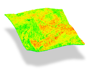
Light Detection and Ranging (lidar), also known as Airborne Laser Scanning (ALS), is an active, remote sensing technology used to produce detailed 3D models of the terrain surface and forest canopy. It provides high-resolution measurements of forest canopy structure, height and crown closure and can inform on key attributes, such as basal area and volume. Since 2007, the provincial government has worked with research institutions and industry on applying this technology in the natural resource sector. The Forest Analysis and Inventory Branch (FAIB) actively uses lidar to improve forest inventory information by incorporating lidar enhanced forest inventories (LEFIs) into the provincial inventory program.
As part of this effort, FAIB has developed a three-tier classification of LEFIs:
- Tier 1: Tree height updates to an existing inventory,
- Tier 2: Area-based approach (ABA) modelling of structural attributes (e.g. volume, basal area),
- Tier 3: Tree species classification and stand delineation.
For detailed descriptions of each tier, please consult the FAIB lidar standards documents section

Highlights
2025
- Interior Douglas Fir (IDF) region overlapping with Williams Lake and 100 Mile House Timber Supply Areas (TSAs). Expected Tier 3 LEFI completion in 2026.
- Invermere TSA. Expected Tier 3 LEFI completion in 2027.
- Kalum TSA, in planning. Expected Tier 3 LEFI completion in 2028.
2023
- Boundary TSA Tier 3 LEFI completed with partners Interfor and British Columbia Timber Sales (BCTS).
- FAIB partners with the Capital Regional District and the University of Victoria on a research project to investigate the potential for lidar to measure forest fuel attributes that drive wildfire behavior models.
- Working with GeoBC on the provincial lidar program. FAIB is responsible for the creation of lidar forest information products (e.g. canopy height models, treetops, canopy metrics). For more information visit: https://lidar.gov.bc.ca/pages/program
2015 - 2016
- FAIB produced another operational Tier 2 lidar enhanced forest inventory project in the Okanagan and Kamloops TSAs with Tolko Industries and BCTS.
- Haida Gwaii Tier 2 LEFI completed.
2012 - 2014
- FAIB was a finalist for a Premier’s award in the partnership category while completing a Tier 2 lidar enhanced forest inventory project over 130,000 hectares of forested land on northern Vancouver Island. This project included partners; Western Forest Products, BCTS and University of Victoria.
- FAIB joined a similar partnership with the University of British Columbia on a lidar trial in the UBC Knife Creek Research Forest near Williams Lake in the Interior.
2008
- FAIB completed the first lidar inventory pilot project partnering with Canfor and the University of Victoria in Tree Farm Licence 18.
FAIB lidar standards documents
Contact information
For more information on lidar, contact our remote sensing specialist.
Geoffrey.Quinn@gov.bc.ca

