
Fort St. John Land & Resource Management Plan
The Fort St. John Land and Resource Management Plan (LRMP) was initiated in 1993 to ensure sustainable management of land, resources, water and ecosystems within the Fort St. John Timber Supply Area. The plan is an outcome of the deliberations of the Fort St. John planning table comprised of private citizens, stakeholders (industrial sectors, environmental groups, etc.), and government agency representatives. First Nations chose not to participate in the planning exercise. The management direction put forward by the plan is without prejudice to Treaty or Aboriginal rights, and ongoing and/or future treaty negotiations. The plan recommendations were approved by government in 1997.
The planning table recommended that a portion of the planning area be included in a formal designation for the area known as the Muskwa-Kechika. In 1997, the Muskwa-Kechika Management Area was legally established.
- For further information, access the Fort St. John Land and Resource Management Plan - 1997 (PDF, 19.1MB)
Plan Status: Approved
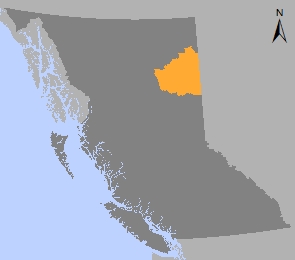
Plan Area: 4,676,637 hectares
Natural Resource Region: Northeast
Natural Resource District: Peace
Timber Supply Area: Fort St. John
Muskwa-Kechika Management Area
Contact information
Contact us if you have questions about land and resource management in the Fort St. John LRMP area.
(778) 576-8901