
Dawson Creek Land & Resource Management Plan
The Dawson Creek Land and Resource Management Plan (LRMP) was initiated in 1992 to provide direction and assurance for resource development to continue while protecting environmental and recreational values within the plan area. The plan is the outcome of consensus decision-making by the Dawson Creek planning table comprised of private citizens, stakeholders (industrial sectors, environmental groups, etc.), and government agency representatives. The majority of local First Nations chose not to participate in the planning process. The management direction put forward within the plan is without prejudice to Aboriginal and treaty rights. The plan recommendations were approved by government in 1999.
The Dawson Creek LRMP identified several special resource management zones because of significant wildlife habitat and wilderness recreation values. In 2000, a strategic management plan for the Dunlevy Creek Special Management Zone was initiated to guide oil and gas development and the disposition of petroleum and natural gas tenures, and to enable landscape-level planning to guide forest development. The Dunlevy Creek Management Plan was approved by government in 2002.
In 2009, old growth management areas (OGMAs) were established for the Dawson Creek Timber Supply Area.
Legal Direction
Implementation & Monitoring Direction
Plans
Decision Support Reports
Plan Status: Approved
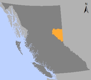
Plan Area: 2,989,836 hectares
Natural Resource Region: Northeast
Natural Resource District: Peace
Timber Supply Area: Dawson Creek
OGMAs under the Oil & Gas Activities Act
Contact information
Contact us if you have questions about land and resource management in the Dawson Creek LRMP area.
(778) 576-8901