
Bulkley Valley Sustainable Resource Management Plan
The 2005 Bulkley Valley Sustainable Resource Management Plan (SRMP) presents objectives and strategies for resource management within the Bulkley Valley portion of the Bulkley LRMP. These objectives were never legally established.
In 2006, Objectives Set by Government for the Bulkley Timber Supply Area streamlined the non-legal objectives with legal objectives from the Bulkley LRMP and 12 landscape unit plans. The Order Establishing Land Use Objectives: Bulkley TSA - 2006 accompanying these objectives cancelled the objectives in Appendix 1 of the Order Establishing RMZs and RMZ Objectives Within the Area Covered by the Bulkley Land Resource Management Plans (2000) and the objectives in the 12 landscape unit plans.
The remaining objectives in the Bulkley LRMP Higher Level Plan Order Establishing RMZs and RMZ Objectives - 2000 Appendices 2-4 are still in effect. Additional objectives were legally established through that order, and can be found in the Bulkley LRMP Objectives Set by Government - 2006.
Plan & Plan Maps
- Bulkley Valley Sustainable Resource Management Plan - 2006 (PDF, 6.2MB)
- Resource Zones (PDF, 1.7MB)
- Ecosystem Network (PDF, 1.8MB)
- Timber Harvesting Landbase (PDF, 1.9MB)
- Key Ungulate Habitat (PDF, 1.7MB)
- Agriculture Development and Wildlife Habitat
- Visual Quality Objectives (PDF, 1.8MB)
- Northeast Slope and Perimeter Trail Systems (PDF)
- Trails and Recreational Features (PDF, 1.7MB)
- Contour Base Map (PDF, 1.4MB)
- Digital Elevation Model Base Map (PDF, 3MB)
- Satellite Base Map (PDF, 2.9MB)
- Biogeoclimatic Zones (PDF, 1.8MB)
- Management Areas (PDF, 1.5MB)
- Ortho Base Map (PDF, 5.7MB)
- Plan Area Map (PDF, 3.6MB)
1:100,000 Maps
- Map 1 - Resource Zones (PDF, 2.8MB)
- Map 2 - Ecosystem Network (PDF, 2.9MB)
- Map 3 - Timber Harvesting Landbase (PDF, 3.2MB)
- Map 4 - Key Ungulate Habitat (PDF, 2.7MB)
- Map 5 - Agriculture Development and Wildlife Habitat (PDF, 2.6MB)
- Map 6 - Visual Quality Objectives (PDF, 2.8MB)
- Map 7 - North East Slope and Perimeter Trail Systems (PDF, 1.1MB)
- Map 10 - Trails and Recreational Features (PDF, 2.5MB)
- Contour Base Map (PDF, 2.5MB)
- Digital Elevation Model Base Map (PDF, 14.5MB)
- Satellite Base Map (PDF, 13.2MB)
- Biogeoclimatic Zones (PDF, 3.4MB)
GIS Data
Plan Type: Sustainable Resource Management Plan
Plan Status: Approved, not legally established.
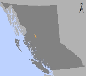
Plan Area: 66,971 hectares
Natural Resource Region: Skeena
Natural Resource District: Skeena Stikine
Timber Supply Area: Bulkley