
Fort St. James Sustainable Resource Management Plan
The Fort St. James Sustainable Resource Management Plan (SRMP) is a consolidated and coordinated approach to a planning at the landscape level for specific values on crown land.
Sustainable resource management plans are a planning tool for the B.C. government to implement strategic land use plans, identify economic opportunities and conserve environmental values. The goal of these plans is to provide objectives that will be site specific, results-based and operationally relevant.
In the Fort St. James LRMP there are sustainable resource management plans for:
- Spatial locations and objectives for scenic areas and visual management
- Delineation of specific areas for agriculture land development
- Objectives for the management of old forest and biodiversity
Old Growth Forest & Biodiversity Management
Conserving old growth forest is an important component of the Fort St. James LRMP and a critical element in the management of biodiversity at the landscape scale. The Fort St. James LRMP provides direction to ensure the protection of old-growth forests into the future. Old growth forests in the Fort St. James LRMP planning area are managed by the Prince George Timber Supply Area Biodiversity Order.
Visual Management
The Fort St. James LRMP provides guidance on the management of the visual landscape to ensure scenic quality is maintained through the designation of scenic areas and visual quality objectives. The Fort St. James SRMP for visual management was a technical process that assessed the landscape visual sensitivity and determine appropriate level of visual alterations.
Agriculture Land Development
The Fort St. James LRMP identifies agriculture and range as an important socio-economic value in the plan area. The Fort St. James LRMP provides general management direction to promote agriculture expansion and minimize the conflict between agriculture and grazing with other resources uses. The Fort St. James LRMP is complementary to the Fort St. James Crown Land Plan (1984) and the Agriculture Land Reserve (ALR)]
The Fort St. James SRMP – Agriculture Development Areas (ADAs) was a planning process within the Prince George Crown land plan area to legally designate specific parcels of crown land for agriculture development and settlements reserves areas
Plan & Plan Maps
Legal Direction
Maps
Decision Support Reports & Background Information
Plan Type: Sustainable Resource Management Plan
Plan Status: Approved, legally established
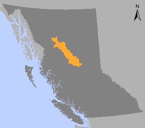
Plan Area: 3,180,877 hectares
Natural Resource Region: Omineca
Natural Resource District: Fort St James
Timber Supply Area: Prince George
Spatial Data
Related Links
Contact information
Contact FrontCounter BC for more information about land and resource management planning in the Fort St. James area.
250 996-5200