Provincial ambient water quality monitoring

Physical, chemical and biological data are collected biannually from a wide variety of B.C. lakes to determine current water quality status and to understand long-term trends.
Currently, 53 lakes (74 lake sites) are sampled, which cover various ecoprovinces and span wide gradients of area, depth, and trophic status. Explore these sites in the interactive map below.
Lake water quality trend data
Analysis is underway regarding these topics:
- Provincial lake water quality trends
- Trophic status of B.C. lakes
- Regional climate signals in lakes
Sampling strategy
Lake sampling technique and effort have been standardized to provide a consistent province-wide approach.
When do we sample?
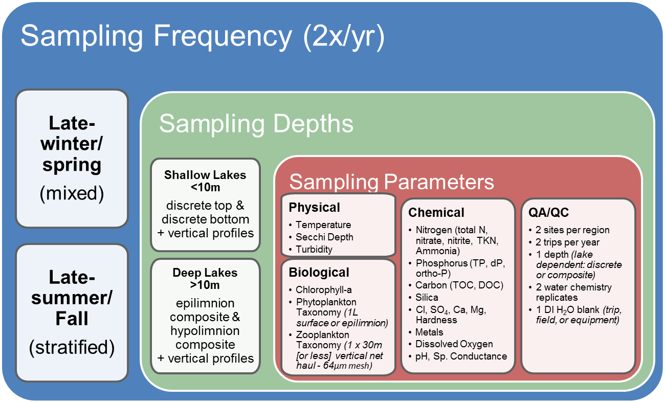
Sampling is conducted biannually
- Late-winter/spring (mixed conditions): February to May, depending on location and ice melt
- Late-summer/fall (stratified conditions): August to September
Where and what do we sample?
Water chemistry samples are collected from multiple depths
- Shallow lakes (<10 m) = 1 surface discrete grab sample (1 m below water surface) + bottom discrete grab sample (1 m above sediment surface)
- Deep lakes (>10 m) = 1 epilimnion composite + 1 hypolimnion composite
Vertical profiles are obtained using multi-parameter sondes (temperature, dissolved oxygen, specific conductance, pH)
- For shallower sites, measurements are taken every 1 m until the bottom
- For deeper sites, measurements are taken every 1 m until 20 m, and then every 5 m until 50 m.
Water Clarity
- Measured as Secchi depth
Plankton
- Phytoplankton: 1 x 1 L sample
- Shallow lakes = discrete surface
- Deep lakes = epilimnetic composite
- Zooplankton: 1 x 30 m vertical net haul (or 1 m off bottom for shallower lakes)
- Invasive zebra/quagga mussel veliger sampling (Late-summer/fall sampling only)

