Snow conditions commentary
A bi-weekly commentary of snow conditions based on readings from the B.C. Automated Snow Weather Station (ASWS) network is published during the snow season. This is not the snow bulletin and the values listed are not the official snow basin indices.
May 1, 2026
Weather during the final half of April was generally dry with temperatures at normal to slightly above normal. A transition to a significant heat wave is occurring and expected to remain through the first week of May.
A complete listing of Automated Snow Weather Stations (ASWS), expressed as a percent of the long-term median for each station’s entire period of record, is available in the ASWS Weekly Summary (PDF, 385 KB)*. Hyperlinks to interactive plots are provided for each station within the table.
Note: These values are not the official snow basin indices.
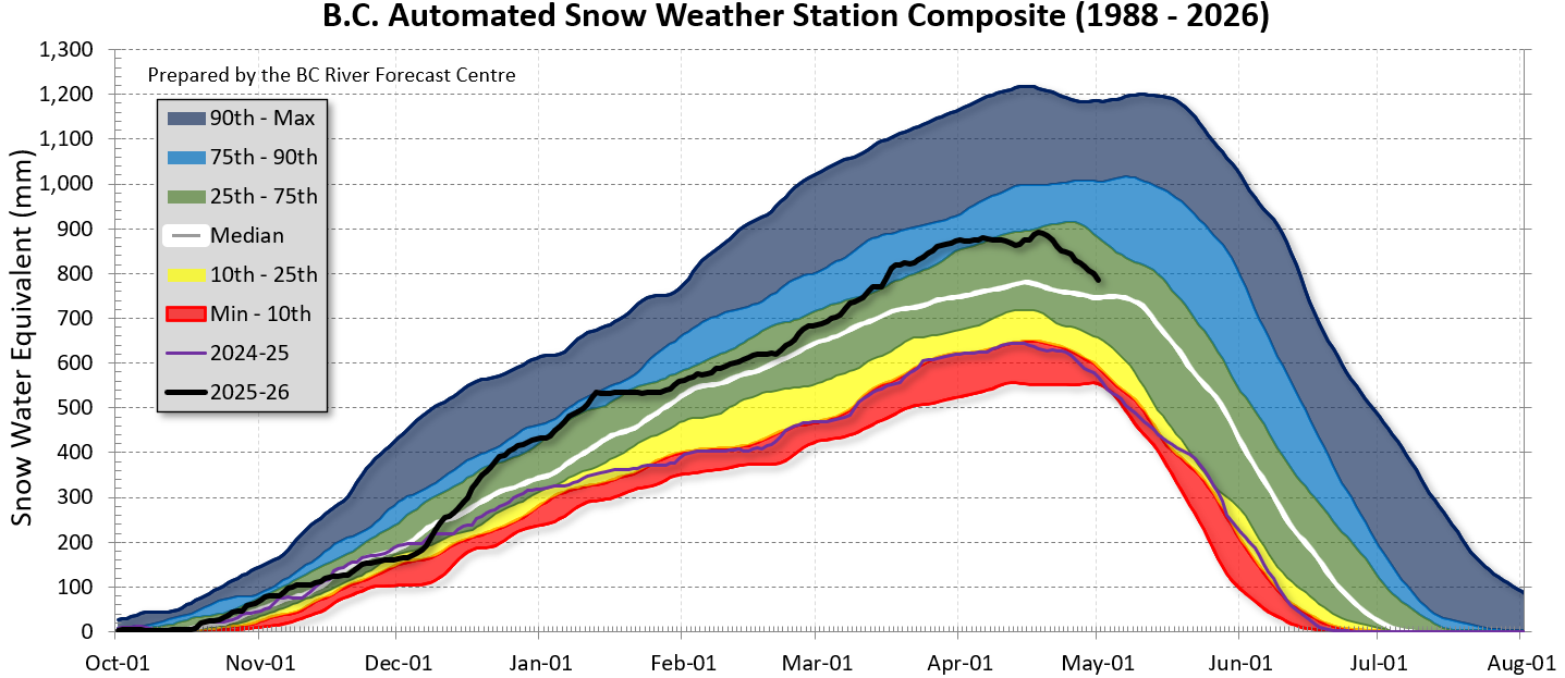
The provincial average across all ASWS sites is 109% of the period-of-record median for May 1, 2026, a decrease from 119% on April 15. Stations within the Fraser River basin average 99% (April 15: 113%). On average, by May 1st approximately 6% of the peak snowpack melts. The date of peak snow was April 18 this year, and approximately 15% of the peak snow has melted.
A provincial composite graph of automated stations with relatively long-term records (beginning in 1988) is provided below.
 Based on this composite, the May 1st percentage of median is 104% (April 15: 112%), placing current conditions at approximately the 56th percentile (April 1st: 71st percentile).
The May 1st, 2026 Snow and Water Supply Bulletin is scheduled to be released May 8th to 12th, 2026, based on data availability. The bulletin will provide a more comprehensive summary of the May 1st snowpack conditions and will include the official Snow Basin Indices.
Snow Links
Contact information
For media inquiries please contact Government Communications and Public Engagement (WLRS) at 250-896-7365
For other contacts, please check the B.C. Government Directory.
