
Data by Air Zones
Air zones are areas that typically exhibit similar air quality characteristics, issues and trends, and are the basis for monitoring, reporting and taking action under the Air Quality Management System.
Seven air zones have been identified (view air zone map). Click on an air zone below to view a list of air monitoring stations and their current ambient pollutant concentrations and meteorological data (from the BC Air Data Archive).
- Northeast air zone
(includes Fort Nelson, Fort St. John, Tumbler Ridge) - Learn more about monitoring in north-east B.C.
- Central interior air zone
(includes Prince George, Smithers, Mackenzie, Quesnel, Williams Lake, Valemount)
- Coastal air zone (includes Prince Rupert, Terrace, Kitimat, Ucluelet)
- Southern interior air zone (includes Barriere, Golden, Lillooet, Kamloops, Kelowna Castlegar, Cranbrook)
- Georgia strait air zone (includes Victoria, Nanaimo, Comox, Campbell River, Powell River)
- Lower fraser valley air zone (includes Vancouver / Lower Mainland, Chilliwack, Hope)
- Northwest air zone (includes Atlin, Dease Lake) - there are no air monitoring stations in this air zone.
Air zones on interactive map
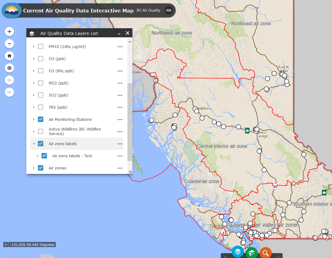
Air Zones can also be viewed on our interactive map through the B.C. Map Hub.