Powell River ISA Refresh 2022
Notice - January 17, 2022
On January 4, 2022, the published values for all monuments in the Powell River ISA were subject to a 3-dimensional refresh. Changes were approximately 0.36m horizontal and -3.1m vertical; they were not uniform across the network. Some monuments were removed from circulation due to having an unknown compatibility with main ISA network. The new values are accurately referenced to official horizontal and vertical datums in B.C.

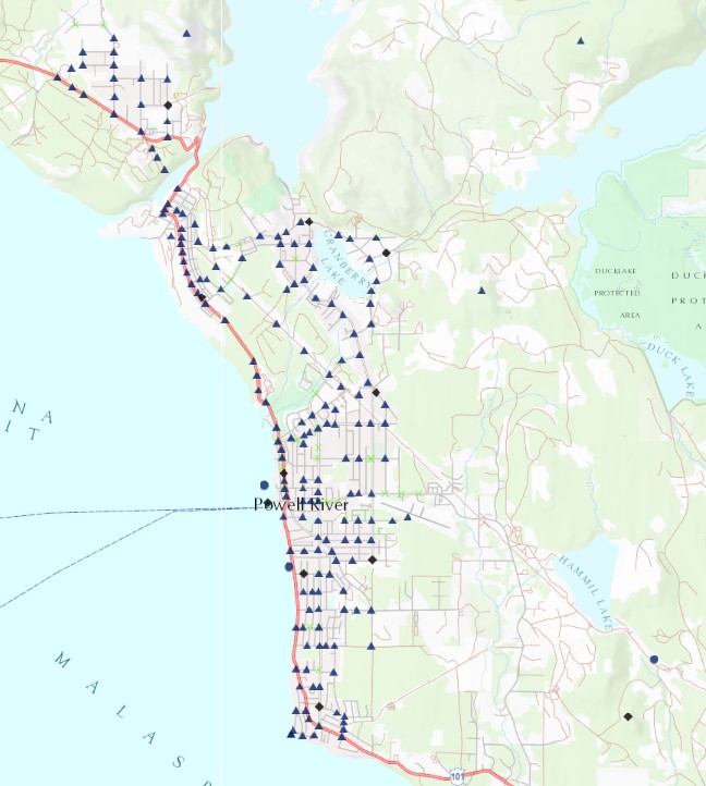
Figure 1: The Powell River ISA as shown in iMaps
Surveyors can expect greatly improved compatibility with independent GNSS-derived positions via post-processing methods such as CSRS-PPP or baselines to provincial/federal active control. The corrections were derived from a GNSS sampling of the network; not all monuments were directly occupied and therefore the accuracy and reliability of corrected positions will have some limitations. That said, new network accuracy (with respect to official horizontal and vertical provincial datums) for the ISA as a whole, will be greatly improved over the previous published values.
Download changes applied throughout the ISA:
Surveyors should check the new data carefully and report any issues. For high-precision work, consider resurveying to ensure accuracy with the new values.
If there are instances where the new published values are found to be poor please report them to GeoBC via Marker Condition Reports.
Horizontal Updates
The Powell River ISA's horizontal data was revised on January 4, 2022. On average, the horizontal positions were adjusted by 0.36 meters. This was done using a grid shift model because the changes were not uniform. Prior to the update the data used old terrestrial observations, which had a systematic error. The new adjustments are based on GNSS observations and are more accurate. Surveyors will find these updated values much better for GNSS-based measurements.
Vertical Updates
The vertical data was updated to align with the CGVD28 datum. Previously, the ISA used a local datum that was about 3.1 meters different from CGVD28. The new heights are now more accurate and consistent with GNSS-derived values. This change helps eliminate confusion from the old local datum. The shift between the two datums varies across the ISA, with differences from -3.09 to -3.145 meters.
