Open Files
Open Files present the interim results of ongoing research, particularly mapping projects.
Jump to:
2026 | 2025 | 2024 | 2023 | 2022 | 2021 | 2020 | 2019 | 2018 | 2017 | 2016 | 2015 | 2014 | 2013 | 2012 | 2011 | 2010 | 2009-2000 | 1999-1990 | 1989-1986
2026
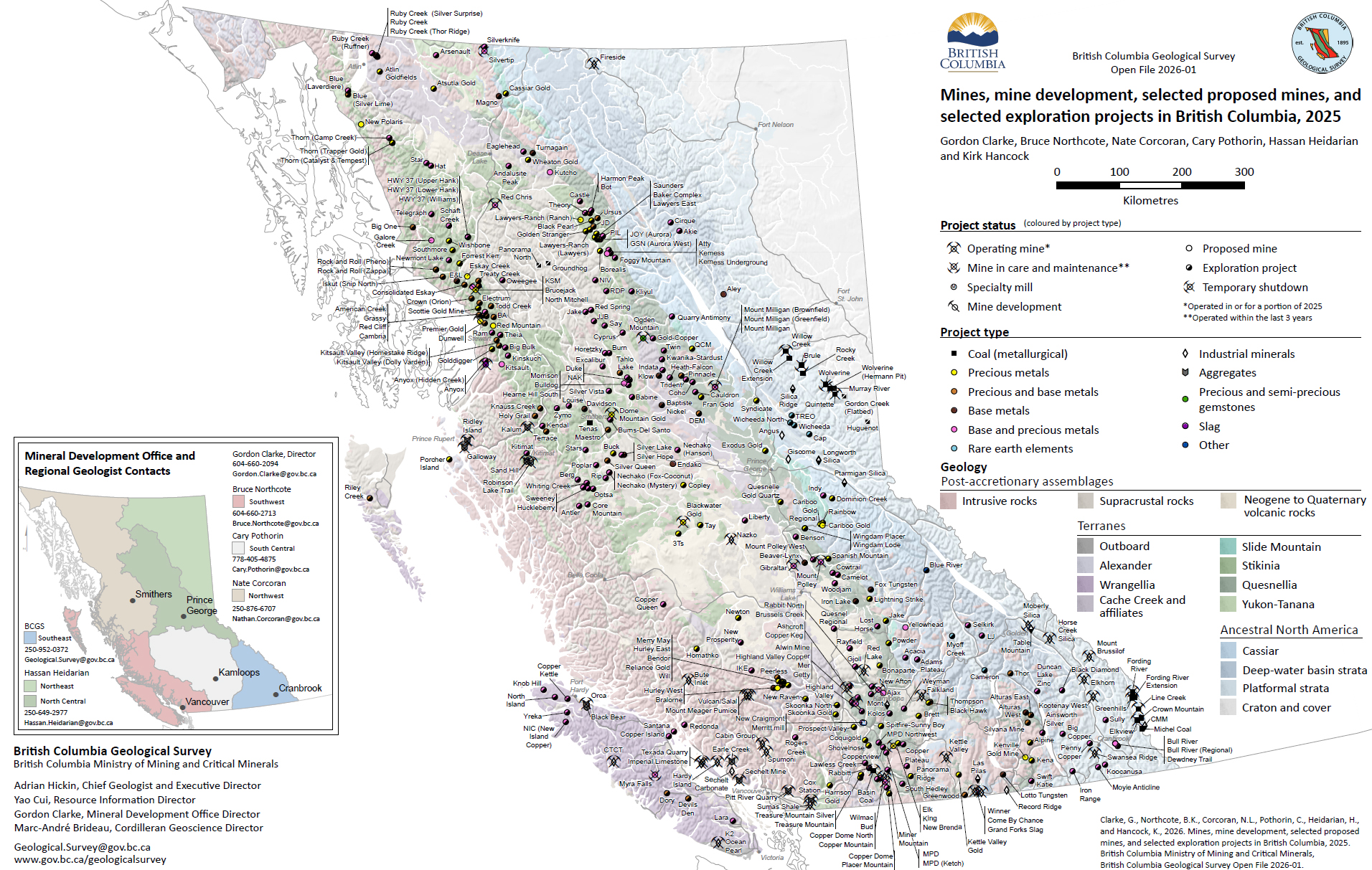
Clarke, G., Northcote, B.K., Corcoran, N.L., Pothorin, C., Heidarian, H., and Hancock, K.
British Columbia is Canada’s largest producer of copper and metallurgical coal and only producer of molybdenum. Also produced are significant amounts of gold and silver, and more than 30 industrial minerals including gypsum, magnesite, limestone, and dimension stone. Numerous quarries produce sand and gravel or crushed aggregate.
2025
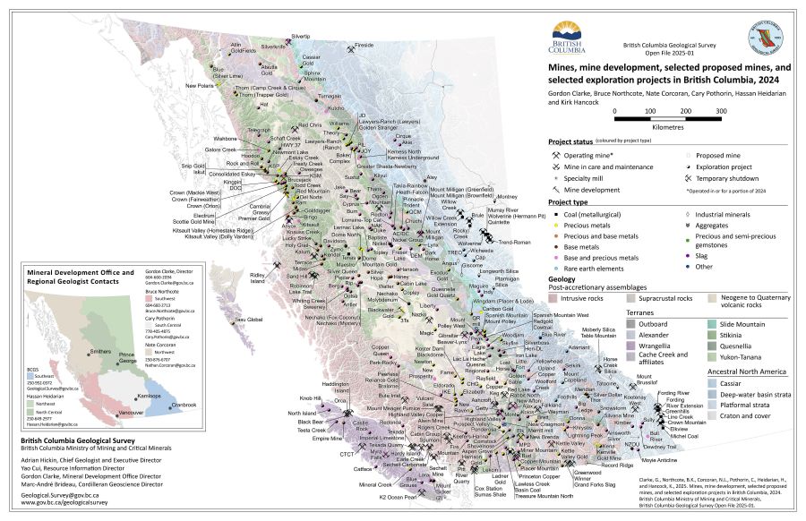
Clarke, G., Northcote, B.K., Corcoran, N.L., Pothorin, C., Heidarian, H., and Hancock, K.
British Columbia is Canada’s largest exporter of metallurgical coal, leading producer of copper, and only producer of molybdenum. Also produced are significant amounts of gold, and silver, and more than 30 industrial minerals including gypsum, magnesite, limestone, and dimension stone. Numerous quarries produce sand and gravel or crushed aggregate.
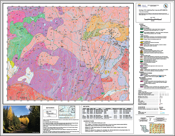
Höy, T. and DeFields, G.M.
Geology of the Lightning Peak map area (NTS 082E/15)
2024
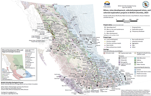
Clarke, G., Northcote, B.K., Corcoran, N.L., Pothorin, C., Heidarian, H., and Hancock, K.
British Columbia is Canada’s largest exporter of coal, leading producer of copper, and only producer of molybdenum. Also produced are significant amounts of gold, silver, lead, and zinc, and more than 30 industrial minerals including gypsum, magnesite, limestone, and dimension stone. Numerous quarries produce sand and gravel or crushed aggregate. In 2023, 10 metal mines operated during at least part of the year. Metallurgical coal was produced at four large open-pit operations in the southeastern part of the province and three open-pit operations in the northeastern part. About 30 industrial mineral mines and more than 1000 aggregate mines and quarries were in operation.
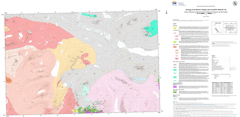
Mihalynuk, M.G., Zagorevski, A., Campbell, R.W., Vaillancourt, A., and Haji Egeh, A.
Geological mapping south of the Yukon border, in the Gladys Lake area near Atlin, updates mapping of 1950s vintage that predates concepts derived from plate tectonics and widespread recognition of ophiolitic sequences. Much of the area is underlain by deformed chert and siliciclastic rocks (Middle Triassic - Lower Jurassic) that overlap Cache Creek terrane (Mississippian - Permian) and primitive arc basalt and slivers of mantle peridotite of the Atlin terrane (mostly Permian to Early Triassic). Some mantle peridotite appears to have been exposed at the seafloor by detachment faulting. It is immediately overlain hemipelagic strata containing laminae with copper, zinc and lead sulfides and elevated contents of other elements such as silver, manganese, germanium and palladium. Lower Jurassic and older rocks are extensively cut by the batholithic scale Fourth of July intrusions (Middle Jurassic, host rocks of the polymetallic Atlin Ruffer deposit) and Surprise Lake intrusions (Late Cretaceous, host rocks of the Ruby Creek molybdenum deposit).
Elia, E.A., Ferbey, T., and Ward, B.C
Remotely piloted aircraft systems (RPAS) and the sensors they carry enable rapid collection and processing of high-resolution lidar data at low cost. We used a commercially available RPAS to collect lidar data at 80 to 100 m above ground level to build digital elevation models at resolutions of up to 0.25 m over areas <1.3 km2 in heavily drift covered parts of the Interior Plateau, near the Woodjam and Mount Polley deposits and in the Guichon Creek batholith. The elevation models and derived hillshade models enabled 1:5,000-scale surficial geology mapping in which features that might otherwise be masked by dense forest canopies could be recognized. Landforms and units as small as ~100 m2 that exhibit subtle surface expressions and cannot be identified on traditional < 1:20,000-scale air photos or from ground observations can be mapped using RPAS lidar.
Ferbey, T., Elia, E.A., Shives, R.B.K., Martin-Burtart, N., Best, M., Ward, B.C.
Although radiometric data are commonly used to aid bedrock mapping and prospecting, the radiometric signature of subglacial tills in extensively drift-covered areas such as the Interior Plateau is not commonly considered. To assess if potassium concentrations in surficial sediments can be measured reliably using a remotely piloted aircraft system (RPAS), we collected radiometric data above low-radioactivity subglacial tills (≤2.00% potassium) near porphyry deposits at the Mount Polley mine, Woodjam developed prospect, and Guichon Creek batholith areas. Using a low-volume crystal (0.35 L) designed for an RPAS-borne gamma-ray spectrometer, potassium data measured from near the Mount Polley mine compare well to in-situ potassium determinations by a handheld gamma-ray spectrometer (120 s count time) and lithium fusion ICP-ES determinations on samples of the same subglacial tills. In addition, our high-resolution RPAS potassium data (2.5-3.33 m cell) are in general agreement with overlapping regional fixed-wing data (100 m cell). RPAS radiometrics fill a scale gap between traditional airborne and ground surveys, can be collected efficiently and affordably, and can be processed in the field to guide geological surveys in near real-time. For high-quality data to be collected over low-radioactivity materials, the instrument must be flown slowly (1 m/s) and close to the ground (≤10 m above ground level). This limitation restricts surveys of low-radioactivity materials in the Interior Plateau to recent cutblocks, which hampers utility of the method. Nonetheless, extended to uranium and thorium, the method could prove useful over higher radioactivity materials where flying height could be increased, or in regions lacking significant vegetation such as deserts or above tree line in alpine or arctic settings.
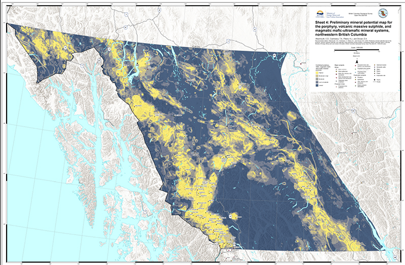
Wearmouth, C., Czertowicz, T., Peters, K.J., and Orovan, E.
After about 30 years, the British Columbia Geological Survey is revitalizing its mineral potential mapping efforts. This new modelling takes advantage of information gained from bedrock mapping since the 1990s, improved exploration techniques, new exploration discoveries, and a better understanding of the geologic processes leading to mineralization. Also, exponential increases in computing power in the last 30 years have led to significant advances in applying geographic information system (GIS) platforms and using computerized statistical methods to model mineral potential. The current work adopts a mineral systems approach, which emphasizes similarities between deposits and takes a large-scale view of all the components that control generating and preserving deposits (source, transport, trap, and deposition) and uses multiple geological features as proxies for the presence of a complete mineral system. We use the weights of evidence method statistical spatial analysis of many mappable proxies (e.g., distance to intrusive rock contacts, fault intersection density, stream-sediment geochemical anomalies, magnetic anomalies) to model the mineral potential for porphyry, volcanogenic massive sulphide and mafic to ultramafic sulphide mineral systems in a large region of northwestern British Columbia. The study area includes the lands and traditional territories of many Indigenous rights holders, and this new mineral potential modelling will support decision-making processes and land-use decisions. Also, as society places more value on the transition to a low-carbon future, demand for minerals important for energy generation, storage, and transmission will increase. The new modelling will aid in the search for relatively common critical elements such as copper, but also for ancillary ‘companion’ critical elements which, occurring in small amounts, were previously overlooked or considered uneconomic. In this release we present mineral potential modelling maps for the porphyry mineral system (Sheet 1), the volcanogenic massive sulphide system (Sheet 2), and the magmatic mafic-ultramafic system (Sheet 3) and a map that combines the results from all three systems (Sheet 4). These maps depict the relative prospectivity of both primary and companion commodities.
Ootes, L and Wall, C.
In geological environments that rapidly evolved, high-precision geochronologic techniques such as chemical abrasion isotope dilution thermal ionization mass spectrometry (CA-TIMS) may be needed to resolve temporal uncertainties from less precise laser ablation inductively coupled plasma mass-spectrometry (LA-ICP-MS). The Toodoggone region of eastern Stikine terrane hosts Late Triassic to Early Jurassic porphyry Cu-Au and epithermal Au-Ag deposits. Mineralization is in the Asitka, Takla (Stuhini), and Hazelton groups and allied granitic intrusions. In north-central Toodoggone region, the areally extensive but undivided Black Lake intrusive suite is spatially related to numerous epithermal mineralized zones. Two new U-Pb zircon ages from the Black Lake intrusive suite, determined by high-precision CA-TIMS indicate that early granodiorite crystallized at 202.87 ± 0.03 Ma (n=6/6; MSWD=1.2) and slightly younger quartz monzonite at 200.02 ± 0.03 Ma (n=6/6; MSWD = 0.8). The results are similar to previous ages for Kemess porphyry Cu-Au mineralization in southern Toodoggone region. Detrital zircons analyzed by LA-ICP-MS from conglomerates at the base of the Toodoggone Formation (Hazelton Group) indicate that they were sourced from the Asitka Group (ca. 313 Ma) and immediately underlying Takla (Stuhini) Group (225 and 207 Ma) and yield a maximum likely age (MLA) of 196 ± 3.8 Ma. Analysis of detrital zircons from an interflow sandstone higher in section indicate derivation from coeval volcanic rocks (ca. 200 Ma); six of the youngest grains from this sample were measured by the CA-TIMS method, yielding a precise maximum depositional age (MDA) of 194.96 ± 0.04 Ma (n=3/6; MSWD=1.5). The results are interpreted to indicate that the Toodoggone Formation post-dates crystallization of the main phases of the Black Lake intrusive suite, and that epithermal mineralization in the Toodoggone Formation cannot be linked in time to these intrusive rocks.
Elia, E.A., Ferbey, T., Campagne, T., Best, M., Shives, R.B.K., and Ward, B.C.
Remotely piloted aircraft systems (RPAS) enable rapid collection of airborne magnetic data using miniaturized magnetometer payloads. We flew two RPAS magnetometer surveys over part of the Deerhorn alkalic porphyry Cu-Au occurrence in British Columbia’s Interior Plateau: a large low-resolution survey at 97.5 m above ground level with 100 m traverse line spacing and a smaller high-resolution survey at 10 m above ground level with 5 m traverse line spacing. Collection of precise, high spatial resolution magnetic data was made possible by terrain following surveys, with altitude above ground maintained by an active RPAS-mounted radar altimeter or by three-dimensional waypoints from a 25 m digital elevation model. We produced two data-rich and two data-poor models of three-dimensional magnetic susceptibility in surface sediments from our RPAS surveys and supplemented by an existing helicopter-acquired magnetic dataset, surficial geology mapping, magnetic depth to source analysis, and depth to bedrock values from exploration drill-hole data. The high-resolution and low-resolution surveys produced inverted models with cell volumes of 0.98 m3 and 612.5 m3. Magnetite contents in the Deerhorn study area and the RPAS survey designs we used did not allow separating the near-surface sediment response from the underlying bedrock. A really larger, high-resolution RPAS surveys over sediments with higher magnetic susceptibility may better isolate the surface component and be used to supplement traditional till geochemical or mineralogical surveys.
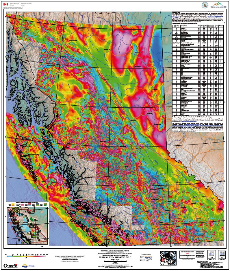
Oneschuk, D., Hayward, N., Fortin, G., and Hickin, A.S.
Magnetic field measurements reflect magnetic properties of bedrock and provides qualitative and quantitative information used in geological mapping. Understanding the geology assists in mineral exploration activities and provide useful information necessary for communities, aboriginal associations, and government to make land use decisions. This project was undertaken to improve our knowledge of the area and will support ongoing geological mapping and resource assessment.
Also published as Geological Survey of Canada Open File 9222, 1:500,000 scale.
Veness, H., Elia, E.A., and Ferbey, T.
This publication catalogues newly scanned surficial geology maps from the British Columbia Geological Survey physical collection. This digital update includes scans of 1339 entries in the surficial geology map index by Bobrowsky et al. (1992), and 603 additional map scans not in that index. These maps are organized in an updated Excel workbook (*.xlsx) and spatial files (*.shp), which contain download links to the *.pdf scans. This update provides, for the first time, access to our physical collection and many maps in Bobrowsky et al. (1992).
Wilson, A.M., Russell, J.K., and Harris, M.A.
Glaciovolcanism involves the interaction between volcanic eruptions and ice in all its forms and produces distinct and diverse edifice morphologies and characteristic deposit lithofacies that are important proxies for local and global paleoclimates. Here, we present nine geologic maps of glaciovolcanic centers situated in the Garibaldi volcanic belt (GVB) of southwestern British Columbia, Canada. Our maps delineate lithostratigraphy, geochemistry, geochronology and petrography, and we use these data to interpret the eruption environment. The maps include (1) Monmouth Creek volcano, (2) Brohm Ridge of the Mount Garibaldi volcanic complex, (3) the Table, (4) the Black Tusk, (5) the Cinder Cone, (6) Cracked Mountain volcano, (7) Lillooet Glacier volcano, (8) the Salal Glacier volcanic field and, (9) the Bridge River volcanic field. For each map area, we use field observations to establish a glaciovolcanic versus non-glaciovolcanic origin and to constrain eruption style and the syn-eruptive paleoenvironment (i.e., paleo ice thickness and extent). These data serve to test, refine, and expand on existing paleoclimate proxies and provide a powerful terrestrial-based means to track the temporal and spatial wax and wane of the Coast Mountain sector of the Cordilleran ice sheet (CIS) beyond the last glacial stage.
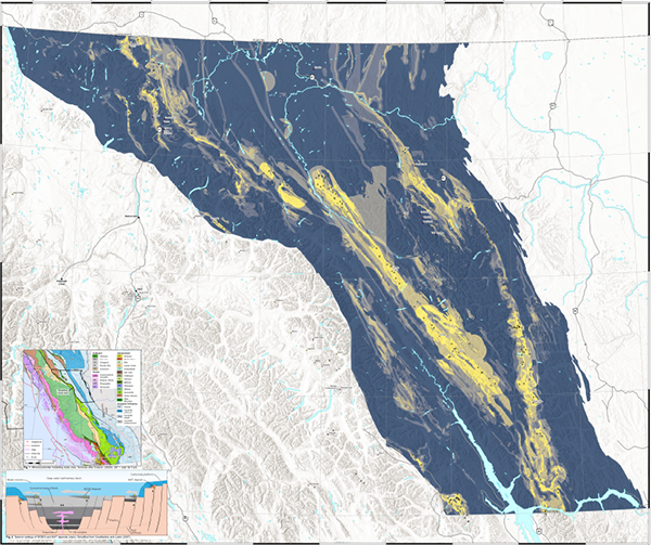
Wearmouth, C., Czertowicz, T.A., and Peters, K.J.
The British Columbia Geological Survey is revitalizing mineral potential mapping after nearly 30 years. This modelling uses data from bedrock mapping since the 1990s and integrates new discoveries, advanced exploration methods, and improved knowledge of geological processes. Furthermore, increased computing power during the past three decades has boosted the use of GIS platforms and statistical methods for mineral potential modelling. The current work uses a mineral systems approach, which focusses on the similarities between different deposits. This approach considers all the factors involved in creating and preserving deposits (source, transport, trap, and deposition). Herein we apply the weights of evidence method for statistical spatial analysis of numerous mappable indicators (e.g., proximity to intrusive rock contacts, fault intersection density, stream-sediment geochemical anomalies, magnetic anomalies) to model the mineral potential for sedimentary exhalative (SEDEX) and Mississippi Valley-type (MVT) mineral systems in a large area of northeastern British Columbia.The study region encompasses the lands and traditional territories of many Indigenous rights holders, and this new mineral potential modeling will support decision-making and land-use planning. As society emphasizes a shift towards a low-carbon future, there will be an increased demand for minerals crucial for energy generation, storage, and transmission. This new modeling supports the search for both common critical elements like copper and ancillary 'companion' critical elements that were previously considered uneconomic or insignificant. This release presents mineral potential modelling maps for the sedimentary exhalative (SEDEX) mineral system (Sheet 1), the Mississippi Valley-type system (Sheet 2), and a combined map of both systems (Sheet 3), illustrating the relative prospectivity of primary and companion commodities.
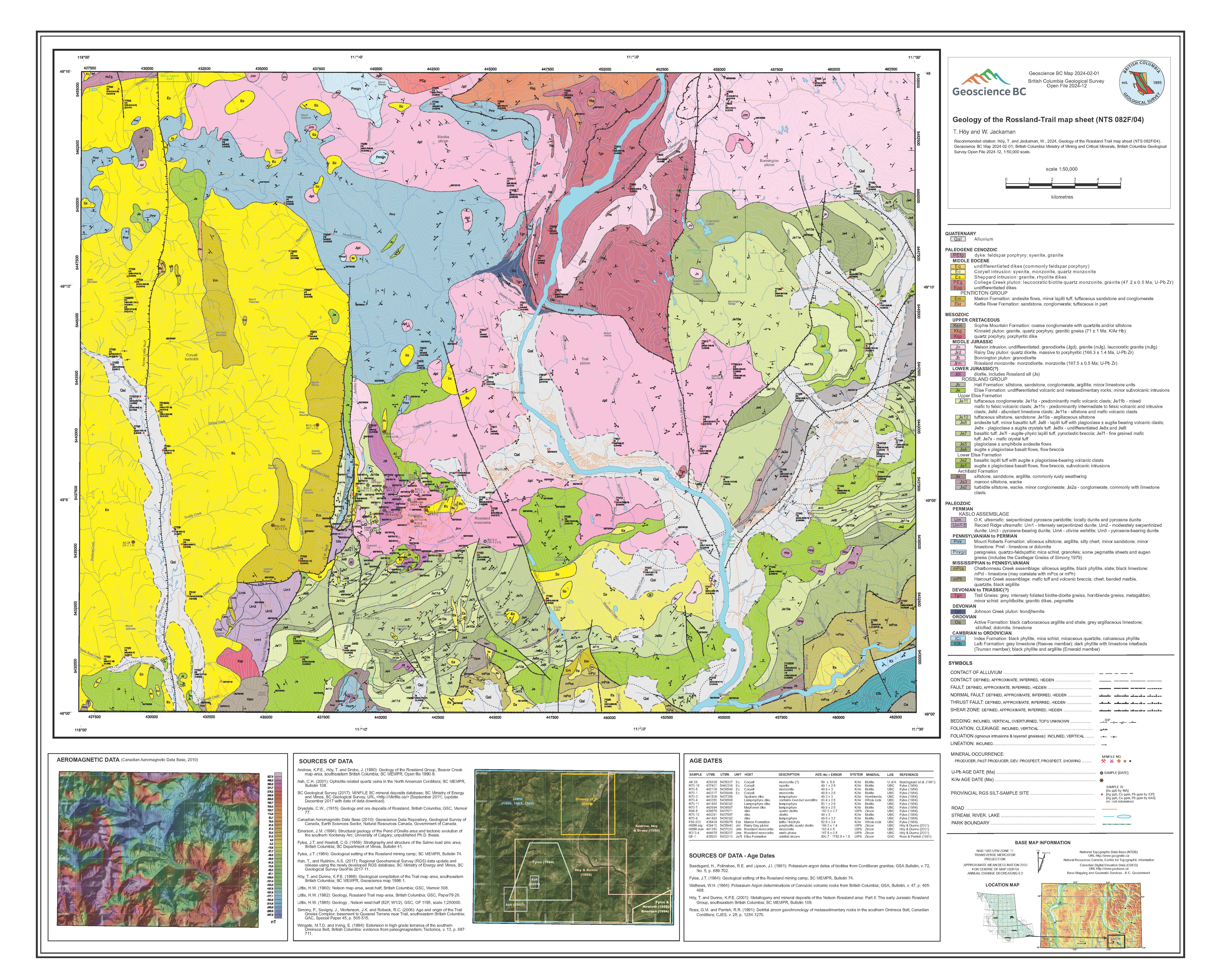
Höy, T. and Jackaman, W.
Geology of the Rossland-Trail map sheet (NTS 082F/04)
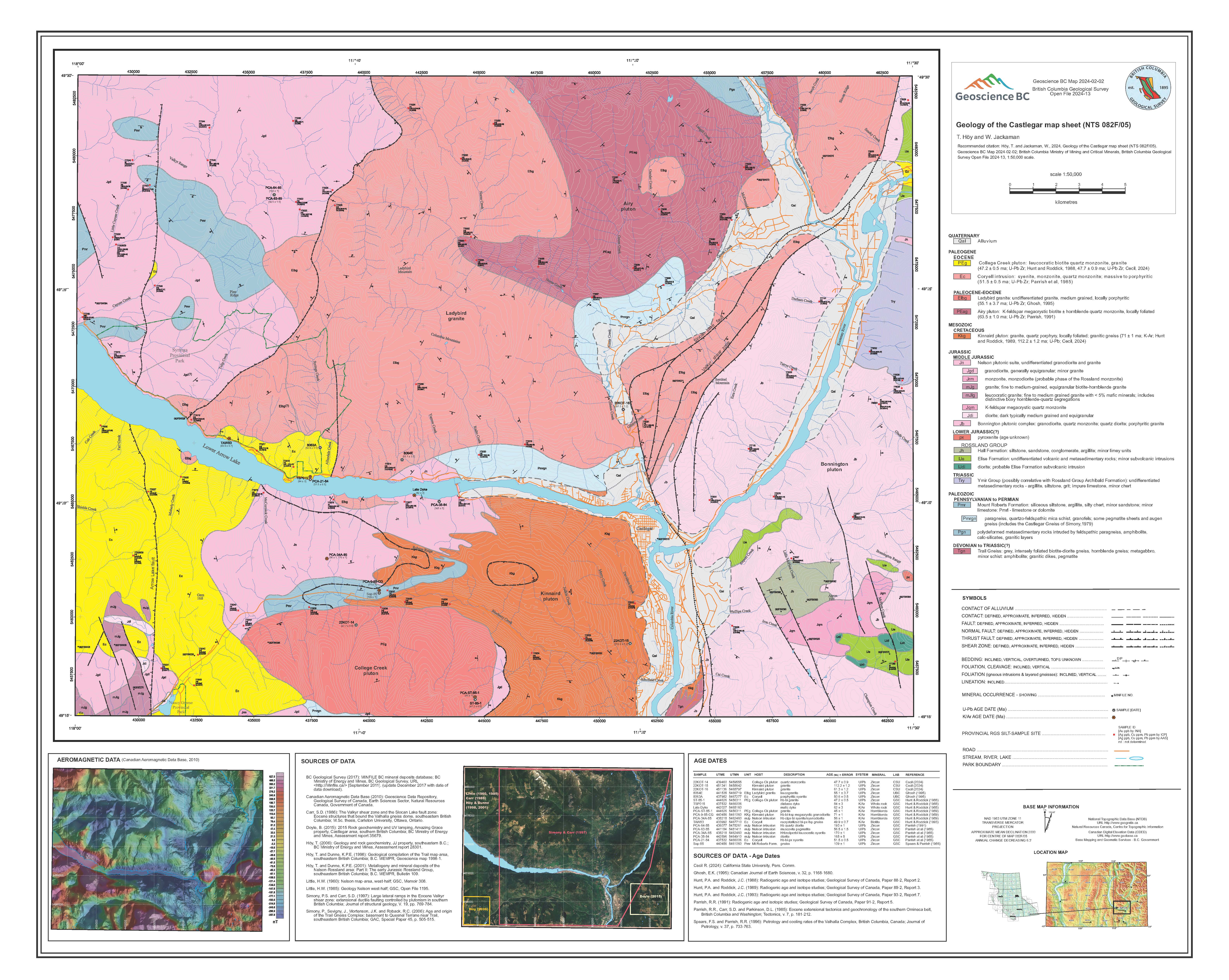
Höy, T. and Jackaman, W.
Geology of the Castlegar map sheet (NTS 082F/05)
2023
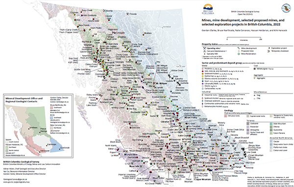
Clarke, G., Northcote, B., Corcoran, N.L., Heidarian, H., and Hancock, K.
British Columbia is Canada’s largest exporter of coal, leading producer of copper, and only producer of molybdenum. Also produced are significant amounts of gold, silver, lead, and zinc, and more than 30 industrial minerals including gypsum, magnesite, limestone, and dimension stone. Numerous quarries produce sand and gravel or crushed aggregate. In 2022, 11 metal mines operated during at least part of the year. Metallurgical coal was produced at four large open-pit operations in the southeastern part of the province and three open-pit operations in the northeastern part. About 30 industrial mineral mines and more than 1000 aggregate mines and quarries were in operation.
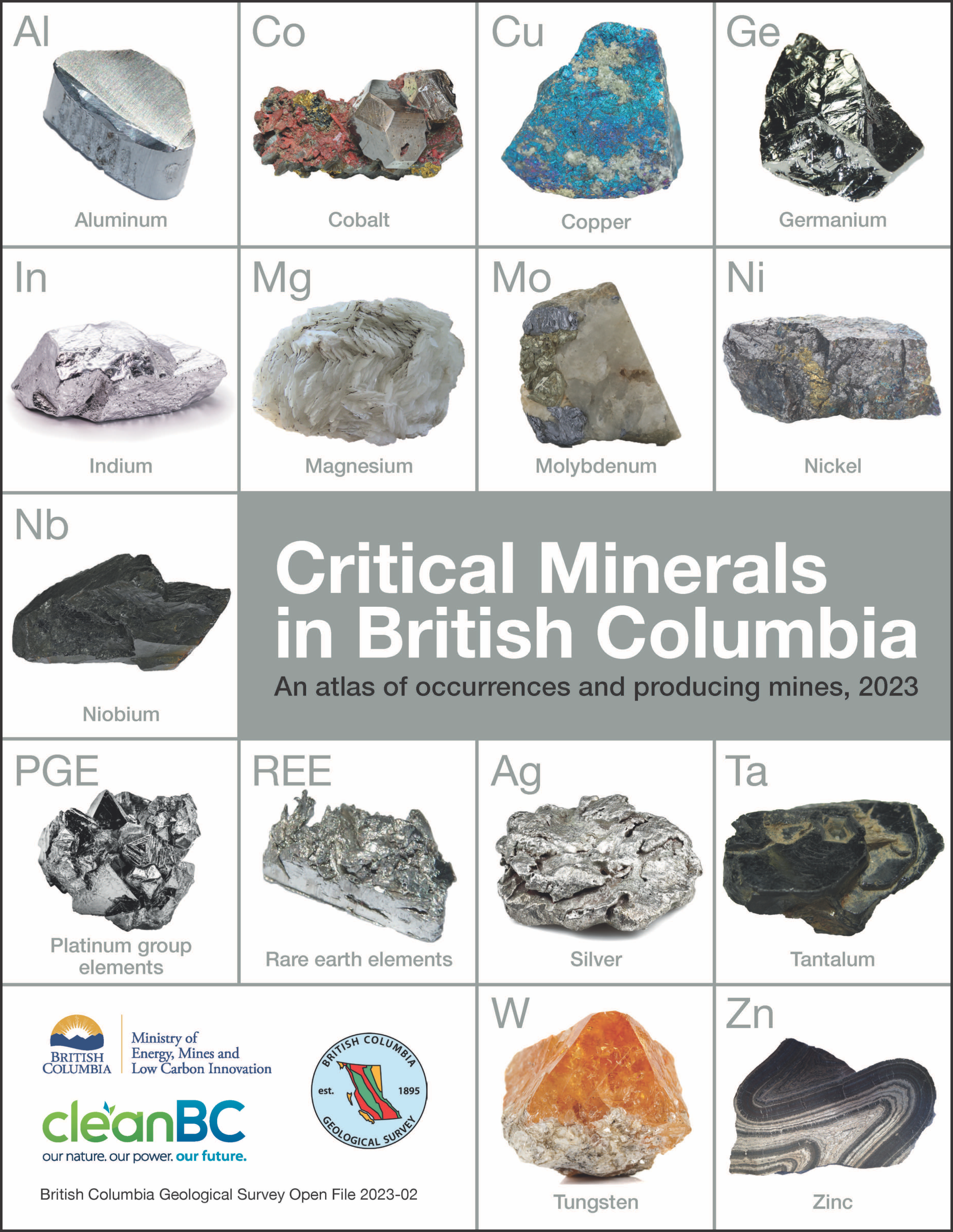
Hickin, A.S., Orovan, E.A., Brzozowski, M.J., McLaren, K., Shaw, K., and Van der Vlugt, J.
Low-carbon technologies demand critical minerals. These minerals are required to make things like electric vehicles, mobile phones, solar panels, wind turbines, electrical transmission lines, batteries, and medical devices, and to manufacture products needed for national defence. Without mining, a green future will never be realized. However, with increased global demand, long-term shortages are predicted. Consequently, jurisdictions in Canada and around the world are developing strategies to ensure critical mineral supply chains are robust and resilient. Mining, exploration, and smelting continue to be important contributors to the economy of British Columbia. Particularly important for northern communities and First Nations, the mineral exploration, mining, and related sectors employ more than 30,000 people. The province seeks to encourage investment that could lead to British Columbia being a significant supplier of the raw materials necessary to support a low-carbon future. The strong environment, social, and governance principals in British Columbia are attractive to investment and make the province a preferred supplier of critical minerals to global partners seeking stable and geopolitically friendly allies. A contribution to British Columbia’s CleanBC Roadmap to 2030, this atlas is the initial step in evaluating the critical mineral endowment of the province and in building awareness of critical mineral opportunities for the exploration and mining industries.
2022
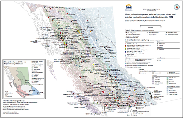
Clarke, G., Northcote, B., Corcoran, N.L., and Hancock, K.
British Columbia is Canada’s largest exporter of coal, leading producer of copper, and only producer of molybdenum. Also produced are significant amounts of gold, silver, lead, and zinc, and more than 30 industrial minerals including gypsum, magnesite, limestone, and dimension stone. Numerous quarries produce sand and gravel or crushed aggregate.
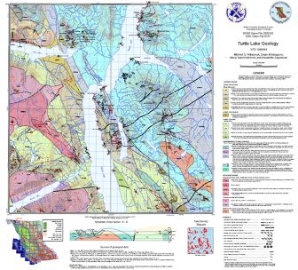
Mihalynuk, M.G., Milidragovic, D., Tsekhmistrenko, M., and Zagorevski, A.
Turtle Lake map area is bordered to the north by Yukon and is bisected by the 120 km-long, south-trending Tagish Lake. It straddles the boundary between exotic, oceanic crustal and mantle rocks of the Cache Creek terrane, and Early Jurassic Laberge Group forearc strata atop the Stikine terrane. A Cache Creek terrane hallmark is thick, regionally-extensive platformal carbonate of the Horsefeed Fm., deposited over at least 25 m.y. in a stable tectonic environment.
Juxtaposition of Stikine and Cache Creek terranes was accommodated by collapse of the Whitehorse Trough in mid-Middle Jurassic (starting ~174 Ma) and creation of a fold and thrust fault belt. This belt was cut by the Fourth of July batholith (~172 Ma) and lamprophyre dikes, emplaced and cooled by ~162 Ma, and followed by a magmatic lull between ~165 – 130 Ma. In the Turtle Lake area, we find a single granitic dyke that crystallized in this time interval, at 145 Ma.
By 125 Ma, the Coast Belt arc had ignited, as recorded by voluminous volcanic and intrusive rocks in the west, and persisted until ~50 Ma. In the Turtle Lake area, volcanism accompanied uplift by ~110 Ma, as indicated by a unimodal detrital zircon population in karst deposits. Youngest known representative intrusions are 56 Ma quartz diorite stocks. One cuts the faulted contact between Whitehorse Trough strata and harzburgite mantle tectonite. An analogous geological setting hosts epithermal gold-silver vein mineralization at the Engineer Mine, ~30km to the south-southwest.
Youngest rocks affected by crustal scale faulting and linked, mainly south-side-down, extensional faults are the ~80 Ma Windy-Table suite volcanic strata.
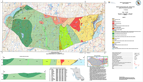
P. Schiarizza
The Stump Lake - Salmon River map area extends across 365 km2 on the Thompson Plateau of south-central British Columbia. The western part of the area is about 40 km south of Kamloops, and the eastern part is 60 km northwest of Kelowna. Most of the map area is underlain by sedimentary and volcanic rocks of the Nicola Group (Middle Triassic to Early Jurassic) which is subdivided into 5 map units. The eastern third of the area is underlain by Paleozoic and Mesozoic rocks of unknown relationship to the Nicola Group. These comprise Paleozoic schists of the Chapperon Group, Late Triassic limestones that are unconformably above the Chapperon Group, and Early Jurassic siliciclastic rocks that are unconformably above the limestones and the Chapperon Group. Mineral occurrences include polymetallic vein systems of the historic Stump Lake mining camp, which cut the Nicola Group in the western part of the map area.
2021
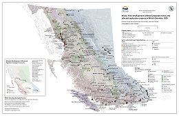
G. Clarke, B. Northcote, F. Katay, and S. Tombe
This provincial map shows the location of selected major exploration projects, selected proposed mines, and producing metal, coal, and industrial mineral mines in 2020.
2020

G. Clarke, B. Northcote, F. Katay, and S. Tombe
This provincial map shows the location of selected major exploration projects, selected proposed mines, and producing metal, coal, and industrial mineral mines in 2019.
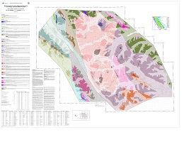
L. Ootes, A.L. Bergen, D. Milidragovic, and G.O. Jones
New bedrock mapping refines the distribution and relationships of plutonic rocks in northern Hogem batholith and surrounding rocks in the Quesnel, Stikine, and Cache Creek terranes. Cutting the Quesnel terrane, the Hogem batholith is composed of ca. 197 Ma hornblendite and diorite of the Thane Creek suite, 182 to 177 Ma biotite pyroxenite and syenite of the Duckling Creek suite, ca. 160 Ma granite of the Osilinka suite, and ca. 174 Ma tonalite and 140 to 135 Ma granodiorite and granite of the Mesilinka suite. All units contain a penetrative foliation and 40Ar/39Ar biotite ages indicate post-deformation cooling and uplift after ca. 124 Ma. The Hogem batholith is bounded to the north and east by volcanic and sedimentary rocks of the Nicola Group (Triassic) along fault and intrusive contacts. To the west, Hogem batholith and Nicola Group are separated from the Cache Creek and Stikine terranes along the Pinchi-Ingenika dextral strike-slip fault system; farther west, an unexposed thrust fault juxtaposes Cache Creek rocks above Stikine terrane rocks. About 88 mineral occurrences in the area are documented in MINFILE. Seven new occurrences discovered in 2019; five of these close to previously recognized mineralization. When combined with results of 2018 mapping, 24 new mineral occurrences have been documented in the study area. Porphyry Cu ±Mo, Au in Hogem batholith is the predominant type followed by quartz-carbonate vein-hosted base and precious metals in Quesnel and Stikine terranes, and volcanic/sediment-hosted Cu in the Telkwa Formation of the Stikine terrane.
H. Arnold, and T. Ferbey
Building on ice-flow indicator compilation for British Columbia and Yukon by Arnold et al. (2016), this database (BCGS_OF2020-03.zip) illustrates major ice-flow directions for the Canadian sector of the Cordilleran Ice Sheet during the Late Pleistocene. A total of 506 ice-flow features in British Columbia have been added to the compilation from 25 bedrock geology maps. The data were derived from published and unpublished surficial geology, terrain, bedrock geology, and glacial feature maps; there are now 152,980 measurements in the database.
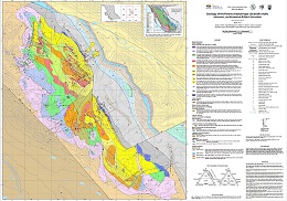
J.A. Nott, D. Milidragovic, G.T. Nixon, and J.S. Scoates
The Polaris Alaskan-type intrusion (Early Jurassic; ca.186 Ma) in north-central British Columbia belongs to a global class of convergent margin ultramafic-mafic intrusions. Although these intrusions are gaining global importance as an economic resource, they remain poorly understood and underexplored. The Polaris intrusion is one of the best exposed Alaskan-type ultramafic-mafic bodies in the Canadian Cordillera, second in size only to the Tulameen intrusion in south-central British Columbia. New mapping (1:15,000 scale) and lithological sampling integrated with the results of a recent aeromagnetic survey have refined internal and external geological relationships and established an intrusion-wide geochronological sample set. Research directed toward developing an emplacement framework for the intrusion continues.
2019
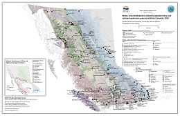
G. Clarke, B. Northcote, F. Katay, and J. DeGrace
This Provincial map shows the location of selected major exploration projects, selected proposed mines, and producing metal, coal, and industrial mineral mines in 2018.
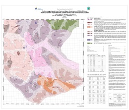
L. Ootes, A.L. Bergen, D. Milidragovic, and B. Graham
New bedrock mapping in parts of NTS 94C/04 (Notch Peak) and 93N/13 (Ogden Creek) refines the distribution and relationships of plutonic rocks in northern Hogem batholith. The eastern part of the study area is mostly underlain by diorite and lesser hornblendite of the Thane Creek suite. The southern part of the study area is underlain by Duckling Creek suite syenite and monzonite, with enclaves of pyroxenite (ca. 180 Ma). The western part of the study area is underlain by foliated granites assigned to the Mesilinka suite (Jurassic to Cretaceous?). In the central part of the study area, the Osilinka suite granite is characterized by its low content of mafic minerals (≤ 5%). Previously documented metallic mineralization is recorded in ca. 34 MINFILE occurrences. During bedrock mapping, 17 new mineral occurrences were discovered.
For more detailed unit description see Ootes et al., BCGS Paper 2019-01, pp. 31-53.
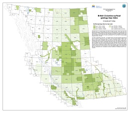
H. Arnold, and T. Ferbey
Presented here is a surficial geology map index for British Columbia. These maps have been produced by the British Columbia Geological Survey, the Geological Survey of Canada (GSC), and Geoscience BC. To be included in this index maps have to be available for digital download. Each map is represented by the actual map extent or footprint rather than a bounding box or NTS sheet that it falls within. This provides an accurate representation of the areal extent of surficial geology mapping for British Columbia.
The index is presented by map scale. In the digital versions of this index advanced searches can also be conducted on fields such as source author, source type (data available in digital or PDF form), or source series (Preliminary maps to A Series or Geoscience maps) to name a few. Publication page URLs are supplied for each map where the source files, PDFs or digital data can be downloaded. Also included is supplemental information which, when applicable, states where data are originally from and/or have elsewhere been used. Instances of this would be when an author published a map which was then revised and published as a GSC A Series map or when a map was used in a subsequent compilation. When this has occurred not only are the publication numbers provided for these other maps but links to their publication pages as well. This enables users to see all sources of the same data. In some cases original mapping is only available as a PDF but a subsequent map or compilation has made it available as an attributed vector file (e.g., shapefile).
View Open File 2019-03 (PDF, 3 MB)
Download Open File 2019-03 (ZIP, 353 MB)
Updated January 2020
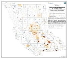
T. Ferbey, A.L. Bustard, and H. Arnold
This map indexes geographically referenced, regional- and property-scale till geochemical and mineralogical surveys that use subglacial tills to target base and precious metals in British Columbia. Regional-scale surveys are listed by NTS; property-scale reports by presumed deposit type. Also included are lists of topical studies relevant to drift prospecting in the province and elsewhere.
The index is presented area in square kilometres. In the digital versions of this index advanced searches can also be conducted on fields such as source author, source type (data available in digital or PDF form), or source series to name a few. Publication page URLs are supplied for each survey where the source files, PDFs or digital data can be downloaded. Also included is supplemental information which, when applicable, states where data are originally from and/or have elsewhere been used. When this has occurred not only is the publication information provided for the other surveys but links to their publication pages as well. This enables users to see all sources of the same data.
Reports and data can be viewed and downloaded from the following websites.
British Columbia Geological Survey Publication Catalogue
British Columbia Geological Survey Assessment Report Indexing System (ARIS)
Geological Survey of Canada
View Open File 2019-04 (PDF, 2 MB)
Download Open File 2019-04 (ZIP, 2 MB)
Updated January 2020
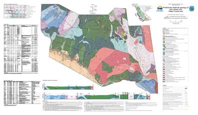
B. I. van Straaten and C. D. Wearmouth
The Latham and Pallen creek area, including parts of NTS sheets 104I/04, 05, 104J/01 and 08, is southwest of the community of Dease Lake in northwestern British Columbia. The oldest units in the map area are penetratively deformed meta-sedimentary and volcanic rocks and limestones of the Stikine assemblage (upper Paleozoic). These rocks are overlain (likely unconformably) by a volcano-sedimentary sequence informally referred to as the Tsaybahe group (Lower-Middle Triassic), which is succeeded by the Stuhini Group (Upper Triassic). We subdivide the Tsaybahe group into a sedimentary unit of fine-grained siliciclastic rocks and minor chert, and a volcanic unit of monomictic tuff breccia with plagioclase-augite-phyric volcanic clasts. Tsaybahe volcanic rocks appear texturally similar to the overlying Stuhini Group, but are separated based on their stratigraphic position atop of the Stikine assemblage, rare Early to Middle Triassic biostratigraphic ages, low magnetic susceptibility, and low response on regional aeromagnetic surveys. Stuhini Group volcanic rocks include massive monomictic tuff breccia and lapilli-tuff with augite-plagioclase-phyric volcanic clasts, have a high magnetic susceptibility, and display a high and variable response on regional aeromagnetic surveys. Triassic and older stratified rocks are cut by Late Triassic stocks and plutons ranging from ultramafic to gabbro, hornblende-rich quartz diorite and hornblende quartz monzonite in composition. Triassic units generally lack penetrative tectonic fabrics and are deformed into map-scale open folds. An outlier of volcano-sedimentary rocks assigned to the upper part of the Hazelton Group is inferred to unconformably overlie the Triassic rocks. The succession (~500 m thick) includes two sedimentary units that are overlain by a maroon volcanic unit, which is capped by a felsic volcanic unit. Based on lithological and stratigraphic criteria, the sedimentary units are assigned to the Spatsizi Formation and the volcanic units to the Horn Mountain Formation. Three Middle Jurassic plutons are exposed in the area, ranging in composition from biotite-hornblende quartz diorite to biotite monzogranite. Developed within or adjacent to these plutons are zones of alteration and mineralization containing locally elevated copper, gold, silver and/or molybdenum in fractures, veins, skarns, and gossans.
Augite-phyric mafic volcanic units in each of the Tsaybahe group, Stuhini Group, and Horn Mountain Formation, although temporally distinct, are texturally similar. Compared to widespread exposures of mafic volcanic rocks of the Stuhini Group in northern Stikinia, occurrences of the Tsaybahe group and its correlatives are rare. However, owing to a lack of age constraints, we consider that Tsaybahe group exposures may have been included in the Stuhini Group and suggest that the unit is more extensive than currently recognized. The Tsaybahe group may represent nascent Middle Triassic arc volcanism before widespread Upper Triassic Stuhini arc activity.
The Open File release includes a digital GIS compilation for an approximately 3,900 km2 area southwest, south, southeast and east of Dease Lake covered by van Straaten et al. (2012), van Straaten et al. (2017), van Straaten and Bichlmaier (2018) and this study.
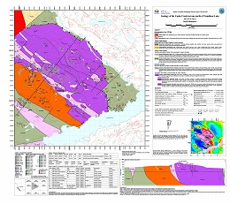
D. Milidragovic
New bedrock mapping in the southern segment of the Cache Creek terrane (part of NTS 93K/14 - Trembleur Lake) refines the distribution and geodynamic setting of the tectonically emplaced, variably serpentinized and carbonate-altered lithospheric mantle , and the surrounding Upper Pennsylvanian to Lower Jurassic, greenschist to amphibolite-facies volcanic, shallow-intrusive, and siliciclastic rocks.
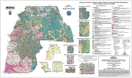
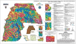
J.J. Angen, M. Rahimi, J.L. Nelson and C.J.R. Hart
Also published as Geoscience BC Map 2019-03-01 and MDRU Map 17-2018
This map presents the results of new mapping carried out during the summer of 2016, a compilation of previous mapping, and interpretations based on new aeromagnetic data. The map is accompanied by spatial data including administrative, cultural and natural features, vector and raster topographic information, historical and modern mineral exploration information, and regional historical geochronology and structural measurements derived from government sources and published literature. The MINFILE data contain records modified from the BC MINFILE database and newly identified occurrences. The map also provides new geochemical and geochronologic results and structural and physical properties measurements. The complete database is available through Geoscience BC.
J.J. Angen, M. Rahimi, J.L. Nelson and C.J.R. Hart
Also published as Geoscience BC Map 2019-03-02 and MDRU Map 18-2018
Complementing British Columbia Geological Survey Open File 2019-07 (Bedrock geology, Search Phase 1 project area, western Skeena arch, west-central British Columbia, by Angen, Rahimi, Nelson, and Hart), Open File 2019-08 integrates bedrock mapping with a recent aeromagnetic conducted by Precision Geosurveys Inc. (Geoscience BC, Report 2016-02).
Angen, J.J., Hart, C.J.R., Nelson, J., and Rahimi, M.
Also published as Geoscience BC Report 2022-09 and MDRU Publication 458.
The Skeena arch is an ENE-trending paleotopographic high in central British Columbia. Lower Jurassic and older rocks exposed along its crest are flanked by Middle Jurassic to Lower Cretaceous units that were deposited in the Bowser basin to the north and Nechako basin to the south. The arch is interpreted to reflect a fundamental, long-lived structural anisotropy that transects Stikine terrane beyond much of its Mesozoic history. This anisotropy contributed to strain localization and to focused episodic magmatic activity from the Triassic to the Eocene. The structural anisotropy is also responsible for the mineral prospectivity of this region.
A. Plouffe and T. Ferbey
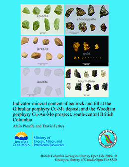
Also published as Geological Survey of Canada Open File 8580
The next generation of porphyry Cu deposits to be discovered in the Canadian Cordillera are likely to be found underlying glacial sediments. The recovery of minerals diagnostic of porphyry Cu mineralization, termed porphyry Cu indicator minerals (PCIM), in till and stream sediments will contribute to the discovery of buried mineralization. To identify minerals that have the potential to be utilized as PCIM, thirteen bedrock samples from the Gibraltar porphyry Cu-Mo deposit and ten from the Woodjam porphyry Cu-Au-Mo prospect were examined after production of mid-density (2.8-3.2 SG) and heavy (>3.2 SG) mineral concentrates. Chalcopyrite, a common Cu ore mineral, is abundant in bedrock and till in the Gibraltar and Woodjam areas making it a key PCIM. Jarosite, common in leached cap and supergene zones of porphyry Cu deposits, is generally more abundant in till near the known mineralized zones compared to surrounding regions and therefore, should be considered a PCIM diagnostic of the oxidized portion of porphyry mineralization. Other Cu (azurite, malachite, covellite, chalcocite) and Mo (molybdenite) minerals are present in mineralized bedrock but are rare or absent in till, limiting their utility as PCIM at these two study sites, but they could be important PCIM where found in detrital sediments. Other minerals (e.g. tourmaline, apatite and rutile) present in till and bedrock need to be characterized geochemically in order to be classified and used as PCIM.
2018
G. Clarke, B. Northcote, F. Katay, and J. DeGrace
G.T. Nixon

B.I. van Straaten and S.J. Bichlmaier
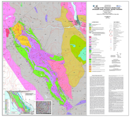
The McBride River area, including parts of NTS sheets 104H/14, 15, 104I/02, 03 and 06, is southeast of the community of Dease Lake in northwestern British Columbia. Mapping and geochronologic studies indicate that Late Triassic rocks of the Cake Hill pluton are unconformably overlain by late Early to Middle Jurassic rocks in the upper part of the Hazelton Group. The unconformity, which has been traced laterally for 50 km, spans at least 30 m.y. and represents one of the few examples of unroofed Stuhini arc in northern Stikinia. The unconformity is overlain by sedimentary rocks of the Spatsizi Formation (up to 0.2 km thick, Toarcian) and volcanic rocks of the Horn Mountain Formation (at least 3.5 km thick, Aalenian-Bajocian). The recently defined Horn Mountain Formation is unusual because it postdates typical Late Triassic to Early Jurassic arc volcanism in northern Stikinia, and was deposited during accretion of the Stikine and Cache Creek terranes. In the lower part of the Horn Mountain Formation, partly or wholly subaqueous, massive green augite-plagioclase-phyric volcanic breccia pass upward to a subaerial volcanic edifice composed of interlayered maroon augite-plagioclase-phyric flows, volcanic breccia and tuff. Felsic volcanic rocks cap the succession. The Horn Mountain Formation is cut by the Three Sisters pluton (ca. 173-169 Ma, Aalenian-Bajocian) and McBride River pluton. The McBride River granodiorite has hitherto been interpreted as Early Jurassic (ca. 184 Ma), but based on crosscutting relationships we suggest a Middle Jurassic or younger age to be more plausible. The Bowser Lake Group (Bajocian) conformably overlies the Horn Mountain Formation; it records initiation of erosion from the Stikinia-Cache Creek tectonic welt. Chert and limestone clast-bearing pebble to cobble conglomerate (>330 m thick) is interpreted to have formed close to range front faults along the building orogen. This coarse facies transitions to interbedded subaerial siltstone, sandstone, chert clast-bearing conglomerate, and mafic flows (>430 m thick) farther south. In the northern part of the study area, the Horn Mountain Formation and Bowser Lake Group are structurally overlain by rocks of the Whitehorse trough, juxtaposed along the Kehlechoa thrust fault (south vergent). In the hanging wall, Sinwa Formation limestones (Upper Triassic) are unconformably overlain by Takwahoni Formation sedimentary rocks (Lower Jurassic). The Takwahoni Formation succession comprises a lithologically variable unit of fine-grained siliciclastic rocks, polymictic conglomerates, and volcanic rocks (Sinemurian?) that appears to grade upward to a thick unit of interbedded sandstone and siltstone (Pliensbachian). In the northernmost part of the map area, rocks of the Whitehorse trough are structurally overlain by rocks of the Cache Creek terrane along the King Salmon thrust fault (south vergent).
At Tanzilla and McBride, northwest of the study area, the Horn Mountain Formation hosts large advanced argillic alteration systems. However in the present area, evidence of alteration and mineralization is more modest. Four grab samples from two intrusion-related hydrothermal alteration zones west and southeast of the McBride River returned no anomalous metal values. Several Cu-Ag mineral occurrences with limited alteration footprints are hosted in the middle and upper parts of the Horn Mountain Formation in the southeast part of the map area. Polymetallic veins near the Kehlechoa and King Salmon thrust faults locally contain significant gold and silver.
The Open File release includes a digital GIS compilation for an approximately 3,000 km2 area east, southeast, and south of Dease Lake covered by van Straaten et al. (2012), van Straaten et al. (2017) and this study.
2017

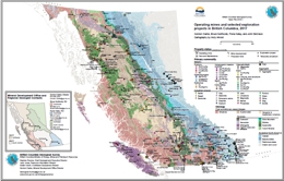
G. Clarke, J. Britton, P. Jago, F. Katay, and B. Northcote
This Provincial map shows the location of major exploration projects and producing metal, coal, and industrial mineral mines in 2016.
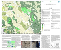
D. Sacco, H. Arnold, T. Ferbey, and W. Jackaman
Also published as Geoscience BC Map 2017-02-01
Mainly drift covered and with sparse outcrop, the Anahim Lake area remains underexplored despite being underlain by the Stikine terrane island-arc assemblage, which has high potential for mineralization. Basal tills have a relatively simple transport and depositional history, thus are an ideal sampling media to explore for buried deposits. This basal till potential map is designed to help plan exploration projects in drift-covered areas by guiding surficial sediment geochemistry and mineralogy sampling programs to where basal till is most likely to occur.
Work in the Anahim Lake map area is part of Geoscience BC's Targeting Resources for Exploration and Knowledge (TREK) project. The basal till potential map presented here is one of a series of 16 maps that were completed for the TREK geochemical program.
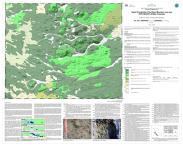
D. Sacco, H. Arnold, T. Ferbey, and W. Jackaman
Also published as Geoscience BC Map 2017-02-02
Mainly drift covered and with sparse outcrop, the Satah Mountain area remains underexplored despite being underlain by the Stikine terrane island-arc assemblage, which has high potential for mineralization. Basal tills have a relatively simple transport and depositional history, thus are an ideal sampling media to explore for buried deposits. This basal till potential map is designed to help plan exploration projects in drift-covered areas by guiding surficial sediment geochemistry and mineralogy sampling programs to where basal till is most likely to occur.
Work in the Satah Mountain map area is part of Geoscience BC's Targeting Resources for Exploration and Knowledge (TREK) project. The basal till potential map presented here is one of a series of 16 maps that were completed for the TREK geochemical program.
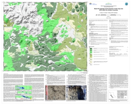
D. Sacco, H. Arnold, T. Ferbey, and W. Jackaman
Also published as Geoscience BC Map 2017-02-03
Mainly drift covered and with sparse outcrop, the Downton Creek area remains underexplored despite being underlain by the Stikine terrane island-arc assemblage, which has high potential for mineralization. Basal tills have a relatively simple transport and depositional history, thus are an ideal sampling media to explore for buried deposits. This basal till potential map is designed to help plan exploration projects in drift-covered areas by guiding surficial sediment geochemistry and mineralogy sampling programs to where basal till is most likely to occur.
Work in the Downton Creek map area is part of Geoscience BC's Targeting Resources for Exploration and Knowledge (TREK) project. The basal till potential map presented here is one of a series of 16 maps that were completed for the TREK geochemical program.
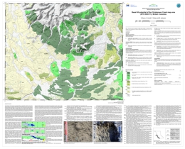
D. Sacco, H. Arnold, T. Ferbey, and W. Jackaman
Also published as Geoscience BC Map 2017-02-04
Mainly drift covered and with sparse outcrop, the Christensen Creek area remains underexplored despite being underlain by the Stikine terrane island-arc assemblage, which has high potential for mineralization. Basal tills have a relatively simple transport and depositional history, thus are an ideal sampling media to explore for buried deposits. This basal till potential map is designed to help plan exploration projects in drift-covered areas by guiding surficial sediment geochemistry and mineralogy sampling programs to where basal till is most likely to occur.
Work in the Christensen Creek map area is part of Geoscience BC's Targeting Resources for Exploration and Knowledge (TREK) project. The basal till potential map presented here is one of a series of 16 maps that were completed for the TREK geochemical program.
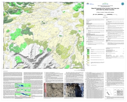
D. Sacco, H. Arnold, T. Ferbey, and W. Jackaman
Also published as Geoscience BC Map 2017-02-05
Mainly drift covered and with sparse outcrop, the Carnlick Creek area remains underexplored despite being underlain by the Stikine terrane island-arc assemblage, which has high potential for mineralization. Basal tills have a relatively simple transport and depositional history, thus are an ideal sampling media to explore for buried deposits. This basal till potential map is designed to help plan exploration projects in drift-covered areas by guiding surficial sediment geochemistry and mineralogy sampling programs to where basal till is most likely to occur.
Work in the Carnlick Creek map area is part of Geoscience BC's Targeting Resources for Exploration and Knowledge (TREK) project. The basal till potential map presented here is one of a series of 16 maps that were completed for the TREK geochemical program.
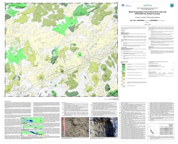
D. Sacco, H. Arnold, T. Ferbey, and W. Jackaman
Also Geoscience BC Map 2017-02-06
Mainly drift covered and with sparse outcrop, the Kushya River area remains underexplored despite being underlain by the Stikine terrane island-arc assemblage, which has high potential for mineralization. Basal tills have a relatively simple transport and depositional history, thus are an ideal sampling media to explore for buried deposits. This basal till potential map is designed to help plan exploration projects in drift-covered areas by guiding surficial sediment geochemistry and mineralogy sampling programs to where basal till is most likely to occur.
Work in the Kushya River map area is part of Geoscience BC's Targeting Resources for Exploration and Knowledge (TREK) project. The basal till potential map presented here is one of a series of 16 maps that were completed for the TREK geochemical program.
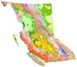
This publication has been superseded. Download the latest BC bedrock geology
Y. Cui, D. Miller, P. Schiarizza, and L.J. Diakow
British Columbia digital geology contains geological maps integrated at scales from 1:250,000 to 1:50,000. Whereas the stratigraphic nomenclature we adopt resembles the classification and hierarchy specified in the North American Stratigraphic Code, we distinguish bedrock in terms of three units: lithostratigraphic, lithodemic, and lithotectonic. The present edition includes updates to Chilcotin-Bonaparte, northern Vancouver Island, North Coast, Kutcho, QUEST, and Terrace.
BC Geological Map at 1:2 million, best suited for printing as a single sheet, available for download (Geoscience Map 2009-1A)
View Open File 2017-08 (PDF, 6.3 MB)
This publication has been superseded. Download the latest BC bedrock geology
B.I. van Straaten, R. Gibson, and J. Nelson
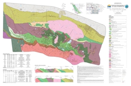
The Tanzilla – McBride area, including parts of NTS sheets 104I/03, 04, 05 and 06, is immediately east-southeast of the community of Dease Lake in northwestern British Columbia. Detailed field mapping (1:20,000-scale) in 2015 and 2016 revealed a previously poorly understood volcanic succession, the Horn Mountain Formation, a late Early to Middle Jurassic unit about 5.4 km thick in the upper part of the Hazelton Group.
The oldest units in the area are mafic volcanic rocks of the Stuhini Group (Triassic) that are cut by the Cake Hill pluton (Late Triassic). Separated by a regional unconformity, these units are overlain by the Spatsizi Formation (Hazelton Group, late Pliensbachian to Toarcian), a sedimentary succession up to 1 km thick. The Spatsizi Formation grades laterally and vertically to the Horn Mountain Formation. Units in the lower part of the Horn Mountain Formation include massive green augite-plagioclase-phyric volcanic breccia and rare grey coarse platy plagioclase-phyric lapilli tuff and pillows that were, at least in part, deposited in a subaqueous environment. Overlying units of interlayered maroon augite-plagioclase-phyric flows, volcanic breccia and tuff suggest increasingly greater volumes of volcanism and the formation of a subaerial volcanic edifice. During a hiatus in volcanism, these rocks were cut and hydrothermally altered by a 173 Ma (Aalenian) porphyry. These units are overlain by Bajocian mafic volcanic flows in the upper part of the Horn Mountain Formation. The Horn Mountain Formation is cut by the Three Sisters pluton (ca 173-169 Ma, Aalenian-Bajocian), and is unconformably overlain by sedimentary rocks of the Bowser Lake Group (Bajocian). In the northern part of the map area, folded Takwahoni Formation siliciclastic rocks deposited in the Whitehorse trough (Laberge Group, Pliensbachian to Toarcian(?)) are in the hanging wall of the south-verging Kehlechoa thrust fault, and structurally overlie the Horn Mountain volcanic succession. The Snowdrift Creek pluton (Late Jurassic) cuts the Kehlechoa fault. The Takwahoni Formation is structurally overlain by undifferentiated limestone, siliciclastic, volcanic and ultramafic rocks of the Cache Creek terrane in the hanging wall of the King Salmon thrust fault.
At least three magmatic-hydrothermal events are recognized in the map area. Late Triassic porphyry-style copper mineralization occurs at the Gnat Pass developed prospect and nearby Moss showing. The Horn Mountain Formation hosts aerially extensive gossans at Tanzilla and McBride (both early-stage porphyry projects) interpreted as Middle Jurassic in age. At Tanzilla, an advanced argillic lithocap overlies porphyry-style alteration at depth. Quartz-sericite-pyrite to potassic alteration with anomalous copper and molybdenum is hosted by a syn-mineral 173 Ma plagioclase porphyry. Our mapping extends the advanced argillic alteration at Tanzilla for at least 17 km along strike. It is interpreted as a lithocap formed by acidic hydrothermal fluid flow along an unconformity or fault in the upper Horn Mountain Formation. At the McBride showing, widespread quartz-sericite-pyrite and local potassic alteration hosts elevated copper and gold in volcanic rocks of the middle Horn Mountain Formation. Molybdenum mineralization is locally in the Snowdrift Creek pluton (Late Jurassic) and its immediate wall rocks, and in a satellite stock to the south.
2016
G. Clarke, J. Britton, P. Jago, F. Katay, J. Kyba, and B. Northcote
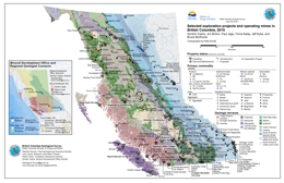
This Provincial map shows the location of major exploration projects and producing metal, coal, and industrial mineral mines in 2015.
Superseded by BCGS Open File 2019-04
updated August 2017
A.L. Bustard and T. Ferbey
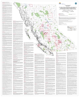
Released in PDF, ESRI Map Package, Shapefile, File Geodatabase, and KMZ formats, Open File 2016-2 indexes geographically referenced, regional- and property-scale subglacial till geochemical and mineralogical surveys targeting base and precious metals in British Columbia. It also lists topical studies relevant to drift prospecting in the province and elsewhere. Original source reports can be downloaded using the URLs provided, as can publications that use the data, such as compilations. The digital versions of the index enable advanced searches using fields such as author, source type (digital or PDF), or source.
The August 2017 update revises links to Geological Survey of Canada publications.
Superseded by BCGS Open File 2019-03
updated January, 2018
H. Arnold and T. Ferbey
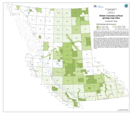
Presented here is a surficial geology map index for British Columbia. These maps have been produced by the British Columbia Geological Survey, the Geological Survey of Canada (GSC), and Geoscience BC. To be included in this index maps have to be available for digital download. Each map is represented by the actual map extent or footprint rather than a bounding box or NTS sheet that it falls within. This provides an accurate representation of the areal extent of surficial geology mapping for British Columbia.
The index is presented by map scale. In the digital versions of this index advanced searches can also be conducted on fields such as source author, source type (data available in digital or PDF form), or source series (Preliminary maps to A Series or Geoscience maps) to name a few. Publication page URLs are supplied for each map where the source files, PDFs or digital data can be downloaded. Also included is supplemental information which, when applicable, states where data are originally from and/or have elsewhere been used. Instances of this would be when an author published a map which was then revised and published as a GSC A Series map or when a map was used in a subsequent compilation. When this has occurred not only are the publication numbers provided for these other maps but links to their publication pages as well. This enables users to see all sources of the same data. In some cases original mapping is only available as a PDF but a subsequent map or compilation has made it available as an attributed vector file (e.g., shapefile).
The January 2018 update includes maps that were published in 2017.
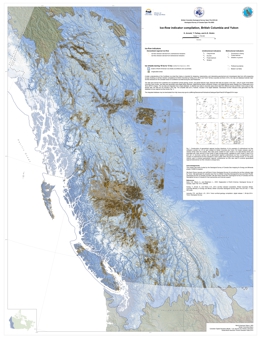
Supersededby BCGS Open File 2020-03
H. Arnold, T. Ferbey, and A.S. Hickin
Also published as Geological Survey of Canada Open File 8083
A better understanding of the Cordilleran ice sheet flow history is important for designing, implementing, and interpreting geochemical and mineralogical data from drift prospecting surveys. Building on ice-flow indicator compilations for British Columbia by Ferbey et al. (2013) and Yukon Territory (Lipovsky and Bond, 2014), this map and database illustrate major ice-flow directions for the Canadian sector of Cordilleran ice sheet during the Late Pleistocene.
The data were derived from published and unpublished surficial geology, terrain, and glacial feature maps. Because field data are sparse in the area ~ 300 km south of the British Columbia -Yukon border, new data were generated using digital stereo airphotos, digital derived-stereo orthophoto mosaics, and digital derived-stereo Satellite Pour l'Observation de la Terre (SPOT ) imagery. The raw data are integrated into a single database; no attempt was made to reconcile cases where data from different sources conflict.
A.S. Hickin, M.E. Best, and A. Pugin
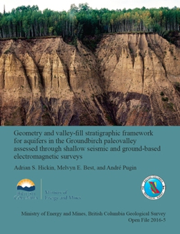
Paleovalleys are significant sources of groundwater in the South Peace River region. To better understand groundwater availability it is necessary to determine the thickness, lateral extent, and connectivity of Quaternary sediments filling these paleovalleys. Direct observations of subsurface lithologic units (through sediment coring) combined with ground-based electromagnetic (EM) and shallow reflection seismic surveys document the geometry of the Groundbirch paleovalley and establishes the three-dimensional configuration of its sediment fill. The combined data suggest that the Groundbirch paleovalley is 3-4 km wide at its top and trends east-west. Based mainly on seismic velocity data, the paleovalley may plunge to the west. Although the EM and seismic data are only effective in the upper 150 m, our interpretation of the seismic data suggests that the paleovalley may extend to depths of >350 m, an interpretation that can be tested by drilling. The stratigraphy of the valley fill includes advance phase glaciolacustrine sediments (glacial Lake Mathews), ice-contact glacial sediments (Late Wisconsinan glaciation), and retreat phase glaciolacustrine sediments (glacial Lake Peace). Gravels and sands deposited during ice margin advance and retreat have the highest potential to host significant aquifers.
2015
G. Clarke, J. Britton, P. Jago, F. Katay, J. Kyba, and B. Northcote
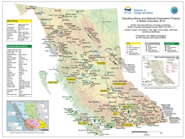
This Provincial map shows the location of major exploration projects and producing metal, coal, and industrial mineral mines in 2014.
This publication has been superseded. Download the latest BC bedrock geology
Y. Cui, D. Miller, G. Nixon and J. Nelson
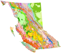
British Columbia Digital Geology is the data source used to create the digital Geological Map of British Columbia. The latest release is based on a framework data model, which consists of attributed geological contacts and faults as linework, and outcrops or centroids as points attributed with bedrock information. It also contains: tables for geological units and colours; ESRI layer files containing bedrock colour symbols; and a map of British Columbia illustrating the suggested colour theme for the bedrock polygons.
British Columbia Digital Geology provides province-wide coverage of bedrock geology, consisting of integrated geological maps. The British Columbia Geological Survey releases updates as new data are integrated into the corporate database. Data within the current BC Digital Geology may include information that has not yet been released as GeoFile, OpenFile or Geoscience maps.
The data package includes a lookup table for geological units and colours (RGB); a number of ESRI layer files with the recommended bedrock colour symbols, compatible to various versions of ArcGIS (designated by suffix_a##_# in file names); and a map of British Columbia illustrating the suggested colour theme for bedrock polygons.
BC Geological Map at 1:2 million, best suited for printing as a single sheet, available for download (Geoscience Map 2009-1A)
Acknowledgements and Partners
BCGeologyMap was updated from original digital regional compilations that were made in 1992-96 in support of the Mineral Potential Project. These compilations involved many B.C. Geological Survey geologists and contractors including Dani Alldrick, Chris Ash, Kim Bellefontaine, Jim Britton, Derek Brown, Neil Church, John Cunningham, Pat Desjardins, Larry Diakow, Kathryn Dunne, Bob Gaba, G. Gibson, Keith Glover, Brian Grant, Trygve Höy, Andrew Legun, Jim Logan, Nick Massey, Don MacIntyre, Mitch Mihalynuk, JoAnne Nelson, Andre Panteleyev, Gerry Ray, and Paul Schiarizza.
Invaluable contributions to BCGeologyMap were also made by Carol Evenchik, Jim Haggart, Murray Journeay, Andy Okulitch, Michael J. Orchard, Terry P. Poulton, Bert Struik, Howard W. Tipper, Edward Tim Tozer, and John Wheeler of the Geological Survey of Canada.
For further information contact: Yao Cui
Download Open File 2015-02 (ZIP, 61.4 MB)
This publication has been superseded. Download the latest BC bedrock geology
2014
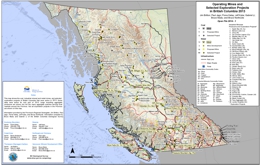
J. Britton, P. Jago, F. Katay, J. Kyba, G. Li, B. Madu, and B. Northcote
This Provincial Map shows the location of major exploration projects and producing metal, coal and industrial mineral mines in 2013.
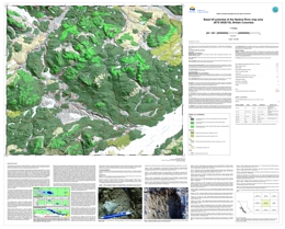
T. Ferbey
The Nadina River map area is underlain by Stikinia, an island-arc terrane with high potential for mineralization. Exploration in the area is challenging due to extensive drift cover and sparse bedrock outcrop. Basal tills have a relatively simple transport and depositional history, thus are an ideal sampling media to explore for buried deposits. This basal till potential map is designed to help plan exploration projects in drift-covered areas by guiding surficial sediment geochemistry and mineralogy sampling programs to where basal till is most likely to occur.
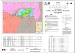
M.J. Manor, C.J. Wall, G.T. Nixon, J.S. Scoates, R.H. Pinsent, and D.E. Ames,
Also published as Geological Survey of Canada Open File 7570
Magmatic Ni-Cu-PGE sulphide deposits in supra-subduction zone or ‘orogenic’ settings are becoming an increasingly important economic resource worldwide yet remain poorly understood and underexplored. Projects initiated recently under the Targeted Geoscience Initiative 4 (TGI-4) Program in the Canadian Cordillera seek to address critical knowledge gaps in order to develop new mineral deposit models and robust exploration criteria. The Giant Mascot ultramafic-mafic intrusion in the southeastern part of the Coast Plutonic Complex is host to British Columbia’s only former nickel mine (1958-1974). The deposit is unusually enriched in Ni-Cu-PGE sulphides and the main ore minerals are pyrrhotite, pentlandite, chalcopyrite and minor pyrite. The sulphide mineralization is hosted primarily by dunite and peridotite in 28 sub-vertical, pipe-like orebodies aligned along a W-E trend. The geological map incorporates original and new mapping supplemented by a compilation of published and unpublished geochemical data for major and trace elements including platinum-group elements. Field mapping and ongoing geochronological studies indicate that the ultramafic-mafic suite intruded the Settler schist and diorite of the Spuzzum pluton during a period of arc magmatism in the Late Cretaceous.
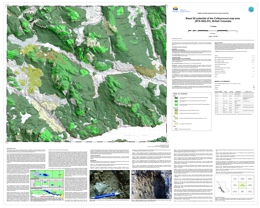
T. Ferbey
The Colleymount map area is underlain by Stikinia an island-arc terrane with high potential for mineralization. Exploration in the area is challenging due to extensive drift cover and sparse bedrock outcrop. Basal tills have a relatively simple transport and depositional history, thus are an ideal sampling media to explore for buried deposits. This basal till potential map is designed to help plan exploration projects in drift-covered areas by guiding surficial sediment geochemistry and mineralogy sampling programs to where basal till is most likely to occur.
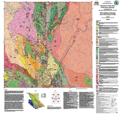
M.G. Mihalynuk, J.M. Logan, L.J. Diakow, M.A. Henderson, J. Jacob, and A.K.G. Watson
Open File 2014-5 is revision mapping of ~1000 km2 area between Merritt and Princeton, in the prolifically mineralized southern Nicola arc. Roots of the Nicola arc include a belt of mineralized intrusions emplaced during an epoch of magmatism centered on ~205 Ma. Known as the Copper Mountain suite, these intrusions and Nicola Group arc rocks mineralized adjacent to them, have been the main source of British Columbia mining wealth for 50 years. Because of this wealth, many geological investigations have focused on the Late Triassic to Early Jurassic Nicola arc rocks. In recent years, substantial logging activities have generated new exposures throughout the region, and together with the wide availability of accurate geochronological techniques, provide opportunity for a new level of understanding of the ancient arc between Princeton and Merritt. The new mapping presented in Open File 2014-5 focused on areas where new access and outcrops provide previously unrecorded views of southern Nicola Arc geology.
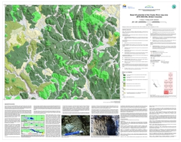
D. Sacco, T. Ferbey, and W. Jackaman
Also published as Geoscience BC Map 2014-06-01
Mainly drift covered and with sparse outcrop, the Clusko River area remains underexplored despite being underlain by the Stikine terrane island-arc assemblage, which has high potential for mineralization. Basal tills have a relatively simple transport and depositional history, thus are an ideal sampling media to explore for buried deposits. This basal till potential map is designed to help plan exploration projects in drift-covered areas by guiding surficial sediment geochemistry and mineralogy sampling programs to where basal till is most likely to occur.
Current work in the Clusko River map area is part of Geoscience BC's Targeting Resources for Exploration and Knowledge (TREK) project. The basal till potential map presented here is one of a series of 10 maps that were completed for the TREK geochemical program.
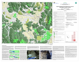
D. Sacco, T. Ferbey, and W. Jackaman
Also published as Geoscience BC Map 2014-06-02
Mainly drift covered and with sparse outcrop, the Clisbako River area remains underexplored despite being underlain by the Stikine terrane island-arc assemblage, which has high potential for mineralization. Basal tills have a relatively simple transport and depositional history, thus are an ideal sampling media to explore for buried deposits. This basal till potential map is designed to help plan exploration projects in drift-covered areas by guiding surficial sediment geochemistry and mineralogy sampling programs to where basal till is most likely to occur.
Current work in the Clisbako River map area is part of Geoscience BC's Targeting Resources for Exploration and Knowledge (TREK) project. The basal till potential map presented here is one of a series of 10 maps that were completed for the TREK geochemical program.
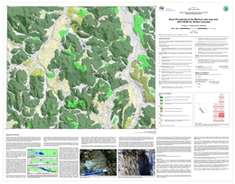
D. Sacco, T. Ferbey, and W. Jackaman
Also published as Geoscience BC Map 2014-06-03
Mainly drift covered and with sparse outcrop, the Marmot Lake area remains underexplored despite being underlain by the Stikine terrane island-arc assemblage, which has high potential for mineralization. Basal tills have a relatively simple transport and depositional history, thus are an ideal sampling media to explore for buried deposits. This basal till potential map is designed to help plan exploration projects in drift-covered areas by guiding surficial sediment geochemistry and mineralogy sampling programs to where basal till is most likely to occur.
Current work in the Marmot Lake map area is part of Geoscience BC's Targeting Resources for Exploration and Knowledge (TREK) project. The basal till potential map presented here is one of a series of 10 maps that were completed for the TREK geochemical program.

D. Sacco, T. Ferbey, and W. Jackaman
Also published as Geoscience BC Map 2014-06-04
Mainly drift covered and with sparse outcrop, the Toil Mountain area remains underexplored despite being underlain by the Stikine terrane island-arc assemblage, which has high potential for mineralization. Basal tills have a relatively simple transport and depositional history, thus are an ideal sampling media to explore for buried deposits. This basal till potential map is designed to help plan exploration projects in drift-covered areas by guiding surficial sediment geochemistry and mineralogy sampling programs to where basal till is most likely to occur.
Current work in the Toil Mountain map area is part of Geoscience BC's Targeting Resources for Exploration and Knowledge (TREK) project. The basal till potential map presented here is one of a series of 10 maps that were completed for the TREK geochemical program.
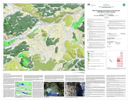
D. Sacco, T. Ferbey, and W. Jackaman
Also published as Geoscience BC Map 2014-06-05
Mainly drift covered and with sparse outcrop, the Suscha Creek area remains underexplored despite being underlain by the Stikine terrane island-arc assemblage, which has high potential for mineralization. Basal tills have a relatively simple transport and depositional history, thus are an ideal sampling media to explore for buried deposits. This basal till potential map is designed to help plan exploration projects in drift-covered areas by guiding surficial sediment geochemistry and mineralogy sampling programs to where basal till is most likely to occur.
Current work in the Suscha Creek map area is part of Geoscience BC's Targeting Resources for Exploration and Knowledge (TREK) project. The basal till potential map presented here is one of a series of 10 maps that were completed for the TREK geochemical program.
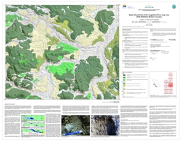
D. Sacco, T. Ferbey, and W. Jackaman
Also published as Geoscience BC Map 2014-06-06
Mainly drift covered and with sparse outcrop, the Coglistiko River area remains underexplored despite its western half being underlain by the Stikine terrane island-arc assemblage, which has high potential for mineralization. Basal tills have a relatively simple transport and depositional history, thus are an ideal sampling media to explore for buried deposits. This basal till potential map is designed to help plan exploration projects in drift-covered areas by guiding surficial sediment geochemistry and mineralogy sampling programs to where basal till is most likely to occur.
Current work in the Coglistiko River map area is part of Geoscience BC's Targeting Resources for Exploration and Knowledge (TREK) project. The basal till potential map presented here is one of a series of 10 maps that were completed for the TREK geochemical program.
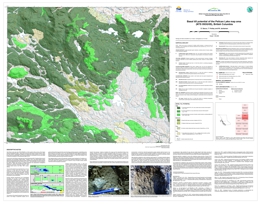
D. Sacco, T. Ferbey, and W. Jackaman
Also published as Geoscience BC Map 2014-06-07
Mainly drift covered and with sparse outcrop, the Pelican Lake area remains underexplored despite its western third being underlain by the Stikine terrane island-arc assemblage, which has high potential for mineralization. Basal tills have a relatively simple transport and depositional history, thus are an ideal sampling media to explore for buried deposits. This basal till potential map is designed to help plan exploration projects in drift-covered areas by guiding surficial sediment geochemistry and mineralogy sampling programs to where basal till is most likely to occur.
Current work in the Pelican Lake map area is part of Geoscience BC's Targeting Resources for Exploration and Knowledge (TREK) project. The basal till potential map presented here is one of a series of 10 maps that were completed for the TREK geochemical program.
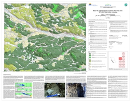
D. Sacco, T. Ferbey, and W. Jackaman
Also published as Geoscience BC Map 2014-06-08
Mainly drift covered and with sparse outcrop, the Euchiniko River area remains underexplored despite its western third being underlain by the Stikine terrane island-arc assemblage, which has high potential for mineralization. Basal tills have a relatively simple transport and depositional history, thus are an ideal sampling media to explore for buried deposits. This basal till potential map is designed to help plan exploration projects in drift-covered areas by guiding surficial sediment geochemistry and mineralogy sampling programs to where basal till is most likely to occur.
Current work in the Euchiniko River map area is part of Geoscience BC's Targeting Resources for Exploration and Knowledge (TREK) project. The basal till potential map presented here is one of a series of 10 maps that were completed for the TREK geochemical program.
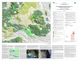
D. Sacco, T. Ferbey, and W. Jackaman
Also published as Geoscience BC Map 2014-09
Mainly drift covered, the Chilako River area is thought to be underlain by Cache Creek terrain, a belt of oceanic crustal and sedimentary rocks that separates Stikine terrane (to the west) and Quesnel terrane (to the east). These two neighbouring island-arc assemblages have high potential for mineralization, but because of sparse outcrop, the area remains underexplored. Basal tills have a relatively simple transport and depositional history, thus are an ideal sampling media to explore for buried deposits. This basal till potential map is designed to help plan exploration projects in drift-covered areas by guiding surficial sediment geochemistry and mineralogy sampling programs to where basal till is most likely to occur.
Current work in the Chilako River map area is part of Geoscience BC's Targeting Resources for Exploration and Knowledge (TREK) project. The basal till potential map presented here is one of a series of 10 maps that were completed for the TREK geochemical program.
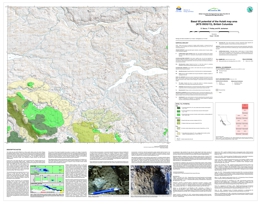
D. Sacco, T. Ferbey, and W. Jackaman
Also published as Geoscience BC Map 2014-06-10
Mainly drift covered, the Hulatt area is thought to be underlain by Cache Creek terrain, a belt of oceanic crustal and sedimentary rocks that separates Stikine terrane (to the west) and Quesnel terrane (to the east). These two neighbouring island-arc assemblages have high potential for mineralization, but because of sparse outcrop, the area remains underexplored. Basal tills have a relatively simple transport and depositional history, thus are an ideal sampling media to explore for buried deposits. This basal till potential map is designed to help plan exploration projects in drift-covered areas by guiding surficial sediment geochemistry and mineralogy sampling programs to where basal till is most likely to occur.
Current work in the Hulatt map area is part of Geoscience BC's Targeting Resources for Exploration and Knowledge (TREK) project. The basal till potential map presented here is one of a series of 10 maps that were completed for the TREK geochemical program.
2013
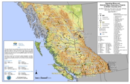
J. Britton, R. Chu, D. Grieve, P. Jago, J. Kyba, B. Madu, and B. Northcote
This Provincial Map shows the location of major exploration projects and producing metal, coal and industrial mineral mines in 2013.
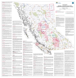
Superseded by BCGS Open File 2019-04
T. Ferbey
Presented here is a geographically referenced list of drift prospecting surveys that have been conducted in British Columbia. A list of topical studies and special volumes that are relevant to drift prospecting in British Columbia have also been included. These studies and geochemical data will be of interest to explorationists and researchers who are assessing the effectiveness of drift prospecting surveys for their own exploration or research program, who are preparing to design and implement their own survey, or who have generated geochemical data on drift samples and are looking for data from orientation surveys for comparison.
This map and list of references is intended to provide a way of quickly identifying drift prospecting studies and data that are either geographically or topically of interest to those working in British Columbia. This publication will be updated annually; we would appreciate being notified of errors or omissions.
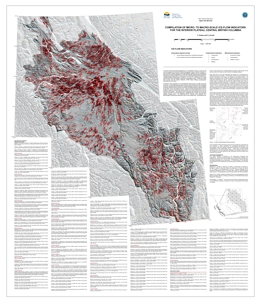
Superseded by BCGS Open File 2016-04
T. Ferbey and H. Arnold
This 1:900,000-scale compilation consists of over 90,000 ice-flow indicators digitally captured from published and unpublished surficial geology, terrain, and glacial features maps for the Interior Plateau physiographic region. Ice-flow indicators include micro-scale features such as striae and rat tails to macro-scale features such as drumlins and flutes. These data illustrate major ice-flow directions for the Cordilleran ice sheet during the Late Pleistocene. This compilation will be of interest to those seeking to understand ice-flow histories, a critical parameter for interpreting geochemical and mineralogical data from glacially transported sediments typically collected in drift prospecting surveys. These data will also benefit researchers who are more generally interested in landscape interactions of the Cordilleran ice sheet during the Late Pleistocene and the locations and evolution of ice divides. Compilation includes
- Geodatabase of ice-flow indicator compilation
- Shapefile of ice-flow indicator compilation
- Symbol set
- Readme file explaining data fields in shapefile
For a similar compilation of the entire British Columbia Cordillera see:
Ferbey, T., Arnold, H. and Hickin, A.S. (2013): Compilation of ice-flow indicators, British Columbia; BC Ministry of Energy and Mines, British Columbia Geological Survey, Open File 2013-06, scale 1: 1 650 000.
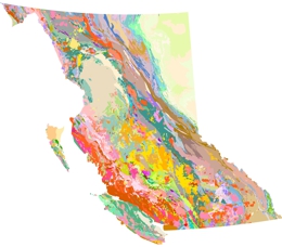
This publication has been superseded. Download the latest BC bedrock geology
Y. Cui, F. Katay, J.L. Nelson, T. Han, P.J. Desjardins, and L. Sinclair
Open File 2013-04 is the data source used to create the digital BC Geological Map, which is provided by the British Columbia Geological Survey to clients in mineral exploration, mining, land-use planning, and other areas.
This release consists of integrated datasets including: geological contacts that delineate bedrock units and structures as linear features associated with descriptions or attributions; and bedrock as polygons formed from the geological contacts and attributed with descriptions of the geological units. It also contains: tables for geological units and colours (RGB); and ESRI layer files containing the bedrock colour symbols, compatible to various versions of ArcGIS (designated by suffix _a##_# in file names); and a map of British Columbia illustrating the suggested colour theme for the bedrock polygons.
Download Open File 2013-04 (ZIP, 85.6 MB)
This publication has been superseded. Download the latest BC bedrock geology
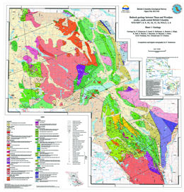
P. Schiarizza, S. Israel, S. Heffernan, A. Boulton, J. Bligh, K. Bell, S. Bayliss, J. Macauley, B. Bluemel, J. Zuber, R.M. Friedman, M.J. Orchard and T.P. Poulton
The Thuya Creek – Woodjam Creek map area encompasses about 5400 square kilometres, mainly in the Shuswap and Quesnel highlands and adjacent Fraser and Thompson plateaus. The geology is based on fieldwork conducted between 2000 and 2008, and integrates, with revisions, the interpretations presented in Open File maps 2002-4 (Nehalliston Plateau), 2002-15 (Clearwater-Bowers Lake), 2006-8 (Canim Lake), 2007-3 (Hendrix Lake), 2008-5 (Timothy Lake), and 2009-3 (Murphy Lake).
The area is underlain mainly by Mesozoic rocks of the Quesnel magmatic arc, including volcanic, volcaniclastic, and sedimentary rocks of the Nicola Group, which is separated into several regionally significant subdivisions. Associated plutonic rocks include a Late Triassic monzodiorite suite, Late Triassic to Early Jurassic calc-alkaline rocks of the Takomkane and Thuya batholiths, Early Jurassic Alaskan-type ultramafic-mafic complexes, and small stocks of Early Jurassic diorite, monzonite and quartz monzonite. The map area also includes Early Cretaceous granitic plutons, Eocene volcanic rocks of the Kamloops Group, Neogene basalt of the Chilcotin Group, and small exposures of Quaternary basalt that are part of the Wells Gray volcanic field.
Important mineral occurrences include porphyry Cu-Au deposits associated with the Late Triassic monzodiorite suite, porphyry Cu-Mo-Au deposits associated with Early Jurassic calc-alkaline plutons, Cu-Au skarns associated with Early Jurassic diorite, and Mo-W deposits associated with Early Cretaceous granitic plutons.
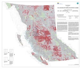
Superseded by Open File 2016-04
T. Ferbey, H. Arnold, and A.S. Hickin
This compilation consists of over 119,000 ice-flow indicators digitally captured from published and unpublished surficial geology, terrain, glacial features, and bedrock geology maps in British Columbia. Ice-flow indicators include outcrop-scale features such as striations and grooves and landform-scale features such as drumlins and flutes. These data illustrate ice-flow directions for the Cordilleran ice sheet during the Late Pleistocene. This compilation will be of interest to those seeking to understand ice-flow histories, a critical parameter for interpreting geochemical and mineralogical data from glacially transported sediments typically collected in drift prospecting surveys. These data will also benefit researchers who are more generally interested in landscape interactions of the Cordilleran ice sheet during the Late Pleistocene and the locations and evolution of ice divides.
Updated December 12, 2013
In this update, 296 features have been added to the compilation and a shapefile has been added to the datafile.
For a compilation of British Columbia and Yukon, see:
Arnold, H., Ferbey, T., and Hickin, A.S., 2016. Ice-flow indicator compilation British Columbia and Yukon. Ministry of Energy and Mines, British Columbia Geological Survey Open File 2016-04; Geological Survey of Canada Open File 8083, scale 1:1,750,000.
For a compilation of the Interior Plateau, see:
Ferbey, T., and Arnold, H., 2013. Micro- to macro-scale ice-flow indicators for the Interior Plateau, central British Columbia. Ministry of Energy, Mines and Natural Gas, British Columbia Geological Survey Open File 2013-03, scale 1:900 000
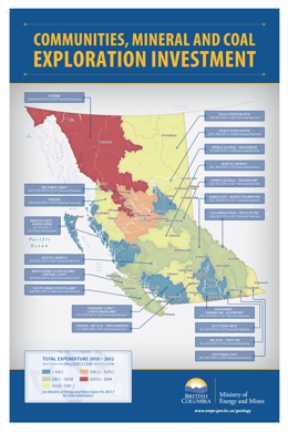
J. Britton, R. Chu, D. Grieve, W. Harman, P. Jago, J. Kyba, B. Madu, and B. Northcote
Open File map 2013-7 provides a geographic representation of estimated expenditures by the mineral and coal exploration industries across British Columbia, allowing local communities to visualize investment in their regions. The map, generated using Arc Map GIS software, is intended for anyone with an interest in mineral exploration activities, including government officials, political representatives, industry associations, students, resource planners, and the general public.
In contrast to previous versions (BCGS Open File 2010-02), Open File 2013-07 includes data from grassroots and early stage projects, recorded in the Mineral Titles database, in addition to expenditures from major projects. It also captures data from multiple years which, given the high annual variation in expenditures, may provide a better indication of mineral exploration interest.
G.E. Ray
The Cordillera of western Canada has a long history of mining metal from skarn. The British Columbia and Yukon MINFILES and the NWT NORMIN databases contain details on more than 1000 occurrences of skarn, recording alteration and mineral assemblages, host-rock descriptions, the nature and age of associated intrusive rocks, and details of scientific investigations, exploration, and mining. Open File 2013-08 compiles significant skarns and skarn deposits in the Canadian Cordillera, examining their distribution, age, tectonic setting, mineralogy, and chemistry. With voluminous extent and high metal grades, some Cordilleran Au, Cu, Fe and W deposits can be classed as ‘megaskarns’. This paper presents an adaptation of the accepted model and considers the origin of megaskarns in terms of the diachronous migration of hydromagmatic and meteoric fluid cells, with prograde and retrograde alteration expanding through time and space.
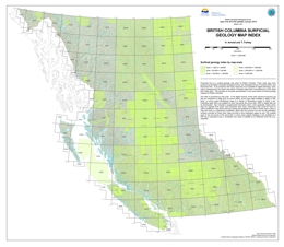
Superseded by BCGS Open File 2019-03
H. Arnold and T. Ferbey
This publication is released in PDF, ESRI Geodatabase, ESRI Map Package, Shapefile, and KMZ formats.
Presented here is a surficial geology map index for British Columbia. The maps indexed were produced by the British Columbia Geological Survey, the Geological Survey of Canada (GSC), and Geoscience BC. We included only those maps available for digital download. Each map is represented by the actual map extent rather than a bounding box or NTS sheet that it falls within. The index provides an accurate representation of the areal extent of surficial geology mapping for British Columbia.
The index is presented by map scale. In the digital versions of this index, advanced searches can be conducted on fields such as author, source type (data available in digital or PDF form), or source series (Preliminary maps to A Series or Geoscience maps). Publication page URLs are supplied for each map from which the source files, PDFs or digital data can be downloaded. Also included is supplemental information about where data were derived and/or used elsewhere. Instances of this would be when an author published a map that was then revised and published as a GSC A Series map or when a map was used in a subsequent compilation. In such cases, not only are the publication numbers provided for these other maps, but links to their publication pages as well. This enables users to see all sources of the same data. In some cases original mapping is only available as a PDF but a subsequent map or compilation has made it available as an attributed vector file (e.g., shapefile).
Download Open File 2013-09 (ZIP, 227 MB) updated January, 2015
2012
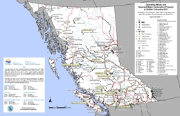
J. Britton, J. DeGrace, D. Grieve, P. Jago, J. Kyba, B. Madu, B. Northcote and R. Chu
This Provincial Map shows the location of major exploration projects and producing metal, coal and industrial mineral mines in 2011.
T. Ferbey, V.M. Levson and R.E. Lett
The silt plus clay-sized fraction of 106 near-surface (<4 m below surface) and 193 sub-surface (up to 30 m below surface) basal till samples collected in the Huckleberry Mine area was analyzed for 37 elements by inductively coupled plasma mass spectrometry (ICP-MS), following an aqua regia digestion, and 35 elements by instrumental neutron activation analysis (INAA). These data show that there is a good spatial relationship between elevated commodity element concentrations in basal tills and the known locations of porphyry Cu-Mo mineralization in bedrock. Geochemical data presented here will enable meaningful assessments of new regional-scale till geochemical data that have been collected in areas adjacent to the mine and provide a means of comparison for other explorationists working in the area who are using other geochemical sample types (e.g., stream sediments, till, etc.). As well, these results will help with the development of strategies for the design and implementation of till geochemistry programs in areas with similar physical and geological characteristics and complex glacial histories.
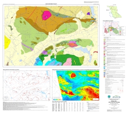
J.M. Logan, D.P. Moynihan, L.J. Diakow and B.I. van Straaten
Also published as Geoscience BC Map 2012-08-01
Geoscience BC's QUEST-Northwest Project is a multidisciplinary, integrated project designed to help focus mineral exploration in a highly prospective area of northwestern BC. The project's main activities include: two airborne magnetic surveys flown at line spacing of 250 metres, bedrock geological mapping and a geochemical program. The digital bedrock data set presents the field mapping results of the QUEST-Northwest Dease Lake Geoscience project - a partnership between Geoscience BC and the BC Geological Survey. The project completed regional scale bedrock geological mapping over a 1275 km2 area extending south west from the community of Dease Lake to the Tuya River that coincides with the northwest corner of the QUEST-Northwest Block 1 airborne magnetic survey area (released through Geoscience BC in January).
The Dease Lake map sheet 104J/08 and the east half of Little Tuya River map sheet 104J/07 are underlain mainly by Paleozoic to Late Triassic sedimentary, volcanic and plutonic arc rocks of the Stikine Terrane, which locally host large Cu-Au porphyry deposits like Red Chris, Schaft Creek and Galore Creek. In the northeast part of the map these rocks are thrust imbricated with similar aged volcanic and sedimentary oceanic rocks of the Cache Creek Terrane along the north-dipping King Salmon Fault. Early to Middle Jurassic sedimentary rocks of the Takwahoni and Inklin formations of the Whitehorse Trough overlie the Stikine and Cache Creek terrane rocks respectively. Middle Jurassic granodiorite and an equi-dimensional Paleocene granite with associated molybdenum mineralization intrudes the Early Jurassic Takwahoni sedimentary rocks. Unconformably capping some of the highest peaks in the area are columnar basalts of the Miocene to Pliocene Tuya Formation. Preserved beneath these young basalts in the southwest corner of the map are lower Tertiary coal-bearing sediments of the Tanzilla Canyon Formation.
The map provides revised geology, geochemical analyses of alteration and mineralization and new isotopic dates for volcanic and plutonic rocks in the area which when integrated with regional exploration target models and the new airborne magnetic and geochemical data collected by Geoscience BC are expected to benefit the exploration community.
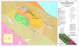
G.T. Nixon, A.C. Hitchins and G.P. Ross
Magmatic Ni-Cu-PGE sulphide deposits in supra-subduction zone (SSZ) settings are becoming an increasingly important economic resource worldwide yet remain poorly understood and underexplored. Projects initiated recently under the Targeted Geoscience Initiative No 4 in the Canadian Cordillera seek to address critical knowledge gaps in order to develop new mineral deposit models and robust exploration criteria. Our use of the term “orogenic” includes all SSZ ultramafic-mafic intrusions exclusive of ophiolite complexes and accreted LIPs (e.g. Wrangellia).
The Turnagain ultramafic intrusion is an Early Jurassic Alaskan-type body emplaced in a SSZ setting and unusually enriched in Ni-Cu-PGE sulphides. The new geology map incorporates previous BCGS mapping supplemented by geological, geophysical and ongoing exploration work (drillhole and trenching information) supplied by Hard Creek Nickel Corporation (HNC). Exploration by HNC has determined a resource of 223.2 Mt @ 0.22 wt % Ni and 0.014 wt % Co (measured); 524.5 Mt @ 0.21% Ni and 0.013% Co (indicated); and 537.5 Mt @ 0.20% Ni and 0.013% Co (inferred). The main mineralization is hosted by wehrlite and dunite (Horsetrail zone), and the principal sulphide minerals are pyrrhotite, pentlandite and chalcopyrite. Work by Scheel (MSc., 2007) has established that the origin of the mineralization is directly related to contamination of parental magmas by crustal material; critical contributions of sulphur and graphite from carbonaceous phyllitic wallrocks led to reduction of parental magmas and triggered sulphide saturation, as determined by S isotopes, petrography and field observations.
Regional geophysical surveys conducted by HNC clarify some important aspects of the tectonic setting of the Turnagain intrusion. Erdmer et al. (2005) proposed that the Turnagain intrusion is hosted by a Carboniferous (Mississippian) metasedimentary and metavolcanic assemblage that conformably overlies miogeoclinal rocks of Ancestral North America and is not part of an accreted terrane. A regional TEM airborne survey shows the following important features: 1) graphitic phyllite and slate wallrocks to the Turnagain intrusion show a marked electromagnetic response (conductivity) not shared by ultramafic or meta-sedimentary/volcanic rocks to the west; 2) mapping traverses north and east of the Turnagain intrusion demonstrate that the sharp, curvilinear EM boundary to the east separates these highly conductive graphitic rocks from poorly conductive strata of Ancestral North America (Kechika Formation and Atan Group); 3) this EM boundary transects miogeoclinal stratigraphy as mapped by Gabrielse (1998) and passes through a 800m gap in outcrop separating Atan Group strata from graphitic phyllite (Erdmer et al., 2005). Based on these observations, we infer that this EM boundary represents a steeply dipping reverse fault (similar to the fault delineating the northern and eastern margins of the Turnagain intrusion) and separates miogeoclinal rocks of Ancestral North America from Mississippian assemblages representing the basement to the accreted Quesnel Terrane (Yukon-Tanana Terrane). This interpretation appears consistent with the tight to slightly overturned, eastward-verging folds in the graphitic phyllites documented by Erdmer et al. (2005) and juxtaposed strata of the Ancestral North American miogeocline which occupy the southwesterly-dipping limb of a large homoclinal structure (Gabrielse, 1998).
B.I. van Straaten, J.M. Logan, and L.J. Diakow
Also published as Geoscience BC Report 2012-10, Map 2012-10-1
A regional-scale reconnaissance bedrock mapping study was conducted in the Hotailuh batholith area, near the town of Dease Lake, as part of Geoscience BC’s QUEST-Northwest Project. This mapping is a partnership between the BC Geological Survey and Geoscience BC. This study combines one summer of field bedrock mapping with detailed petrography, geochemistry of both altered/mineralized and unaltered samples, geochronological data, and integration with airborne geophysical survey results.
The 2275 km2 composite Late Triassic to Middle Jurassic Hotailuh batholith is in the Stikine terrane of northern British Columbia. The investigation aimed to refine the temporal magmatic and geochemical evolution of the batholith, and specifically focused on relating mineralization with magmatic events.
The Late Triassic plutonic suite comprises the Gnat Lake ultramafic to mafic bodies, Cake Hill felsic pluton and Beggerlay Creek ultramafic to mafic pluton. The absence of equivocal crosscutting relationships, lack of absolute crystallization age determinations for the ultramafic to mafic intrusions, and the absence of detailed mineral chemistry data makes it difficult to determine the genetic and temporal relationships between the different Late Triassic intrusions. The Late Triassic intrusions are spatially associated with, and in places intrude, poorly exposed and poorly dated, intermediate-mafic volcanic and sedimentary rocks of the Triassic Stuhini group. The Middle Jurassic Three Sisters pluton comprises at least four phases, namely the finegrained mafic-intermediate phase, a mafic phase, central felsic phase, and a crosscutting potassic phase. U-Pb zircon crystallization ages and Ar-Ar cooling ages confirm that all phases formed during a relatively short time span in the Middle Jurassic. The northern and eastern margin of the batholith is nonconformably overlain by a succession of Early Jurassic basal sedimentary rocks grading upward into Early-Middle Jurassic volcanic rocks. The volcanic rocks were previously mapped as Triassic Stuhini group, but new geochronological data and mapping suggest they are part of the Jurassic Hazelton group.
Geochronology and geochemistry confirm the presence of at least two discrete magmatic events in the Late Triassic and Middle Jurassic. Both magmatic events have a strong calc-alkaline subduction-modified subcontinental mantle geochemical signature, and formed in a volcanic island arc to continental volcanic arc setting. At least two episodes of mineralization associated with Late Triassic and Middle Jurassic magmatism are found in the area. In addition to the known mineral occurrences within the batholith and its immediate surroundings, this study identified several new mineral occurrences. The intrusion-related magmatic-hydrothermal mineralization comprises predominantly copper, gold, silver, molybdenum and/or tungsten occurrences. Mineral occurrences occur peripheral to the main batholith and along contact zones between different magmatic phases within the batholith. The Gnat Pass ductile to brittle shear zone on the western margin of the batholith appears especially well endowed with mineral occurrences, and includes the newly dated (ca. 216.5 Ma) porphyry copper prospect at Gnat Pass.
G.J. Simandl, E.A. Prussin, and N. Brown
Specialty metals are essential raw materials for manufacturing high technology products and for fabricating devices that reduce greenhouse gas emissions. Industrialized countries consider access to specialty metals important for national security. More than 1000 Ta, Nb, Zr, Hf, Li, REE and Be occurrences are known in Canada. These occurrences can be described as anomalies (140), showings (563), prospects (204), developed prospects (109), past producers (23), current producers (8), Li-bearing oilfield brines (48), and oil sands by-products (2). Geologically, the occurrences can be grouped into 14 categories: carbonatite/syenite-related; peralkaline intrusion-related; pegmatite/granite/aplite; REE ± P veins; placer/paleoplacer; sedimentary phosphates; REE- enriched Iron oxide copper gold ore (IOCG); sandstone–hosted xenotime; REE as uranium by-products; skarns; greisen/veins; Li-bearing brines; oils sands by-products; and other/unknown. Canada has excellent geological potential to meet the continued global demand for specialty metals.
The document was produced as part of the Targeted Initiative 4 (TGI-4) led by the Geological Survey of Canada (Natural Resources Canada) in collaboration with provincial and territorial partners.
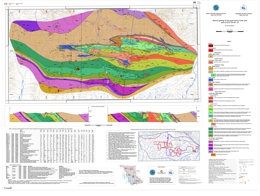
P. Schiarizza
The upper Kutcho Creek map area is in northern British Columbia, about 100 km east of Dease Lake. It covers about 400 square kilometres and encompasses the transition between the Stikine Ranges of the Cassiar Mountains to the north and the Spatsizi Plateau to the south. Open File 2012-08 presents a 1:40 000-scale geologic map of this area based on fieldwork conducted in 2010 and 2011. The map features new subdivisions of the Permo-Triassic Kutcho assemblage, a heterogeneous package of schists derived from felsic and mafic volcanic and volcaniclastic rocks and associated felsic and mafic intrusions. The Kutcho assemblage hosts the Kutcho Creek Cu-Zn volcanogenic massive sulphide deposit (MINFILE 104I 060), as well as several other VMS prospects and younger vein occurrences. The Kutcho assemblage is in the King Salmon allochthon, a narrow belt of penetratively deformed, greenschist-grade metamorphic rocks that also includes slivers of the late Paleozoic to early Mesozoic Cache Creek Complex, and a Triassic-Jurassic metasedimentary succession, the Whitehorse trough, that unconformably overlies both Kutcho and Cache Creek rocks. The allochthon is bounded to the south by the north-dipping King Salmon thrust fault, and to the north by the Nahlin fault; it is truncated by the northwest-striking Kutcho dextral strike-slip fault near the northeast edge of the map area.
Operating funds for the Kutcho mapping program were provided by the BC Geological Survey, a private-public partnership agreement with Kutcho Copper Corporation, the Geological Survey of Canada (EDGES component of the GEM program) and, in 2010, a partnership agreement with the University of Victoria.
Details and descriptions of the geologic units and structures within this map area can be found in:
Schiarizza, P. (2012): Geology of the Kutcho assemblage between the Kehlechoa and Tucho rivers, northern British Columbia (NTS 104I/01, 02); in Geological Fieldwork 2011, British Columbia Ministry of Energy and Mines, Paper 2012-1, pages 75-98.
2011
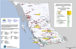
D. Grieve, B. Madu, B. Northcote, P. Wojdak, J. Fredericks, S. Meredith-Jones and P. Desjardins
This Provincial Map shows the location of major exploration projects and producing metal, coal and industrial mineral mines in 2010.
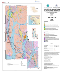
J.L. Nelson, L.J. Diakow, S. Karl, J.B. Mahoney, G.E. Gehrels, M. Pecha and C. van Staal
This open file map displays new geological mapping conducted in 2010 of the mid-coast region of British Columbia, centred on the channels of the Inside Passage near the village of Klemtu. The area lies within the western Coast Plutonic Complex. It is mostly underlain by large Cretaceous plutonic bodies, which contain screens of metamorphosed stratified rocks assigned to the Alexander terrane. These are assigned to the Mathieson Channel Formation, a mainly clastic sequence that contains detrital zircons as young as Early Devonian (G. Gehrels and B. Mahoney, unpublished data, 2011). It is probably correlative with mid-Paleozoic clastic units of the Alexander terrane in southeastern Alaska. The Grenville Channel fault transects the western part of the area. It is a regionally extensive, sinistral fault with unknown amounts of displacement in Early to mid-Cretaceous time.
Details and descriptions of the map units and structures within this map area can be found in:
Nelson, J.L., Diakow, L.J., Karl, S., Mahoney, J.B., Gehrels G.E., Pecha, M., and van Staal, C. (2011): Geology and mineral potential of the southern Alexander terrane and western Coast Plutonic complex near Klemtu, northwestern British Columbia, in Geological Fieldwork 2010, BC Ministry of Forests, Mines and Lands, BC Geological Survey Paper 2011-1, p. 73-98.
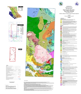
M.G. Mihalynuk, J.M. Logan and A. Zagorevski
Open File 2011-4 covers NTS map area 104B/14E and the northern part of 11E within the Iskut River area of northwestern British Columbia. This region is characterized by exceptional mineral endowment, as described by Mihalynuk et al. (2011, Geological Fieldwork 2010, Paper 2011-1): “… a 20km-wide corridor south of the Iskut River includes the Bronson Slope, Snip, Johnny Mountain, Eskay Creek and Rock and Roll deposits -all with past production or defined resources. These deposits formed in a surprisingly diverse set of environments ranging from intrusion hosted sulphide veins to shallow subaqueous hotspring settings. No deposits with past production or defined resources occur within a 20km corridor immediately north of the Iskut River, yet those farther afield include Galore Creek, Copper Canyon and Schaft Creek deposits that are hosted by alkalic and calc-alkalic porphyries. An obvious explanation for the dearth of deposits within the northern corridor is not forthcoming from existing geological maps; however, a significant part of the corridor has either never been systematically mapped or at least not since it was surveyed by Forrest Kerr in the 1920’s. A working partnership was established between the BC Ministry of Energy, Mines and Petroleum Resources, the Geological Survey of Canada (under the auspices of the Geoscience for Energy and Minerals Strategy: GEMS), Pacific North West Capital Corp., and the University of Victoria to address this lack of public geologic knowledge through systematic mapping. Supplementary goals were to provide a more accurate geological setting for the Rock and Roll deposit and to evaluate the potential for similar precious metal rich polymetallic massive sulfide mineralization within the Iskut and adjacent regions. Our work was mainly focused where published mapping was entirely lacking: the eastern half of the Hoodoo Mountain mapsheet (NTS 104B/14E). This mapsheet is bordered to the north by the Galore Creek mapsheet (104G/3) and to the east by Forrest Kerr mapsheet (104B/15), both covered by relatively recent regional geological surveys (Logan and Koyanagi, 1994, 104G/3, 4; and Logan et al., 2000, 104B/10, 15, 104G2, 7W).”
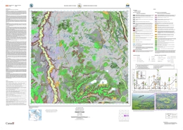
M. Tommelen and V. Levson
Also published as GSC Open File 6832
T. Ferbey
Also published as Geoscience BC Report 2011-9
The silt plus clay-sized fraction of 84 basal till samples collected within the Colleymount map area (093L/01), located approximately 40 km southeast of Houston, BC, was analyzed for 37 elements by inductively coupled plasma mass spectrometry (ICP-MS), following an aqua regia digestion, and 35 elements by instrumental neutron activation analysis (INAA). An additional 18 basal till samples were collected for analysis of heavy metal concentrates and gold grain counts. The spatial distribution of till samples elevated in Cu, Mo, Pb, Zn, Ag, Hg, Au, As, Sb, and visible gold grains are the focus of this study. Detrial dispersal of commodity metals and pathfinder elements from known sources of mineralization is discussed (e.g., past producing Equity Silver mine) as are areas of geochemical interest.
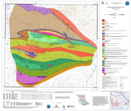
P. Schiarizza
The Andrea Creek map area is located in northern British Columbia, about 100 km east of Dease Lake. It covers about 200 square kilometres and encompasses the transition between the Stikine Ranges of the Cassiar Mountains to the north and the Spatsizi Plateau to the south. Open File 2011-07 presents a 1:25 000-scale geologic map of this area based on fieldwork conducted in 2010. The map features new subdivisions of the Permo-Triassic Kutcho assemblage, a heterogeneous package of schists derived from felsic and mafic volcanic and volcaniclastic rocks and associated felsic and mafic intrusions, which hosts the Kutcho Creek Cu-Zn volcanogenic massive sulphide occurrence (MINFILE 104I 060). The Kutcho assemblage is part of the King Salmon allochthon, which also includes a structurally underlying unit of metabasalt and serpentinite assigned to the Cache Creek Complex, and a Triassic-Jurassic metasedimentary succession that overlies the Kutcho assemblage across an erosional unconformity. The latter succession includes a local conglomerate unit containing clasts derived from the Kutcho assemblage, and overlying limestone, slate, siltstone and sandstone correlated with the regionally extensive Late Triassic Sinwa and Early to Middle Jurassic Inklin formations. The allochthon is bounded to the south by the north-dipping King Salmon thrust fault, and to the north by the Nahlin fault. Jurassic chert-pebble conglomerate of the Bowser Lake Group occurs in the footwall of the King Salmon fault, and serpentinized ultramafic rocks of the Cache Creek complex crop out on the north side of the Nahlin fault. The northwest-striking Kutcho fault truncates the King Salmon allochthon near the northeast edge of the map area, and juxtaposes it against undated plutonic rocks, mainly granodiorite and quartz diorite, which are part of the Quesnel terrane.
Operating funds for the 2010 mapping program were provided by the BC Geological Survey, a private-public partnership agreement with Kutcho Copper Corporation, the Geological Survey of Canada (EDGES component of the GEM program) and a partnership agreement with the University of Victoria.
Details and descriptions of the geologic units and structures within this map area can be found in:
Schiarizza, P. (2011): Geology of the Kutcho assemblage between Kutcho Creek and the Tucho River, northern British Columbia (NTS 104I/01); in Geological Fieldwork 2010, British Columbia Ministry of Energy and Mines, Paper 2011-1, pages 99-117
2010
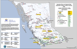
D. Grieve, B. Madu, B. Northcote, P. Wojdak, J. Fredericks, S. Meredith-Jones and P. Saunders
This Provincial Map shows the location of major exploration projects and producing metal, coal and industrial mineral mines in 2009.
View Open File 2010-01 (PDF, 13.5 MB)
Download Open file 2010-01 (ZIP 40.9 MB)
Updated December 2010
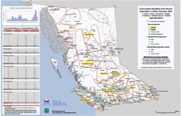
B. Northcote, D. Grieve, B. Madu, P. Wojdak, J. Fredericks, P. Saunders and S. Meredith-Jones
This Provincial Map shows the location of major exploration projects; producing metal, coal and industrial mineral mines and the communities they influenced in 2009.
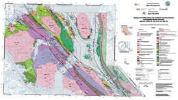
J. Nelson, B. Mahoney, G. Ghrels and C. van Staal
Also published as GSC Open File 6624
The northern coastal area is a part of British Columbia in which the mineral potential of a significant number of tracts is assessed as high (Categories 1 and 2 out of 10; BC Mineral Potential Assessment Program; Kilby, 1995), but recent mineral exploration activity has been at relatively low levels. Moreover, this area has also not seen systematic public geological mapping since original Geological Survey of Canada work in the 1960’s.
This open file covers 1:50,000 scale mapping conducted in 2009 on Porcher Island and adjacent islands, and the mainland coast on the eastern side of Grenville Channel. The area is underlain by rocks of the southern Alexander terrane, intruded by a suite of mid-Cretaceous plutons. The Alexander terrane is a large composite crustal fragment that underlies part of the St. Elias Range on the Yukon-Alaskan border, and most of southeastern Alaska. It is of considerable exploration interest because of the volcanogenic massive sulphide deposits that it hosts, including Niblack and others on southern Prince of Wales Island just north of the BC-Alaska border, as well as a trend of Triassic deposits, notably Windy Craggy and the Greens Creek Mine.
Some of the stratified rock units in the map area are correlated confidently with the Ordovician Descon Formation and Devonian Karheen Formation, which have type sections in the Alexander terrane of southeastern Alaska. Highly deformed and metamorphosed sedimentary strata that form a series of bands intercalated with the Ogden Channel complex on Porcher Island are considered probably Neoproterozoic-Cambrian. An undated sequence of strata between Porcher and Kennedy Islands, intruded by a ca 482 Ma pluton (Gehrels and Boghossian 2000), may belong to the Neoproterozoic-Cambrian Wales Group or, alternatively, to the Descon Formation. The Paleozoic volcanic, carbonate and clastic units east of Grenville Channel are of ambiguous terrane association. Nelson et al. (2010) assigned them to the Alexander terrane, but they may be part of the Yukon-Tanana terrane and Gravina belt.
The oldest known plutonic bodies in the area, the McMicking and Hunt Inlet plutons, are Early Ordovician. They cut both greenschist-facies Descon rocks on northern Porcher Island, and amphibolite-facies undated strata on the islands along Chismore and Kelp passages. The Billy Bay intrusive complex on southwestern Porcher Island is also considered to be Ordovician, possibly the intrusive roots of the Descon volcanic sequence. The Porcher Inlet pluton (Early Devonian; unpublished U-Pb data, J.B. Mahoney 2010) crosscuts fabrics in the polymetamorphosed, as yet undated Ogden Channel intrusive-metamorphic complex. The Devonian-Mississippian Swede Point pluton is a highly elongate granitoid body that is largely bounded by sinistral transcurrent faults.
Mid-Cretaceous plutons include the ca 108 Ma Captain Cove pluton (Butler et al., 2006), and many similar bodies dominated by undeformed, fresh granodiorite. They are displaced and locally mylonitized by the major faults.
The structure of the Porcher Island – Grenville channel area is dominated by a series of regional, northwest- to north-striking sinistral transcurrent faults – the Salt Lagoon, Useless, Lamppost and Grenville Channel faults and other unnamed strands. They are expressed as intense mylonite zones tens to hundreds of metres wide in the stratified rocks, in which asymmetric fabrics are well developed (Nelson et al., 2010).
The Porcher Island gold mine, located near Edye Pass, is a previous producer that still contains well over a million tonnes at 7 grams per tonne of indicated plus inferred reserves. In the Ordovician and older rocks, there are two belts of stratabound magnetite iron formation, one on the northeastern side of Porcher Island, and one on the northeastern side of Pitt Island. These indicate the potential for volcanogenic massive sulphide mineralization.
T. Ferbey and V.M. Levson
A 2.5 km east-west geochemical sampling transect over the Copper Star porphyry occurrence in an area of a known ice-flow reversal reveals evidence for dominantly westward (locally 290°) glacial dispersal. The highest Cu (686.1 ppm) and Mo (4.98 ppm) values in the till transect occur directly west of the occurrence and generally decrease westward. The second highest Cu value (194.78 ppm), however, occurs in till directly east of the occurrence suggesting that a component of eastward dispersal also occurred. These observations are consistent with the ice-flow model for the area that predicts both eastward and westward dispersal. Dispersal distance from the mineral occurrence to the highest Cu concentration in till is short, probably reflecting the shallow till depth (<1 m) at the occurrence. In addition elevated Au and Ag at two sites at the east end of the transect suggests potential precious metal mineralization in that area.
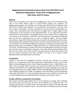
C. Dunn and V.M. Levson
Results from the analyses of the outer bark of lodgepole pine collected at 51 sites in the Interior Plateau region of central British Columbia are presented. The biogeochemical samples were collected from the Tsacha Lake (NTS 93F/2) and Chedakuz Creek (NTS 93F/7) 1:50 000 scale map areas. The concentrations of 44 elements in the ash of the bark samples are presented. The mean concentrations of most elements, including lead, zinc, copper, silver, nickel, gold, arsenic and antimony, are higher than in a larger regional survey conducted just to the northwest. Likewise the maximum concentration of most elements, including gold, arsenic, silver, nickel and zinc, are higher than in the survey to the northwest. In particular, mean and maximum concentrations of gold (40ppb and 733 ppb, respectively) are an order of magnitude higher. The three highest concentrations of gold (733, 408, and 109 ppb) are clustered in one area southwest of Top Lake. Concentrations of the pathfinder element arsenic are also elevated at these sites (10-12 ppm; >75th percentile). The anomalously high gold concentrations, clustering of the three sites, and high associated arsenic concentrations, suggest that there is an undiscovered gold occurrence in this area. An additional area of interest, with the fourth highest gold occurrence in the study area (74 ppb), occurs in the Big Bend Creek area. Two nearby sites have elevated gold (18-25 ppb) and one of these shows more than 90th percentile arsenic (15 ppm) and antimony (2.6 ppm). No mineral occurrences have been recorded in this area or at a number of other identified locations with high metal concentrations.
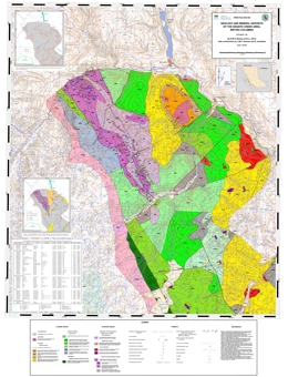
Mapping and compilation by N.W.D. Massey and S.L. Oliver (with contributions by J.M.S. Vineham and S. Jasechko)
The map covers an area about 15 km to the west of Princeton. The map area stretches from the Whipsaw Creek and Hudson Bay Meadows areas in the south to the Tulameen River in the north. It partially overlaps the area covered by Open File 2009-8.
The map area lies at the western edge of Quesnellia and includes some of the southernmost exposures of the late Triassic Nicola Group. These lie to the west of the Boundary Fault and were included in the calc-alkaline “western belt” by Mortimer (1987). Clastic sedimentary rocks, dominated by black argillites, are intercalated with feldspathic tuffs and tuffaceous sediments. These pass westwards, and probably upwards, into typical Nicola pyroxene-feldspar tuffs, lapilli tuffs and breccias. A sequence of massive feldspar basalt and greenstone flows occurs in the area southeast of the Granite Creek campsite. The volcanic rocks become more deformed to the west, the change from massive to schistose rocks being transitional and gradual from east to west as foliation becomes progressively more penetrative and steeper. Both schistose metasedimentary and metavolcanic rocks occur in the aureole of the Eagle Plutonic Complex along the western margin of the map area.
The Tulameen Ultramafic-Gabbro Complex is structurally emplaced into, though probably coeval with, the Nicola Group. Several smaller bodies of diorite-gabbro or pyroxenite also occur in the map area.
In the west of the map area, rocks of the Eastgate-Whipsaw metamorphic belt have been correlated with the Nicola by Rice (1947) and Monger (1989). The belt is bound by the syntectonic Eagle Plutonic Complex to the west and the Similkameen fault to the east. The belt shows significant lithological differences to the immediately adjacent Nicola volcanic rocks. It has been divided into three northwest trending lithological assemblages to the south (Massey et al., 2009), that show increasing metamorphic grade from greenschist in the east to amphibolite in the west. Only the amphibolite unit continues north into the present map area. The belt may be equivalent to the Late Permian to Early Triassic Sitlika-Kutcho sequences, although preliminary zircon geochronology suggests an Early Permian age (Oliver, pers. comm.).
Volcanic and sedimentary rocks of the Eocene Princeton Group occur in the northern (Tulameen coal basin) and eastern (Princeton basin) parts of the map area. They lie unconformably on the Nicola Group and related intrusive rocks. Comagmatic minor intrusions occur throughout the map area as ubiquitous intermediate-felsic porphyry dikes.
Some 48 mineral occurrences are reported within the map area. The most important of these are the deposits of the Late Triassic Tulameen Complex (chromite±Pt, magnetite, copper), the Tertiary Tulameen coal basin (coal, clay, zeolites) and the various gold-platinum placers.
T. Ferbey
Also published as GBC Report 2010-10
The silt plus clay-sized fraction of 79 basal till samples collected within the Nadina River map area (093E/15), located approximately 100 km south of Houston, BC, was analyzed for 37 elements by inductively coupled plasma mass spectrometry (ICP-MS), following an aqua regia digestion, and 35 elements by instrumental neutron activation analysis (INAA). An additional 16 basal till samples were collected for analysis of heavy metal concentrates and gold grain counts. The spatial distribution of samples elevated in Cu, Mo, Pb, Zn, Ag, Ni, Hg, Au, As, Sb, Cr, and visible gold grains are the focus of this study. Data presented here highlight four areas of geochemical interest. Follow-up field work is required to assess the significance of the elevated element values used to identify these areas.
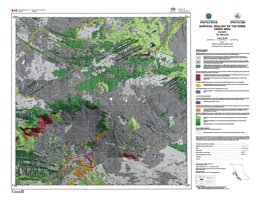
T.E. Demchuk
Also published as GSC Open File 6568
The Komie Creek map area was fully glaciated by the Laurentide Ice Sheet (LIS) during the Late Wisconsinan Fraser Glaciation. Ice flow during the glacial maximum was towards the southwest, as indicated by the orientation of streamlined landforms on the Etsho Plateau. At some time after the Fraser Glaciation maximum, the LIS divided into two lobes (upland and lowland). The subsequent landform assemblages, highlighted well in LiDAR imagery, provide evidence that the upland lobe retreated to the northeast and the lateral margin of the lowland lobe dropped to the southwest.
Organic deposits are the dominant surficial material type in the Komie Creek map area. They have accumulated and been deposited on poorly drained clay and silt-rich morainal and glacio-lacustrine deposits. Morainal deposits are the next most common surficial material type in the area and dominate along the top of the Etsho Escarpment and in the northeast corner of the study area. Glaciofluvial deposits are rare.
During ice retreat, an ice-marginal lake formed in the south-central part of the study area where the lowland lobe prevented drainage of meltwater out of the area. An aerially extensive landform, interpreted as an ice-contact glaciofluvial delta complex, was deposited into this dynamic glacial lake. The lake levels rose abruptly several times during delta deposition as a result of large west-flowing outburst floods in the Cabin Creek melt water channel, generated when a glacial lake breached its margins on or under the upland lobe. The delta is composed of several lobate landforms that sedimentologically are highly variable.
A new, detailed 1:50,000-scale surficial geology map for the Komie Creek map area is presented in this Open File. This map was generated using aerial photographs, LiDAR DEMs, ground-based geophysics and field observations.
R. Lett
Open File 2010-9 describes soil geochemical orientation surveys over the Mouse Mountain and Shiko Lake porphyry Cu-Au mineral occurrences and two other areas near Soda Creek and Alexandria. Bedrock in this part of British Columbia between Williams Lake and Quesnel is mainly glacial sediment covered and consists of Mesozoic-age rocks overlain by younger plateau basalts. The primary aim of the soil sampling was to examine the soil geochemical expression of porphyry Cu-Au and related sulphide mineralization in drift and barren bedrock covered areas. In each survey area samples from different soil horizons were analysed for multi-elements by a range of techniques including instrumental neutron activation (INAA), aqua regia-inductively coupled mass spectrometry (aqua regia-ICPMS), Mobile Metal Ion leach (MMI) TM, Enzyme LeachSM, BioLeachSM and Soil Gas Hydrocarbons (SGH) and for soil pH and loss on ignition (LOI). Gold and other mineral grains were also identified and counted in the heavy mineral concentrate of C soil horizon samples.
Gold, Cu, Mo and V soil anomalies outlined by soil sampling over the Mouse Mountain and Shiko Lake mineral properties are most likely caused by minerals entrained in a till deposited down-ice from bedrock hosted sulphide mineralization. Copper, Au, Ni and V by aqua regia-ICPMS show greatest anomaly contrast in the C soil horizon compared to the B and F-H horizons whereas Ag and Mo are more elevated in the F-H organic horizon. Anomaly size and contrast for selected elements by MMITM, BioLeachSMand Enzyme Leach SM in the B soil is generally similar to the contrast for elements by a more rigorous aqua regia digestion, but the different partial leaches display a preference for enhancing certain metals. For example MMITM enhances Au anomaly contrast compared to that of Cu whereas BioLeachSM enhances Co and Cu contrast compared to Au. Anomaly contrast by a partial leach also reflects the soil horizon sampled stressing the need for consistency when maintaining the soil sampling in the same horizon.
The number and relative shape of Au grains in the C soil sample heavy mineral concentrates complements the soil geochemistry in locating a buried bedrock source for the minerals. Comparison of SGH, multi element and pH patterns in the soil at Mouse Mountain and Shiko Lake suggest that the geochemistry may have been modified by a reduced chimney induced by oxidizing sulphides in bedrock. A model developed by interpreting all of the geochemical data displays the most likely relationship between the bedrock, drainage and soil geochemistry in areas where bedrock is concealed beneath a till veneer.
edited by G.J. Simandl and D.V. Lefebure
The International Workshop on the Geology of Rare Metals was held at the Harbour Towers Hotel in Victoria, Canada on November 9-10, 2010. It was organized by the British Columbia Geological Survey in collaboration with the Geological Survey of Canada’s Targeted Geoscience Initiative 4 and the Pacific Section of the Geological Association of Canada.
The Workshop focused on various aspects of rare earth elements (lanthanides, Y and Sc) and other rare metals (mainly Nb, Ta, Li, Be, Zr, Hf). The program consisted of 26 oral presentations and 6 poster displays. Extended abstracts are included in this volume for all the technical presentations. They are arranged in order that they were presented.
The Workshop is the first deliverable of the Rare Metals Project that is part of the renewed Targeted Geoscience Initiative. This Project is co-led by the Geological Survey of Canada and a number of Canadian provinces and territories. The Rare Metals Project will be implemented to:
-
focus and coordinate research efforts across Canada that are designed to improve the
understanding of the tectonic and depositional environments of this suite of deposit types,
which in turn will lead to the development of better predictive models and more effective
exploration methods and techniques; and -
facilitate greater interaction between interested provincial and territorial geological surveys,
industry representatives and academics in order to generate sub-projects and foster greater
Canadian expertise in the geoscience of rare metals through the staging of workshops and
seminars.
Project activities will be carried out by federal, provincial and territorial geoscientists and academia. The research direction will be influenced by consultation with industry as to their present and future requirements for public geoscience data and knowledge. The Rare Metals Project will employ a number of geoscience methodologies including: geological, geophysical and geochemical mapping; geochronological and isotopic studies; and geometallurgical evaluations.
