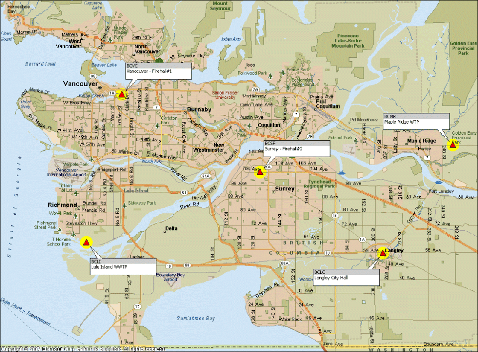
Metro Vancouver Active Control Points Map
The B.C. Active Control System (BCACS) is a network of strategically located satellite receivers that are used for georeferencing in British Columbia. These satellite base stations are called active control points.
View the location of the Metro Vancouver active control points on the map below. Click on the links below the map for base station information (PDF):
Heights Derived from BCACS Stations in Metro Vancouver

Metro Vancouver Active Control Points Information
- Langley City Hall (BCLC) (PDF, 19KB)
- Lulu Island WWTF (BCLI) (PDF, 24KB)
- Maple Ridge WTP (BCMR) (PDF, 21KB)
- Surrey - Firehall #2 (BCSF) (PDF, 27KB)
- Vancouver - Firehall #1 (BCVC) (PDF, 21KB)
Notice - December 3rd, 2018
In conjunction with the Metro Vancouver CGVD28 Refresh Adjustment published in November 2018, the BCACS stations in Metro Vancouver have also been assigned refreshed hybrid ellipsoidal heights which have been configured into their receivers. These heights are not true ellipsoidal heights; a true ellipsoidal height being one derived through GNSS observations. These hybrid ellipsoidal heights were derived by taking their latest CGVD28 (levelling-derived) orthometric heights and adding the HTMVBC00_Abb separations at those stations. The benefit behind this method is that users of the Metro Vancouver Real-Time Network and/or post mission data in conjunction with HTMVBC00_Abb will arrive at orthometric heights that are more consistent with published CGVD28 values for the network of passive GCMs throughout Metro Vancouver. This practice is a continuation of the vertical system that has already been in place since 2005.
The drawback to this system is that land surveyors using the NRCAN CSRS-PPP service will be working in a system that uses true ellipsoidal heights as their basis and therefore inconsistencies between users of the different systems is to be expected. Users of private GNSS networks may experience similar inconsistencies; this will be the case if private GNSS networks have vertically referenced their stations based on true ellipsoidal heights. The predicted magnitude of the resulting discrepancy is approximately 3cm plus the additional error sources that are always present in any GNSS observation set; this prediction is based on the difference between true vs hybrid ellipsoidal heights at the BCACS stations. GeoBC has taken these drawbacks into consideration and has found that continuing use of HTMVBC00_Abb while maintaining the system whereby BCACS-derived CGVD28 heights are consistent with the surrounding network of passive GCMs was the most practical course of action at the time of the November 2018 Refresh.
