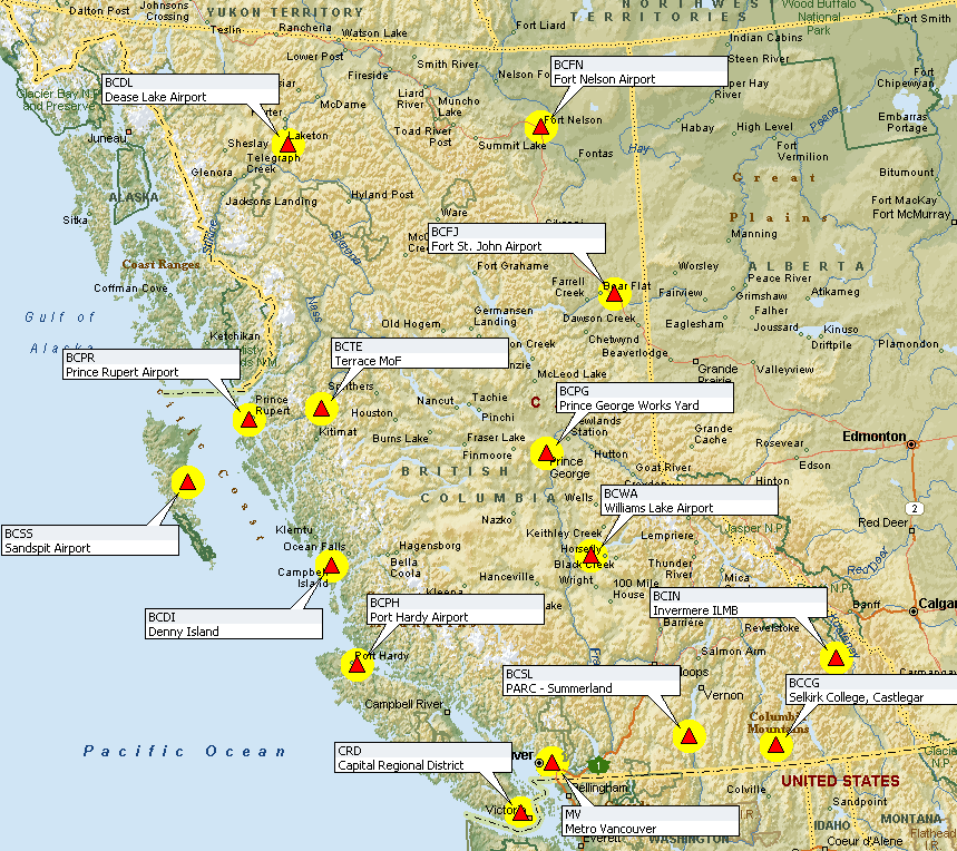
B.C. Active Control Points Map
The B.C. Active Control System (BCACS) is a network of strategically located satellite receivers that are used for georeferencing in British Columbia. These satellite base stations are called active control points.
View the location of B.C.'s active control points on the map below. Click on the links below the map for base station information (PDF):

B.C. Active Control Points Information
- Capital Regional District (CRD)
- Dease Lake Airport (BCDL) (PDF, 21KB)
- Denny Island (BCDI)(PDF, 98.4)
- Forst Nelson Airport (BCFN) (PDF, 95.9KB)
- Fort St. John Airport (BCFJ) (PDF, 69KB)
- Invermere ILMB (BCIN)
- Metro Vancouver (MV)
- PARC - Summerland (BCSL) (PDF, 105KB)
- Port Hardy Airport (BCPH) (PDF, 106KB)
- Prince George Works Yard (BCPG) (PDF, 98KB)
- Prince Rupert Airport (BCPR) (PDF, 97KB)
- Sandspit Airport (BCSS) (PDF, 97KB)
- Selkirk College, Castlegar (BCCG (PDF, 98KB)
- Terrace MoF (BCTE)
- Williams Lake Airport (BCWA (PDF, 102KB)
Contact
General enquiries: GeoBCinfo@gov.bc.ca
- About GeoBC
Deliveries Courier
3rd Floor, 3400 Davidson Ave
Victoria, BC V8Z 3P8
Mailing Address
PO BOX 9375 STN PROV GOVT
Victoria, BC V8W 9M5
