Aggregate geoscience
Listed below are British Columbia Geological Survey projects designed to establish an inventory of natural and crushed aggregate pits in the province, and to develop a series of predictive aggregate potential maps for key areas in the province likely to experience future development.
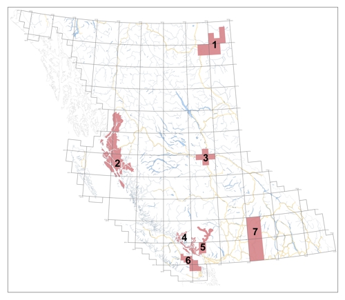
1: Oil and Gas: Northeast aggregate
Aggregates and Detailed Aggregate Studies - Oil and Gas Division
2: Open File 2001-19: North Coast Aggregate Potential Project
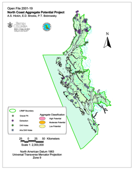
A.S. Hickin, E.D. Brooks, and P.T. Bobrowsky
The North Coast LRMP Aggregate Potential Map provides a mechanism for identifying target areas for further aggregate investigation. In general, there is limited aggregate potential within the North Coast LRMP, as access and availability of material is relatively restricted. However, a number of possible aggregate locations were identified in this project that, with further investigation, may prove to be economic for either local use or export. Almost all locations will have to rely on transportation by water, as the existing road network infrastructure does not extend beyond Prince Rupert and the Skeena River corridor.
View Open File 2001-19 (PDF, 813 KB)
Download Open File 2001-19 (ZIP, 12 MB)
Hickin, A.S., Brooks, E.D., Bobrowsky, P.T., 2001. Sea-to-Sky Aggregate Potential Mapping Project. In: Geological Fieldwork 2000, British Columbia Ministry of Energy and Mines, British Columbia Geological Survey Paper 2001-01, 411-422.
3: Open File 1996-24: Aggregate Resource Potential of the Prince George Area
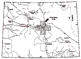
P.T. Bobrowsky, N.W.D. Massey and A. Matheson
Aggregate potential maps provide guidelines for testing, evaluating and managing aggregate resources within a defined area. The maps provide first approximation estimates of broad, regional aggregate distribution and are suitable for use by municipal and landuse planners as well as the aggregate industry.
A pilot study was undertaken in the Prince George area, covering five 1:50 000-scale map sheets (Red Rock 093G10, Isle Pierre 093G14, Prince George 093G15, Wansa Creek 093G16, Salmon River 093J02) forming a cross, centered on the city of Prince George and including the major transportation corridors in the area. The study area has a reasonable endowment of aggregates but suffers from problems in the management of the resource and conflicts with other land uses. Methodologies developed here should also be applicable elsewhere in British Columbia. The project had the support and cooperation of the Ministry of Transportation and Highways, the Ministry of Forests, the City of Prince George, the Regional District of Fraser - Fort George, and faculty members of the University of Northern British Columbia. These partners were invaluable sources of relevant technical data, and also provided input on the effectiveness of the presentation format of final products.
Within the Prince George area, 321 individual areas (polygons) have been identified as significant for hosting potential natural aggregate resources. The polygons are based on soil and landform units identified and delineated by Farstad (1976a,b,c,d,e) and Dawson (1989). The potential was assessed by compiling data pertaining to important geological factors for each of the original 1107 landform polygons within the study area. Parameters used were landform type, soil type, area of polygon, presence/absence of historical aggregate extraction, thickness of overburden, gravel thickness and volume.
Each factor was subdivided into several classes and ranked. The rankings were used to eliminate unfavourable polygons, and to subdivide the remainder into areas of primary, secondary or tertiary significance. For the project area, 61 polygons are of primary, 207 of secondary and 53 of tertiary potential. These comprise 11.8%, 9.2% and 6.0%, respectively, of the total map area. All other polygons are unclassified (class = U).
4: Paper 2002-01: Sunshine Coast Aggregate Potential Mapping Project
A.J. Bichler, E.D. Brooks, and P.T. Bobrowsky
This release consists of a file containing: 18 Maps (.pdf): 092F/8, 9, 10, 15, 16; 092G/5, 6, 11, 12, 13; 092J/4; 092K/1, 2, 3, 6, 7, 8, 9. It Includes: a project summary (ProjectSummary.pdf) and an Open File 2002-14 report (OF2002-14.pdf); a related Geological Fieldwork article; an Adobe Acrobat version of the map area results; an ArcView copy of the digital data; and a ReadMe.txt file with instructions.
View Open File 2002-14 (PDF, 2.42 MB)
Download Open File 2002-14 (ZIP, 128 MB)
Bichler, A.J., Brooks, E.D., Bobrowsky, P.T., 2002. Sunshine Coast Aggregate Potential Mapping Project. In: Geological Fieldwork 2001, British Columbia Ministry of Energy and Mines, British Columbia Geological Survey Paper 2002-01, 403-408.
5: Open File 2001-12: Sea to Sky Aggregate Potential Study
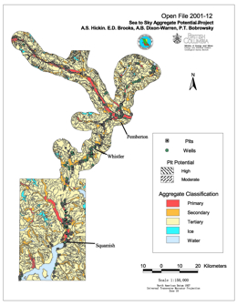
A.S. Hickin, E.D. Brooks, A.B. Dixon-Warren, P.T. Bobrowsky
The Sea-to-Sky region, north of Vancouver, British Columbia, is currently experiencing competing land use options which range from the development of scarce, but economically important aggregate resources to complete conservation and preservation of the natural resources. However, with the continued urban growth of communities such as the Villages of Whistler and Pemberton and the City of Squamish, coupled with a potentially successful bid for the 2010 Winter Olympics, pressure on the existing local aggregate reserves will eventually reach a critical stage. To address these concerns, the Ministry of Energy and Mines with funding assistance from the Corporate Resource Inventory Initiative (CRII), British Columbia Assets and Lands (BCAL), and Ministry of Transportation and Highways (MoTH), initiated a joint project to assess, at a reconnaissance level, the aggregate potential of the Sea-to-Sky corridor.
6: Open File 1998-12: Aggregate Potential Mapping - Nanaimo Study
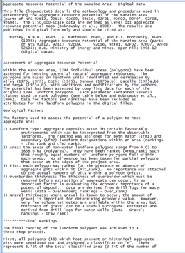
N.W.D. Massey, A. Matheson and P.T. Bobrowsky
In 1998, a survey was initiated in the Nanaimo area of southern Vancouver Island in response to local need for aggregate information to be used for municipal and regional planning. The study area comprises parts of nine 1:50 000-scale map sheets covering an area adjacent to the Straits of Georgia stretching from Parksville to Duncan, and west to Port Alberni.
Fieldwork during August, 1998, combined with air-photo interpretation, identified 101 existing pits in the study area. Each pit has been accurately located, using hand-held GPS or from published NTS maps, and its host landform type was determined in the field. Preliminary results suggest that fluvial and glaciofluvial deposits host 75% of the aggregate pits in the study area. Of these, outwash fans, terraces and kame terraces are the most important host landforms. A significant number of pits (15%) are hosted in marine or glacio-marine deposits.
Within the Nanaimo area, 1394 individual areas (polygons) have been assessed for their potential to host natural aggregate resources. The polygons are based on landform units identified and delineated by Alley (1975, 1977), Cotic (1975), Jungen (1975a,b), Lacelle (1975a,b) and Senyk (1975a,b), with additions and modifications by BC Geological Survey staff as part of this project. Landform data derived from these polygons have been combined with the pit inventory and water well records to produce the final aggregate resource potential maps.
All polygons (48) which host present or historical aggregate pits were assigned a classification "H". These represent 3.64% of the total area. In the rest of the project area, 75 polygons have been assessed as being of primary, 214 of secondary and 662 of tertiary potential. These comprise 5.38%, 15.35% and 47.49%, respectively, of the total map area. Remaining polygons (1085) are classified "U" (Unclassified) comprising 28.34% of the total area.
Massey, N.W.D., PGeo., A. Matheson, PGeo., and P.T. Bobrowsky, PGeo, (1998); Aggregate Resource Potential of the Nanaimo Area (parts of NTS 92B12, 92B13, 92C09, 92C16, 92F01, 92F02, 92F07, 92F08, 92G01); B.C. Ministry of Energy and Mines, Open File 1998-12.
7: Open File 1998-05: Aggregate Resource Potential of the Okanagan Area
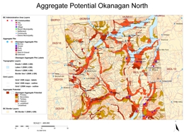
P.T. Bobrowsky, N.W.D. Massey, and A. Matheson
Aggregate potential maps provide guidelines for testing, evaluating and managing aggregate resources within a defined area. The maps provide first approximation estimates of broad, regional aggregate distribution and are suitable for use by municipal and land use planners as well as the aggregate industry.
In 1996, a survey was initiated in the Shushwap and Okanagan areas of southeastern British Columbia, where expansion of population has stressed existing aggregate resources. The study area comprises sixteen 1:50,000-scale map sheets covering the western halves of NTS sheets 82E and 82L. The area forms a corridor 80 km wide and 200 km long stretching from Shushwap Lake south to Osoyoos and the US border.
Fieldwork during 1996 and 1997, combined with air-photo interpretation, identified 308 pits in the study area. Each pit has been accurately located, by hand-held GPS or from published NTS maps, and its host landform type determined. Preliminary results suggest that glaciofluvial deposits, located mainly in and along the low-lying valleys, host 80% of the aggregate pits in the study area. Of these, glaciofluvial fans, terraces and kame terraces account for 75% of the pits. Fluvial sediments (e.g. fans and deltas) form only thin deposits of unconsolidated material and host less than 9% of the pits.
Within the Okanagan area, 3400 individual areas (polygons) have been assessed for hosting potential natural aggregate resources. The polygons are based on soil and landform units identified and delineated by Kowall (1986) and Wittneben (1989), with additions and modifications by the authors. Data derived from these polygons has been combined with the pit inventory, water well records and available geotechnical data to produce the final aggregate resource potential maps.
All polygons (220) which host present or historical aggregate pits were separated out and assigned a classification "H". These represent 9.95% of the total area. In the rest of the project area, 274 polygons have been assessed as being of primary, 552 of secondary and 1296 of tertiary potential. These comprise 5.58%, 16.54% and 34.16%, respectively, of the total map area. Remaining polygons (1085) are classified "U" (Unclassified) comprising 33.78% of the total area.
The resulting aggregate potential maps have been released, in digital format only, as:
P.T. Bobrowsky, PGeo, N.W.D. Massey, PGeo., and A. Matheson, PGeo. (1998); Aggregate Resource Potential of the Okanagan Area (NTS 82E(west) and 82L(west)), B.C. Ministry of Energy and Mines, Open File 1998-5.
8: Open File 1996-05: Aggregate Inventory of British Columbia Private Pits

Not shown on map
A. Matheson, N.W.D. Massey, P.T. Bobrowsky, C.E. Kilby and G. Manson
This database of private aggregate pits in British Columbia was compiled as part of the BC Geological Survey's Aggregate Inventory Project. In this compilation, private pits were considered to be only those natural aggregate occurrences for which an application by an operator for a Notice of Work had been received and subsequently issued by the Ministry of Energy, Mines and Petroleum Resources. All other pits, including public pits operated by the Ministry of Transportation and Highways, are not included.
Information about each pit in the database file includes its location (both latitude/longitude and UTM coordinates), NTS map sheet number, Notice of Work file number and status (active/inactive) and the type of landform hosting the pit.
For further information about aggregate, visit the following websites:
