GeoFiles
GeoFiles enable rapid release of extensive data tables from ongoing geochemical, geochronologic, and geophysical work. As such, they serve the same function as data repositories provided by many journals, providing immediate access to raw data from specific projects.
Jump to:
2025 | 2024 | 2023 | 2022 | 2021 | 2020 | 2019 | 2018 | 2017 | 2016 | 2015 | 2014 | 2013 | 2012 | 2011 | 2010 | 2009 | 2008 | 2007 | 2006 | 2005 | 2004 | 2003 | 2002 | 2001 | 2000 | 1999 | 1998 | 1997 | 1996
2025
Clarke, G., Northcote, B.K., Corcoran, N.L., Pothorin, C., Heidarian, H., and Hancock, K.
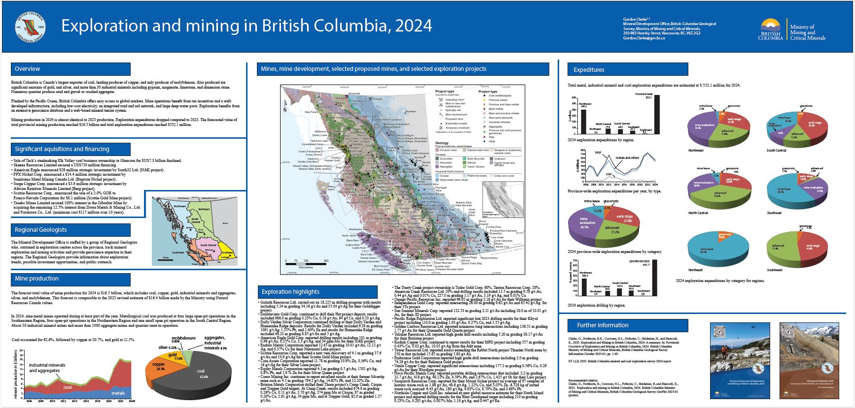
British Columbia is Canada’s largest exporter of coal, leading producer of copper, and only producer of molybdenum. Also produced are significant amounts of gold, and silver, and more than 30 industrial minerals including gypsum, magnesite, limestone, and dimension stone. Numerous quarries produce sand and gravel or crushed aggregate. Mining production in 2024 is almost identical to 2023 production. Exploration expenditures dropped compared to 2023. The forecasted value of total provincial mining production reached $16.5 billion and total exploration expenditures reached $552.1 million.
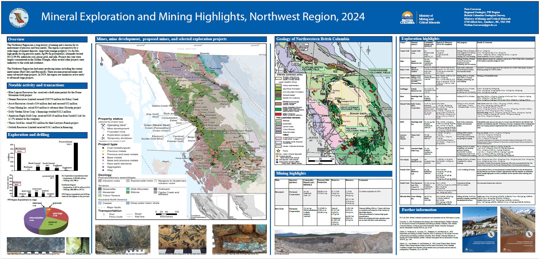
Corcoran, N.L.
The Northwest Region has had many producing mines including the current metal mines (Red Chris and Brucejack). There are nine proposed mines and many advanced-stage projects. In 2024, the region saw numerous active early- to advanced-stage projects.
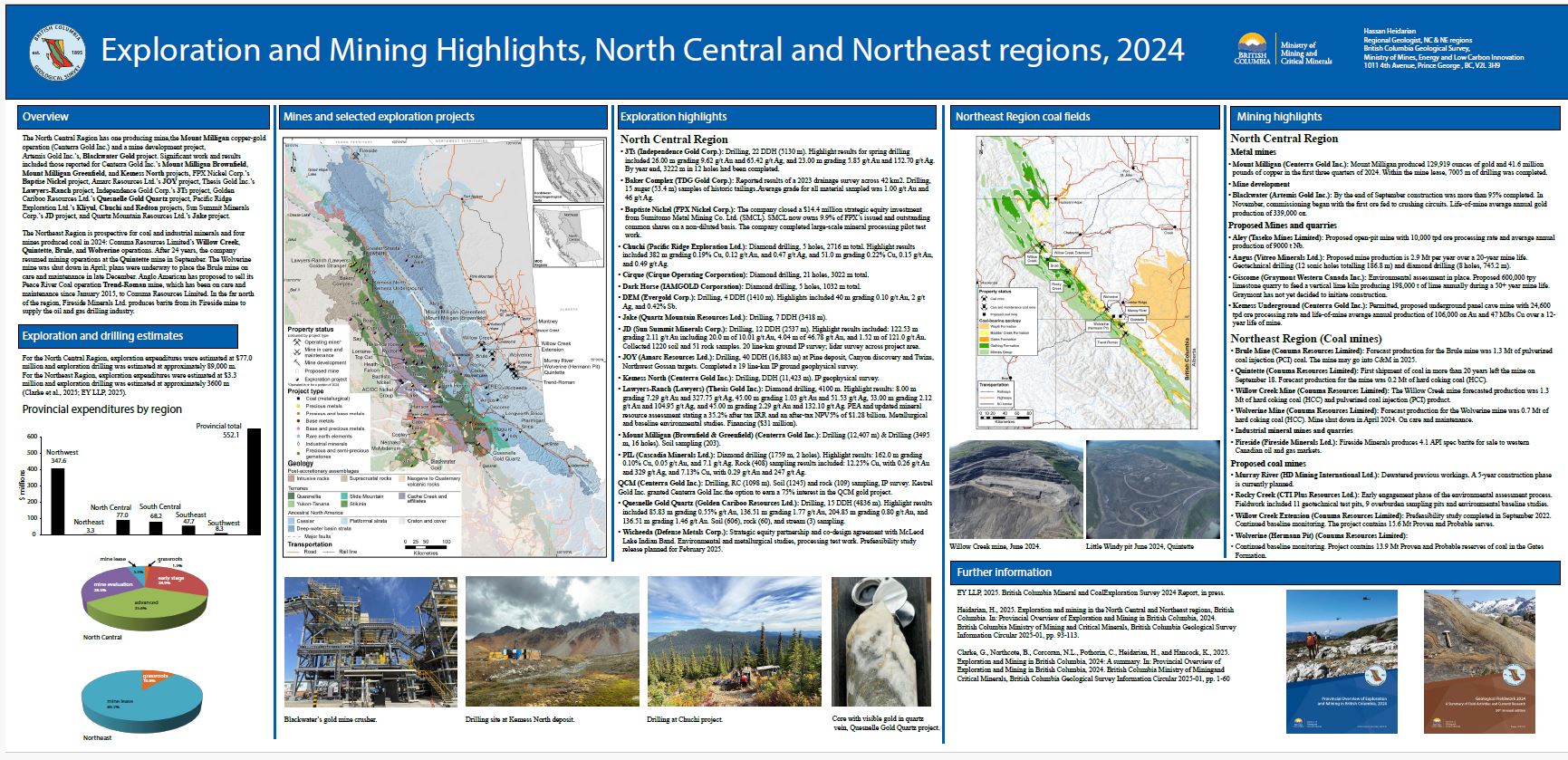
Heidarian, H.
The North Central Region has one producing mine, the Mount Milligan copper-gold operation (Centerra Gold Inc.) and a mine development project, Artemis Gold Inc.’s, Blackwater Gold project. The Northeast Region is prospective for coal and industrial minerals and four mines produced coal in 2024: Conuma Resources Limited’s Willow Creek, Quintette, Brule, and Wolverine operations.
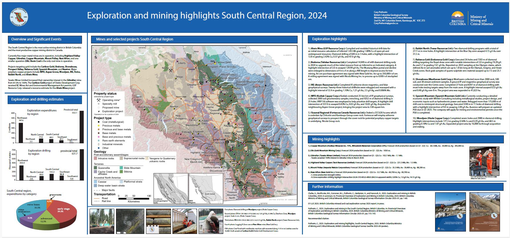
Pothorin, C.
The South Central Region is the most active mining district in British Columbia and the most productive copper mining district in Canada. Currently five major metal mines are in operation, including Highland Valley Copper, Gibraltar, Copper Mountain, Mount Polley, New Afton, and one smaller operation (Elk). Basin Coal is the only coal mine in operation.
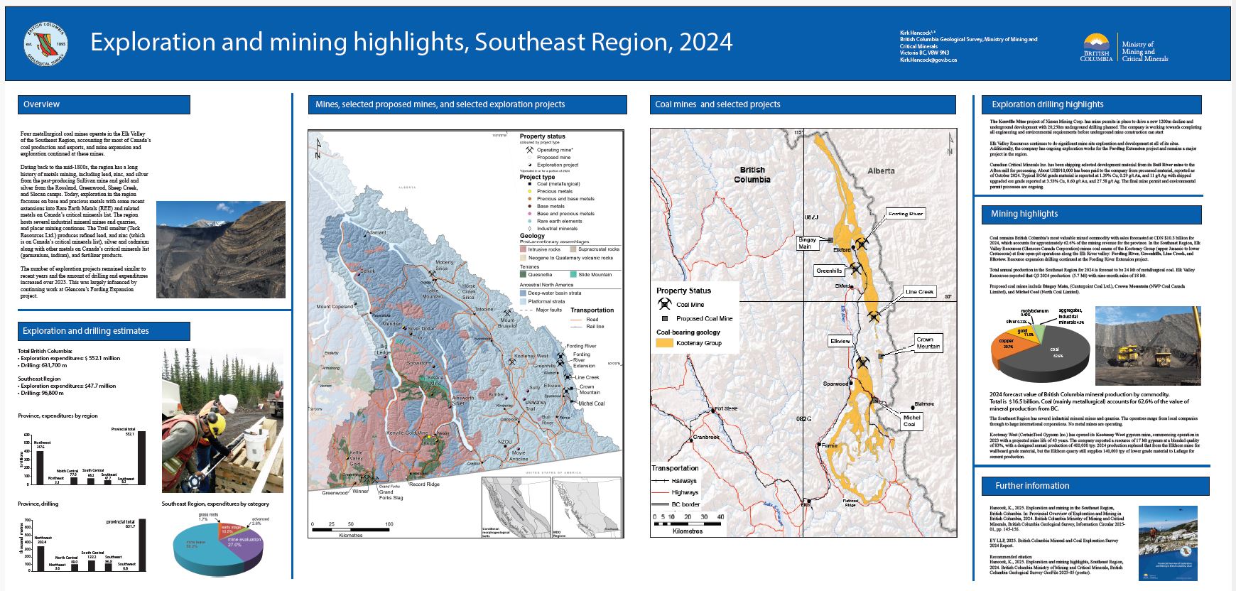
Hancock, K.
Four metallurgical coal mines operate in the Elk Valley of the Southeast Region, accounting for most of Canada’s coal production and exports, and mine expansion and exploration continued at these mines. The number of exploration projects remained similar to recent years and the amount of drilling and expenditures increased over 2023. This was largely infuenced by continuing work at Glencore’s Fording Expansion project.
Northcote, B.K.
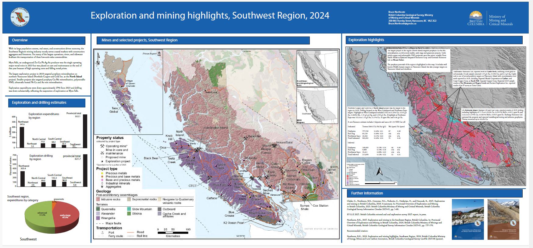
With its large population centres, real estate, and construction-driven economy, the Southwest Region’s mining industry mostly serves coastal markets with construction aggregates and limestone. For many of the largest operations, rivers, and tidewater facilitate the transportation of these low-unit-value commodities. Myra Falls, an underground Zn-Cu-Pb-Ag-Au producer was the single operating major metal mine in 2023 but was placed on care and maintenance at the end of that year because of high operating costs and falling metal prices. Exploration expenditures were down approximately 25% from 2023 and drilling was down substantially, reflecting the suspension of exploration at Myra Falls.
Wallace, B., Grundy, R., and Harrison, D.
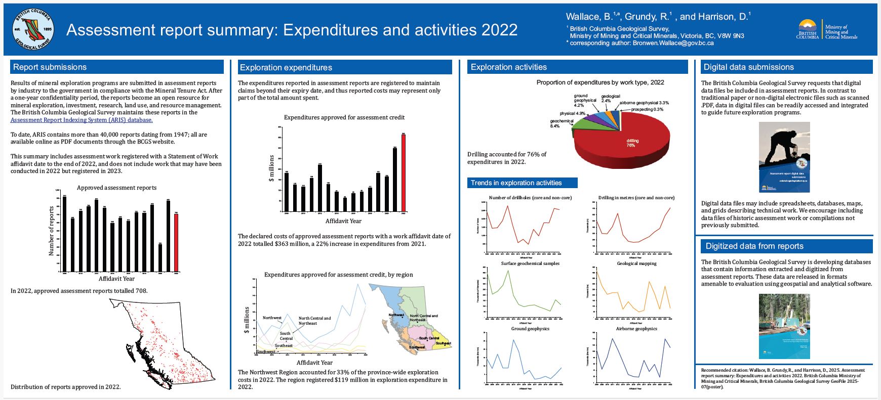
Results of mineral exploration programs are submitted in assessment reports by industry to the government in compliance with the Mineral Tenure Act. The British Columbia Geological Survey maintains these reports in the Assessment Report Indexing System (ARIS). This summary includes work registered with a Statement of Work affidavit date to the end of 2022. The expenditures reported in assessment reports are registered to maintain claims beyond their expiry date and thus reported costs represent only a portion of the total amount spent.
British Columbia Geological Survey
As part of province-wide geochemical re-analysis, the British Columbia Geological Survey is collecting hundreds of new whole rock radiogenic isotope and trace-element data. Here we contribute whole rock and mineral Sr-Nd-Hf-Pb and galena Pb isotopic data, compiled from 1439 samples.
Rukhlov, A.S., Ootes, L., Creaser, R.A., Cunningham, Q.F., de Waal, F.S., and Wenger, D.K.
This GeoFile serves as a data repository for Rukhlov et al. (2025b). It provides complete field and analytical data for whole-rock and stream-sediment samples downstream of known carbonatites and related alkaline rocks in southeastern British Columbia, including sample details; whole-rock lithochemistry and Sr-Pb-Nd isotopic data; a new Re-Os molybdenite date; stream-sediment lithochemistry; and a summary of analytical methods, quality control, and results.
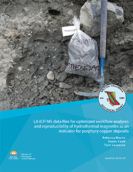
Morris, R., Canil, D., and Lacourse, T.
This release provides major and trace element chemistry data from magnetite analyses in bulk subglacial till samples collected near the Mount Polley porphyry copper deposit. These samples were re-analyzed by laser ablation inductively coupled mass spectrometry (LA-ICP-MS) using revised and optimized workflows described in Morris et al. (2025).
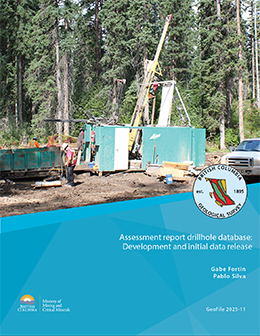
Fortin, G., and Silva, P.L.
ARIS (Assessment Report Index System) is a collection of more than 40,000 reports that detail results from mineral exploration and development programs. Submitted by the exploration and mining industry to comply with Mineral Tenure Act Regulations and maintain titles in good standing, the reports become an open resource after a one-year confidentiality period. Although containing a wealth of information, the assessment reports are typically submitted in a form (e.g., paper or PDF file) that makes working with the data cumbersome. To address this problem, we are developing databases that contain information extracted and digitized from assessment reports and releasing data in formats that are amenable to evaluation using geospatial and analytical software. This initial release of drillhole data from assessment reports includes collar information, lithological descriptions and assays from more than 400 reports.
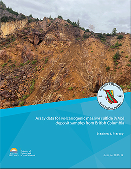
Piercey, S.J.
This release provides multi-element assay and quality control and quality assurance data to support the initial study of critical minerals in provincial volcanogenic massive sulphide deposits by Piercey et al. (2025).
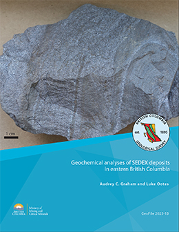
Graham, A.C., and Ootes, L.
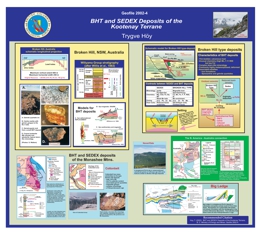
Sedimentary exhalative (SEDEX) deposits with primary commodities Pb, Zn, and Ag commonly contain recoverable concentrations of companion metals (e.g., Bi, Cd, Ga, Ge, In, Sb, Sn, Te). These companion metals, which could be recovered as by-products, are on the critical mineral lists of many political jurisdictions. Although SEDEX deposits near the western margin of Ancestral North America have long been recognized, the amount and distribution of companion metals in these deposits remains unclear. This contribution provides bulk-rock geochemical data for 40 mineralized samples retrieved from the British Columbia Geological Survey rock archive from SEDEX and related deposits and mineral occurrences in Belt-Purcell basin, south Kootenay arc, Monashee-Shuswap region, Germansen Landing area, and the Kechika trough. Samples from all regions are strongly enriched (>100x the average concentration of upper continental crust) in Cd, Sb, and Te. Massive sulphide samples from past-producing deposits in Belt-Purcell basin, including the Sullivan mine, are strongly enriched in In (up to 113 ppm) and moderately enriched (10-100x average upper continental crust) in Sn and Bi. Samples from the Cottonbelt occurrence in the Monashee-Shuswap region are weakly to moderately enriched in In (up to 6 ppm). Stratiform laminated sulphide-barite samples from the Cirque project in the Kechika trough are weakly (<10x average upper continental crust) to moderately enriched in Ge and sporadically moderately enriched in In (up to 3 ppm). Samples from the Reeves MacDonald deposit in south Kootenay arc and mineral occurrences in the Germansen Landing area are moderately enriched in Ge (up to 35 ppm).
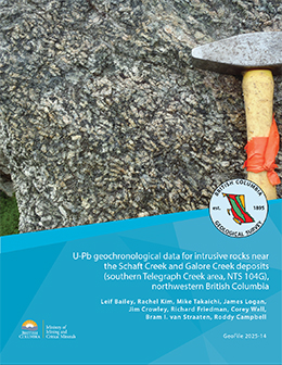
Bailey, L., Kim, R., Takaichi, M., Logan, J., Crowley, J., Friedman, R., Wall, C., van Straaten, B.I., and Campbell, R.
This release provides U-Pb geochronology data for 19 intrusive rock samples from northwestern British Columbia. Samples were collected between 2005-2023 by Teck Resources Limited, Galore Creek Mining Corporation, and the British Columbia Geological Survey from Late Triassic to Cretaceous intrusive rocks in Stikine terrane. The dataset can be used to better understand the magmatic evolution of Stikine terrane, particularly as it relates to the Schaft Creek and Galore Creek porphyry deposits.
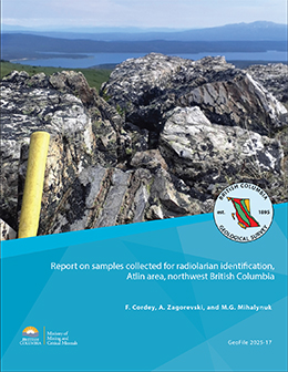
Cordey, F., Zagorevski, A., and Mihalynuk, M.G.
Geofile 2025-17 reports on 18 samples collected in 2024 as part of the joint Federal-Provincial GEM-GeoNorth project. This report builds on results presented previously from 35 samples that were collected during mapping of the Gladys Lake area in 2023 as part of an ongoing topical study in south-central Yukon. Standard radiolaria extraction and identification were performed at the Université Claude Bernard. Ages could be successfully determined from radiolaria extracted from seven of the 18 samples. Radiolaria identified from six of the samples are Permian, one is Pennsylvanian.
2024
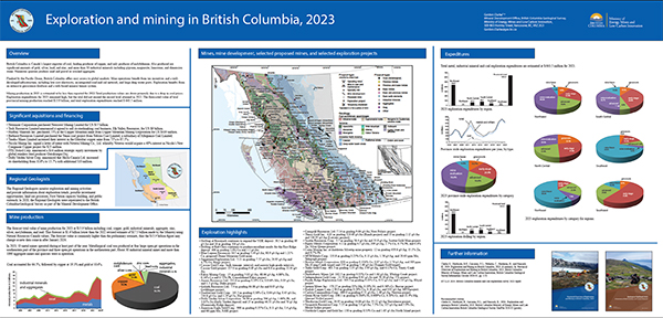
Clarke, G., Northcote, B.K., Corcoran, N.L., Pothorin, C., Heidarian, H., and Hancock, K.
British Columbia is Canada’s largest exporter of coal, leading producer of copper, and only producer of molybdenum. Also produced are significant amounts of gold, silver, lead, and zinc, and more than 30 industrial minerals including gypsum, magnesite, limestone, and dimension stone. Numerous quarries produce sand and gravel or crushed aggregate. Flanked by the Pacific Ocean, British Columbia offers easy access to global markets. Mine operations benefit from tax incentives and a well-developed infrastructure, including low-cost electricity, an integrated road and rail network, and large deep-water ports. Exploration benefits from an extensive geoscience database and a web-based mineral tenure system. Exploration expenditures for 2023 remained high, but the total did not exceed the record level attained in 2022. The forecasted value of total provincial mining production reached $15.9 billion, and total exploration expenditures reached $ 643.5 million.
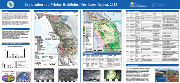
Corcoran, N.L.
The Northwest Region of BC has a long history of mining and is known for its endowment of precious and base metals. The region is prospective for a wide range of mineral deposits: large bulk-tonnage porphyry Cu-Au-Mo; high-grade Au-Ag precious metal; Ag-Pb-Zn polymetallic; ultramafic-hosted Ni-Co-Pt-Pd; anthracite coal; placer gold; and jade. Projects this year were largely concentrated in the Golden Triangle, while several other projects were underway to the southeast. The Red Chris (Cu-Au) and Brucejack (Au-Ag) mines currently operate in the Northwest Region. There are seven proposed mines and many advanced-stage projects. In 2023, the region saw numerous early- to advanced-stage projects that focussed mainly on precious, base metal, and porphyry deposits. Exploration expenditures are estimated at $444.1 million. The estimate for exploration drilling is 439,610 m.
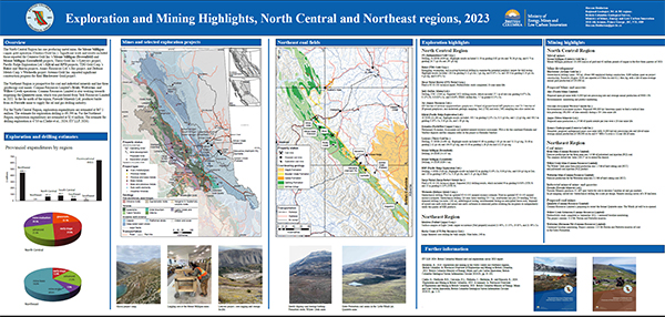
Heidarian, H.
The North Central Region has one producing metal mine, the Mount Milligan copper gold operation (Centerra Gold Inc.). The Northeast Region is prospective for coal and industrial minerals and has three producing coal mines: Conuma Resources Limited’s Brule, Wolverine, and Willow Creek operations. In the far north of the region, Fireside Minerals Ltd. produces barite from its Fireside mine. For the North Central Region, exploration expenditures are estimated at $67.1 million. The estimate for exploration drilling is 69,590 m. For the Northeast Region, exploration expenditures are estimated at $2.6 million. The estimate for drilling exploration is 4710 m (Clarke et al., 2024; EY LLP, 2024).
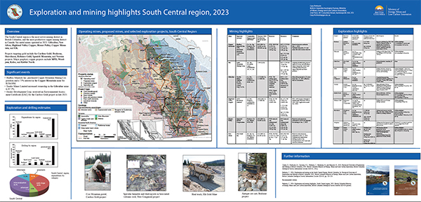
Pothorin, C.
The South Central region is the most active mining district in British Columbia, and the most productive copper mining district in Canada. Six metal mines operated in 2023: Gibraltar, New Afton, Highland Valley Copper, Mount Polley, Copper Mountain, and Elk. Projects targeting gold include the Cariboo Gold, Bralorne, Shovelnose, Reliance Gold, Spanish Mountain, and Newton projects. Major porphyry copper projects include MPD, Woodjam, Kolos, and Rabbit North. Exploration expenditures are estimated at $83.7 million. The estimate for exploration drilling is 110,710 m.
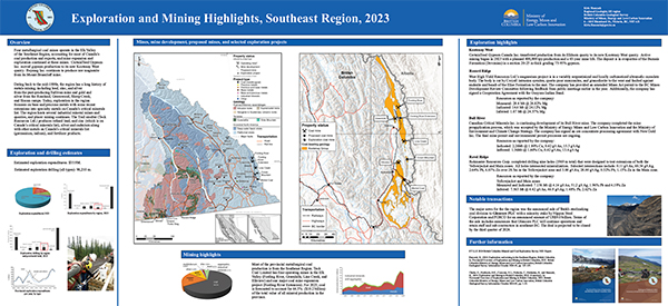
Hancock, K.
Four metallurgical coal mines operate in the Elk Valley of the Southeast Region, accounting for most of Canada’s coal production and exports, and mine expansion and exploration continued at these mines. The region hosts several industrial mineral mines and quarries, and placer mining continues. Exploration in the region focusses on base and precious metals with some recent extensions into rare Earth metals (REE) and related metals on Canada’s critical minerals list. The Trail smelter (Teck Resources Ltd.) produces refined lead, and zinc (which is on Canada’s critical minerals list), silver and cadmium along with other metals on Canada’s critical minerals list (germanium, indium), and fertilizer products. Exploration expenditures for 2023 are estimated at $35.9 million and exploration drilling is estimated at 98,200 m.
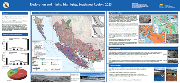
Northcote, B.K.
With its large population centres, real estate, and construction-driven economy, the Southwest Region’s mining industry mostly serves coastal markets with construction aggregates and limestone. For many of the largest operations, rivers, and tidewater facilitate the transportation of these low-unit-value commodities. Myra Falls, an underground Zn-Cu-Pb-Ag-Au producer was the single operating major metal mine in 2023 but was placed on care and maintenance in December. For 2023,exploration expenditures are estimated at $10.1 million. The estimate for exploration drilling is 24,700 m.
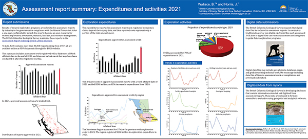
Wallace, B. and Norris, J.
Results of mineral exploration programs are submitted in assessment reports by industry to the government in compliance with the Mineral Tenure Act. The British Columbia Geological Survey maintains these reports in the Assessment Report Indexing System (ARIS). This summary includes work registered with a Statement of Work affidavit date to the end of 2021. The expenditures reported in assessment reports are registered to maintain claims beyond their expiry date and thus reported costs represent only a portion of the total amount spent.
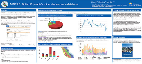
Shaw, K., Norris, J. and Cui, Y.
MINFILE is a searchable database documenting over 16,000 metallic, industrial mineral, and coal occurrences throughout British Columbia. An occurrence is defined as in-situ bedrock or placer mineralization, on surface, in drill holes, or in underground workings; generally, it does not include float, geochemical or geophysical anomalies. The data can be queried in many ways, including by: location, production (commodities by year or tonnes mined), inventory (resource/reserve or assay data), minerals, commodities, deposit type or characteristics, host rock, geological setting, and age.
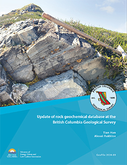
Han, T. and Rukhlov, A.S.
Rock geochemical data are an integral part of provincial lithogeochemical data, which also include data from till, drainage sediments such as alluvium (including heavy mineral concentrates), moss-mat sediment, and lacustrine deposits. These lithogeochemical data characterize primary dispersion of elements in bedrock and secondary dispersion in weathered rocks, soil, and other surficial sediments, including mechanical dispersion by streams, gravity flows, and glaciers. The development and operation of the British Columbia Geological Survey rock geochemical database allows long-lasting storage and consistent update of rock geochemical data collected from across the province. For the current update, new rock geochemical data were compiled, format standardized, metadata validated, quality checked, and populated into the database, where they were integrated with existing data for permanent storage.
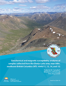
Campbell, R, W., Mihalynuk, M, G., and Zagorevski, A
Geofile 2024-10 contains magnetic susceptibility data and the results, methods, and quality control data from geochemical analyses of samples collected during fieldwork conducted in the Atlin area near the British Columbia-Yukon border.
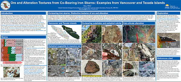
Bain, W.B.
Iron skarns commonly contain Co and other critical minerals that can be extracted as byproducts of base- and precious-metal refining. They are, therefore, an increasingly important target for mineral development required for the transition to a low-carbon economy. Vancouver and Texada islands contain numerous iron skarn deposits that form a broadly NS-trending metallogenic belt that covers much of the southern portion of the Wrangel terrane. Field relationships, and mineralogical and textural features of mineralization and alteration in these deposits are characteristic of the iron skarn class of deposits but are distinct from other base- and precious-metal skarn varieties. Key distinctions include 1) the occurrence of massive magnetite and sulphide orebodies that are enveloped by course-grained (5->10cm), euhedral calcite; 2) carbonate and calc-silicate alteration that are restricted primarily to the igneous host rocks; 3) the absence of hydrothermal quartz and other features indicative of silica addition during deposit formation; and 4) the occurrence of magnetite-calcite ores with pegmatite-like textures. Formation of these mineralogical and textural features is likely related to the processes that generated critical mineral enrichment in these deposits. Accordingly, ongoing research is focussed on characterizing these processes using mineralogical, textural, and geochemical data, and identifying how, if at all, these deposits may be related to other critical mineral deposits in British Columbia (e.g., porphyry and magmatic sulphide deposits).
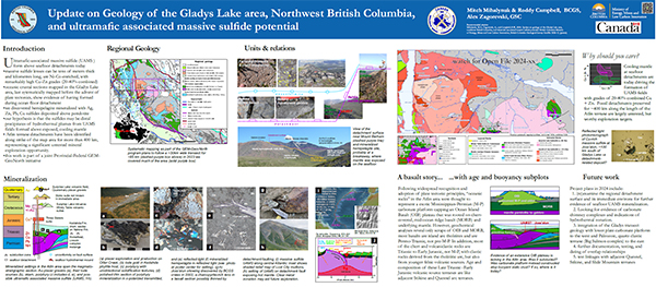
Mihalynuk, M, G., Zagorevski, A., and Campbell, R, W.
Mapping immediately south of the Yukon border in the Gladys Lake area updates work that predates concepts derived from plate tectonics. Much of the area is underlain by deformed chert, primitive arc basalt, and slivers of mantle peridotite. Atlin terrane oceanic crustal sections record evidence of having formed during ocean floor detachment. Mineralized hemipelagic strata deposited atop mantle peridotite exposed by seafloor detachment contain Ag, Zn, Pb, and Cu sulphides. These strata may be distal precipitates of hydrothermal plumes from ultramafic-associated seabed massive sulphide fields formed atop exposed, cooling mantle. Atlin terrane detachments have been identified along strike of the map area for more than 400 km, representing a significant untested mineral exploration opportunity.
Cordey, F., Zagorevski, A., Mihalynuk, M, G., and Campbell, R, W.
This release presents radiolaria data from 35 samples collected during mapping of the Gladys Lake area in 2023. Radiolaria extracted from 21 of these samples successfully yielded ages; all are identified as Triassic or Early Jurassic.
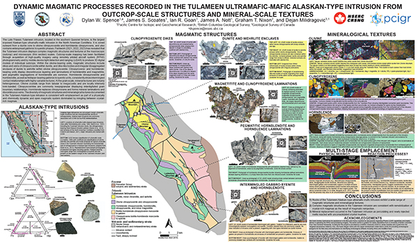
Spence, D.W., Scoates, J.S., Goan, I.R., Nott, J.A., Nixon, G.T., and Milidragovic, D.
The Tulameen intrusion (Late Triassic) in southern Quesnel terrane is the largest exposed Alaskan-type ultramafic-mafic intrusion in the North American Cordillera. It is zoned outward from a dunite core to olivine clinopyroxenite and hornblende clinopyroxene and contains widespread gabbroic to syenitic phases. Outcrop-scale mapping has been facilitated through acquisition of high-quality imagery using remotely piloted aircraft system (RPAS) photogrammetry and by mobile-device light detection and ranging (lidar) to produce 3D digital models of individual outcrops. Within the olivine-bearing units, magmatic structures include dikes and veins of clinopyroxenite within dunite, and dike-like bodies and irregular disaggregated enclaves of dunite to wehrlite within olivine clinopyroxenite. Clinopyroxene- and hornblende-bearing units display discontinuous layering and laminations of hornblendite and magnetitite, and pegmatitic segregations of hornblendite are common. Hornblende clinopyroxenite and hornblendite, as well as feldspar-bearing gabbroic to syenitic units, consistently show intermingled contact relationships. At the grain scale, olivine crystals range from tabular to megacrystic and are locally intensely kink banded. Clinopyroxenites are commonly inequigranular displaying interdigitated grain boundary relationships. Hornblende replaces clinopyroxene and forms mineral laminations and discontinuous veins. The diversity of magmatic structures and mineralogical textures in the Tulameen intrusion is consistent with emplacement as part of a physically and chemically dynamic and open magmatic system with mingling between crystal-rich magmas.
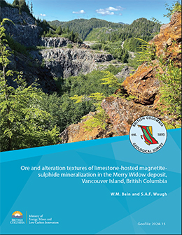
Bain, W.M., and Waugh, S.A.F.
Iron skarns are a distinct subtype in the skarn class of deposits characterized by massive magnetite orebodies with variable Co-bearing sulphide mineralization. The Wrangel terrane of western British Columbia has several Co-bearing iron skarns, including the Merry Widow deposit on northern Vancouver Island. The Merry Widow deposit contains several large sulphide-bearing, magnetite-calcite orebodies and numerous other minor massive sulphide occurrences. Both host minor Co mineralization in the form of sulphide and arsenide minerals. This deposit also has several distinctive textural and mineralogic features, including: 1) banded and tabular magnetite-calcite ores; 2) zones of massive, euhedral calcite that are always associated with sulphide mineralization; 3) tabular sulphide masses adjacent to mafic dikes; and 4) calc-silicate and carbonate-bearing sodic alteration that occurs predominantly in intrusive and volcanic rocks.
2023
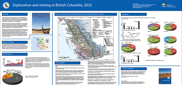
Clarke, G., Northcote, B., Corcoran, N.L., Heidarian, H., and Hancock, K.
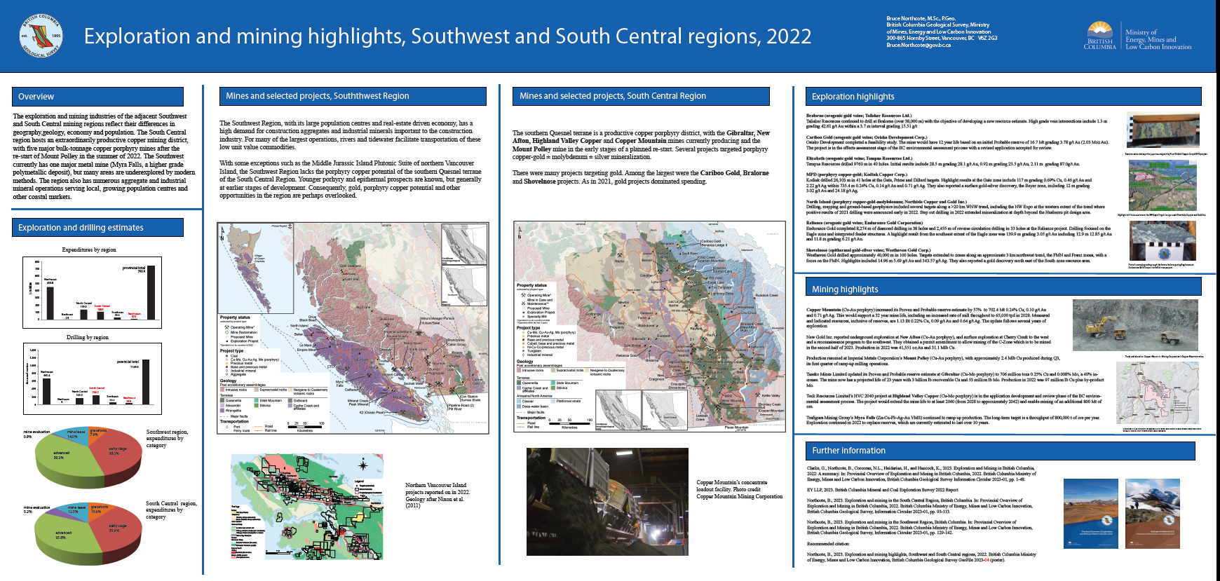
British Columbia is Canada’s largest exporter of coal, leading producer of copper, and only producer of molybdenum. Also produced are significant amounts of gold, silver, lead, and zinc, and more than 30 industrial minerals including gypsum, magnesite, limestone, and dimension stone. Numerous quarries produce sand and gravel or crushed aggregate. Flanked by the Pacific Ocean, British Columbia offers easy access to global markets. Mine operations benefit from tax incentives and a well-developed infrastructure, including low-cost electricity, an integrated road and rail network, and large deep-water ports. Exploration benefits from an extensive geoscience database and a web-based mineral tenure system. Although Covid continued to cause minor interruptions, 2022 did not have the significant forest fire and flooding disruptions of 2021. Provincial mining production reached a new high due to continued high coal prices. The year started with significant exploration financing in place and exploration expenditures improved for the third year in a row, reaching a new record level. The forecasted value of total provincial mining production reached an all-time high of $18.2 billion, and total exploration expenditures reached a record of $740.4 million.
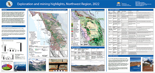
Corcoran, N.
The Northwest Region has a long history of mining and is prospective for a wide range of commodities including precious metals, base metals, and coal. Exploration in the region is concentrated in a loosely defined area in the northern part of the region popularly known as the ‘Golden Triangle’; several other projects were underway to the southeast. Increased financing of manyprojects due to high metal prices in 2021 helped finance 2022 exploration.The Northwest Region contains two operating metal mines (Brucejack and Red Chris). The region also contains five proposed metal mines (Dome Mountain, Galore Creek, KSM, Kutcho, and Red Mountain), and one proposed coal mine (Tenas). There is one mine development project (Premier Gold). In 2021, the region saw numerous active early- to advanced-stage projects that focussed mainly on precious, base metal, and porphyry deposits. At $450.8 million, forecast exploration expenditures in the region are the highest ever recorded.
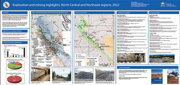
Heidarian, H.
The Northeast Region is prospective for coal and industrial minerals and has three producing coal mines: Conuma Resources Limited’s Brule, Wolverine, and Willow Creek operations. The North Central Region has one producing mine, the Mount Milligan copper-gold operation (Centerra Gold Inc.).For the North Central mining region, 2022 exploration expenditures were estimated at $139.0 million and exploration drilling was estimated at 163,200 m. For the Northeast region exploration expenditures were estimated at $ 2.0 million and no exploration drilling was reported.
Northcote, B.
The South Central region hosts an extraordinarily productive copper mining district, with five major bulk-tonnage copper porphyry mines after the re-start of Mount Polley in the summer of 2022. The Southwest currently has one major metal mine (Myra Falls, a higher grade polymetallic deposit), but many areas are underexplored by modern methods. The region also has numerous aggregate and industrial mineral operations serving local, growing population centres and other coastal markets. For British Columbia's Southwest mining region, 2022 exploration expenditures were estimated at $10.8 million and exploration drilling was estimated at approximately 28,600 m. For the South Central region, exploration expenditures were estimated at $ 108.5 million and exploration drilling was estimated at approximately 243,200 m.
Hancock, K.
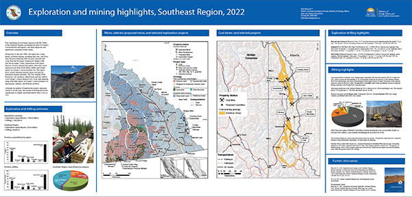
Four metallurgical coal mines operate in the Elk Valley of the Southeast Region, accounting for most of Canada’s coal production and exports, and mine expansion and exploration continued at these mines. The region hosts several industrial mineral mines and quarries, and placer mining continues. Exploration in the region focusses on base and precious metals with some recent extensions into rare Earth metals (REE) and related metals on Canada’s critical minerals list. The Trail smelter (Teck Resources Ltd.) produces refined lead, and zinc (which is on Canada’s critical minerals list), silver and cadmium along with other metals on Canada’s critical minerals list (germanium, indium), and fertilizer products. Exploration expenditures for 2022 are forecast at $29.4 million and exploration drilling is estimated at 28,600 m.
Mihalynuk, M. G., Ootes, L., Drobe, J. R., Wall, C., and Friedman, R., M.
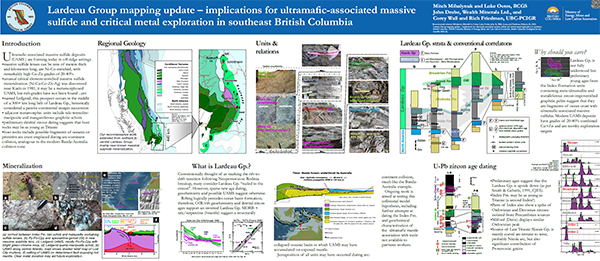
Ultramafic-associated massive sulfide deposits (UAMS ) are forming today on mantle exposed by ocean floor detachment faults in off-ridge settings. These massive sulfide lenses can be tens of meters thick and kilometres long, are Ni-Co-enriched, and display remarkably high Cu-Zn grades of 20-40%. Unusual critical element-enriched massive sulfide mineralization (Ni-Cu-Co-Zn-Ag-Au) was discovered near Kaslo in 1981. Known as the Ledgend, this prospect may be a metamorphosed UAMS, but rich grades have yet to be found. Adjacent metamorphic units include talc-tremolite-mariposite and manganiferous graphitic schists. It occurs in the middle of a 300+ km long belt of Lardeau Group, historically considered a passive continental margin succession. Preliminary detrital zircon dating suggests that host rocks may be as young as Triassic, and include possible fragments of oceanic or primitive arc crust emplaced during arc-continent collision, analogous to the modern Banda-Australia collision zone.This poster presents observations made during our geological mapping campaigns in the Lardeau Group, and follow-up geochemical and geochronological findings that bear on long-standing questions about unit correlation and age of the Lardeau in southeast BC.
E.A. Elia, T. Ferbey, B.C. Ward, R.B.K. Shives, M. Best, and N. Martin-Burtart
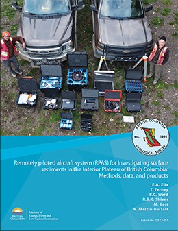
Recent advancements in remotely piloted aircraft systems (RPAS) and the miniaturization of external sensors have made collecting geomatics, geological, and geophysical data more accessible. These data can be affordably acquired at spatial resolutions similar to traditional fixed-wing and helicopter-mounted surveys, in some instances at higher resolutions, and can be visualized and used in near-real time. In the 2021 and 2022 field seasons, we used RPAS aircraft to collect gamma-ray spectrometer, magnetometer, and lidar data and aerial photographs for photogrammetric processing at 13 sites centred on alkalic and calc-alkaline porphyry systems in the Mount Polley mine, Woodjam prospect, and Guichon Creek batholith areas of the Interior Plateau. Because glacial deposits cover bedrock in large parts of the Interior Plateau, the surveys were designed to assess the application of RPAS-borne instruments for mapping surficial geology and to test their use for drift prospecting of subglacial tills in areas and of known mineralization. Magnetic and radiometric data were collected over areas of 10000 m2 at a 5-10 m line spacing and a 5-10 m instrument height that was maintained using an RPAS-mounted altimeter and active terrain-following software. Data processing techniques, developed for use in the field with a laptop, produced images of gridded magnetic total field, magnetic first vertical derivative, radioelement concentrations (K, eU, eTh), and radioelement ratios (eTh/K, eU/eTh, and eU/K), with a cell size resolution of 1.67 to 3.33 m. Lidar data were collected at 80-100 m above take-off elevation at a 90-110 m line spacing to produce bare-Earth digital elevation models (DEM) with a cell size resolution of 0.5-0.25 m. Aerial photographic surveys used an RPAS-fixed RGB camera flying 80 to 100 m above take-off location with data being processed in the field using the structure from motion technique, to obtain cm-scale resolution DEMs and orthomosaic images. In this report, we summarize the RPAS platforms and sensors we used in 53 individual surveys, describe the methods for acquiring and processing survey data and, in an accompanying supplementary file, release raw and processed magnetic and gamma-ray spectrometry radiometric data and lidar and air photo products.
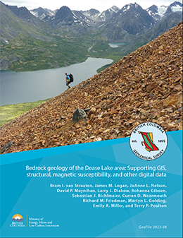
van Straaten, B.I., Logan, J.M., Nelson, J.L., Moynihan, D.P., Diakow, L.J., Gibson, R., Bichlmaier, S.J., Wearmouth, C.D., Friedman, R.M., Golding, M.L., Miller, E.A. and Poulton, T.P.
This release provides Geographical Information System (GIS) files, structural measurements, magnetic susceptibility measurements, and other digital data from the Dease Lake area of northwestern British Columbia to support the bedrock geology map by van Straaten et al. (2022, BCGS Geoscience Map 2022-01).
2022
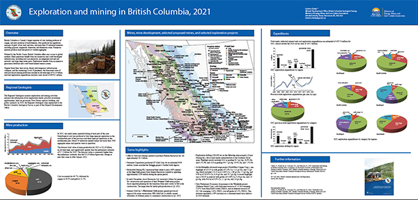
Clarke, G., Northcote, B., Corcoran, N.L., and Hancock, K.
British Columbia is Canada’s largest exporter of coal, leading producer of copper, and only producer of molybdenum. Also produced are significant amounts of gold, silver, lead, and zinc, and more than 30 industrial minerals including gypsum, magnesite, limestone, and dimension stone. Numerous quarries produce sand and gravel or crushed aggregate. Flanked by the Pacific Ocean, British Columbia offers easy access to global markets. Mine operations benefit from tax incentives and a well-developed infrastructure, including low-cost electricity, an integrated road and rail network, and large deep-water ports. Exploration benefits from an extensive geoscience database and a web-based mineral tenure system. Despite forest fires, heat waves, floods (and temporary infrastructure collapse), and the continuing Covid 19 pandemic, the forecasted value of total provincial mining production reached an all-time high of $12.6 billion, and total exploration expenditures reached a near record of $659.8 million.
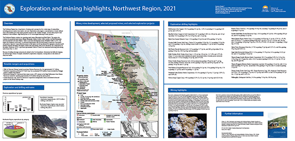
Clarke, G.
The Northwest Region has a long history of mining and is prospective for a wide range of commodities including precious metals, base metals, and coal. Exploration in the region is concentrated in a loosely defined area in the northern part of the region popularly known as the ‘Golden Triangle’; several other projects were underway to the southeast. High metal prices in 2021 encouraged financing of many projects.
The Northwest Region contains two operating metal mines (Brucejack and Red Chris). The region also contains five proposed metal mines (Dome Mountain, Galore Creek, KSM, Kutcho, and Red Mountain), and one proposed coal mine (Tenas). There is one mine development project (Premier Gold). In 2021, the region saw numerous active early- to advanced-stage projects that focussed mainly on precious, base metal, and porphyry deposits. Large industrial projects in the region are driving demand for aggregate, and placer gold mining continues throughout the region. At $365.9 million, forecast exploration expenditures in the region are the highest ever recorded.
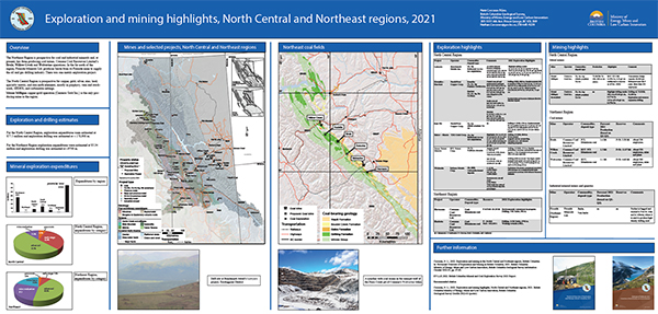
Corcoran, N.L.
For British Columbia's North Central mining region, 2021 exploration expenditures were estimated at $77.5 million and exploration drilling was estimated at approximately 170,000 m. For the Northeast region exploration expenditures were estimated at $ 5.3 million and exploration drilling was estimated at approximately 9700 m.
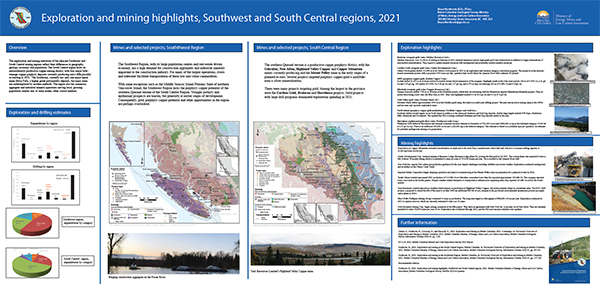
Northcote, B.
For British Columbia's Southwest mining region, 2021 exploration expenditures were estimated at $8.0 million and exploration drilling was estimated at approximately 40,400 m.
For the South Central region, exploration expenditures were estimated at $147.6 million and exploration drilling was estimated at approximately 462,500 m.
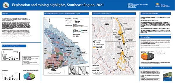
Hancock, K.
Four metallurgical coal mines operate in the Elk Valley of the Southeast Region, accounting for most of Canada’s coal production and exports, and mine expansion and exploration continued at these mines. The region hosts several industrial mineral mines and quarries, and placer mining continues. The Trail smelter produces refined zinc and lead, silver, critical metals (including germanium, indium, and cadmium), and fertilizer products. Exploration expenditures for 2021 forecast at $55.4 million and exploration drilling is estimated at 96,700 m.
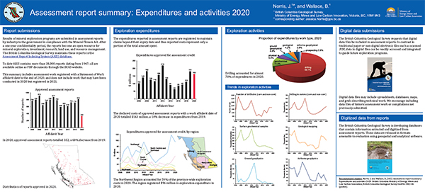
Norris, J. and Wallace, B.
Results of mineral exploration programs are submitted in assessment reports by industry to the government in compliance with the Mineral Tenure Act. The British Columbia Geological Survey maintains these reports in the Assessment Report Indexing System (ARIS). This summary includes work registered with a Statement of Work affidavit date to the end of 2020. The expenditures reported in assessment reports are registered to maintain claims beyond their expiry date and thus reported costs represent only a portion of the total amount spent.
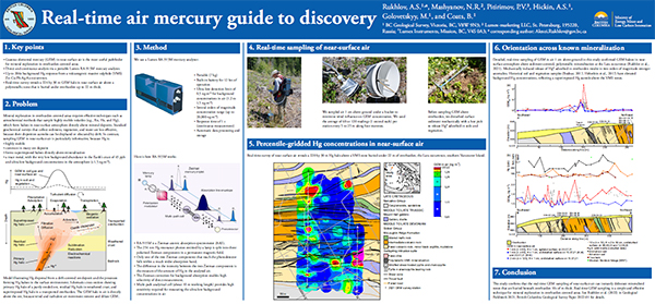
Rukhlov, A.S., Mashyanov, N.R., Pitirimov, P.V., Hickin, A.S., Golovetskyy, M., and Coats, B.
This poster summarizes Rukhlov et al.'s (2022) study of gaseous elemental mercury (GEM) haloes in near-surface atmosphere above sediment-covered, polymetallic mineralization at the Lara-Coronation occurrence, southern Vancouver Island (MINFILE 092B 129). Real-time grid sampling of air 1 cm above ground across steeply dipping, massive sulphide zones in volcanic rocks of the McLaughlin Ridge Formation (Sicker Group; Middle to Late Devonian) reveals a pattern of northwest-trending GEM haloes that reflect bedrock structure, including a 224 by 30 m halo above the polymetallic Coronation zone, covered by up to 22 m of overburden. This study confirms that the real-time GEM sampling of near-surface air can instantly delineate mineralized zones that are buried beneath overburden 10s of m thick. Real-time GEM sampling is a simple and effective technique for mineral exploration in overburden-covered areas.
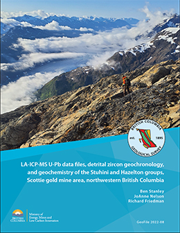
Stanley, B., Nelson, J.L. and Friedman, R.
This release provides whole rock geochemical and LA-ICP-MS zircon geochronologic data from Stuhini Group and Hazelton Group rocks in the Scottie gold mine area of northwestern British Columbia to support conclusions presented in Stanley and Nelson (2022).
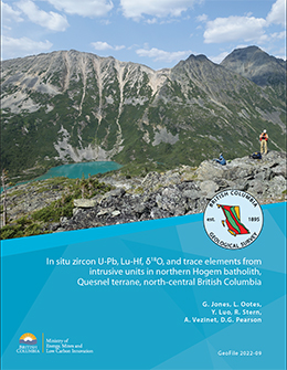
Jones, G., Ootes, L., Luo, Y., Stern, R., Vezinet, A., and Pearson, D.G
New and refined geochronology and geochemistry results complement bedrock mapping in northern Hogem batholith, Quesnel terrane. Data and interpretations presented here include 13 new and refined U-Pb zircon crystallization ages and five new U-Pb titanite crystallization ages, determined by LA-ICP-MS. These are supported by zircon oxygen-isotope data, determined by SIMS, and zircon Lu-Hf and trace elements. and titanite and apatite Sm-Nd results, determined by LA-ICP-MS.
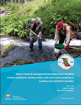
Lett, R.E., Friske, P.W.B., and McClenaghan, M.B.
Preliminary results from a detailed geochemical survey carried out in 2004, which included analysis of sediments from 34 streams in northwestern British Columbia, revealed geochemically anomalous Ag, Au, Bi, Cd, Cu, Hg, Mo, Pb, Sb, Se, Tl, and Zn in sediment from streams draining the area near the Eskay Creek gold mine. In the present contribution, we release all of the geochemical and mineralogical analysis of the heavy mineral concentrates, stream sediment, and water samples.
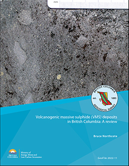
Northcote, B.
Volcanogenic massive sulphides (VMS) are syngenetic metal sulphide deposits precipitated near submarine hydrothermal vents discharging waters heated by volcanism. Approximately 600 mineral occurrences in British Columbia have characteristics of VMS deposits. These deposits formed in relatively narrow stratigraphic intervals during spans of intense volcanic activity, producing clusters in time and space. Although globally, VMS deposits started forming in the Archean and continue forming today, the British Columbia deposits range from Cambrian to Cretaceous. Paleozoic deposits are the most numerous, but the two largest known deposits (Britannia and Windy Craggy) are Mesozoic, and Mesozoic rocks host the most ore delineated to date and include ore of the highest value. Using the most recent British Columbia Geological Survey mineral deposit profile scheme for base and precious metals-bearing marine volcanic associated deposits (Besshi, G04; Cyprus, G05; Kuroko, G06; hybrid G07; and Noranda, G08), Kuroko deposits are by far the most common. Notable examples are in Wrangell terrane (Sicker Group), Stikine terrane (Kutcho assemblage, Eagle Bay assemblage, Stikine assemblage and Hazelton Group) and in post-accretionary overlap assemblage rocks (Gambier Group). Parts of these terranes and the Yukon-Tanana terrane are prospective but underexplored. Hybrid precious metals enriched deposits are well documented in upper Hazelton Group rocks, but probably also occur in the Eagle Bay assemblage, where several deposits are also highly enriched in precious metals, particularly silver. Besshi deposits are represented in the Lardeau Group of Ancestral North America, the Stuhini Group of Stikine terrane, and the Tats Group of Alexander terrane. Less well-recognized are those of the southern Quesnel and southern Alexander terranes. Cyprus deposits are relatively uncommon, but examples occur in Slide Mountain, Cache Creek and Bridge River terranes. Deposits of the Anyox camp at the southern end of the Eskay Rift are in a pendant of Hazelton Group basalts and interpreted as Cyprus type. VMS deposits may be of interest not only for base metals, but for precious metals and other metals on Canada’s critical minerals list. Although favourable lithological associations are commonly recognized in the province, the relatively restricted geometry of VMS deposits pose exploration challenges. Consequently, some areas have seen relatively little recent exploration and may represent overlooked opportunities.

Bram I. van Straaten, James M. Logan, Rebecca C. Hunter, JoAnne L. Nelson, Emily A. Miller
This release provides whole-rock lithogeochemical data for 555 Devonian to Quaternary rock samples from northwestern British Columbia. Samples were collected between 2003 and 2021 for petrogenetic studies, and are predominantly from Triassic to Jurassic igneous rocks within the Stikine terrane. The extensive dataset can be used to better understand the magmatic and geochemical evolution of the Stikine terrane, particularly as it relates to its large mineral endowment. We developed a new geoscientific metadata structure that allows for full capture and querying of bedrock geological unit information and better integration with data formats for these units in BC digital geology. We also evaluate 56 quality control samples.
Hunter, R.C., Sebert, C.F.B., Friedman, R., and Wall, C
The Hazelton Group is an extensive package of volcanic and sedimentary rocks that span the entire width of the Stikine terrane. The geochronological data presented herein are part of a larger study to better resolve the ages of the Hazelton and Bowser Lake groups in the Kitsault River area. The results serve as a data repository for summaries and interpretations presented in Hunter et al. (2022, British Columbia Geological Survey Paper 2022-01, pp. 63-81).
Van der Vlugt, J., Rukhlov, A.S., and van Straaten, B.I.
Whole-rock re-analysis of archived samples mainly from Stikine terrane in northwestern British Columbia can help better understand the magmatic and geochemical evolution of the region and evaluate its prospectivity. From the British Columbia Geological Survey (BCGS) archive, we retrieved a suite of 946 samples for re-analysis. These samples, predominantly Triassic to Jurassic igneous rocks but including a range from Devonian to Quaternary, were collected between 1985 and 2021 mostly for petrogenetic studies (775) or for determination of metal contents in altered and mineralized rocks (171). The re-analysis included determinations for 60 analytes using four-acid digestion with a combination of inductively coupled plasma atomic emission spectroscopy (ICP-AES) and inductively coupled plasma mass spectrometry (ICP-MS) for ultra-low minimum detection limits. In addition, 498 samples that lacked modern determinations were re-analyzed for 56 analytes using lithium-borate fusion with ICP-AES or ICP-MS finish with ultra-low minimum detection limits, and for LOI at 1000 oC gravimetrically. Quality of the new data is evaluated based on 87 blind quality controls . A comprehensive geoscientific metadata structure captures full bedrock geological unit and sample information from the original source.
2021
G. Clarke, B. Northcote, F. Katay, and S.P. Tombe
British Columbia is Canada’s largest exporter of coal, leading producer of copper, and only producer of molybdenum. Also produced are significant amounts of gold, silver, lead, and zinc, and more than 30 industrial minerals including gypsum, magnesite, limestone, and dimension stone. Numerous quarries produce sand and gravel or crushed aggregate. Flanked by the Pacific Ocean, British Columbia offers easy access to global markets. Mine operations benefit from tax incentives and a well-developed infrastructure, including low-cost electricity, an integrated road and rail network, and large deep-water ports. Exploration benefits from an extensive geoscience database and a web-based mineral tenure system. Despite the Covid-19 pandemic, provincial mining production and exploration expenditures improved in 2020 relative to 2019.
S.P. Tombe
The Northwest Region has long been known for its history of mining and its vast endowment of precious and base metals. The region is prospective for a wide range of mineral deposits: large bulk-tonnage porphyry Cu-Au-Mo, high-grade Au-Ag precious metal, Ag-Pb-Zn polymetallic, ultramafic-hosted Ni-Co-Pt-Pd, anthracite coal, placer gold, and jade. Projects this year were again largely concentrated in the Golden Triangle, while several other projects were underway to the southeast. High metal prices in 2020 encouraged financings of many projects and led to an increase in exploration activity for the fourth consecutive year. The Northwest Region has several producing mines including two large metal mines (Red Chris and Brucejack) and an abundance of proposed and advanced-stage projects. In 2020, the region saw numerous active early- to advanced-stage projects that focussed mainly on precious, base metal, and porphyry deposits.
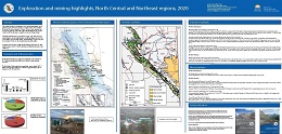
G. Clarke
The Northeast Region is prospective for coal and industrial minerals and, at present, has two producing coal mines, Conuma Coal Resources Limited’s Brule and Wolverine operations. Conuma’s Willow Creek operation shut down in July. In the far north of the region, Fireside Minerals Ltd. produces barite from its Fireside mine to supply the oil and gas drilling industry.
The North Central Region is prospective for copper, gold, silver, zinc, lead, specialty metals, and rare earth elements, mostly in porphyry, vein and stockwork, SEDEX, and carbonatite settings. The Mt. Milligan copper-gold operation (Centerra Gold Inc.) is the only producing mine in the region.
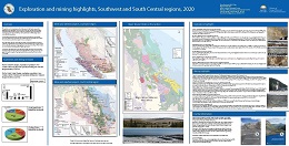
B. Northcote
The exploration and mining industries of the Southwest and South Central regions reflect geography as much as geological endowments. In the Southwest, with large coastal population centres, the industry is mainly mining for construction materials to feed growing cities. Many of the largest quarries make use of the Fraser River and tidewater for efficient transportation of low unit value commodities.
Some sparsely populated areas, such as northern Vancouver Island that have resource-based economies, maintain active mineral exploration industries. The mineral potential of the northern Vancouver Island is considerable and parts of it remain underexplored.
The South Central Region also serves southern population centres with industrial minerals and construction materials but the mining industry is dominated by bulk tonnage, low grade porphyry Cu-Au and Cu-Mo deposits. Four major porphyry mines are in operation today. A fourth remains on care and maintenance awaiting sustained higher copper prices.
A combination if geological endowment, engineering expertise, demand from Asia and access to infrastructure has made these deposits viable since the 1960s. More recently gold exploration has surged, echoing the recognition of geological potential that opened up the province more than 150 years ago.
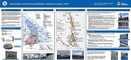
F. Katay
Extensive metallurgical coal deposits exist in the Southeast Region, and account for most of Canada’s coal production and exports. Four mines currently produce coal (Fording River, Greenhills, Line Creek, and Elkview), operated by Teck Coal Limited Two major coal projects (Michel Coal, and Crown Mountain) are in the Environmental Assessment process. Several industrial mineral mines produce silica, magnesite, and gypsum, and one gypsum mine is currently under construction (Kootenay West). Various other industrial products, such as rip-rap, flagstone, railroad ballast, dimension stone, and sand and gravel are quarried throughout the region. Exploration is also ongoing for other minerals, including graphite and phosphate. Exploration is also ongoing for precious and base metals, mostly in veins and stockworks, SEDEX, VMS, stratabound and carbonate replacement, and skarn deposits.
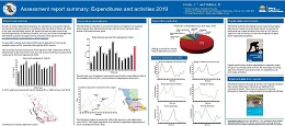
J. Norris and B. Wallace
Results of mineral exploration programs are submitted in assessment reports by industry to the government in compliance with the Mineral Tenure Act. The British Columbia Geological Survey maintains these reports in the Assessment Report Indexing System (ARIS). This summary includes work registered with a Statement of Work affidavit date to the end of 2019. The expenditures reported in assessment reports are registered to maintain claims beyond their expiry date and thus reported costs represent only a portion of the total amount spent.
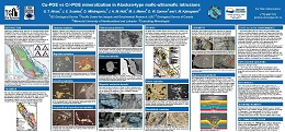
G. T. Nixon, J. S. Scoates, D. Milidragovic, J. A. M. Nott, M. J. Manor, D. W. Spence and I. M. Kjarsgaard
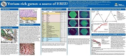
A.S. Rukhlov, J. Spence, N. LaForge, E. Czech, J. Kabel, G.N. and Kaplenkov
Rare earth elements (REE), including Sc, Y, and lanthanides (La to Lu), are increasingly important in high-technology industries and are considered ‘critical’ materials. Most of heavy REE (HREE, i.e. Sc, Y, Gd, Tb, Dy, Ho, Er, Tm, Yb, Lu) are produced from ion adsorption clay deposits in southern China. Some are recovered from placer and peralkaline intrusion-hosted deposits, with gadolinite (Y₂FeBe₂Si₂O₁₀), xenotime (YPO₄), and REE-bearing Ta-Nb oxides being the main hosts of these metals. They also occur in Zr-minerals such as zircon and eudialyte, and in some Mn-rich garnets containing up to 2.64 wt% Y₂O₃. Because deposits of HREE are rare compared with those of light REE (LREE, i.e. La to Eu), anomalous concentrations of HREE in heavy mineral concentrate (HMC) fractions of stream sediment samples at Loss Creek on southern Vancouver Island are intriguing. This study examines mineralogy of the panned HMC samples and chemical composition of garnet that comprises 25-28 wt% of the HMC samples. We present modal mineralogy of the sieved, 0.5-1.0 mm and <0.18 mm fractions of the HMC samples, determined by a scanning electron microscope (SEM); geochemistry of pure garnet fraction (0.25 to 2.0 mm) by lithium borate-fusion and combination of inductively coupled plasma optical emission and mass spectrometry (ICP-OES/MS) analysis for 56 analytes; in situ major and trace-element compositions of individual garnet grains by an electron probe microanalyzer (EPMA) and a laser ablation ICP-MS (LA-ICP-MS); and elemental X-ray maps of the garnets by SEM with energy-dispersion X-ray microanalysis system (EDS). Manganese-rich almandines at Loss Creek have up to 0.563 wt% REE (i.e. 3000x chondritic), with HREE comprising >99.8% of the total REE. This contrasts with most garnets elsewhere that have much lower REE levels (<0.06 wt%). Other ubiquitous heavy minerals include ilmenite, magnetite, hematite, pseudobrookite, leucoxene, pyroxene, staurolite, sillimanite, and epidote. Although we specifically looked for REE hosts, REE-bearing minerals such as allanite, xenotime, monazite, apatite, and zircon occur only as rare accessories (0.001 to 0.8 wt%) in the studied HMC samples. Therefore, the Mn-rich almandine with anomalous HREE contents (up to 600x the average Yb abundance in the Earth’s crust), derived from the greenschist-facies country rocks of the Leech River complex (Pacific Rim terrane), is the main host of REE at Loss Creek. The REE grade of the Loss Creek garnet is comparable with that of the world’s producing ion-adsorption clay (0.05-0.5% REE) and alkaline intrusion-hosted REE deposits (e.g., Bokan-Dotson Ridge, Alaska with 0.602% REE₂O₃). This study finds that Y-Mn-rich almandine associated with placer Au and significant prognostic resources of HREE, Mn, and Ge at Loss Creek could be a potentially viable source for the recovery of HREE and other ‘critical’, green-energy metals.
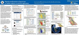
Y. Cui, D. Miller, F. Fortin, S. Zhao, E. Elia, and E. Orovan
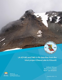
J.L. Nelson, R. Friedman, and B. van Straaten
Between 2013 and 2016, stratigraphic and structural studies in northwestern Stikinia between Dease Lake and Kitsault focussed on uppermost Triassic to Middle Jurassic volcanic and sedimentary rocks of the Hazelton Group. In the course of this work, 14 samples of siliciclastic rock were collected for LA-ICP-MS U-Pb analysis of detrital zircons, and 4 igneous samples were collected for U-Pb TIMS analysis. Herein we present complete data and calculations for the entire sample set. This dataset provides constraints on the absolute age of intrusive and stratified protoliths, age and affinity of sedimentary sources, and timing of fault-related shearing. These data support previously published and forthcoming studies.
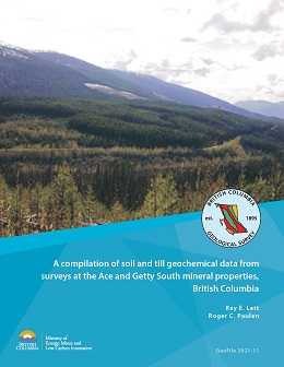
R.E. Lett and R.C. Paulen
Detailed geochemical soil and till surveys over the Ace massive sulphide and quartz vein gold property and the Getty South porphyry copper property in 1998 and 2000 generated trace element, minor element, and major oxide data for 57 elements from 112 profiles. Presented herein is a compilation of the data from these surveys. The data include analyses of field duplicate and analytical duplicate samples and standard reference materials as part of the quality control measures.
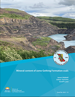
J. Riddell, J. Soriano, and G. Lane
With few exceptions, non-carbonaceous mineral matter poses problems for the coal industry. Mineral matter displaces the marketable combustible organic material, its residue after combustion can interfere with coal use, and some coals contain hazardous heavy metals such as arsenic, selenium, and cadmium. Thus, it is important to establish the identity and amount of the mineral phases in a coal deposit. Ten Gething Formation coal samples from the Willow Creek mine in the Peace River coalfield of northeastern British Columbia were analyzed with TESCAN Integrated Mineral Analyzer system to identify and quantify the mineralogy of the non-carbonaceous material. Quartz, kaolinite, feldspars and siderite are most abundant; micas, other carbonate minerals, crandallite group minerals, apatite, illite and smectite, and sulphide minerals were found in trace to small amounts in most samples. Iron is most commonly hosted in carbonate minerals. Calcium occurs mainly in feldspars, phosphate minerals, and micas. Magnesium is held mainly in siderite. The ash chemistry of Willow Creek mine samples is generally similar to that of Gething Formation samples regionally, except that on average the Willow Creek mine samples contain about 50% less iron, and about 80% more phosphate.
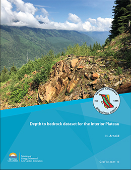
H. Arnold
This dataset contains both surface and subsurface locations of bedrock in the Interior Plateau. Observations were extracted from surficial and bedrock geology maps, sample locations for lithogeochemistry and geochronology, water well records, and assessment reports. These data were classified and compiled into consistent terminology and data structure while retaining original unit descriptions and publication information. These data that can be used as training data to produce or constrain spatial or geophysical predictions of the depth to bedrock.
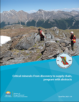
A virtual workshop, November 16-18, 2021, organized by the British Columbia Geological Survey, Geological Survey of Canada, United States Geological Survey, Geoscience Australia, and Geological Association of Canada-Pacific Section. The abstracts address the critical minerals needed to grow low-carbon economies, emphasizing those used in battery, magnet, and photovoltaic technologies, and consider the life cycle of critical minerals from exploration, resource availability, and mineral systems to market trends and supply chains.
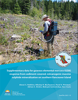
This GeoFile serves as a data repository for interpretations presented by Rukhlov et al. (2022). It provides complete summary of field data for gaseous elemental mercury (GEM) orientation surveys at the polymetallic Lara-Coronation occurrence, southern Vancouver Island (MINFILE 092B 129). These data include measurements of: GEM in near-surface air (statistical summary and raw); in situ soil temperature, moisture content, electrical conductivity, and pH; simultaneous meteorological parameters; and GEM concentrations in the air of sealed glass jars containing selected ore minerals.
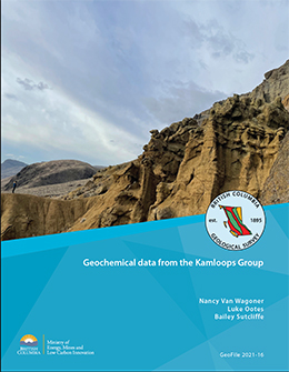
The Kamloops Group forms part of a discontinuous belt of graben-fill volcanic and sedimentary rocks that extends from the Challis volcanic field in Idaho through central British Columbia to southern Yukon. The whole-rock major, trace, and rare-earth element geochemical data presented herein are part of a study to better understand the volcanism and geochemical evolution of the Kamloops Group and the relationship of the unit to other volcanic complexes (e.g., Penticton Group), and to early Eocene tectonics, mineralization, and climate. The results are from samples collected during 2019 and 2020 and serve as a data repository for interpretations presented elsewhere. Most of the samples are from the type area of the Kamloops Group, near Kamloops, British Columbia.
2020
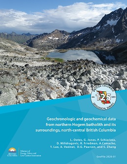
L. Ootes, G. Jones, P. Schiarizza, D. Milidragovic, R. Friedman, A. Camacho, Y. Luo, A. Vezinet, D.G. Pearson, and S. Zhang
Bedrock mapping in the Omineca Mountains of north-central British Columbia is supported by new geochemistry and geochronology. The data reported here are for rocks that are part of the Quesnel and Stikine terranes and, to a lesser extent, the Cache Creek terrane. Data and interpretations include assays, whole rock geochemistry that includes selected radiogenic Rb-Sr and Sm-Nd results, and 25 new U-Pb zircon crystallization ages, determined by chemical abrasion (CA)-TIMS, LA-ICP-MS, and ID-TIMS (mechanical abrasion, multi-grain). These are complemented by 12 new 40Ar/39Ar (hornblende, muscovite, and biotite) laser step-heating results from eight samples. Three new detrital zircon U-Pb, TE, and Lu-Hf results are included for sedimentary rocks in the Stikine terrane. This GeoFile serves as a data repository for summaries and interpretations presented by Ootes et al., (2020a,b), Jones et al. (2021), and forthcoming studies.
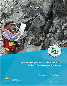
Tian Han and Alexei S. Rukhlov
The development of the British Columbia Geological Survey (BCGS) rock geochemical database provides a solution for storing and managing data collected by BCGS geologists and their associates in a systematic and consistent fashion. New rock geochemical data are format-standardized, metadata-completed, quality-controlled, and populated into the database, where they are integrated with existing data for permanent maintenance and storage. At the beginning of 2016, a new BCGS rock geochemical database was developed and populated with data compiled from 214 BCGS releases published between 1986 and 2015. It included about 11,000 samples with 250,000 determinations analyzed by 26 analytical methods in 21 laboratories. Since the original release, we have been updating the database, which is now augmented with new rock geochemical data compiled from BCGS publications between 2016 and 2019. The new data include 721 samples from 16 locations with ca. 45,000 determinations analyzed by 10 analytical methods in five laboratories. This GeoFile releases the new rock geochemical data in four CSV files: 1) ‘rock_geochem_ data.csv’, contains sample-level information and analyte concentrations determined by various analytical methods; 2) ‘rock_geochem_lab.csv’ is a metadata file that provides information about detection limits, analytical laboratory, and sample pre-processing; 3) ‘rock_geochem_ method.csv’ is a file of reference for all analytical methods and the codes adopted in ‘rock_geochem_data.csv’; and 4) 'bcgs_rock_geochem_data_all.csv' contains all rock geochemical data currently stored in the BCGS lithogeochemical database.
G.T. Nixon, R.M. Friedman, and R.A. Creaser
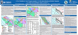
Late Neogene porphyry Cu-Mo mineralization hosted by the Klaskish Plutonic Suite (new formal name) in northern Vancouver Island occupies a unique position in the forearc of the Cascadia subduction zone. The Klaskish granitoid plutons and Alert Bay volcanic rocks comprise the Brooks magmatic suite, which forms a northeast-oriented zone, the Brooks-Haddington tract, extending for 65 km across the island from the Pacific coast to Queen Charlotte Strait in the east. The southern part of the Brooks-Haddington tract is marked by a narrow (10 km) structural corridor, the Brooks Peninsula fault zone, which hosts the mineralized Klaskish intrusions. The northern part of the tract is occupied by eroded edifices of the Alert Bay volcanic suite. High-precision U-Pb zircon and Re-Os molybdenite dates for mineralized stocks of the Klaskish Plutonic Suite (ca. 7-4.6 Ma) confirm that their emplacement was coeval with older phases of Alert Bay volcanism (8-2.5 Ma), and that porphyry Cu-Mo magmatic-hydrothermal systems are genetically linked to pluton emplacement and crystallization. Neogene plutons associated with porphyry Mo/Cu-Mo mineralization elsewhere in British Columbia are restricted to the Pemberton arc in the southeastern Coast Mountains, where pluton ages diminish progressively northwards. The late Neogene porphyry Cu-Mo mineralizing systems in the Pemberton arc and forearc environment of northern Vancouver Island are linked to the plate tectonic evolution of the northern Cascadia subduction zone, notably plate-edge effects generated by subduction of the Juan de Fuca plate and newly redefined Nootka fault zone in the oceanic crust. The young Cu-Mo porphyry mineralization in northern Vancouver Island forms a well-defined metallotect that is underexplored and rich in opportunities for discovering economic porphyry deposits.
A.S. Rukhlov, G. Fortin, G.N. Kaplenkov, R.E. Lett, V. W.-M. Lai, and D. Weis
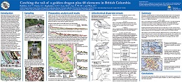
Regional geochemical surveys support the societal resource base by identifying prospective areas for large-tonnage economic deposits of a wide range of commodities, including non-traditional deposit types in undeveloped and underexplored regions. With the objective of developing geochemical exploration methods that are both effective and inexpensive, herein we use the <1 mm fraction of heavy mineral concentrate (HMC) samples (200- 400 g) from several Vancouver Island drainages recovered by sluicing and panning of 11-16 kg of the <2 mm fraction of bulk alluvium in the field. Analysis of the field-processed HMC samples greatly enhanced the geochemical anomaly contrast and confidently identified visually confirmed mineralization even at the mouths of third- to fifth-order streams, many km downstream from known mineralization. In contrast, analysis of the conventional stream and moss-captured sediments commonly failed to detect even proximal mineralization. The prognostic geochemical resources not only confirm known base and precious metal deposits, but also indicate a large, unconventional type of a placer garnet-hosted HREE-Y-Sc-Mn deposit and other ‘critical’
commodities. We propose a three-stage method for drainage geochemical surveys that is rapid, inexpensive, and effective.
G.J. Simandl, R.J. D’Souza, S. Paradis, J. Spence, and W. Fitz-Gerald
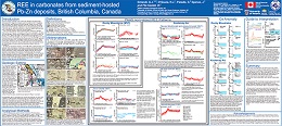
Paleozoic platform carbonate rocks of the Rocky Mountains host Mississippi Valley-type (MVT) deposits in the north and, in the south, host MVT, magnesite, barite, and Rare Earth Element (REE)-barite-fluorite deposits. Farther to the west of the Rocky Mountains, the platform carbonate rocks of the Kootenay arc pericratonic terrane also host MVT deposits in addition to vein- and replacement-type Zn-Pb (±Ag, ±Au) deposits. Sparry dolomitization is commonly spatially associated with most of these deposits and is used as an exploration guide.
This is the first systematic study documenting compositional variations of carbonate minerals in MVT deposits. It is based on more than 200 analyses by LA-ICP-MS, supported by electron microprobe work. Investigated samples are from the Munroe, Shag, Kicking Horse, Monarch, Coral and Robb Lake deposits in the Rocky Mountain belt, and from the Pend Oreille, Reeves MacDonald, Jersey-Emerald, HB, Duncan and Abbott-Wagner deposits in the Kootenay arc. These are all MVT deposits, except for Abbott-Wagner, which is a fracture-controlled replacement-type deposit. The REE patterns, normalized to Post-Archean Australian Shale (PAAS), indicate that none of the analyzed samples (including recrystallized dolomite, and sparry dolomite) showed the LREE depletion and strong negative Ce anomalies characteristic of modern seawater. Some of the patterns are nearly flat with slight positive or negative overall slope, others show depletion in LREE similar to modern seawater but lacking pronounced negative Ce anomalies or are upward convex (MREE enriched). Carbonates with PAAS-normalized REE patterns showing a strong Eu anomaly (e.g., calcite from Pend Oreille and Jersey-Emerald, dolomite from Abbott-Wagner and both calcite and dolomite from Reeves MacDonald - most from the Kootenay arc) likely precipitated from or interacted with different fluids than carbonates that yielded flatter patterns and weak or no Eu anomalies (e.g., dolomite from Robb Lake, Shag, Munroe and Pend Oreille, and calcite from HB).
Overall, REE signatures of carbonates reflect crystallization conditions of primary carbonates, crystallization and re-equilibration conditions of carbonates with ambient fluids during diagenesis, deep burial, and/or metamorphic recrystallization. Chemical evolution of the fluids along their migration path, the fluid-to-rock ratio, fluid acidity, redox and temperature are also factors. The data contained in this paper, in conjunction with petrographic observations, stable and radiogenic isotope data will be ultimately used to establish genetic and timing constraints on the above listed ore deposits and improve our knowledge of regional metallogeny of the Kootenay arc and Rocky Mountains.
J. Riddell
CSR (coke strength after reaction with CO2) is a globally accepted measure of coking coal quality. But because obtaining direct CSR measurements is logistically complex, time-consuming, and expensive, numerous indices calculated from standard ash analyses have been developed to serve as predictors of CSR. Based on unpublished proprietary data from 50 samples representing the main coking coal-producing units in the Rocky Mountains of British Columbia (Gates, Gething, and Mist Mountain formations), correlations between measured CSR and the most commonly used predictive index (Base-Acid Ratio or BAR) are moderate to strong. Thus, they can be used to provide a reasonable first-order prediction for CSR. For all three formations, correlations improve slightly by modifying the predictive index by adding P2O5. Correlations improved further when the BAR index was modified to correct for calcium in apatite, which is less reactive that calcium in carbonate minerals. Ash chemistry-based predictions are not accurate enough for feasibility studies or product marketing, but they can provide a timely and inexpensive first indication of CSR. The relationships between CSR and other factors (rank, fluidity, and petrographic properties) have much weaker correlations to CSR than ash chemistry. CSR prediction methods that are based on rheological and petrographic properties fail to correlate well with measured CSR values for the British Columbia Rocky Mountain coking coals in this study and appear to have no predictive value.
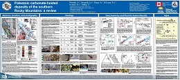
S. Paradis, G.J. Simandl, N. Drage, R.J. D'Souza, D.J. Kontak, and Z. Waller
Paleozoic carbonate rocks of the southeastern Canadian Cordillera contain a variety of deposit types, including Mississippi Valley-type (MVT), magnesite, and REE-F-Ba. These deposits are hosted in weakly deformed and metamorphosed Paleozoic platform carbonate rocks of the Rocky Mountains. They are found at different stratigraphic levels. However, most of them are hosted in dolostones of the Cathedral Formation (middle Cambrian), Jubilee Formation (upper Cambrian), and Palliser Formation Upper Devonian).
The deposits occur along major structurally controlled facies transitions between the shallow-water carbonate platforms and deeper water basin rocks of the Paleozoic continental margin. The location and geometry of these deposits reflect the juxtaposition of structures (e.g., deep-seated faults at the platform to deep-water basin transition) and rock types (i.e., permeable and reactive stratigraphic units) favourable to mineralization. This confluence of favourable conditions resulted from episodic rifting and mineralization along the Paleozoic margin during the middle to Late Cambrian and Late Devonian to Middle Carboniferous.
This poster reviews the geology, petrography, stable (C, O, S) and radiogenic (Pb, Sr) isotopes, and geochronology of selected carbonate-hosted deposits. Petrography shows dissolution and replacement of the original carbonate by fine-grained dolomite followed by different stages of coarser dolomite replacement and cavity-fracture-filling (e.g., saccharoidal, sparry and saddle dolomites) accompanied by sulphide deposition, mainly sphalerite, galena and pyrite. Geochemical signatures for each mineralization type show a pattern of dolomitizing and mineralizing fluids interacting with barren host rocks.
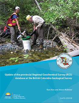
T. Han and A.S. Rukhlov
The Regional Geochemical Survey (RGS) database stores and manages geochemical data collected by the British Columbia Geological Survey (BCGS), the Geological Survey of Canada (GSC), and Geoscience BC. It includes data from drainage waters, fluvial deposits such as heavy mineral concentrates (HMC) and moss-mat sediments, lacustrine deposits, and vegetation such as spruce twigs and needles. Herein we augment data released in 2017 (GeoFile 2017- 11) with new information from BCGS and Geoscience BC sources published between 2016 and 2019. The new data include 656 samples with ca. 70,000 determinations analyzed by 12 analytical methods in seven laboratories.
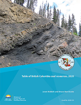
J. Riddell and B. Northcote
Tabulated herein as a MS Excel file are data from 130 coal deposits in British Columbia, both surface and underground. The table includes resource estimates, citations to reports from which the data were sourced, and information about project name(s), primary commodities, location, age, host unit, type, MINFILE status, predominant rank, and tenure holder and tenure restrictions (as of May 2020).
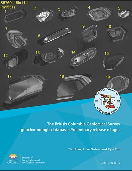
T. Han, L. Ootes, and K. Yun
This GeoFile releases ages published between 1960 and 2020 in two CSV files and one Microsoft Access file. The CSV files, one for new data (new_age.csv) the other for BCAge data (bc_age.csv), were generated with simplicity, exchangeability, and GIS-readiness in mind. They contain sample location coordinates, age, and numerous other primary attributes. The Microsoft Access database file (geochron_db.accdb) includes entities, relationships, and data that mirror the operating BCGS system.
D.V. Lefebure and L.D. Jones, (compilers)
The mineral deposit profiles compiled herein were initially prepared by the British Columbia Geological Survey (BCGS) between 1995 and 2012. Most of the profiles were initially published in BCGS Open File reports or in Geological Fieldwork volumes and were made available to the public on the BCGS website. The profiles are concise but comprehensive descriptions of metallic mineral, industrial mineral, gemstone, and coal deposits. These descriptions include geological characteristics, mineral exploration techniques, resource data, age of mineralization, tectonic setting, and concepts about deposit origins. Although the profiles have a global scope, many provide information specific to British Columbia. The present report re-releases all 120 profiles in one collection, with the original profiles virtually unchanged. In addition, the BCGS has initiated a multi-year mineral potential mapping project to identify areas of high prospectivity for key mineral systems across the province, and this release includes ten profiles for VMS, porphyry, and mafic-ultramafic deposits, which include mineral systems information and are included as an Addendum. The next generation of mineral deposit profiles will further support completing modern resource assessments, likely enabled by artificial intelligence applications.
R.M. Friedman, M.G. Mihalynuk, and L.J. Diakow
Raw data for two new U-Pb zircon dates from the southern Nicola arc are reported here. These dates extend the age and spatial limits of magmatic Nicola Group rocks. Older Nicola Group volcanic strata now span almost the entire known width of exposed Nicola Group at the latitude of Merritt.
A CA-TIMs age of 239.99 ±0.16 Ma from Missezula formation (informal) felsic tuffs near Pennask Mountain is now the oldest dated Nicola Group. The new date places these rocks in the early Ladinian (Middle Triassic). This age is similar to those from the central part of the Nicola arc farther west, strengthening stratigraphic ties across the arc. We also obtained a LA-ICPS detrital zircon age of 200.2 ±1.1 Ma from tuff bands in a section of Shrimpton formation (informal) calcareous and argillaceous siltstone near Pothole Lake. Accepting the recent IUGS timescale calibration for the Triassic-Jurassic boundary at 201 Ma, the youngest Nicola magmatism now extends to the earliest Jurassic.
A.S. Rukhlov, L. Ootes, A.S. Hickin, and N.R. Mashyanov
This GeoFile serves as a data repository for interpretations presented by Rukhlov et al. (2021). It provides complete field data and plots of real-time mercury vapour concentrations in near-surface air and simultaneously measured meteorological parameters at 15 locations that include the British Columbia Geological Survey and a variety of known ore deposits, fault structures, and barren rocks on Vancouver Island.
2019
M. G. Mihalynuk, R. M. Friedman and J. M. Logan
U-Pb geochronological results reported by Mihalynuk et al. (2019, Geologcial Fieldwork 2018) for host rocks of the Rock and Roll and Granduc volcanogenic massive sulphide (VMS) deposits in the Iskut area of northwestern British Columbia are consistent with the Late Triassic age suggested by previous workers. Although a direct age determination is still lacking, they constrained mineralization to between ~222 Ma and <~208 Ma for Granduc and 292 Ma to 186 Ma for Rock and Roll. The Late Triassic age may mark an important VMS mineralizing event within the submarine Stuhini arc, with implications for regional mineral exploration. Data from their study also provides constraints on two phases of superimposed deformation to between 210 Ma and 183 Ma. This Geofile 2019-01 contains the full geochronologic data set for detrital zircon samples reported in summary fashion by Mihalynuk et al. (2019).
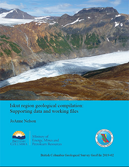
J.L. Nelson
This geofile contains files of supporting data and references used in the 2018 geological compilation of the Iskut region between the village of Iskut and Summit Lake, which is incorporated in the revised digital geological map of British Columbia (Cui et al. 2019). It includes:1) working GIS (.shp) files of geological linework, polygons and centroids, with notes and references; 2) working files of geochronological and biochronological supporting data from published sources with edits and notes by the compiler 3) reference list of sources for geology; and 4) a copy of the paper that justifies Iskut stratigraphic nomenclature (Nelson et al. 2018).
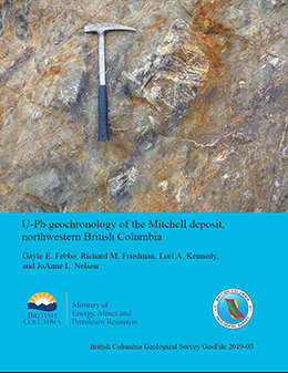
G. E. Febbo, R. M. Friedman, L. A. Kennedy and J.L. Nelson
Cross-cutting relationships separate three phases of plutonism at the Mitchell calc-alkalic porphyry Au-Cu-Ag-Mo deposit in Stikine terrane of northwestern British Columbia. A sample of porphyritic hornblende diorite from Phase 1 yielded a U-Pb zircon age of 196 ± 2.9 Ma. A second porphyritic hornblende diorite sample from Phase 1 yielded a U-Pb zircon age of 189.9 ± 2.8 Ma. A sample of hornblende diorite from Phase 2 yielded a U-Pb zircon age of 192.2 ± 2.8 Ma, which is within error of the younger Phase 1 determination.
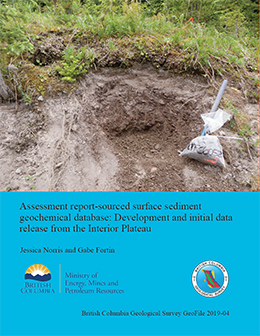
J. Norris and G. Fortin
ARIS (Assessment Report Index System) is collection of about 36,700 reports that detail results from mineral exploration and development programs. Submitted by the exploration and mining industry to comply with Mineral Tenure Act Regulations and maintain titles in good standing, the reports become an open resource after a one-year confidentiality period. Although containing a wealth of information, the assessment reports are typically submitted in a form (e.g., paper or PDF file) that make working with the data cumbersome. To address this problem, we are developing databases that contain information extracted and digitized from assessment reports, and releasing data in formats that are amenable to evaluation using geospatial and analytical software. This first such database contains surface sediment geochemical data (e.g. soil, silt, stream sediment, and till) from the Interior Plateau, and includes location coordinates, sampling parameters and notes, laboratory information, sample preparation methods, and analytical methods. We use a streamlined process for data compilation, verification, product generation, and distribution. Containing information from about 120 assessment reports, the database includes results from more than 34,000 samples, with 1,446,000 determinations from 13 laboratories. The data released herein (BCGS_GF2019-04.zip) are provided as a GeoPackage, which can be imported directly into most GIS, and as a set of CSV files. Updates to the current surface sediment geochemical database will contain additional geochemical data. Future assessment report-sourced databases will include information from drill holes and geophysical surveys.
Search tools and report specific downloads can be found here.
G.J. Simandl, C. Akam, M. Yakimoski, D. Richardson, A. Teucher, Y. Cui, S. Paradis, S. McPhail, and F. Ferri
Produced waters are a co-product of hydrocarbon extraction from conventional and unconventional fields. Treatment and disposal of these waters present a significant cost to the oil and gas industry. However, produced waters may contain non-negligible concentrations of Cl, Na, Ca, K, Sr, Mg, Br, Ba, Fe, I, B, Mn, Li, and other potentially recoverable elements.
Most elements discussed in this study are considered specialty metals (e.g., Li and Mg), industrial minerals (e.g., B, Br, and I), or starting materials for ‘synthetic’ industrial minerals (e.g., precipitated calcium carbonate). Lithium exploration and development projects worldwide currently benefit from a bullish outlook for the battery-grade portion of the Li market. Virtually every site in the Alberta portion of the Western Canada Sedimentary Basin with reported Li concentrations equal to or greater than 50 mg/l is claimed. Only five samples of produced waters analysed for Li in British Columbia are currently in public domain; one of which contains 54 mg/l Li.
The quality of produced water analyses is commonly questioned due to analytical problems or contamination by mud filtrate, completion fluids, or corrosion inhibitors. Automated data culling may be beneficial for treatment of data as it removes spurious analyses, although it may eliminate valuable data for elements not affected by contaminants.
This study is a first step toward identifying areas with anomalous concentrations of elements in produced waters. More work is needed to confirm our findings and determine which, if any, of the discussed elements can be extracted and marketed to offset the cost of treatment and disposal of produced waters.
G.J. Simandl, J.A. Petrus, M.I. Leybourne, S, Paradis, and C. Akam
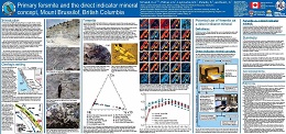
Fersmite ([Ca,Ce,Na][Nb,Ta,Ti] [O,OH,F] ), an important Nb ore mineral, occurs commonly as a metamict alteration product of pre-existing niobate minerals in carbonatites, alkaline and peralkaline intrusions, and rare element pegmatites. Well-crystalized fersmite is found in 'alpine clefts' (open joints, vugs, and cavities partially filled with well-crystallized minerals) formed during metamorphism and uplift.
At the Mount Brussilof (MB) magnesite deposit, 40 km northeast of Invermere, British Columbia, coarse fersmite crystals are in in vugs within sparry dolomite, which cross-cuts sparry magnesite. It occurs as accessory, black, acicular to platy, strongly-zoned crystals up to 2 cm long or as smaller crystals (< 3 mm) commonly fractured and cut by late dolomite.
The MB fersmite is characterized by strongly-zoned, euhedral crystals growing on the walls of cavities or enclosed in a dolomite matrix. It shares similarities with niobate mineral occurrences reported in ‘alpine clefts’ and it differs texturally from fersmite observed in carbonatite-related Nb mineralization. Zoning in the MB fersmite crystals probably reflects variations in the composition of fluids from which they formed. The higher concentrations of LREE in fersmite from Aley carbonatite relative to the MB fersmite may reflect differences in concentrations of LREE in these fundamentally distinct fersmite-forming systems. Fersmite can be successfully used to complement minerals of the pyrochlore supergroup and minerals of the columbite-tantalite solid solution series as a direct indicator mineral in exploration for carbonatite-, pegmatite-, and alpine cleft-related mineral occurrences.
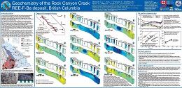
G.J. Simandl, Y. Kon, S. Paradis, M. Hoshino, C. Akam, D. Miller, D. Araoka, and S. Kodama
The Rock Canyon Creek carbonate-hosted REE-F-B deposit is 90 km northeast of Cranbrook on the eastern flank of the Canadian Cordillera. It has tectonic, stratigraphic, and structural similarities with Mississippi Valley-type and sparry magnesite deposits in the southeast Rocky Mountains.
The main REE-fluorite zone is a steeply dipping tabular body or set of lenses extending more than 1100 m along strike, at least 50 m wide, and at least 100 m deep. It coincides with a crackle breccia in carbonate rocks. Fluorite concentrations vary from less than 1% to 13.5% by weight, and REE+Y concentrations vary from trace to 2%. The mineralized zone consists of dolomite, fluorite, barite, pyrite, quartz, K-feldspar, calcite, porous apatite, REE-fluorocarbonates, and REE-phosphates. The main fluorocarbonates are bastnäsite, parisite, and synchysite. Monazite and crandallite group minerals consisting mainly of Al, Ca, Sr, and lesser proportions of La, Ce, Nd, S, and F are the main phosphates.
Three-dimensional modeling of the deposit suggests possible co-variation between Ba, F, and La, and between La and Nd. Chondrite-normalized REE pattern of fluorite from the mineralized zone shows higher LREE content and differs from that of fluorite associated with prosopite in transported boulders, and from distal fluorite (850 m from the main mineralized zone). Detailed studies of mineral paragenesis and chemical and isotopic compositions of minerals are underway to elucidate the timing of mineralization and the origin of ore-forming fluids.
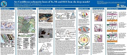
A.S. Rukhlov, L.B. Aspler, and J. Gabites
Important targets for Ta, Nb, and REE exploration, carbonatites and related rocks in the Canadian Cordillera were emplaced at ca. 810-700, 500, and 360-330 Ma, forming part of the British Columbia alkaline province. The most prolific Late Paleozoic carbonatites, including Aley and Upper Fir hosts of Nb-Ta deposits, are unusual. In contrast to the ca. 810-700 and ca. 500 Ma carbonatites, which mark breakup of the supercontinent Rodinia and passive margin development on the western flank of Laurentia, and to most carbonatites globally, which are found in intracratonic regions in association with large igneous provinces, the 360-330 Ma carbonatites formed near the continental margin during subduction taking place immediately to the west. We combine our findings from Blue River carbonatites with the new C-O-Sr-Pb-Nd isotopic analyses of separated carbonates from the ca. 810 Ma Perry River and ca. 360-330 Ma Aley, Ice River, Mount Grace, and Wicheeda Lake carbonatites to investigate their metallogeny. Most carbonatites, including the Ta-Nb deposits of the Blue River area, have primary mantle C-O isotopic signatures, whereas those of REE-rich carbonatites from Wicheeda Lake and Ice River dike, and literature data from Aley suggest carbohydrothermal fluid exchange with the host limestones. The available isotopic data, in conjunction with the geological, paleogeographic, and geophysical evidence, indicate that Cordilleran carbonatites were derived from a long-lived, deep-level mantle plume that was tapped episodically since the Neoproterozoic.
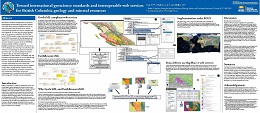
Y. Cui, L.J. Diakow, and D. Miller
The British Columbia Geological Survey (BCGS) is implementing the international geoscience standard GeoSciML and its extension EarthResourceML, to deliver geoscience data products and to develop interoperable geospatial web services compliant with these standards. As a first step, the bedrock geology map of the province is available in the Web Map Service (WMS) interface, using vocabularies adopted by the IUGS Commission for the Management and Application of Geoscience Information (CGI). We also have mineral occurrences from our MINFILE database available as WMS, compliant to EarthResourceML Lite, with details converted to the CGI vocabularies. Our next step is to make these data available on OneGeology, the portal for worldwide geoscience data. Our current geology and mineral occurrence data are maintained using BCGS specifications in data collection, compilation, and data production, and will continue to be accessible through MapPlace 2, the Survey's geospatial web service. However, it will take significant effort and time to have our data, specifications, and web services fully compliant with the international geoscience standards. We take this as an opportunity to update our data models and specifications, to produce consistent data with standardized classification systems and terminology, and to eventually enable interoperation in data sharing, data exchange, and data integration.
F. Ferri, and J. Reyes
Middle Devonian to Lower Carboniferous shales and siltstones of the Besa River Formation exposed in the Rocky Mountains are equivalent to shale gas-bearing rocks in the subsurface of the Liard Basin and, farther east, in the Horn River Formation of the Horn River Basin. To better understand these shale gas-bearing horizons, we investigated the Besa River Formation in outcrops near the southwestern margin of Liard Basin. Complementing data and interpretations presented in previous publications, herein we present the full data set from two sections that were measured and systematically sampled in the Stone Mountain area. Included are location maps, graphic logs, lithologic descriptions, images of representative rock types, and data files with results from whole rock and Rock-Eval geochemistry, bulk mineral composition, vitrine reflectance, and gamma ray work. These sections and data sets will provide a reference for shale gas-bearing rocks of the Besa River Formation in the subsurface of southern Liard Basin.
F. Ferri, and J. Reyes
Middle Devonian to Lower Carboniferous shales and siltstones of the Besa River Formation that are exposed in the Caribou Range of west-central Liard Basin are lithologically similar to time-equivalent shale-gas bearing rocks in the subsurface of the eastern Liard Basin and, farther east, in the Horn River Basin. Complimenting a nearly identical data set obtained from the Besa River Formation in southern Liard Basin and previous investigations, herein we present the full dataset from a continuous stratigraphic section that we measured and systematically sampled in the Caribou Range of northernmost British Columbia.
F. Ferri, M. Golding, and J. Reyes
Triassic calcareous siltstones and fine-grained sandstones of the Grayling and Toad formations exposed in the Halfway River area of the Rocky Mountains in northeastern British Columbia represent the western equivalents of gas-bearing units in the Montney and Doig formations in the subsurface of the Western Canada Sedimentary Basin. To better document these units, herein we present the results of a section, more than 640 metres thick, that we systematically measured and sampled across the Grayling and Toad formations and the lower part of the Liard Formation. These results include lithologic, organic and whole rock geochemical, thermal maturation, x-ray diffraction, and gamma ray spectrometer data.
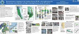
Mihalynuk, M. G.
In 1981, unusual polymetallic mineralization (Ni-Cu-Co- Zn-Ag) was discovered near Kaslo, in southeast British Columbia. However, it was not until 2017 that John Drobe (Cardero Resources) recognized its similarity with Outokumpu-style sea-floor detachment related deposits in Finland, for which a refined deposit model has only arisen in the last decade. Ni and Co are enriched in these Besshi-like deposits because they develop over mantle but why are they in the “passive continental margin” succession of North America? Previous workers have mapped small mafic/ultramafic intrusions. Could some be mantle? Plus, how extensive is this mineralization within the 300+ km long Lardeau belt?
In 2018, during a week-long reconnaissance mapping and sampling program, we looked into this “Outokumpu-style” mineralization to see if further study was needed. This poster presents some preliminary findings as well as an introduction to major questions about unit correlation that persist in the Kootenay region of southeastern British Columbia.
Rukhlov, A.S., Fortin, G., Kaplenkov, G.N., Lett, R.E., Lai, V. W.-M., and Weis, D.
This GeoFile serves as a data repository for interpretations presented by Rukhlov et al. (2020). It provides tables with field data, sample details, analytical results and quality control of geochemical and Pb isotopic analyses of stream and moss mat-sediment, heavy mineral concentrate, rock, and stream water samples, and modal mineralogy of heavy mineral concentrate samples by QEMSCAN. The samples were collected from the Loss Creek placer gold occurrence on southern Vancouver Island and from streams draining prospective rocks of the Bonanza Group (Late Triassic to Middle Jurassic) hosting porphyry Cu-Mo-Au, epithermal Au-Ag-Cu and related mineralization on northern Vancouver Island.
2018
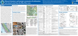
A.S. Rukhlov, M. Mao, L.B. Aspler. J. Spence, R.A. Creaser, E. Czech, and J. Gabites
Poster presented at the annual Mineral Exploration Roundup Conference (2018) sponsored by the Association for Mineral Exploration (AME).
G.T. Nixon, M.J. Manor, and J.S. Scoates
Poster presented at the annual Mineral Exploration Roundup Conference (2018) sponsored by the Association for Mineral Exploration (AME).
M.G. Mihalynuk, R.M. Friedman, N. Joyce, A. Camacho, and A. Zagorevski
Geofile 2018-3 contains the results, methods, and quality control data from geochronological analyses of samples collected during fieldwork conducted as part of the Federal Geo-mapping for Energy and Minerals (GEM) program near the British Columbia – Yukon border, in the Atlin area.
R.E. Lett
Results of two multi-media geochemical surveys along the west side of the Fraser River between Lillooet and French Bar Creek were originally published in British Columbia Geological Survey Fieldwork papers in 2006 and 2007, but the digital data for the surveys were not released. A compilation of the results from the two surveys, the raw data of which are released herein as readily accessible spreadsheets, reveals a strong geochemical expression of epithermal gold mineralization from occurrences in the ‘Watson Bar gold belt’ as anomalous Au, As, As, and Hg in stream sediments. The highest Au, As, Cu, and Pb concentrations are in bedrock at the Watson Bar developed prospect. Gold mineralization is also reflected by elevated As in stream water. Several other Au anomalies in stream sediment and bedrock lack a clear source of Au mineralization. Sediment and water from Boiler Creek near the northern limit of the project area have anomalous REE levels. The sediment and water also have elevated Al and Fe values suggesting that the source for the REEs may be clay minerals weathered from volcanic rocks.
R.E. Lett
Geofile 2018-5 describes a reconnaissance-scale moss mat-sediment geochemical survey carried out in 2000, in the Porcher Island, Grenville Channel, and Dundas Island areas of coastal British Columbia (NTS 103G, 103H, 103J). Seventy five moss mat-sediment samples were analyzed by a combination of a HNO3-HCl-H2O (modified aqua regia) dissolution - inductively coupled plasma emission/mass spectrometry and instrumental neutron activation, resulting in a total of 65 analytes. They were also analyzed for F and loss on ignition. Water samples were analyzed for pH, SO4, F, and U. The moss mat-sediment analyses reveal scattered Au anomalies that may reflect Cu-Mo sulphide mineralization on Porcher Island. Stronger Cu-Ag-V-Fe and Ba-Mo-Zn anomalies in streams draining the northeast part of Porcher Island, the central part of Porcher Island and along Grenville Channel can be explained by northeast-trending, metavolcanic-hosted, exhalative style magnetite and sphalerite-chalcopyrite mineralization. Only background Au, Cu, Pb and Zn values were found in the moss mat sediments collected from Dundas, Dunira and Melville islands.
A.S. Rukhlov, T.C. Chudy, H. Arnold, D. Miller
Carbonatites are igneous rocks containing abundant primary carbonate minerals. These rare rocks generally form in intracratonic settings as part of crustal-scale dome and rift systems. Historically regarded as petrogenetic curiosities, recent interest in strategic metals has led to significant exploration for carbonatites. In the Canadian Cordillera, carbonatites were emplaced episodically, at ca. 810-700, 500, and 360-330 Ma, forming part of the British Columbia alkaline province, which defines a long (at least 1000 km), narrow (ca. 200 km) orogen-parallel belt. The ca. 810-700 Ma and 500 Ma carbonatites were injected during protracted breakup of the supercontinent Rodinia and passive margin development on the western flank of Laurentia. In contrast to these and to most carbonatites globally, the 360-330 Ma carbonatites, such as the Blue River area examples, are unusual. They were emplaced near the continental margin during subduction rather than in the cratonic interior during continent breakup. The Blue River carbonatites include at least 18 carbonatite and 2 alkaline, silica-undersaturated-rock occurrences. This field trip considers the characteristics, magmatic evolution, and mineralization of the Blue River carbonatites as represented by the Upper Fir complex, which hosts one of the largest and best studied Nb-Ta deposits in the Canadian Cordillera. Exploration by Commerce Resources Corporation at the Upper Fir complex established an NI 43-101-compliant resource of 48.4 million tonnes (Indicated) averaging 1,610 ppm Nb2O5 and 197 ppm Ta2O5 plus 5.4 million tonnes (Inferred) averaging 1,760 ppm Nb2O5 and 191 ppm Ta2O5. Participants will examine outcrops and drill-core sections of amphibolite-grade metacarbonatites, related metasomatic rocks, syntectonic pegmatites, enclosing pelites and amphibolites of the Mica Creek assemblage (750-550 Ma), and Mesozoic-Cenozoic Cordilleran structures. We consider the tectonometamorphic overprinting of igneous features in the Upper Fir carbonatites, as recorded by paragenetic relationships, mineral chemistry, recrystallization, and retrograde deformation.
Isotopic evidence and spatial and temporal associations with large igneous provinces containing ultramafic and alkaline silicate rocks indicate derivation of carbonatite magmas from sub-lithospheric mantle plumes. New isotopic and elemental compositions of minerals from Blue River carbonatites and related rocks are indistinguishable from worldwide carbonatites generated by such deep-mantle plumes. The 360-330 Ma Cordilleran examples formed along the western margin of Laurentia while subduction was taking place immediately to the west. Lithospheric extension related to this Late Paleozoic subduction is considered responsible for rifting the continent margin and initiating the Slide Mountain ocean as a back-arc basin. We suggest that this same back-arc extension triggered emplacement of the Blue River carbonatites, which were derived from a long-lived, deep-level mantle plume that was tapped episodically since the Neoproterozoic.
R.E. Lett
In 2006, a geochemical orientation survey in the McLeod Lake area (NTS 093J/5, 6, 12) collected till at 16 sites, stream sediment at 6 sites, and stream water at 3 sites. The till and sediment samples were analyzed for 40 elements by a combination of HCl- HNO3-H2O dissolution-inductively coupled mass spectrometry (ICP-MS) and instrumental neutron activation (INAA), and for loss on ignition (LOI). Filtered (0.45 μ) acidified (1 M HNO3) water sample were analyzed for 60 elements by inductively coupled mass spectrometry (ICP-MS) and inductively coupled emission spectrometry (ICP-ES). The water samples were also analyzed in the field for pH and conductivity. Although results and an interpretation of the analyses were previously reported, the digital data were not released. GeoFile 2018-7 provides these data (Datafiles 1 and 2).
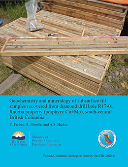
T. Ferbey, A. Plouffe, and A.S. Hickin
Till geochemistry and mineralogy have the potential to detect buried porphyry Cu mineralization in drift-covered regions. The Guichon Creek batholith (Late Triassic) is a large (65 km by 30 km) texturally and compositionally zoned intrusive body in south-central British Columbia. It hosts the Highland Valley mine (calc-alkaline porphyry Cu-Mo±Au) and numerous other porphyry Cu±Mo mineral occurrences, including the Rateria porphyry Cu±Mo property (held by Happy Creek Minerals Ltd.). At the Rateria property, NQ diamond drill hole R17-01 reached bedrock at a depth of 146 m and till was intersected at two depth intervals: 90 to 111 m and 120 to 144 m below surface. Both till units contain clasts of local (intrusive felsic rocks) and exotic (volcanic rocks) derivation. Based on analysis of 14 samples, concentrations of ore and pathfinder elements in the silt plus clay sized fraction (<0.063 mm), and grain counts for ore and alteration minerals (0.25 – 2 mm), do not follow a specific trend, except for Cu which generally decreases with depth. The three highest Ag values in subsurface till samples from the Rateria drill hole exceed the values observed in regional surface till of the Highland Valley mine district. In addition, most Cu, As, Au, and all Pb, and Zn values are greater than background values for surface tills in the region. Chalcopyrite and gold grain counts for subsurface tills are within the range of nearby (<5 km) surface till samples. Samples with maximum elemental Cu and Au do not contain gold grains or copper-bearing minerals >0.25 mm. This suggests that the host mineral phases for these elements are predominantly in the fine fraction of till (<0.063 mm), possibly indicating post-glacial weathering of sand-sized mineral grains.
2017
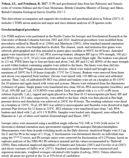
J. Nelson and R.M. Friedman
This data release accompanies and supports the isochrons and geochemical plots in Nelson (2017). It includes 3 TIMS zircon analyses and major and trace element analyses of 28 igneous rocks.
Nelson, J., 2017. Composite pericratonic basement of west-central Stikinia and its influence on Jurassic magma conduits: Examples from the Terrace-Ecstall and Anyox areas. In: Geological Fieldwork 2016, British Columbia Ministry of Energy and Mines, British Columbia Geological Survey Paper 2017-01, pp. 61-82.
A.S. Rukhlov, S.M. Rowins, M. Mao, L.A. Coogan, and J. Spence
Poster presented at the annual Mineral Exploration Roundup Conference (2017) sponsored by the Association for Mineral Exploration (AME).
Y. Cui, S. Zhao, L. Jones, G. Fortin, and S. Meredith-Jones
Poster presented at the annual Mineral Exploration Roundup Conference (2017) sponsored by the Association for Mineral Exploration (AME).
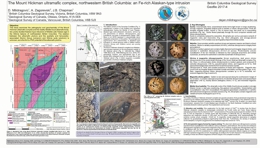
D. Milidragovic, A. Zagorevski, and J. Chapman
Poster presented at the annual Mineral Exploration Roundup Conference (2017) sponsored by the Association for Mineral Exploration (AME).
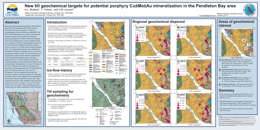
A. Bustard, T. Ferbey, and V.M. Levson
Poster presented at the annual Mineral Exploration Roundup Conference (2017) sponsored by the Association for Mineral Exploration (AME).
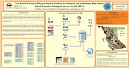
T. Han, A.S. Rukhlov, M. Nazri, and A. Moy
Poster presented at the annual Mineral Exploration Roundup Conference (2017) sponsored by the Association for Mineral Exploration (AME).
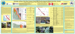
C. Green, G.J. Simandl, S. Paradis, F. Katay, M. Hoshino, Y. Kon, S. Kodama, and C. Graf
Poster presented at the annual Mineral Exploration Roundup Conference (2017) sponsored by the Association for Mineral Exploration (AME).
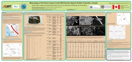
M. Hoshino, Y. Kon, S. Kodama, G.J. Simandl, C. Namatame, I. Matsunaga, and T. Takagi
Poster presented at the annual Mineral Exploration Roundup Conference (2017) sponsored by the Association for Mineral Exploration (AME).
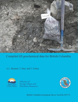
A. L. Bustard, T. Han, and T. Ferbey
The complete data set of publicly available, regional-scale, till geochemical surveys carried out in British Columbia by the British Columbia Geological Survey, the Geological Survey of Canada, and Geoscience BC compiles 39 reports released between 1992 and 2017, and includes geochemical data for 10,454 samples. Five Microsoft Excel tables generated from this database provide analytical determinations for the clay (<2 µm) and silt plus clay (<63 µm) size fractions of tills by inductively coupled plasma mass spectrometry after an aqua regia or modified aqua regia digestion, after a lithium fusion, and by instrumental neutron activation. These data tables can be brought into GIS software and integrated with other geoscience data to generate new exploration targets and design follow-up exploration programs.
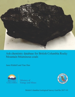
J. Riddell and T. Han
Ash is the inorganic residue remaining after coal combusts. It is composed of oxides of the mineral content in the coal. Coal ash chemistry can have a significant influence on coke strength after reaction (CSR), an important measure of coking coal quality. Coals that were overlain by non-marine deposits (which includes most Canadian Rocky Mountain coals) generally have mineral assemblages that form ashes with low ratios of reactive oxides (i.e. Fe2O3, CaO, MgO, Na2O and K2O) to refractory oxides (i.e. SiO2, Al2O3 and TiO2), which favours good coke strength under blast furnace conditions. Coal ash chemistry is also used to predict slagging and fouling potential in the furnaces or kilns of all types of coals. This database compiles ash chemistry analyses of British Columbia Rocky Mountain bituminous coals from public sources into a standardized relational format to facilitate its distribution and use.
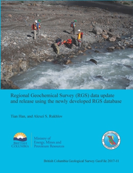
T. Han and A.S. Rukhlov
This GeoFile is a release of the most current and complete province-wide geochemical data set collected under the Regional Geochemical Survey (RGS) program. This data set was generated by integrating RGS data previously published by the British Columbia Geological Survey and Geoscience BC. It was compiled from 111 original sources with 64,828 samples and about 5 million determinations analyzed using 18 methods in 18 laboratories. For the ease of use and consistency with previously published data, the data set is in a flat tabular format. Behind the scenes is the newly developed RGS database that operates through a semi-automated process for data compilation, quality control, upload, and product generation. This RGS database provides a solution for consistent, standardized, and long-term data storage and for timely data update and regular data release. The RGS data set is just one of many potential data products that can be generated from the RGS database.
D. Milidragovic, A Zagorevski, and D. Weis
Poster presented at the Geological Society of America Annual Meeting, 2017.
2016
A. Rukhlov, A. Plouffe, T. Ferbey, M. Mao, J. Spence
GeoFile 2016-01 provides tables with electron microprobe (EMPA) and laser ablation – inductively coupled plasma mass spectrometer (LA-ICP-MS) analytical results of apatite grains separated from till and mineralized bedrock samples collected as part of the Geological Survey of Canada’s collaborative Targeted Geoscience Initiative-4 Program. The samples were obtained from the regions of porphyry mineralization at the Gibraltar, Highland Valley Copper and Mount Polley mines, and the Woodjam developed prospect in central British Columbia. This GeoFile serves as a data repository for interpretations presented by Rukhlov et al. (2016) in BC Geological Fieldwork 2015. In addition, Appendix 4 lists calculated parameters for the apatite grains discussed in Rukhlov et al. (2016; in Geological Fieldwork, British Columbia Geological Survey Paper 2016-1)
Detection limits for EMPA and LA-ICP-MS analyses of apatite grains from tills and mineralized rocks at Gibraltar, Highland Valley, Mount Polley, and Woodjam porphyry deposits and statistics for Durango and Madagascar apatites and NIST reference glasses. EMPA and LA-ICP-MS data for apatite grains from tills and mineralized rocks at Gibraltar, Highland Valley, Mount Polley, and Woodjam porphyry deposits. EMPA and LA-ICP-MS data for Durango and Madagascar apatites and NIST reference glasses. Calculated discriminant-function scores, chondrite-normalized rare-earth element ratios, and classification of apatite grains from tills and mineralized rocks at Gibraltar, Highland Valley, Mount Polley, and Woodjam porphyry deposits.
M.G. Mihalynuk and A. Zagorevski
R.M. Friedman, M.G. Mihalynuk and L.J. Diakow, and J.E. Gabites
T. Han, A.S. Rukhlov, M. Naziri, and A. Moy
A new database system was developed to maintain, update, and manage province-wide lithogeochemical data collected by British Columbia Geological Survey (BCGS) geoscientists and their research partners. The database is populated with data compiled from 214 BCGS publications released between 1986 and 2015. It includes ~11,000 samples with about 250,000 determinations analyzed by 26 analytical methods in 21 laboratories. The database operates through a semi-automated process for data compilation, quality control, upload, and product generation, which helps provide consistent, standardized, and long-term data storage and update, and regular release. The data product derived from the database provided in this release is in a user-friendly format (CVS), which can be easily brought into GIS and geochemical data evaluation software for visualization and analysis.
H. Arnold and T. Ferbey
Poster presented at the annual Mineral Exploration Roundup Conference (2016) sponsored by the Association for Mineral Exploration British Columbia (AMEBC).
G.J. Simandl, S. Paradis, M. Neetz, and C. Akam
Poster presented at the annual Mineral Exploration Roundup Conference (2016) sponsored by the Association for Mineral Exploration British Columbia (AMEBC).
J. Kyba
Poster presented at the annual Mineral Exploration Roundup Conference (2016) sponsored by the Association for Mineral Exploration British Columbia (AMEBC).
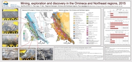
P. Jago
Poster presented at the annual Mineral Exploration Roundup Conference (2015) sponsored by the Association for Mineral Exploration British Columbia (AMEBC).
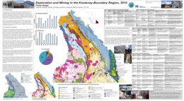
F. Katay
Poster presented at the annual Mineral Exploration Roundup Conference (2016) sponsored by the Association for Mineral Exploration British Columbia (AMEBC).
Also released as Geological Survey of Canada Open File 8028
A. Plouffe and T. Ferbey
Till sampling surveys were completed in 2011, 2012 and 2013 near four Cu-porphyry mineralized zones in British Columbia: Highland Valley Copper Mine (Cu-Mo porphyry); Gibraltar Mine (Cu-Mo porphyry); Mount Polley Mine (Cu-Au porphyry), and the Woodjam prospect (Cu-Au-Mo porphyry). The goal of these till surveys is to develop new mineral exploration methods using till geochemistry and mineralogy to detect buried porphyry mineralization. Presented herein are the resulting geochemical, mineralogical and grain size (textural) data. Quality control and quality assurance measures demonstrate that analytical results are unaffected by analytical artefact or sampling and thus fit for geological interpretation.
Also released as Geological Survey of Canada Open File 8119
T. Ferbey, A. Plouffe, and A. Bustard
Although rocks of Quesnel terrane in the Intermontane Belt of south-central British Columbia have long-been known as prolific producers of porphyry mineralization, much of the bedrock in the region is covered by glacial sediments. Nonetheless, geochemical and mineralogical data, particularly from locally derived tills, can help detect deposits buried under Quaternary sediments. We collected till samples from 99 sites near the Highland Valley Copper mine for geochemical, indicator mineral, and grain size determinations to test the utility of the method at a site where the configuration and tenor of ore-grade porphyry Cu mineralization are known. Landform-scale features such as drumlins, flutings, crag-and-tails mapped on aerial photographs, outcrop-scale features such as striations, grooves, and rat tails measured in the field, and data from previous studies indicate a relatively simple regional Late Wisconsinan ice-flow history with generally southward sediment transport, making provenance determinations on subglacial tills relatively straightforward. Commonly a first derivative of bedrock, subglacial till is the ideal sample medium for till geochemical and mineralogical surveys. Most of our samples were taken from a regionally developed till facies interpreted as a subglacial till deposited by moving ice (well compacted, markedly fissile, massive, cobble-boulder diamicton with a relatively clay-rich matrix and abundant faceted and striated clasts). For comparison, we also collected from a more locally developed till facies interpreted as an ablation till (poorly compacted, non-fissile, massive cobble-boulder diamicton with a relatively clay-deficient matrix) that overlies the subglacial till. Quality assurance/quality control results indicate that, uncontrolled by analytical artefact, the geochemical and mineralogical results for the dataset presented herein are suitable for geological interpretations that will be considered in future publications.
2015
A. Rukhlov and T. Ferbey
New elemental abundances and Pb isotopic ratios for 2.5N HCl leachates from basal till samples (<0.063 mm fraction) are used to highlight down-ice glacial dispersal for volcanogenic massive sulphide (VMS) occurrences in the Chehalis valley, southwestern British Columbia. The middle Jurassic Seneca VMS deposit and surrounding volcanic-arc rocks show up to 9% lead isotopic difference, orders of magnitude above the state-of-the-art analytical uncertainties. The Pb abundances and isotopic compositions of the Chehalis tills are consistent with mixing of leads derived from the local bedrock sources and the isotopically distinct VMS mineralization. Pb, Zn, Cu, and Ba abundances show inconsistent till anomalies. In contrast, the Pb isotopes are effective indicators of down-ice glacial dispersal for the VMS deposits.
M.G. Mihalynuk, R.M. Friedman and J.M. Logan
GeoFile 2015-2 contains the results, methodology and quality control data from geochronological analyses of samples collected during fieldwork conducted in as part of the Southern Nicola Arc Project (SNAP, 2012 – 2013) between Merritt and Princeton. It is the second installment of geochronological data released as part of SNAP (following Mihalynuk et al., 2014a), and augments other published project results (Mihalynuk and Logan 2013a, b; Mihalynuk et al., 2014a, b, c; Mihalynuk et al., 2015), as a component of the BC Porphyry Deposit Initiative (Hickin et al., 2014).
Hickin, A.S., Rowins, S.M, Jones, L.D., and Madu, B., 2014. British Columbia Geological Survey annual program review 2013. In: Geological Fieldwork 2013, British Columbia Ministry of Energy and Mines, British Columbia Geological Survey Paper 2014-1, 1-14.
Mihalynuk, M.G., and Logan, J.M., 2013a. Geological setting of Late Triassic porphyry Cu-Au mineralization at Miner Mountain, Princeton, southern British Columbia. In: Geological Fieldwork 2012, British Columbia Ministry of Energy, Mines, and Natural Gas, British Columbia Geological Survey Paper 2013-1, 81-96.
Mihalynuk, M.G., and Logan, J.M., 2013b. Geological setting of Late Triassic porphyry Cu-Au mineralization at the Dillard Creek property near Merritt, southern British Columbia. In: Geological Fieldwork 2012, BC Ministry of Energy, Mines and Natural Gas, British Columbia Geological Survey, Paper 2013-1, 97-114.
Mihalynuk, M.G., Friedman, R.M., Gabites, J.E., Logan, J.M., 2014a. Southern Nicola Arc Project 2013: Geochronological data. British Columbia Ministry of Energy and Mines, British Columbia Geological Survey, GeoFile 2014-3.
Mihalynuk, M.G., Logan, J.M., Diakow, L.J., Friedman, R.M., and Gabites, J., 2014b. Southern Nicola Arc Project (SNAP): preliminary results. In: Geological Fieldwork 2013, British Columbia Ministry of Energy and Mines, British Columbia Geological Survey, Paper 2014-1, 29-57.
Mihalynuk, M.G., Logan, J.M., Diakow, L.J., Henderson, M.A., Jacob, J., and Watson, A.K.G., 2014c. Summers Creek area preliminary geology, NTS 92H/9W & 10E. British Columbia Ministry of Energy and Mines, British Columbia Geological Survey, Open File 2014-5, 1:50 000 scale.
Mihalynuk, M.G., Diakow, L.J., Logan, J.M, and Friedman, R.M., 2015. Preliminary geology of the Shrimpton Creek area (NTS 092H/15E, 16W) Southern Nicola Arc Project. In: Geological Fieldwork 2014, British Columbia Ministry of Energy and Mines, British Columbia Geological Survey Paper 2015-1, pp. 129-163.
A. Rukhlov and M. Naziri
A new MS Access database has been created to house results from the provincial Regional Geochemical Survey (RGS), an ongoing program that was initiated in 1976. The database uses a flat-table format readily compatible with GIS and geochemical software to aid exploration and development of mineral resources, environmental baseline monitoring, and land-use planning. The new database standard captures survey locations, field observations, analytical results, several multi-media surveys and geology underlying sites of about 65,000 fine-grained (<0.18 mm) stream- and lake-sediment and water samples. Geochemical determinations include up to 63 analytes from sediments and up to 78 analytes from water. The RGS currently covers approximately 80 percent of the province, with an average density of about 1 sample site per 7–13 km2.
J. Nelson and J. Kyba
Poster presented at the annual Mineral Exploration Roundup Conference (2015) sponsored by the Association for Mineral Exploration British Columbia (AMEBC).
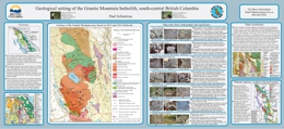
P. Schiarizza
Poster presented at the annual Mineral Exploration Roundup Conference (2015) sponsored by the Association for Mineral Exploration British Columbia (AMEBC).
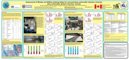
D. Mackay, G. Simandl, W. Ma, B. Grcic, M. Redfearn, P. Luck, and C. Li
Poster presented at the annual Mineral Exploration Roundup Conference (2015) sponsored by the Association for Mineral Exploration British Columbia (AMEBC).
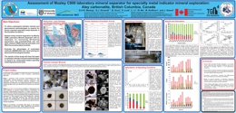
D. Mackay, G. Simandl, B. Grcic, P. Luck, C. Li, W. Ma, M. Redfearn, and J. Gravel
Poster presented at the annual Mineral Exploration Roundup Conference (2015) sponsored by the Association for Mineral Exploration British Columbia (AMEBC).
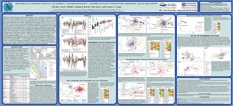
M. Mao, A.S. Rukhlov, S.M. Rowins, J. Spence, and L.A. Coogan
Apatite is a widespread accessory mineral that incorporates significant quantities of a wide range of trace elements (e.g., Na, Mg, Mn, Fe, Sr, Y, Ba, REE, Pb, Th, U, V, As, Si and S). This study shows that trace-element compositions can be used to discriminate between apatites associated with mineral deposits and those in unmineralized rocks and to identify major deposit types.
Poster presented at the annual Mineral Exploration Roundup Conference (2015) sponsored by the Association for Mineral Exploration British Columbia (AMEBC).
P. Jago
Poster presented at the annual Mineral Exploration Roundup Conference (2015) sponsored by the Association for Mineral Exploration British Columbia (AMEBC).
F. Katay
Poster presented at the annual Mineral Exploration Roundup Conference (2015) sponsored by the Association for Mineral Exploration British Columbia (AMEBC).
B. Northcote
Poster presented at the annual Mineral Exploration Roundup Conference (2015) sponsored by the Association for Mineral Exploration British Columbia (AMEBC).
2014
J.M. Logan and P. Schiarizza
Geofile 2014-1 contains analytical results from mineralized and unaltered, fresh samples collected during a two-week field investigation of the Rayfield River pluton, which was conducted as part of the ongoing BC Geological Survey’s Porphyry Deposit Initiative. The central Nicola Arc project focused on determining the geological setting, age, and style of copper-gold mineralization of the alkalic Rayfield River pluton (Late Triassic). The composition, age, and location of the Rayfield River pluton suggest that it is part of the highly prospective Late Triassic (205-200 Ma) Copper Mountain magmatic belt.
M.G. Mihalynuk, J.M. Logan, and L.D. Diakow
Geofile 2014-2 contains analytical results from samples collected during fieldwork conducted as part of the Southern Nicola Arc Project (SNAP), which is a component of the BC Porphyry Deposit Initiative. It augments data released as part of Geofile 2013-5.
Excel workbook containing five data tables:
- Sheet 1: Lab and field sample numbers cross, sample locations
- Sheet 2: ICP-MS analyses, Acme (raw)
- Sheet 3: INAA analyses of mineralized samples, Actlabs (raw)
- Sheet 4: Actlabs QC, including variance analysis by Alexei Rukhlov.
- Sheet 5: ICP-MS data table with headers stripped for import.
M.G. Mihalynuk, R.M. Friedman, J.E. Gabites and J.M. Logan
Geofile 2014-3 contains the results, methodology, and quality control data from geochronological analyses of samples collected during fieldwork conducated as part of the Southern Nicola Arc Project (SNAP), which is a component of the BC Porphyry Deposit Initiative.
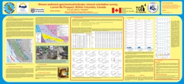
P. Luck and G.J. Simandl
Presented as a poster at the annual Mineral Exploration Roundup Conference (2014), GeoFile 2014-4 describes the results of an orientation survey aiming to optimize stream sediment geochemical/indicator mineral surveys targeting specialty metal deposits in the Canadian Cordillera. This project received funding from Targeted Geoscience Initiative 4 (2010-2015), a Natural Resources Canada program carried out under the auspices of the Geological Survey of Canada.
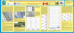
D.A.R. Mackay and G.J. Simandl
Presented as a poster at the annual Mineral Exploration Roundup Conference (2014), Geofile 2014-5 contains the results of a stream sediment orientation survey carried out on the Aley carbonatite complex, the largest and most developed Nb deposit in British Columbia. This study found the +125 μm stream sediment size fraction to be ideal for indicator mineral study. It shows the usefulness of pXRF data in determining downstream trends in pathfinder elements and predicts indicator minerals expected in the stream sediments based on deposit mineralogy. This project received funding from Targeted Geoscience Initiative 4 (2010-2015), a Natural Resources Canada program carried out under the auspices of the Geological Survey of Canada.
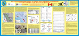
D.A.R. Mackay and G.J. Simandl
Presented as a poster at the annual Mineral Exploration Roundup Conference (2014), Geofile 2014-6 contains the results of a stream sediment orientation survey carried out on the Wicheeda carbonatite complex, the most promising REE prospect in British Colubmia. Portable XRF was used to determine relative concentrations of pathfinder elements in stream sediment samples and indentify the +125 μm stream sediment size fraction as the most useful for indicator mineral studies. Trends observed in the pXRF data were interpreted alongside the known mineralogy of the Wicheeda carbonatite to predict indicator minerals associated with the deposit. This project received funding from Targeted Geoscience Initiative 4 (2010-2015), a Natural Resources Canada program carried out under the auspices of the Geological Survey of Canada.
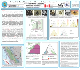
D.A.R. Mackay and G.J. Simandl
Presented as a poster at the annual Mineral Exploration Roundup Conference (2014), Geofile 2014-7 presents mineral chemistry discrimination diagrams for pyrochlore and columbite-tantalite minerals. These diagrams can be used to explore for undiscovered specialty metal deposits. They are based on new microprobe analyses from British Columbia carbonatites and worldwide data compiled from the literature. This project received funding from Targeted Geoscience Initiative 4 (2010-2015), a Natural Resources Canada program carried out under the auspices of the Geological Survey of Canada.
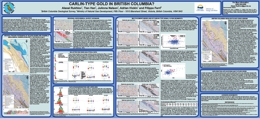
A. Rukhlov, T. Han, A. Hickin, and F. Ferri
Eocene Carlin-type gold deposits (CTGD) in Nevada constitute the second largest concentration of Au in the world. Similar structure-controlled Au and realgar-orpiment showings have recently been discovered in Proterozoic-Paleozoic Selwyn basin strata of the Rackla belt in east-central Yukon. These discoveries raise the possibility of similar occurrences in equivalent settings in British Columbia. This reconnaissance project uses the provincial regional geochemical databases and digital geology to test for Au±As±Hg±Tl±Sb anomalies that may be spatially related to long-lived structures and to platform to deep-water transitions in the Kechika trough (the southward extension of Selwyn basin) of north-central British Columbia.
GeoFile 2014-08 is a poster that was presented at the annual Mineral Exploration Roundup Conference, 2014.
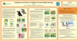
Y. Cui
The British Columbia Geological Survey has developed techniques to deliver to the exploration industry a continuously updated geological map of the province. Our ‘geologic framework data’ (GFD) model enables rapid integration of new mapping. These techniques are transferable, and the exploration industry can advance their own map integration by adopting our model.
The GFD model builds on the 2005 edition of our provincial bedrock map and operates in a spatial database. The spatial database makes it possible to handle large volumes of data, and permits multiple users to perform concurrent operations on the same GFD base. We have developed applications as part of the spatial database management system to automate checking-out, anchoring, and integration. These applications not only simplify the integration process, but also streamline rules-driven data quality assurance and content standardization, and automate auditing changes, populating bedrock attributes, generating map unit colour schemes, and creating customized maps for delivery via web services.
GeoFile 2014-09 is a poster that was presented at the annual Mineral Exploration Roundup Conference, 2014.
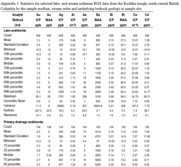
A.S. Rukhlov, T. Han, J. Nelson, A.S. Hickin, and F. Ferri
GeoFile 2014-10 provides tables for geochemical analyses of lake- and stream-sediment samples collected by the Regional Geochemical Survey (RGS) and National Geochemical Reconnaissance (NGR) from the Kechika trough, north-central British Columbia and the Rackla belt, east-central Yukon. It serves as a data repository for interpretations presented by Rukhlov et al., 2015.
Rukhlov, A.S., Han, T., Nelson, J., Hickin, A., and Ferri, F., 2015. Carlin-type geochemical signal in lake and stream sediments from Kechika trough, north-central British Columbia. In: Geological Fieldwork 2014, British Columbia Ministry of Energy and Mines, British Columbia Geological Survey Paper 2015-1, pp. 165-188.
Includes:
- Statistics for selected lake- and stream-sediment Regional Geochemical Survey data from the Kechika trough, north-central British Columbia by sample medium, stream order and bedrock geology at sample site.
- Statistics for selected stream-sediment National Geochemical Reconnaissance data from the Rackla belt, east-central Yukon by stream order and bedrock geology at sample site.
- Univariate data summary for Regional Geochemical Survey and National Geochemical Reconnaissance lake- and stream-sediment samples from the Kechika trough, north-central B.C. and the Rackla belt, east-central Yukon. The original and standardized data are compared in terms of linear-scale histograms, Tukey box plots and probability plots. The original data were standardized by log-transformation and levelled by sample medium, stream order and underlying bedrock geology at sample site using robust Z-score method. The standardized data are also plotted on regional maps for the Kechika trough and Rackla belt areas.
- Summary of Regional Geochemical Survey and National Geochemical Reconnaissance lake- and stream-sediment samples showing possible Carlin-type geochemical signatures.
M.A. Henderson, M.G. Mihalynuk, K. Sigloch, S.T. Johnston, and G.A. Shephard
GeoFile 2014-11 uses the paleo-GIS program GPlates, to develop a paleogeographic model for much of the North American Cordillera between 200 Ma and the present. It is the preliminary release of ongoing work to produce a model that best incorporates land geology, paleomagnetic data, and geometric constraints on volcanic arc geometry from detailed mantle tomography.
2013
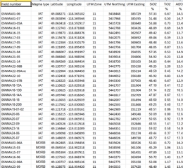
N.W.D. Massey and J. Dostal
GeoFile 2013-1 supplements the geological synthesis in Massey and Dostal (2013), by providing spreadsheets containing a complete geochemical dataset from the Knob Hill complex and Anarchist Group and additional geochemical plots.
The Knob Hill complex and Anarchist Group constitute part of the Paleozoic basement to southern Quesnellia. These units occupy adjacent northward-dipping, south-vergent thrust sheets extending along the Canada-Washington State border. Metabasalts in both units are tholeiitic to transitional or alkalic, comprising three magma types. The ophiolitic Knob Hill complex contains rocks of predominantly island arc affinity (IAT), with local MORB and E-MORB varieties. They probably formed by subduction-related rifting processes, but the precise setting remains unclear. The Anarchist Group metabasalts display predominantly within-plate E-MORB geochemical traits; local IAT and MORB signatures are indistinguishable from those in the Knob Hill Complex. The basalt geochemistry suggests that that the two units share a magmatic history and may have once been contiguous, with the Anarchist Group having formed off axis relative to spreading represented by the Knob Hill complex.
Massey, N.W.D. and Dostal, J., 2013. Geochemistry of metabasalts from the Knob Hill complex and Anarchist Group in the Paleozoic basement to southern Quesnellia. In: Geological Fieldwork 2012, British Columbia Ministry of Energy, Mines and Natural Gas, British Columbia Geological Survey Paper 2013-1, pp. 45-52.
H.M. Reid, G.J. Simandl, F. Ferri, and J. Veltheer
The Lonnie Nb deposit is spatially associated with the Wolverine Fault, which is in turn related to the Manson Creek Fault system. The Lonnie deposit is the third most developed Nb prospect in British Columbia. In the larger Aley Carbonatite and Upper Fir deposits, the Nb and Nb±Ta zones are carbonatite-hosted. Historical work done on the Lonnie deposit suggests that the highest Nb grades are associated with quartz-free feldspathic rocks; nevertheless, carbonatite (metacarbonatite) zones also contain significant concentrations of Nb. Limited sampling, carried out in 2012, agrees with historical findings in these respects. It also indicates that metacarbonatites have similar chondrite-normalized REE patterns to quartz-free feldspathic rocks, fenites, and nearby outcropping limestone; however, they have the highest REE concentrations. Fenitization extends for more than 30 metres from the complex southwestward into the host rock, perpendicularly to the strike of the Lonnie mineralization and the projection of the Wolverine fault. Carbonatite emplacement predates 4 periods of tectonic activity and the upper-amphibolite grade metamorphic climax. Pyrochlore is the main Nb-bearing mineral within aegirine-bearing metacarbonatite; however, it is absent, or a trace constituent in quartz-free feldspathic rocks - suggesting that Nb mineralization is present as columbite-series minerals or fersmite. Microprobe analysis is needed to confirm the presence and nature of these ore minerals. The adjusted Wolverine Fault Zone, as shown here, is probably the main Nb metalotect in the area; it aligns with a recently-available magnetic survey. Geochemical anomalies identified by Rara Terra Minerals Corp. at the Vergil carbonatite complex also appear to be located on the re-interpreted projection of the Wolverine fault.
Poster presented at the annual Mineral Exploration Roundup Conference, sponsored by the Association for Mineral Exploration British Columbia (AMEBC) in January, 2013.
M.G. Mihalynuk and J.M. Logan
Geofile 2013-5 contains analytical results from samples collected during fieldwork conducted as part of the ongoing Porphyry Copper-Gold project. This component of the project was focused on the geological setting of porphyry and related mineralization between Princeton and McLure.
- Sheet 1 Lab and Field sample number cross reference, includes sample locations given in UTM coordinates (NAD 83, UTM zone 10)
- Sheet 2 ICPMS analyses of mineralized samples, Acme
- Sheet 3 INAA analyses of mineralized samples, Actlabs
- Sheet 4 ICPMS (research grade) lithogeochemical analyses, Actlabs
- Sheet 5 Actlabs QC
View GeoFile 2013-05 (PDF, 0.1 MB)
Download GeoFile 2013-05 (ZIP, 229 MB)
A.S. Rukhlov
Concentrations of 24 elements (S, K, Ca, Ti, V, Cr, Mn, Fe, Ni, Cu, Zn, As, Se, Rb, Sr, Zr, Mo, Sn, Cs, Ba, W, Pb, Th, U) were determined in 12 Canadian sediment reference samples using a portable energy-dispersive X-ray fluorescence (ED-XRF) spectrometer and Compton scatter radiation for matrix correction. The reference samples represent till, stream sediments, and lake sediments that have been widely used as quality-control standards in geochemical surveys. A total of 11 international certified reference materials were analyzed to calibrate the ED-XRF spectrometer using error-weighted least-squares regression of the measured and the recommended data. The ED-XRF results are consistent with the published data within the uncertainties for V, Cr, Ni, Cu, Zn, As, Rb, Sr, Zr, Mo, W, and Pb in the reference sediment samples. Magnitude of bias for S, Ca, K and Ba concentrations appears to correlate with high loss-on-ignition (mainly H2O) contents (up to 44 wt. %) in these samples. Concentrations of Ti, Mn and Fe in all samples show small but significant systematic error, whereas Cs, Ba, Th and U concentrations may reflect spectral interferences in some samples. Concentrations of Co, Ag, Cd, Sb, Au, and Hg in the analyzed reference samples are all below the detection levels of the portable ED-XRF. Precision of the ED-XRF analyses is better than 6% (average 1.6%) at the 2σ level for most of the trace elements, except Cs. The portable ED-XRF spectrometer, with Compton scatter normalization for matrix correction, can be used for precise and accurate analysis of till, stream- or lake-sediment samples in mineral exploration, geochemical mapping and environmental monitoring. Compared to other analytical methods, the technique is fast, non-destructive, and requires less sample preparation.
Poster presented at the annual Mineral Exploration Roundup Conference, sponsored by the Association for Mineral Exploration British Columbia (AMEBC) in January, 2013.
R.C. Paulen and R.E. Lett
In 1997 and 1998, the British Columbia Geological Survey and the Geological Survey of Canada conducted till geochemistry surveys north of Kamloops. Trace, minor, and major element analyses from 1513 till samples contributed to the Eagle Bay Project, an integrated regional exploration program that focused on Devonian-Mississippian rocks of the Eagle Bay assemblage and Permian to Devonian rocks of the Fennell Formation. During the till geochemistry surveys, 60 grab samples were collected, 37 from gossanous outcrops and 23 from mineralized float. GeoFile 2013-07 presents analytical data derived from these samples, with a report and three spreadsheets.
2012

G.J. Simandl, R. Fajber, E.A. Prussin, S. Paradis and K. Grattan
Mineral Exploration Roundup 2012 Poster
Thirty-two samples of phosphate rock (pulps) from the Fernie Formation (south-eastern British Columbia) were analysed using a hand-held XRF analyser (Thermo Scientific Niton XL3t) and a lithium metaborate fusion–inductively coupled plasma method (LMB-ICPMS). The results from both methods were compared; correction factors for the portable XRF analyser were established and the effectiveness of the correction procedure tested. As any instrument type designed for field use, hand-held XRF analysers have to be light and compact. This translates into some technical limitations relative to their much larger laboratory counterparts that operate in chemically inert settings, benefit from elaborate sample preparation and use large power sources. However, if correction factors are established, hand-held instruments can be used systematically and very effectively in exploration for phosphate deposits by analyzing samples directly for phosphorus (P) and identifying zones of phosphate rock that are enriched in rare earth elements (REE). The hand-held XRF can also be used in spotting zones with unacceptable levels of deleterious elements such as U, Th, As, Se, Cd, Pb etc.
G.J. Simandl, E.A. Prussin, K. Hancock and S. Meredith-Jones
Mineral Exploration Roundup 2012 Poster
More than 100 RM occurrences are reported in BC. This compilation may serve as a starting point for those considering RM exploration programs in BC. There is uncertainty in the classification of some occurrences due to the scarcity of available information or the unusual nature of particular occurrences. The economic significance of many of these occurrences is poorly known because the size, shape, depth, grade, composition and orientation are not well defined. Based on currently available information, carbonatite-/syenite-related deposits are the most promising for the recovery of RMs, especially Nb and REE.
Y. Cui
The KML file MinFile_production_ts.kmz contains 1,696 past and current producing mines over the last 160 years in British Columbia that can be displayed at any range or point of time by using the Time Slider on Google Earth®. Only mines with known operating years are included in this KML file. More mines and detailed information can be found on the MINFILE Mineral Inventory.
Y. Cui
Regionated KML files have been created to provide a lightweight and quick display of over 12,500 mineral occurrences on Google Earth®. An application has been developed to extract the data from the MINFILE database and style the occurrences based on their status.
Y. Cui
To speed up the display of over 60,000 Regional Geochemical Survey (RGS) sites on Google Earth®, regionated KML files have been produced. In this release, the data is extracted from the RGS database and the sample sites are ranked or scored based on copper content. Due to the large number of sample sites, a single KML file containing all the sites would be too big both for displaying on Google Earth® or as a network link from a website. The regionation technique allows the creation of thousands of inter-linked small KML files (file sizes 9 KB or less in this case), and only fetches and displays a small number of KML files at a given viewing altitude, which significantly improves the performance of loading and displaying the sample sites.
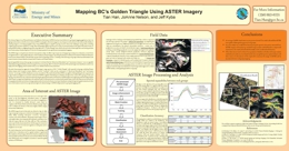
T. Han, J.L. Nelson and J. Kyba
Mineral Exploration Roundup 2012 Poster
The Advanced Space-borne Thermal Emission and Reflection Radiometer (ASTER) has been found effective for geological mapping applications due to its high spectral resolution in the Shortwave Infrared (SWIR) wavelengths of the electromagnetic wave; frequent revisit cycle and wide swath; and affordability of acquiring images to cover large geographic areas. Using ASTER imagery to map BC's geology, however, faces a few challenges, among others, including complex terrain and dense vegetation coverage. This may partially explain why there are not many documented studies in this regard. This study focuses on testing ASTER's ability on mapping the general rock groups in BC's “Golden Triangle” area, which is chosen for the vibrant exploration and mining activities in its vicinity and good surface exposure of bedrock rock, a prerequisite for any optical remote sensing based-mapping.
J. Logan, L. Diakow, B. Van Straaten, D. Moynihan And O. Iverson
Mineral Exploration Roundup 2012 Poster
Geoscience BC's QUEST-Northwest Project Is A Multidisciplinary, Integrated Project Designed To Help Focus Mineral Exploration In A Highly Prospective Area Of Northwestern BC.
The Project's Main Activities Include: Two Airborne Magnetic Surveys Flown At Line Spacing Of 250 Metres, Bedrock Geological Mapping And A Geochemical Program. Collectively These Programs Will Provide Detailed, High Quality Geoscience Data That Is Intended To Assist Metallic Mineral Exploration In This Area Of Highly Prospective Geology.
The QUEST-Northwest Dease Lake Geoscience Project Is A Partnership Between Geoscience BC And The BC Geological Survey And Is The Focus Of This Poster.
B. van Straaten, J. Logan and L. Diakow
Mineral Exploration Roundup 2012 Poster
The composite Late Triassic to Middle Jurassic Hotailuh batholith occupies 2275 km2 at the centre of the Stikine arch, close to the northern margin of the Stikine terrane in northwestern BC. We present the preliminary results of detailed mapping, geochemical and geochonological sampling aimed at refining the temporal magmatic evolution of the batholith, and building a metallogenic framework that relates mineralization to magmatic events. The project is part of the Geoscience BC funded QUEST-Northwest program developed to stimulate mineral exploration in the northwestern part of the province.
This study confirms that the Hotailuh batholith is prospective for intrusion-related mineral deposits that formed during at least two mineralizing events – an older event at ca. 220 Ma and a younger event at ca. 170 Ma. The Late Triassic calc-alkaline metallogenic event produced the Gnat Pass porphyry Cu and several other Cu and Cu-Au occurrences on the edges of the Hotailuh batholith, and may be temporally related with Cu mineralization at Schaft Creek further to the southwest. Newly discovered mineral occurrences in Middle Jurassic calc-alkaline plutonic rocks represent a relatively unrecognized metallogenic event that deserves more attention.
R.J.W. Turner, R.G. Anderson, R. Franklin, M. Ceh, N. Hastings, and C.L. Wagner
Geological Survey of Canada Popular Geoscience 98E
British Columbia has a rich geological heritage extending back in time for over 2.3 billion years. Because of a long history of mountain-building processes that continue today, much of this geoheritage is well exposed. The map is accessible to anyone with an interest in natural history. With over a hundred photographs of roadside geological wonders thoughout southern BC and many synoptic diagrams that illustrate basic processes and principles, the map is a self guide to many of the geological features of the southern Cordillera.
Digital copies can also be downloaded from the Geological Survey of Canada (GEOSCAN Natural Resources Canada). In French or English.
2011
M.G. Mihalynuk and J.M. Logan
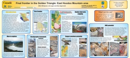
M. Mihalynuk, J. Logan and A. Zagorevski
The Iskut River area of northwestern BC is characterized by exceptional mineral endowment, it is mostly enveloped by the fabled “Golden Triangle”. Westflowing lower Iskut River marks the northern edge of the south-pointing Golden Triangle. Rocks which host stratabound mineralization, such as at the Rock and Roll deposit, are apparently barren north of the river. There is no obvious geological explanation for the dearth of deposits north of the Iskut River edge of the Golden Triangle. However, a reason for the lack of deposits in the Hoodoo Mtn area (104B/14) may arise from the lack of a geological framework; much of the area has never been systematically mapped. A working partnership was established between the BC Ministry of Forests, Mines and Lands, the Geological Survey of Canada (GEMS), Pacific North West Capital Corp. and the University of Victoria to address this lack of public geologic knowledge.
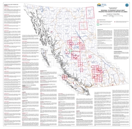
T. Ferbey
Presented here is a geographically referenced list of drift prospecting surveys that have been conducted in British Columbia. A list of topical studies and special volumes that are relevant to drift prospecting in British Columbia have also been included. These studies and geochemical data will be of interest to explorationists and researchers who are assessing the effectiveness of drift prospecting surveys in the context of their own exploration or research program, who are preparing to design and implement their own survey, or who have generated geochemical data on drift samples and are looking for data from orientation surveys for comparison.
This map and list of references is intended to provide a way of quickly identifying drift prospecting studies and data that are either geographically or topically of interest to those working in British Columbia. Any omission in the reference list or on the map should be brought to the attention of the compiler. This publication will be updated on an annual basis.
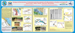
S. Paradis, G.J. Simandl, H. Keevil and M. Raudsepp
Carbonate-hosted, nonsulphide base metal deposits of the Kootenay terrane (Salmo district), adjacent Cariboo terrane (Quesnel Lake district), and elsewhere in BC have near-surface Zn- and Pb-bearing iron oxide-rich gossans formed by supergene processes. The nonsulphide deposits of the Salmo district, which occur mainly as large irregular replacement masses, encrustations, or open-space fillings, consist predominantly of Fe-oxyhydroxides, goethite, hematite, hemimorphite, and minor smithsonite, hydrozincite and cerussite. They contain 0.8-23% Zn, 0.7-5% Pb, and >20% Fe. Deposits of the Quesnel Lake district consist of pervasive fine-grained sulphide and nonsulphide disseminations and aggregates forming pods and masses, sulphide- and nonsulphide-bearing quartz (±calcite) veins, and crackle breccias. Sulphides are galena, sphalerite, and trace amounts of pyrite. Nonsulphides are smithsonite, hemimorphite, cerussite, hydrozincite, and anglesite. Grab samples assayed 17.3-51.0% Zn, 0.1-1.5% Pb, and 0.4-0.8% Fe. In most occurrences of both districts, the spatial continuity and/or the close spatial relationships in combination with morphological similarities between sulphide and associated nonsulphide zones suggest direct replacement of sulphides by nonsulphide base metal-bearing minerals.
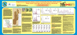
G.J. Simandl, R. Fajber, C.E. Dunn, B. Ulry and J. Dahrouge
Coniferous trees represent suitable sampling media in the exploration for carbonatites and related rare earth elements (REE), Ta, Nb, phosphate and fluorspar mineralization referred to in the British Columbia “Carbonatite Deposit profile N01” (Birkett and Simandl, 1999).
Twenty four samples of twigs with needles from coniferous trees (Subalpine Fir and White Spruce) were collected over the Upper Fir Ta, Nb and apatite-bearing carbonatite. The results indicate that carbonatite is detectable by biogeochemical methods. Light rare earth elements (LREE), Y, Zr and P are good exploration vectors for REE and apatite mineralization; whereas Ta and Nb are direct indicators for their own ores. Ta is found in detectable concentrations only in White Spruce twigs (41% of samples), and mainly those directly overlying mineralization, concentrations range from 0.001 to 0.003 ppm Ta. Nb concentrations are higher than those of Ta; concentrations range from 0.02 to 0.24 ppm Nb in White Spruce twigs, 0.00496 to 0.070814 ppm Nb in White Spruce needles (ash values normalized to dry weights), and 0.012011 ppm to 0.030214 ppm in Subalpine Fir needles (ash values normalized to dry weights).
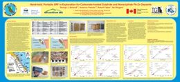
G.J. Simandl, S. Paradis, R. Fajber and N. Rogers
Carbonate-hosted nonsulphide base metal mineralization is derived from sulphide deposits by supergene processes. In the field such occurrences can be described as ‘red ores’ or ‘white ores’. Red ores consist mainly of Fe-oxyhydroxides: goethite, hematite, and hemimorphite, as well as minor smithsonite, hydrozincite and cerussite (+/- vestiges of galena ). They are difficult to distinguish macroscopically from barren gossans. White ores consist mainly of hemimorphite, smithsonite, and hydrozincite, as well as minor Fe-oxyhydroxides. In some cases white ores are difficult to distinguish from the enclosing carbonate host rock.
Samples from the red and white nonsulphide mineralization were analysed first using portable hand-held X-Ray Fluorescence (XRF) spectrometry and secondly using laboratory ICP-MS/ICP-ES methods (following lithium metaborate fusion).
Comparison between the methods indicates that the portable hand-held XRF is a useful field tool in exploration for carbonate-hosted nonsulphide mineralization. The instrument is able to distinguish between barren, moderately mineralized and high grade mineralized samples; making it useful where rapid decisions are needed (on a drill site, during helicopter supported geological work, or for semi-quantitative verification of ore grades at a mine site). Our tests also indicate that currently available portable hand-held XRF analysis is not a substitute for analytical laboratory methods (such as ICP-MS/ICP-ES or assays).
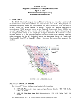
R. Lett
The British Columbia Geological Survey, Ministry of Energy and Mines has been involved in reconnaissance-scale stream sediment and water surveys since 1976. This program has generated high-quality stream and lake sediment and surface water data from geochemical surveys carried out across Canada. In British Columbia the National Geochemical Reconnaissance (NGR) program, known as the Regional Geochemical Survey (RGS), has covered roughly 75 percent of the province with stream sediment and stream water sampling at an average sample density of one sample per 13 square kilometres. A MicrosoftTM Access
database contains all of the field and analytical information from 61,425 samples collected and/or reanalysed by the BC Geological Survey, the Geological Survey of Canada and Geoscience BC from 1976 to March 2011. The figure to the right shows the RGS sample coverage.
Significant References
- Lett, R. and Jackaman, W. (2004): Stream Geochemical Survey Guide; BCGS GeoFile 2004-7
- Lett, R. (2005): Regional Geochemical Survey Database on CD; BCGS GeoFile 2005-17
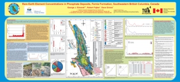
G.J. Simandl, R. Fajber and D. Grieve
Sedimentary phosphate deposits are known to contain non-negligible concentrations of Rare Earth Elements (REE). This conceptual study, based on 53 samples, gives an indication of the REE concentrations in phosphate rock occurrences located in southeast British Columbia. The emphasis of this study is on the Fernie Formation which is covered by 31 samples. This study indicates that there is good positive correlation between P2O5 content and REE as well as strong positive correlation between Yttrium and the lanthanides. The Yttrium and neodymium concentrations of the Fernie Formation in particular are higher than expected.
Current prices of rare earth oxides are at or near an all time high. Assuming sufficient resources could be established, a follow-up study to investigate the economic potential of REE extraction as a by-product of the transformation of phosphate rock into fertilizers may be justified.
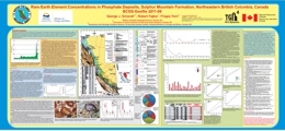
G.J. Simandl, R. Fajber and F. Ferri
This study covers concentrations of lanthanides and Y in phosphate deposits in northeastern British Columbia. Fifty representative samples of phosphate rocks (containing from 0.1 to 29% P2O5), collected during the mid 1980's were re-analysed in 2009 for REEs using modern analytical technique (ICP-MS, following Li-metaborate fusion). They contain from 6 ppm to 972 ppm REE’s (not including Y) and from 5 ppm to 590 ppm Y.
The emphasis of this study is on the Sulphur Mountain formation (SMF) and more specifically at its Whistler member. In general, in decreasing order, Y, La, Nd and Ce are the most abundant REE’s in northeastern British Columbia. Samples from the Kechika formation are an exception because Ce, La, and Nd (in decreasing order) are more abundant than Y.
Within the SMF, there is a good agreement between results obtained using ICP-MS and historical data for P and some of the REEs; however, results of historical La analyses are significantly lower than corresponding results obtained using modern ICP-MS.
Should any of the British Columbia phosphate deposits be considered as sources of phosphate raw material for fertilizer manufacturing, at current REE prices, the economic viability of REE recovery as a by-product of phosphate mining should be considered.
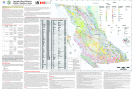
G.J. Simandl, E.A. Prussin and N. Brown
GeoFile 2011-10 provides background information regarding Specialty Metals (“Rare Metals”) in British Columbia and can be considered a Specialty Metals primer for prospectors and geologists. The accompanying 1:2 000 000 scale map shows the location and geological setting of 106 rare metal occurrences. The GeoFile also lists 45 references on the subject.
Most of the primary occurrences are part of the belt-shaped British Columbia alkaline province which parallels the Rocky Mountain Trench. They can be grouped into seven main geological categories based on the association between mineralization and host-rock or key lithological units: 1) Carbonatite/syenite-related deposits, 2) Peralkaline/alkaline intrusion-related deposits, 3) Skarns, 4) Pegmatites/granite hosted 5) Placers and paleoplacers, 6) Phosphate-hosted REE deposits and 7) Others. Aley carbonatite (niobium) and the Upper Fir carbonatite (niobium and tantalum) are the two most developed rare metal prospects approaching the feasibility study stage.
The Aley carbonatite (niobium) (094B 027) and the Upper Fir carbonatite (niobium and tantalum) (083D 035) are the two most developed rare metal prospects, approaching the feasibility study stage. The less developed Wicheeda Lake rare earth element occurrence (093J 014) is also promising. Carbonatite/syenite-related deposits appear to be the primary exploration targets for niobium and rare earth element exploration in British Columbia.
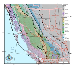
M. Colpron and J.L. Nelson
The framework of the Cordilleran orogen of northwestern North America is commonly depicted as a ‘collage’ of terranes – crustal blocks containing records of a variety of geodynamic environments including continental fragments, pieces of island arc crust and oceanic crust. The series of maps available here are derived from a GIS compilation of terranes based on the map published by Colpron et al. (2007) and Nelson and Colpron (2007), and include modifications from recent regional mapping. These maps are presented here in a variety of digital format including ArcGIS file geodatabase (.gdb), shapefiles (.shp and related files) and Map Packages (.mpk), as well as in a number of graphic formats (Adobe Illustrator CS3, CorelDraw X3, PDF and JPEG). The GIS data includes individual terrane layers for British Columbia, Yukon and Alaska, as well as a layer showing selected major Late Cretaceous and Tertiary strike-slip faults. Graphic files derived from the GIS compilation were prepared for the Northern Cordillera (Alaska, Yukon and BC), the Canadian Cordillera (BC and Yukon), Yukon, and British Columbia. These maps are intended for page-size display (~1:5,000,000 and smaller). Polygons are accurate to ~1 km for Yukon and BC, and ~5 km for Alaska. More detailed geological data are available from both BC Geological Survey and Yukon Geological Survey websites. Descriptions of the terranes, their tectonic evolution and metallogeny can be found in Colpron et al. (2007), Nelson and Colpron (2007), Colpron and Nelson (2009), and references therein.
The terrane map project is a collaborative effort of the BC Geological Survey and Yukon Geological Survey.
References:
Colpron, M., Nelson, J.L. and Murphy, D.C., 2007. Northern Cordilleran terranes and their interactions through time. GSA Today, vol. 17, no. 4/5, p. 4-10.
Colpron, M. and Nelson, J.L., 2009. A Palaeozoic Northwest Passage: incursion of Caledonian, Baltican and Siberian terranes into eastern Panthalassa, and the early evolution of the North American Cordillera. In: Earth Accretionary Systems in Space and Time, P.A. Cawood and A. Kröner (eds.), Geological Society of London, Special Publications 318, p. 273-307.
Nelson, J.L. and Colpron, M., 2007. Tectonics and metallogeny of the Canadian and Alaskan Cordillera, 1.8 Ga to present. In: Mineral Deposits of Canada: A Synthesis of Major Deposit Types, District Metallogeny, the Evolution of Geological Provinces, and Exploration Methods, W.D. Goodfellow (ed.), Mineral Deposit Division, Geological Association of Canada, Special Publication 5, p. 755-791.
Recommended citation:
Colpron, M. and Nelson, J.L., 2011. A Digital Atlas of Terranes for the Northern Cordillera. Accessed online from Yukon Geological Survey (www.geology.gov.yk.ca), [DATE]. OR: Colpron, M. and Nelson, J.L., (2011): A Digital Atlas of Terranes for the Northern Cordillera; British Columbia Ministry of Energy and Mines, BCGS GeoFile 2011-11.
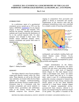
R.E. Lett
In a preliminary report of a geochemical orientation survey carried out in 1992 over the Galaxy Cu-Au deposit (MINFILE 092INE007) southwest of Kamloops, BC, Kerr, Sibbick and Getchell, 1993 describe the geology, sampling and analytical methods. A map shows the distribution of Cu in the surficial deposits (till). No other elements were reported in their Geological Fieldwork paper (BCGS Paper 1993-1, pages 439-442). This GeoFile reports digital data for 47 elements, location coordinates for 169 sample sites on a grid extending 1500 metres southeast of the deposit and field notes in digital records.
Appendix A: Field notes
Appendix B: Analytical data
Appendix C: Duplicate sample data
2010
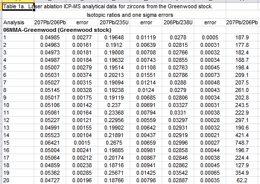
N.W.D. Massey, J.E. Gabites, J.K. Mortensen and T.D. Ullrich
The Boundary Project was initiated in 2005 with the purpose of better characterizing the lithological and geochemical variations within and between the various Paleozoic sequences in the southern Okanagan region along the USA border. These occur within Quesnel terrane, which is dominated by Paleozoic mafic volcanic and pelitic rocks, unconformably overlain by Triassic and Jurassic volcanics and sediments, and intruded by various suites of Triassic, Jurassic and Eocene granitic rocks.
The results of isotopic dating and lithogeochemical studies of several of the granitic intrusions in the study area are presented in Massey et al. (2010). This geofile complements that paper and presents the full analytical data tables for samples analysed by both laser-ablation ICP-MS on zircons and Ar40/Ar39 on hornblende and biotite separates.
Massey, N.W.D, Gabites, J.E., Mortensen, J.K. and Ullrich, T.D. (2010): Boundary Project: Geochronology and Geochemistry of Jurassic and Eocene Intrusions, Southern British Columbia (NTS 082E); in Geological Fieldwork 2009, BC Ministry of Energy, Mines and Petroleum Resources, Paper 2010-1, pages 127–142.
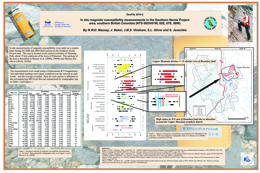
N.W.D. Massey, J. Baker, J.M.S. Vineham, S.L. Oliver and S. Jasechko
This GeoFile updates and replaces GeoFile 2009-7. It comprises in situ measurements of magnetic susceptibility that were made on a routine basis at most stations during the 2008 (the Whipsaw Creek-Eastgate-Wolfe Creek area) and 2009 (Granite Creek area) field seasons. The project area is located on the eastern boundary of Manning Park, about 15 km southwest of the town of Princeton. The geology of the area is described in Massey et al. (2009a, 2009b) and Massey and Oliver (2010a, 2010b).
The measurements were made using a Exploranium KT-9 kappameter. Ten individual readings were taken scattered over the outcrop at each station and the average recorded. Data for each station is tabulated in the MS Excel file and summarized by stratigraphic unit in Table 1 and Figure 1 on the accompanying poster.
Massey, N.W.D., Vineham, J.M.S. and. Oliver, S.L (2009a): Geology and Mineral Deposits of the Whipsaw Creek-Eastgate-Wolfe Creek area, British Columbia (92H/01W, 92H/02E, 92H/07E and 92H/08W), B.C. Ministry of Energy, Mines and Petroleum Resources, Open File 2009-8.
Massey, N.W.D., Vineham, J.M.S. and. Oliver, S.L (2009b): Southern Nicola Project: Whipsaw Creek-Eastgate-Wolfe Creek area, (92H/01W, 92H/02E, 92H/07E and 92H/08W) in Geological Fieldwork 2008, B.C. Ministry of Energy, Mines and Petroleum Resources, Paper 2009-1, pages 189 - 204.
Massey, N.W.D and Oliver, S.L. (2010): Geology and Mineral Deposits of the Granite Creek Area, British Columbia (92H/07, 92H/10S), B.C. Ministry of Energy, Mines and Petroleum Resources, Open File 2010-06, 1:30,000-scale.
Massey N.W.D. and Oliver, S.L. (2010): Southern Nicola Project: Granite Creek Area, southern British Columbia (parts of 92H/07, 10), in Geological Fieldwork 2009, B.C. Ministry of Energy, Mines and Petroleum Resources, Paper 2010-1, pages 113 – 126.
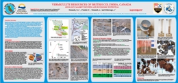
G.J. Simandl, S. Paradis, L. Simandl and J. Dahrouge
Expanded vermiculite is used as a lightweight aggregate in concrete, an additive in a variety of acoustic, thermal and fire insulation products, in soil conditioning, as a fertilizer or insecticide carrier, and in absorbent packing, paints and sealants. It is also used in refractory gunning and castable mixes, in vermiculite dispersions and in replacing asbestos in brake linings, primarily for the automotive market.
There is currently no vermiculite produced within the province of British Columbia. Only four localities in the BC MINFILE list vermiculite as a commodity. High concentrations of vermiculite were encountered adjacent to the Hodgie Rare Earth Zone, previously discovered by Commerce Resources Inc. in the Blue River area. This occurrence has above average vermiculite and higher grade than other known vermiculite occurrences in the province. Reconnaissance-level field observations, in-house particle-size analyses and rudimentary laboratory scale exfoliation tests are encouraging. They indicate that detailed chemical and mineralogical studies are the next logical step in the assessment of this and other vermiculite occurrences in the Blue River area. Chemical analyses are required to establish the trace-element levels in the vermiculite-bearing material, to ensure that it does not contain elevated levels of environmentally sensitive substances. Mineralogical follow-up should establish the absence or presence of asbestiform particles. The presence of such particles would negatively impact the development of this vermiculite resource.
If the outcomes of the above-recommended tests justify more rigorous laboratory and field investigations, then these occurrences of the Blue River area have the potential to become significant commercial sources of vermiculite.
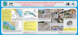
S. Paradis, G.J. Simandl, J. Bradford, C. Leslie and C. Brett
Under favourable geological, climatic, topographic and hydrological conditions, the weathering of carbonate-hosted, sulphide deposits may result in the formation of economically significant direct replacement and wallrock replacement nonsulphide base metal deposits. Nonsulphide deposits were the main source of zinc in the 19th century. Due to the metallurgical innovations during the early 20th century, the interest of explorationists shifted to sulphide ores. For a variety of environmental and economic reasons, nonsulphide deposits are again representing attractive exploration targets; however, they are commonly overlooked.
Cariboo Zinc property provides excellent examples of Zn-Pb sulphides and “mixed ores” (rocks consisting of sulphide and nonsulphide minerals). Mineralization is concentrated along a northwest-trending, dolomitic belt (8 km long). It consists of pervasive fine-grained sulphide and nonsulphide disseminations and pods and masses, sulphide- and nonsulphide-bearing quartz (±calcite) veins, and crackle breccias. Sulphides are galena, sphalerite, and trace amounts of pyrite. Nonsulphides are smithsonite, hemimorphite, cerussite, hydrozincite, and possibly anglesite. The main showings are Canopener, DeBasher, Flipper Creek, Dolomite Flats, Main, Gunn and Que. In most exposed occurrences, the spatial continuity and/or the close spatial relationships in combination with morphological similarities between sulphide and associated nonsulphide zones suggest direct-replacement of sulphides by nonsulphide base metal-bearing minerals.
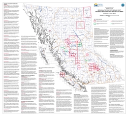
T. Ferbey
Presented here is a geographically referenced list of drift prospecting surveys that have been conducted in British Columbia. A list of topical studies and special volumes that are relevant to drift prospecting in British Columbia have also been included. These studies and geochemical data will be of interest to explorationists and researchers who are assessing the effectiveness of drift prospecting surveys in the context of their own exploration or research program, who are preparing to design and implement their own survey, or who have generated geochemical data on drift samples and are looking for data from orientation surveys for comparison.
This map and list of references is intended to provide a way of quickly identifying drift prospecting studies and data that are either geographically or topically of interest to those working in British Columbia. Any omission in the reference list or on the map should be brought to the attention of the compiler. This publication will be updated on an annual basis.
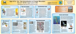
M. Mihalynuk, J. Logan, R. Friedman and V. Preto
A chain of alkali Cu-Au±Ag-Mo porphyry deposits and coeval instrusive and volcanic rocks extend the length of the Canadian Cordillera. They are the product of a prolific metallogenic event. Mineralization at Copper Mountain is part of this event; recognized by workers in the 1970’s as coeval with intrusions that host the mineralization along with nearly coeval volcanic rocks. However, by the mid 2000’s this nearly coeval relationship was challenged by time scale revisions, changes to isotopic decay constants, improvements in dating techniques and over-interpretation of earlier cooling ages. If the isotopic age data were taken at face value, the mineralization at Copper Mountain appeared to be nearly 10 million years younger than the host rocks. With a new era of deep porphyry exploration about to begin, it was imperative to know whether mineralization was related to a younger, perhaps hidden intrusion or if existing age data were misleading.
R.J.W. Turner, R.G. Anderson, R. Franklin and D. Grieve
Also published as GSC Open File 2477
East Kootenay is a landscape full of contrasts: from dry grasslands of the Rocky Mountain Tranch to high glacier peaks of the Purcell and Rocky Mountains; and from the big Kootenay River and great forested valleys to desert-like hoodoos near Fairmont and Kimberly.
To the curious mind, East Kootenay is also a landscape full of questions. Why is the East Kootenay mountainous, while nearby Alberta is flat? Why are fossils of ancient sea life found high on mountain peaks? Why are some lakes so green? Where was the gold rush that created Fort Steele? Why so they find dinosaur footprints in coal mines near Sparwood? Why does the East Kootenay have so many hot springs? What wealth financed the fine heritage buildings in Fernie?
This guide explores these and other questions. Is there logic to the landscape? Can geologists explain some of these puzzles? Let’s go take a look!
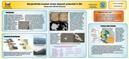
Z.D. Hora
A number of opaque nickel minerals (sulphides, arsenides and antimonides, as well as NiFe alloys) can occur as a by-product of serpentinization of ultramafic rocks, a variety of phases of Fe, Ni and Co minerals originate as these metals are released from the oxide-silicate-bound olivine structure. In British Columbia, "some nickeliferous sand" was identified in alluvial gold from Fraser River in 1888, and Bridge River, awaruite (Ni3Fe) on Wheaton Creek (with native Cu nuggets) in Cassiar District (Holland, 1940), Letain Creek (Krishnarao, 1964) and awaruite in Yukon from Pelly River in 1908. In Cassiar asbestos deposit, O'Hanley et al. (1992) listed pentlandite and heazlewoodite. Recent discoveries of several coarser awaruite zones have been reported over a large tract of ultramafic rocks in the area between Fort St. James and Ogden Mountain (First Point Minerals, 2009). Awaruite is also reported in 2008 from Dease Lake area in northern BC. Hard Creek Nickel - Turnagain Project in a serpentinized Alaskan type ultramafic intrusion contains some Ni minerals with low sulphur content like millerite and heazelwoodite (Hard Creek Nickel, 2009), the typical serpentinization products.
R.J.W. Turner, B. Van Heek and S. Dodd
Also published as GSC Open File 5560
This guide tells its story about the landscape of the Hazeltons area by taking you on a tour through the local area. These locations will be familiar to many but the guide may inspire a new look with “landscape eyes”.
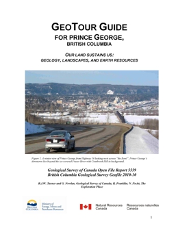
R.J.W. Turner, G. Nowlan, R. Franklin, and N. Focht
Also published as GSC Open File 5559
Prince George, like any other community, is dependent on the Earth for water, food, materials and energy. Not only does the Earth provide resources but it accepts our wastes. The purpose of this field guide is to explore how the community of Prince George “lives off the land”. How has the local landscape shaped human use of the area? Where does the drinking water supply come from? Where does the sewage go? Where does the garbage go? Where does the energy, which fuels people’s lives, come from? What earth materials underlie this landscape and how do they affect us? What local earth resources to people in Prince George depend on? Are we sustaining the land that sustains us?
This guide takes a tour of the city area. The sites will be familiar to many but the guide may inspire a new look with “landscape eyes”. A better understanding of how we depend on the land, helps us to better consider how “best practices” can protect the land and ensure that the land continues to sustain us.
B. Northcote
Geofile 2010-11 presents a table of approximately 100 of British Columbia’s published coal resource estimates, publicly available as of early 2010. Sources are mainly British Columbia Coal Assessment Reports and other documents made public by exploration and mining companies, such as technical reports, annual reports or project descriptions filed for environmental assessment purposes.
The estimates in the table must be read with caution. They are both historical and recent, and range from regional, order-of-magnitude estimates of exploration potential to National Instrument 43-101 or JORC-compliant estimates of reserves. Estimates intended to comply with NI-43-101 are flagged as such. Historical and other non-compliant estimates should not be considered comparable to compliant estimates. Resource categories are given similar names to compliant estimates simply for consistency with the Ministry of Energy, Mines and Petroleum Resources MINFILE database.
Similarly, indications of ASTM rank are not necessarily definitive. They are generally taken as-published in the cited references and may be based on very few analyses. Readers are encouraged to conduct further research on deposits of interest and contact owners and operators where appropriate.
Other sources of coal quality information include previous publications of the BC Geological Survey, which undertook a coal quality project in the 1990’s resulting in compilations of coal quality data and washability characteristics for samples from the principal BC coalfields. Reports include those of Grieve (1992), Holuszko (1994) and Grieve et al. (1995).
Ryan (2002) provides an overview of coal resources in BC, including potentially mineable resources by coalfield, average coal quality data and an extensive list of references organized by coalfield.
In a Geological Survey of Canada publication, Smith (1989) also provides information of a general nature on Canada’s coal resources, including those of BC.
Owner/operator information available as of early 2010 is provided to assist in further research, but is not authoritative. The Ministry of Energy Mines and Petroleum Resources’ Mineral Titles Branch administers most coal tenures in the province, with the exception of freehold and federally-administered coal lands.
BC Geological Survey
Geofile 2010-12 is a listing of contact links within the mining industry in BC, up to date in 2010. For earlier versions of this document see GeoFile 2007-11 and GeoFile 2003-23.
T.E. Demchuk
Geofile 2010-13 provides unprocessed ground penetrating radar (GPR) data collected during field studies at the Komie North glaciofluvial delta in northeastern British Columbia. The data was collected as part of a research project investigating the genesis of the glaciofluvial delta. This work was also part of the northeast BC Aggregate Program of the Ministry of Energy, Mines and Petroleum Resources. Further information about this area, including surficial geology and sedimentology, are presented by Demchuk (2010). The data presented here include JPEGs of unprocessed GPR data and raw data files for processing.
Y. Cui
As part of the QUEST South regional geochemical studies sponsored by Geoscience BC, a total of 785 stream samples were collected in southern British Columbia in 2009, with analytical results published in 2010 (Jackaman, 2010).
The BC Geological Survey recently delineated catchment basins for these new infill stream sample sites, after extensive validation and adjustment of the sample locations to the TRIM streams. Detailed methodology on the delineation of catchment basins was described and published by Cui, et al. (2009).
The release of the catchment basin data for these sample sites is to complement and enhance the values of the Geoscience BC publication, in the advancement of the levelling, interpretation, application and presentation of the geochemical results for mineral exploration.
2009
J. Larocque and M. Mihalynuk
GeoFile 2009-1 is part of an ongoing programme to help reduce the economic impact on communities within British Columbia that have been affected by the widespread infestation of Mountain Pine Beetle. The programme aims to promote mineral exploration in areas where logging is the dominant industry. Logging activity is expected to wane as the commercial value of the dead forests steadily declines.
The Clusko - Chezacut - Chilanko Forks areas were targeted for revision mapping because of relatively good logging road access and a historical lack of mineral exploration that we believed to be unwarranted. This viewpoint was validated with 2007 mapping in the Chezacut area, and supported by results from 2008 mapping in the Clusko River - Chilanko Forks area. Geological mapping demonstrated that rock exposures are more extensive than previously recognized, and that the economically uninteresting Chilcotin basalt cover is less extensive. Both observations provide incentive for future mineral exploration in the area.
GeoFile 2009-1 presents lithogeochemical data from rock samples collected with the Chilanko Forks and southern Clusko River map areas, which are located on British Columbia’s Fraser Plateau (part of the Interior Plateau physiographic region). For more details on the bedrock geology of the map area, please refer to: Geology, Geochronology and Mineralization of the Chilanko Forks to Southern Clusko River Area, West-Central British Columbia (NTS 093C/01, 08, 09S)1 and Open File 2009-6, Chilanko Forks Geology (NTS 093C/01)2 (both Mihalynuk et al., 2009).
Mihalynuk, M.G., Orovan, E.A., Friedman, R.M., Larocque, J. and Bachiu, T. (2009): Geology, Geochronology and Mineralization of the Chilanko Forks to Southern Clusko River Area, West-Central British Columbia (NTS 093C/01, 08, 09S); inGeological Fieldwork 2008, BC Ministry of Energy, Mines and Petroleum Resources, Paper 2009-1
Mihalynuk, M.G., Orovan, E.A., Larocque, J., Bachiu, T. and Wardle, J. (2009): Chilanko Forks Geology (NTS 093C/01); BC Ministry of Energy, Mines and Petroleum Resources, Open File 2009-6
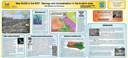
M.G. Mihalynuk, J. Larocque, E. Orovan
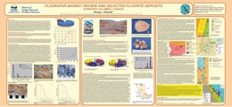
G.J. Simandl
Fluorspar is the commercial term for fluorite (CaF2). Fluorite contains 51.1% Ca and 48.9% F. Collector specimens occur as cubes and octahedrons. Typical fluorspar ores are massive, disseminations, or form layered crusts, globular and botroidal aggregates and cox-comb textures. Other sources of F are cryolite and phosphate rock. Cryolite (Na3AlF6) was historically mined in Greenland. Due to environmental pressure, F compounds are now recovered during the processing of sedimentary phosphates. Fluosilic acid (H2SiF6), used in water fluoridation, is one of these compounds. Strict environmental regulations suggest that this acid will be increasingly converted into Al- or Ca-fluorides, cryolite, or H. Phosphate rock reserves in the USA alone contain 370 million tonnes of F.
Fluorspar is used largely in the manufacturing of fluorocarbons for refrigerants, foam products, polytetrafluoroethylene (“Teflon”) and other fluoropolymers. Petroleum alkylation, glass, medical, agricultural and metallurgical uses also represent important markets. Demand for fluorspar in the manufacture of fluoropolymers and fluoroelastomers, including partially fluorinated polymers or copolymers is growing. Over 70% of fluorspar used in developed countries is transformed into HF products, while in developing countries over 65% of fluorite is used in steel-making. Fluorspar uses in USA are summarized on Figure 1. Aluminum fluoride (AlF3) and synthetic cryolite, derived largely from acid grade fluorspar, are the main F compounds used in aluminum (Al) smelting. The growth of this market is favoured by increasing demand for Al in the automotive industry, but it is counterbalanced by improvements in smelting technology, increased recycling of both, Al and F, and by increased use of AlF3 derived from fluosilic acid. Fluorspar products are sold to steel mills, cement plants, foundries, glass and ceramic plants, and welding rod manufacturers where they are used as fluxes.
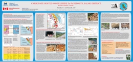
S. Paradis and G.J. Simandl
Under favourable geological, climatic, topographic and hydrological conditions, the weathering of sulphide deposits may result in the formation of economically significant carbonate-hosted, nonsulphide, base-metal (CHNSBM) deposits. CHNSBM deposits were the main source of zinc prior to the 1930s. Following the development of differential flotation and breakthroughs in smelting technology, the mining industry turned its attention to sulphide ore (Hitzman et al., 2003). The situation is changing as evidenced by the successful operation of a dedicated processing plant, extracting Zn through direct acid leaching, solid-liquid separation, solvent extraction and electrowinning, from nonsulphide and mixed ores from the Skorpion mine in Namibia.
The Salmo district (NTS 082F/03) of British Columbia is renown for its Irish and MVT massive sulphide deposits (Paradis, 2007). It also contains associated direct-replacement CHNSBM deposits and has a potential to host undiscovered Zn-rich wallrock replacement-type CHNSBM deposits.
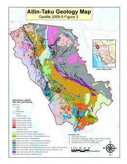
D.G. MacIntyre and W.E. Kilby, with contributions from R. Duncan, C. Aspinall, M. O'Donnell, A. Panteleyev, P. Wojdak, M. Mihalynuk, G. Simandl, K. Hancock, P. Desjardins, L. Jones and D. Lefebure
At the request of the Integrated Land Management Bureau of the Ministry of Agriculture and Lands, the British Columbia Geological Survey (BCGS) undertook a Level 2 Mineral Resource Assessment of the Atlin-Taku land use planning area, which encompasses approximately four million hectares in northwestern British Columbia. This work was done in September 2008 by eight experts with specific knowledge of the geology and mineral resources of the study area and two facilitators – D. MacIntyre and W. Kilby. The primary purpose was to provide detailed up-to-date information on metallic and industrial mineral resource potential. The final results were presented at a land-use planning workshop in Atlin in late November 2008. Geofile 2009-5 provides a Summary Report on the methodology of the results, data tables, a Manifold Map, Metallic and Industrial Mineral Potential PDF maps, a Geology Map in PDF, Shape files, MINFILE reports, links to interactive data on MapPlace, and links to additional documents of mineral potential and deposit profiles.
This new mineral assessment updates an earlier Level 1 Mineral Resource Assessment completed in 1996 and includes new estimates for an expanded list of mineral deposit types. The estimation methodology employed in the assessment was the same as that used in the earlier Level 1 assessment with the exception that known resources were not factored into the tract ranking schema. A total of 67 tracts within the study area were given relative ranks that reflected their potential for the discovery of new metallic and industrial mineral resources in the future. Highest ranked tracts for metallic mineral potential are those where the geologic framework is favourable for the presence of large tonnage, low grade porphyry copper, molybdenum, tungsten and gold deposits.
MacIntyre, D.G. and Kilby, W.E. (2009): Atlin-Taku Mineral Resource Assessment, northwestern British Columbia (NTS 104F, J, K, L, M, N): methodology and results; in Geological Fieldwork 2008, BC Ministry of Energy Mines and Petroleum Resources, Paper 2009-1, pages 45-53.
R.J.W. Turner, R.G. Anderson, R. Franklin, L. Anderton, and F. Fowler
Also published as GSC Open File 6135
The West Kootenay region is a land of contrasts: the rolling pastures of the Slocan Valley and rich floodplain farms near Creston; the big Kootenay, Slocan, and Arrow Lakes; the heritage downtowns of Nelson and Kaslo; the high glacier peaks of the Selkirk and Purcell Mountains; and the industrial landscape of Trail.
To the curious mind, the West Kootenay is a landscape full of questions. Why is the West Kootenay region so mountainous? Why do most of the valleys run north-south? Why are the major lakes long and skinny? Why do the Columbia and Kootenay rivers follow such convoluted routes? Why are there hot springs? What source of wealth financed the fine heritage buildings in Nelson, Trail, Rossland and Kaslo?
This guide helps up explore these questions and others. Is there logic to the landscape? Let’s go take a look.
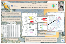
N.W.D. Massey, J. Baker, J.M.S. Vineham, S.L. Oliver and S. Jasechko
In situ measurements of magnetic susceptibility were made on a routine basis at most stations during the 2008 field season in the Whipsaw Creek-Eastgate-Wolfe Creek area. The area is located on the eastern boundary of Manning Park, about 15 km southwest of the town of Princeton. The geology of the area is described in Massey et al (2009a, 2009b).
The measurements were made using a Exploranium KT-9 kappameter. Ten individual readings were taken scattered over the outcrop at each station and the average recorded. Data for each station is tabulated in the MS Excel file and summarized by stratigraphic unit in Table 1 and Figure 1 on the accompanying poster.
References:
Massey, N.W.D. , Vineham, J.M.S. and Oliver, S.L. (2009a): Southern Nicola Project: Whipsaw Creek-Eastgate-Wolfe Creek area, southern British Columbia, (NTS 92H/01W, 02E, 07E, 08W); in Geological Fieldwork 2008, B.C. Ministry of Energy, Mines and Petroleum Resources, Paper 2009-1, pages 189 - 204.
Massey, N.W.D. , Vineham, J.M.S. and Oliver, S.L. (2009b): Geology and mineral deposits of the Whipsaw Creek-Eastgate-Wolfe Creek area, British Columbia, (parts of NTS 92H/01W; 92H/02E; 92H/07E; 92H/08W); B.C. Ministry of Energy, Mines and Petroleum Resources, Open File 2009-8: 1:30 000-scale.
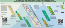
This collaboration of the British Columbia Geological Survey, Geological Survey of Canada and Geoscience BC brings together experts in geophysical, geochemical, bedrock and surficial geology to use new information to create a better bedrock map for the poorly exposed region along the belt from Williams Lake north through Prince George to Williston Lake. It concentrates primarily on geophysical and geochemical data recently acquired by Geoscience BC through its QUEST Program. The new bedrock map will be made through a training and awareness raising workshop (done) and followup interpretation, drafting, evaluation and finalization of a the new map. The workshop was held March 11 - 13, 2009.
This poster highlights the project, its key data sets, its approach, the principle experts, some interesting geological interpretations and the anticipated product.
This work is a contribution to the Edges Project of the Natural Resources Canada, GeoMapping for Energy and Minerals Program (GEM).
N. Barlow
Also published as Geoscience BC Report 2009-17
This project resulted in the addition to Property File of 2860 documents and maps from the QUEST areas. The items, which are from the Cyprus-Anvil, Chevron, Placer Dome and Rimfire collections, were scanned, indexed and cross-referenced with related MINFILE occurrences. In total, 481 MINFILE occurrences were updated and 17 new MINFILE occurrences were identified.
Geoscience BC Report 2009-17 includes a description of the project, a table of the items added with links to the documents, and KML files for the 17 new and 481 updated MINFILE occurrences. BCGS GeoFile 2009-10 compliments these components with display and links to reports of the new and updated occurrences on the BCGS Geoscience, Exploration Assistant, QUEST, and QUEST-West maps. The download ZIP file contains extract tables from MINFILE and MapPlace. The layers are located in the Mineral Inventory Layers group in the maps.
References and Links:
Barlow, N. (2009): QUEST Project Property File Update; Geoscience BC Report 2009-17 and BC Ministry of Energy, Mines and Petroleum Resources Geofile 2009-10.
GeoFile Components:
-
MS Access database containing three tables; 481 updated MINFILE, 17 new MINFILE, table of scanned documents.
-
Two each of Excel, KML, DBF, and Shape files containing the updated and new MINFILE occurrences.
2008
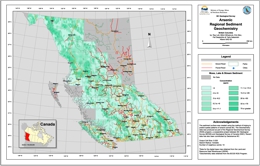
R.E. Lett, T. Nakanishi, E. Man, P.J. Desjardins, M.G. Mihalynuk
British Columbia is suited for using drainage geochemistry to find new mineral resources. As a result the British Columbia Geological Survey started a regional stream sediment and stream water geochemical survey (RGS) in 1976 as part of the Geological Survey of Canada National Geochemical Reconnaissance Program. This survey now covers about 70 percent of the province with field and analytical data from the collection and analysis of over 55 000 stream sediment, lake sediment, moss mat sediment and surface water samples.
Geofile 2008-1 is an atlas of gold, arsenic, cobalt, copper, iron, manganese, molybdenum, nickel, lead, uranium and zinc geochemical maps created from the analyses of stream, lake and moss sediment samples collected throughout British Columbia. Background variations between some of the elements in the different samples types have been reduced by adjusting the source data using levelling procedures. The atlas maps are accompanied by element data files and documentation.
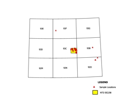
C.R. Peat, M.G. Mihalynuk, T. Ferbey, and L.J. Diakow
GeoFile 2008-2 is part of an ongoing programme to help reduce the economic impact on communities within British Columbia that have been affected by the widespread infestation of mountain pine beetle. The programme aims to promote mineral exploration in areas where logging is the dominant industry, as logging activity is expected to decrease once the dead trees no longer have any economic value.
The Chezacut area was targeted for revision mapping because of relatively good logging road access and a historical lack of mineral exploration that we believed to be unwarranted. Significant mineralization was discovered during the first two weeks of mapping. Geological mapping demonstrated that rock exposures are more extensive and Chilcotin basalt is less extensive than previously recognized, giving incentive for future mineral exploration in the area.
GeoFile 2008-2 presents lithogeochemical data from rock samples collected with the Chezacut map area, which is located on British Columbia’s Fraser Plateau (part of the Interior Plateau physiographic region). Refer to Open File 2008-2: Chezacut area Geology (93C/08) by Mihalynuk et al. for more details on the bedrock geology of the map area.
References:
Mihalynuk, M.G., Peat, C.R., Orovan, E.A., Terhune, K., Ferby, T. and McKeown, M.A. (2008): Chezacut area geology (NTS 93C/8); BC Ministry of Energy, Mines and Petroleum Resources, Open File 2008-2, 1:50 000 scale.
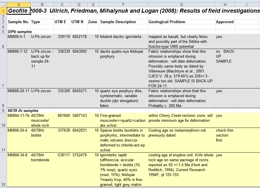
T. Ullrich, R.M. Friedman, M.G. Mihalynuk and J.M. Logan
GeoFile 2008-3 is part of a Provincial program to stimulate economic diversification British Columbia communities which have been adversely impacted by the Mountain Pine Beetle. Southern interior portions of British Columbia that have been most severely affected by the Mountain Pine Beetle are included in the Beetle Impacted Zone (BIZ).
Geofile 2008-3 includes the raw digital data files for age determinations made as part of reconnaissance field investigations in the BIZ. This information will be of interest mainly to geochronologists who wish to assess the quality of the isotopic age data presented in Mihalynuk et al. (2008). Most users will find the geochronological synopsis presented in Mihalynuk et al. (2008) of more utility as it is presented together with geological background and significance of the age determinations. Location information for other samples collected for isotopic age dating as part of the study, but yet to be released, is also included in Geofile 2008-3. All data and original plots are included as worksheets in “Geofile2008-3_UllrichEtAl.xls”.
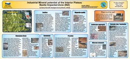
Z.D. Hora
GeoFile 2008-4 is part of a Provincial program to stimulate mineral exploration and economic diversification within British Columbia communities which have been adversely impacted by the Mountain Pine Beetle. Southern interior portions of British Columbia that have been most severely affected by the Mountain Pine Beetle are included in the Beetle Impacted Zone (BIZ).
Geofile 2008-4 includes the digital version of a poster display created to heighten awareness about the potential for industrial mineral discovery and development within the BIZ. Information on product value, markets and exploration criteria are presented. This poster will be of most interest to those with a budding interest in industrial mineral exploration in Interior British Columbia. This poster was first presented at the Mineral Exploration Roundup 2008, in Vancouver.
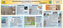
M.G. Mihalynuk and C.R. Peat
Geofile 2008-5 is part of a Provincial program to help reduce the long term economic impact of the Mountain Pine Beetle through support of economic diversification. The program includes geological mapping projects aimed at locating areas of potential interest to the mining and oil and gas industries. Geofile 2008-5 the digital version of a poster display highlighting the results of mapping in the Chezacut area (NTS 93C/08). It was first presented at Mineral Exploration Roundup 2008, in Vancouver.
The Chezacut mapsheet, part of the Anahim area, is ~200 kilometres west of Williams Lake. It was targeted for geological mapping because of a historical lack of mineral exploration. A network of logging roads that today provide access to large parts of the area, did not exist in the late 50’s, when regional geological mappers last passed through the region.
Geological mapping does not specifically focus on the search for mineral occurrences, but occasionally significant mineralization is discovered during the course of mapping. During the summer of 2007, mapping crews in the Chezacut area discovered five mineralized zones in a ~1000 km2 area where only one mineral occurrence was known previously.
One of the zones, called the “Vampire”, is of particular interest. Altered and mineralized volcanic rocks can be traced in sparse outcrops for over 100 metres. Analysis of a 1.1-metre zone speckled with copper sulphide minerals retuned over 0.2% copper.
Detailed technical and location data can be obtained from the Technical Background.
In another zone, called the “Orovain”, subparallel veins ~1 metre apart cut volcanic rocks over a 50 by 75-metre area. Most of these veins carry traces of mineralization, with the most mineralized containing more than 1% copper and 3 g/t silver.
A third zone, called the “Pyro”, is a coarsely fractured rock cemented by iron and manganese oxide minerals over a 10 by 25-metre area. Oxide material has elevated zinc (to 0.3%), silver (11 ppm), bismuth (30 ppm) and gold (0.16 ppm) contents.
The new showings span the Chezacut area and occur primarily in the oldest rock package which is now known over more than twice the area as previously mapped. Young basaltic and glacial cover in the region are an exploration hindrance. However, neither is as extensive as has in the past been generally assumed. These discoveries demonstrate the untapped mineral potential beneath the beetle-infested forests of Interior British Columbia.
R.J.W. Turner and R.G. Anderson, Geological Survey of Canada; R. Franklin, North Saanich; M. Cathro, Consulting Geologist; B. Madu, British Columbia Ministry of Energy, Mines and Petroleum Resources; C.Huscroft, E.Frey, and K. Favrholdt, Thompson Rivers University
Also published as GSC Open File 5810
This new, Geotour Guide for Kamloops, BC, provides a rich source of local earth-science information for teachers, prospectors, students, visitors, and interested residents. The 16 stops described in this colour guidebook tour the reader through the geology and geography of the Kamloops area. Highlights include a canyon walk through ancient volcanoes, a look at ancient fossil beds and a discussion of how dykes protect the city from flooding. The guidebook also shows how the city depends on earth resources like sand and gravel, clean water sources and how the earth accommodates waste materials.
Kamloops’ mining history is highlighted by a stop at Highland Valley Copper mine as well as the Lafarge limestone quarry. Colour illustrations and photos help make this guide easy to follow and understandable.
R. Lett, J. Logan and Z. Sandwith
Copper mineralization has been found during past exploration of the JEN mineral claims (Murray Property) near the Blackwater River and the published results of a government regional geochemical survey detected up to 138 ppb Au in the sediment collected from streams draining the claims. Geofile 2008-7 documents the results of detailed geochemical sampling and a geological examination of selected outcrops in the area.
Geofile 2008-7 is an example of a multi-media geochemical orientation study combined with detailed geological mapping aimed at better understanding the relationship between mineralized bedrock and the geochemistry of the overlying soil and steam sediment. High nickel and chromium in bedrock reflect mafic to ultramafic rocks within a shear zone. Anomalous gold levels in moss sediment from a creek east of the shear zone and the presence of several gold grains isolated from the bulk sediment heavy mineral concentrate may be evidence of near-by concealed gold mineralization.
R.E. Lett
There is a good potential for discovering new metallic mines on Vancouver Island because much of the geology that has formed through the evolution of island arc-related rock suites is a favourable host for a range of mineral deposit types including porphyry Cu-Mo, volcanic massive sulphides and skarn mineralization. In addition to past and present producing mines such as Island Copper and Myra Falls, numerous mineral occurrences have been found and are still being developed.
Vancouver Island is also ideal for testing new geochemical exploration methods because it not only has varied geology, numerous mineral occurrences and different styles of metallic mineralization, but has also contrasting local climates, different surficial environments and physiographies. These features were incentives for the staff of the applied geochemical unit in the British Columbia Geological Survey to carry out a number of orientation studies in 1987 and 1988 with the aim of improving drainage geochemical survey techniques on Vancouver Island. Results of the studies were fully documented but were never reported at that time. Geofile 2008-8 contains full details of these geochemical studies.
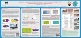
G.J. Simandl and L. Simandl
Portland cement production is an energy intensive process involving the use of fossil fuels. Cement plants are considered to be significant stationary sources of greenhouse gas emissions. The cement industry is succeeding in the reduction of “Fuel-related” CO2 emissions per tonne of cement produced by increasing the efficiency of cement making equipment, increasing the use of biofuels and alternative fuels, and by reducing the use of Portland Cement through the increased use of blended cements (without sacrificing quality).
This poster introduces the cement-making process, describes how CO2 is generated during Portland cement production, explains the blended cement concept, and demonstrates how the increased use of blended cement is resulting in substantial reductions of CO2 emissions.
Blended cement has chemical and physical properties similar to those of traditional Portland cement (the main cementitious material used to make concrete); however, it commonly consists of 10-30% (in some cases up to 50%) additives that do not require, or require only low temperature calcining. These additives are supplementary cementitious materials (SCMs) or natural pozzolans. They include fly ash, silica fumes, volcanic ash, scoria, pumice, silica sinter, metakaolin, slags, zeolites, diatomaceous earth, rice husk ash, calcined shale, and a number of other materials. As a result, the production of blended cement requires the combustion of a smaller quantity of fossil fuels than Portland cement. The reduction in the use of Portland cement also lowers the level of raw material - related emissions emitted by the calcination of limestone.
The most common secondary cementitious material in British Columbia (BC) is imported fly ash. BC has a variety of locally available secondary cementitious resources. Most of these resources are undeveloped and a lot of them remain untested.
In BC, the substitution of imported fly ash by domestically available pozollans would not be without challenges, but if economically and technically viable, it could benefit the mining industry, help the environment by reducing CO2 emissions and create employment.
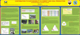
L. Simandl
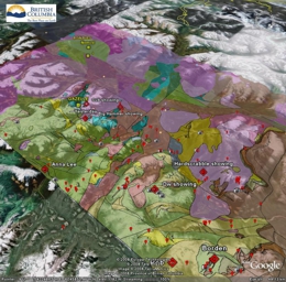
J.L. Nelson, M. McKeown, Y. Cui, P. Desjardins and T. Nakanishi, F. Shirvani
GeoFile Components:
-
ESRI Shape file exports of Terrace geology and contacts (ZIP, 1.6 MB)
-
Manifold map of Terrace East Half, including new mappings of 103I 08,09,10,16 (ZIP, 665 KB)
-
Rock Assay data 2005-2008 (ZIP, 64 KB)
-
KML/KMZ Files for use in viewers such as Google Earth (ZIP, 1.2 MB)
-
Terrace Photos (ZIP, 35.5 MB)
-
Terrace Geology Map on MapPlace
For more details about this project see references below.Geofile 2008-11 presents for the first time in digital form the geology and mineral deposit potential of the Terrace area of northwestern British Columbia. It provides an easy-to-use introduction to the geology and exploration potential of the area. This release presents results of the ongoing Terrace Geological Mapping and Mineral Assessment Project which is now in its third year with publication of three 1:50,000 geological maps. This data release gives direct access to the digital files and geoscience data generated during the project.
Available Datasets
The GIS compatible data files on this CD represent a major part of the ouput of the 4 year, ongoing Terrace Geological Mapping and Mineral Assessment Project. The shape (.shp) files can be downloaded and incorporated into standard GIS software packages.
A Manifold GIS Map file that contains all of the layers used to build the Terrace map is above. We also welcome user comments to make this style of product more useful.
Also included are KML (.kml/.kmz) files for use in Google Earth – simply open GE then drag and drop the files from their folder into it. The following KML layers were generated for the project area: new rock geochemical analyses from the project, MINFILE and groups of mineral occurrences such as porphyry Mo associated with Eocene plutons; selected project photographs, and a new geological compilation that integrates 2005-2007 project mapping.
Finally, the Terrace Service Directory offers an introduction to services of use to explorationists in the area.
Notes on using the .kml files
Note that there are 2 separate files presenting assay data. They both present the same data set, which includes all of the analyses in 2006 through 2008 publications. They differ in the “look” of the data. The file Terrace assays with symbols.kmlshows symbols of varying size corresponding to concentrations of a given element, with different symbols/colours corresponding to the four key elements copper, gold, silver and molybdenum. Double clicking on an individual symbol will display the sample number and complete analysis. In the file Terrace photos and assays.kml, clicking on the “Au, Ag, Cu, Pb, Zn” in the left-hand menu and then double clicking on an individual sample will display assay results for these elements. If a single element is chosen in the left hand menu, tilt Google Earth to a slanted perspective, and the element will appear as a scaled column relative to its value. In this file, click “Turn off layers” in the left hand column under Geochemistry in order to view the photographs more clearly.
References:
Nelson, J.L., Barresi, T., Knight, E. and Boudreau, N. (2006a): Geology and mineral potential of the Usk map area (103I/09) near Terrace, British Columbia; B.C. Ministry of Energy, Mines and Petroleum Resources, Geological Fieldwork 2005, Paper 2006-1, pages 117-134.
Nelson, J.L., Barresi, T., Knight, E. and Boudreau, N. (2006b): Geology of the Usk map area (193I/09); B.C. Ministry of Energy, Mines and Petroleum Resources Open-File 2006-3, 1:50,000 scale.
Nelson, J.L. and Kennedy, R. (2007a): Terrace regional mapping project Year 2: New geological insights and exploration targets (NTS 103I/16S, 10W), west-central British Columbia; BC Ministry of Energy, Mines and Petroleum Resources Geological Fieldwork 2006, Paper 2007-1, pages 149-162.
Nelson, J.L., Kennedy, R., J. Angen and S. Newman (2007b): Geology of the Terrace Map Area (103I 9,10,15,16), British Columbia; BC Ministry of Energy, Mines and Petroleum Resources Open-File 2007-4, 1:70,000.
Nelson, J.L., Kyba, J., McKeown, M. and Angen, J., in preparation: Geology of the Chist Creek map area (103I/08); B.C. Ministry of Energy, Mines and Petroleum Resources Open-File 2008-3, 1:50,000.
Nelson, J.L., Kyba, J., McKeown, M. and Angen, J. (2008, this volume): Terrace Regional Mapping Project Year 3: Contributions to Stratigraphic, Structural and Exploration Concepts Zymoetz River to Kitimat River, 103I/08; BC Ministry of Energy, Mines and Petroleum Resources, Geological Fieldwork 2007, Paper 2008-1, pages 159-174.
McKeown, M., Nelson, J.L. and Friedman, R.(2008): Newly discovered VHMS potential within Paleozoic volcanics of the Stikine assemblage, Terrace area, northwestern B.C.; B.C. Ministry of Energy, Mines and Petroleum Resources, Geological Fieldwork 2007, Paper 2008-1.
Hooper, D.G. (1984): Geological report on the Gazelle claim, record number 4229; B.C. Ministry of Energy, Mines and Petroleum Resources, Assessment Report 12717, 41 pages.
Hooper, D.G. (1985): Gazelle claim geological report; B.C. Ministry of Energy, Mines and Petroleum Resources, Assessment Report 14076, 25 pages.
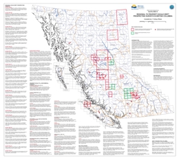
Superseded by Open File 2019-04
T. Ferbey
Presented here is a geographically referenced list of drift prospecting surveys that have been conducted in British Columbia. A list of topical studies and special volumes that are relevant to drift prospecting in British Columbia have also been included. These studies and geochemical data will be of interest to explorationists and researchers who are assessing the effectiveness of drift prospecting surveys in the context of their own exploration or research program, who are preparing to design and implement their own survey, or who have generated geochemical data on drift samples and are looking for data from orientation surveys for comparison.
This map and list of references is intended to provide a way of quickly identifying drift prospecting studies and data that are either geographically or topically of interest to those working in British Columbia. Any omission in the reference list or on the map should be brought to the attention of the compiler. This publication will be updated on an annual basis.
Related References: GeoFile 2008-13 - British Columbia Till Geochemical Survey Data Compilation
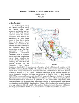
R.E. Lett
Since 1991 the BC Geological Survey and Geological Survey of Canada have carried out regional till geochemical surveys in the central and southern parts of the province and on Vancouver Island. More than 5700 samples of till have been collected and analysed for trace elements and major oxides. Most results have been previously released by the BC Geological Survey, Geological Survey of Canada and Geoscience BC.
Geofile 2008-13 is a Microsoft Excel spread sheet containing all of the analytical results published to date with additional previously unpublished data from the Mount Milligan area. All of the samples have been classified by bedrock geology and glacial sediment type based on information recorded in the data source document. A text file explaining the data file structure and with element statistics accompanies the data file.
2007
R.J.W. Turner, R. Franklin, M. Ceh, C. Evenchick, N. Hastings, N. Massey, and P. Wojdak
The Geological Landscapes Highway Map for Northern British Columbia results from a cooperative project between the Geological Survey of Canada and the British Columbia Geological Survey.
The maps are designed to provide visual material explaining some of the more interesting geological features commonly seen while travelling the various highways in the northern part of the province. The land is viewed through "geological eyes" and the map's many colours represent the different geological materials that underlie this diverse landscape. The accompanying photos and illustrations, with the text explanations, help to explain what the various mountain chains are composed of, why is farmland typically so flat, and why there are so few outcrop exposures between Prince George and Smithers, etc.
Northern BC is a highly diverse landscape composed of many elements which are interesting in their form and because of the processes which led to their creation.
Interestingly, the maps also provide information on the mines which have contributed to the social fabric and community well-being in the Province's north, some of which still provide jobs and significant economic benefits to their surrounding communities. Additionally, some of the more significant major prospects, e.g. Galore Creek (6), are also located and these will prove to be significant economic assets for communities and the province well into the future.
This map complements the Southern British Columbia Geological Landscapes Highway Map, which was released in 2012 as GeoFile 2012-09
Digital copies can also be downloaded from the Geological Survey of Canada (GEOSCAN Natural Resources Canada). In French or English.
D.G. MacIntyre
GeoFile Components:
- ESRI Shape Files:
Geoscience Map 1995-1: Geographic Projection (ZIP, 1.1 MB)
Geoscience Map 1995-1: UTM Projection (ZIP, 1.2 MB)
Geoscience Map 2004-1: Geographic Projection (ZIP, 388 KB)
Geoscience Map 2004-1: UTM Projection (ZIP, 391 KB)
Southeast Geology: Geographic Projection (ZIP, 76.2 MB)
Southeast Geology: UTM Projection (ZIP, 51.2 MB)
MapPlace Layers: Geoscience Map 1995-1; Geoscience Map 2004-1 - Manifold GIS Map files:
Geoscience Map 1995-1: Purcell Supergroup (ZIP, 30.8 MB)
Geoscience Map 2004-1: Geology of the St Mary Map Sheet (ZIP, 2.1 MB)
Southeast Geology (ZIP, 118.5 MB) - KML Files for use in viewers such as Google Earth (ZIP, 483 KB)
- Belt-Purcell Metallogenic Map on MapPlace
Geofile 2007-2 presents GIS data and interactive map on the geology and mineral deposits of the Belt-Purcell Basin area of Southeast British Columbia. The data and map were compiled by D.G. MacIntyre and Associates Ltd. on contract to Natural Resources Canada as part of a Targeted Geoscience Initiative (TGI-3) program, covering the Belt Purcell Basin and Kootenay Arc regions of southeastern B.C. This Geofile is the primary vehicle for distributing map based geoscience data and linking to the compilation map from this project.
Downloadable Datasets
A key objective of the Belt-Purcell project was to generate a series of GIS compatible data files that could be downloaded and incorporated into standard GIS software packages. The files are available as ESRI shape files. Two projections are currently available – UTM and Geographic. Also included for download is a Manifold GIS Map file that contains all of the layers used to build the Belt-Purcell metallogenic map. These include Manifold Map files from Geoscience Map 1995-1 and Geoscience Map 2004-1. Manifold also supports the creation of KLM files for use in viewers such as Google Earth. KML layers generated for the project area are: RGS silver, lead and zinc anomalies, Sedex deposits, and geology layers, including Upper, Lower and Middle Aldridge formation, Moyie Sills, faults and marker units.
References:
Höy, T., Price, R.A., Legun, A., Grant, B. and Brown, D. (1995): Purcell Supergroup, Southeastern British Columbia, Geological Compilation Map (82G, F, E; 82J/SW, 82K/SE); B.C. Ministry of Energy and Mines, Geoscience Map 1995-1, scale 1:250,000.
Höy, T. and Jackaman, W. (2004): Geology of the St. Mary map sheet (NTS 82F/09); B.C. Ministry of Energy and Mines, Geoscience Map 2004-1, scale 1:50,000.
Trygve Höy, Derek Brown and others, Tectonostratigraphic Map Purcell Supergroup (841KB in PDF) produced in MapInfo by Kennecott Canada Exploration Inc., April 19, 1999. BCGS Open File 2000-32
D.G. MacIntyre
Also published as Geoscience BC Report 2007-05
GeoFile Components:
- ESRI Shape Files:
Geographic (Longitude-Latitude) Projection (ZIP, 15.8 KB)
UTM Projection (ZIP, 15.2 KB) - Manifold GIS Map file (ZIP, 53 MB)
- KML Files for use in viewers such as Google Earth (ZIP, 9 MB)
- Skeena Arch Geology and Mineral Deposit Map on MapPlace
Geofile 2007-3 (Geoscience BC Report 2007-5) presents the geology and mineral deposits of the Skeena Arch area of West Central British Columbia. This project was funded by Geoscience BC (Contribution Number GBC047). This Geofile is the primary vehicle for distributing map-based geoscience data and linking to the map from this project. For more details about this project go to Geological Fieldwork 2005, pages 303-312 and Geological Fieldwork 2006, pages 333-340.
Downloadable Datasets:
A key objective of the Skeena Arch project was to generate a series of GIS compatible data files that could be downloaded and incorporated into standard GIS software packages. The files are available as ESRI shape files because this format can be used in almost all commercially available GIS packages including ESRI’s free Arc Explorer (desktop version now retired). Two projections are currently available – UTM and Geographic. Also included for download is a Manifold GIS Map file that contains all of the layers used to build the Skeena Arch metallogenic map. Manifold also supports the creation of KLM files for use in viewers such as Google Earth. The following KML layers were generated for the project area: RGS, copper and molybdenum anomalies; MINFILE and Porphyry Cu-Mo and Mo occurrences; geology layers, including Babine, Bulkley and Nanika intrusive suites, faults and marker units; and logging roads.
References:
Massey, N.W.D., MacIntyre, D.G. and Desjardins, P.J., (2003): Digital Geology Map of British Columbia: Tile NN9 North Coast, B.C. Ministry of Energy and Mines, Geofile 2003-13, scale 1:250,000.
Massey, N.W.D., MacIntyre, D.G., and Desjardins, P.J., (2003a): Digital Geology Map of British Columbia: Tile NO9 North Central B.C., B.C. Ministry of Energy and Mines, Geofile 2003-18, scale 1:250,000.
MacIntyre, D.G., (2006): Geology and Mineral Resources of the Skeena Arch, West-Central British Columbia: A Geoscience BC Digital Data Compilation Project (parts of NTS 093E, L, M, 094D, 103I and 103P), in Geological Fieldwork 2005, B.C. Ministry of Energy, Mines and Petroleum Resources, Paper 2006-1, pages 303-312.
MacIntyre, D.G., (2006): Geology and Mineral Resources of the Skeena Arch, West-Central British Columbia: Update on a Geoscience BC Digital Data Compilation Project (parts of NTS 093E, L, M, 094D, 103I, P), in Geological Fieldwork 2006, B.C. Ministry of Energy, Mines and Petroleum Resources, Paper 2007-1, pages 333-340.
M.G. Mihalynuk, L.L. Harker, R.E. Lett, B. Grant
Geofile 2007-05 is part of an economic diversification initiative by the Province of BC, which aids communities affected by the Mountain Pine Beetle.
Pine forests extend across much of the interior plateau of southern British Columbia where they are the principal commercial tree species. These forests are infested by the Mountain Pine Beetle, and it is estimated that by 2016 less than ~10% of the already diminished 2006 volume of pine will be left standing. Economic welfare of the many forestry-dependent communities in the Beetle Infested Zone (BIZ) will be severely impacted. Anticipating an economic downturn in the forestry sector, the Provincial Government is supporting economic diversification throughout the region via stimulation of other industries. Work presented in Geofile 2007-05 is a part of that provincial effort aimed at stimulation of new jobs in the high-paying mineral exploration and mining industries.
Reconnaissance field studies conducted during 2006 as part of the BIZ Project were aimed at optimizing the design of future BC Geological Survey field programs within the BIZ. A principal objective of the project is to demonstrate how application of conventional and non-conventional exploration techniques can be successfully applied to large tracts of the BIZ, and how geoscientific information can best benefit British Columbians living within the BIZ.
Results of the 2006 program are presented in Geofile 2007-05 as two parts:
Part A provides a summary of 2006 BIZ project activities
Part B presents analytical results together with annotations and maps. Specific results included within Part B are:
- data from analysis of stream sediment samples collected from in and around the BIZ (.xls)
- lithogeochemical data from rock samples collected (.xls)
- analytical data from samples containing native copper prepared using variable grinding times and digestion - techniques with the aim of accurate determination of copper content (.xls)
- geochemical analysis of sieved and magnetic separates of samples collected from eskers in the Nazko area (.xls)
- magnetic susceptibility data measured on a variety of lithologies within and around the BIZ (.xls)
- compilations of Provincial regional geochemical data contoured for four elements (Au, Mo, U (water), and Th in Manifold .map and .pdf formats)
- thickness model for the Chilcotin Group (Manifold .map format).
R.E. Lett
For many years the BC Geological Survey, jointly with the Geological Survey of Canada, has been carrying out regional geochemical drainage surveys across the province using a variety of sample types and collection techniques. The primary objective is to assist prospectors and companies to locate new mineral occurrences. Stream sediment sampling is the most commonly used method to identify areas of high mineral potential but collecting moss-sediment; lake-sediment and heavy minerals are also useful techniques to help locate hidden ore deposits.
This publication contains the material presented at the recent "Exploration 2007" workshop in Toronto, and presents different drainage sampling methods, and shows their usefulness in regional exploration for base and precious metals.
British Columbia is suited for using drainage geochemistry to find new mineral resources. As a result the British Columbia Geological Survey started a regional stream sediment and stream water geochemical survey (RGS) in 1976 as part of the Geological Survey of Canada National Geochemical Reconnaissance Program. This survey now covers about 70 percent of the province with field and analytical data from the collection and analysis of over 50 000 stream sediment, lake sediment and surface water samples.
Geofile 2007-6 contains the slides and notes presented as part of a workshop titled “Exploration Geochemistry – Basic Principals and Concepts” given as part of Exploration 07, the 5th Decennial International Conference on Mineral Exploration, Toronto, Canada. The presentation aimed to illustrate examples of the survey techniques such as the design, sampling methods for stream sediment, water, lake sediment moss sediment and heavy minerals in addition to quality control procedures, sample preparation and sample analysis.
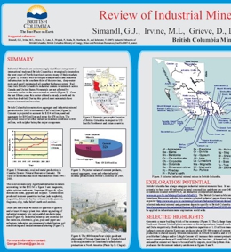
G.J. Simandl, M.L. Irvine, D. Grieve, R. Lane, P. Wojdak, B. Madu, B. Northcote, and T. Schroeter
This Geofile reviews British Columbia's construction aggregate and industrial mineral production for 2006. Displayed are a number of industrial mineral deposits and selected market trends. It provides a guide to industrial mineral potential in BC.
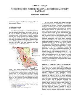
R.E. Lett and B. Bluemel
This Geofile (with Appendices A-C) reviews the Mining of the BC Regional Geochemical Survey Database. Stream sediment and water sampling covers much of British Columbia and the multi-element geochemical data generated from the reconnaissance scale surveys helps locate hidden ore deposits. This poster and accompanying text highlight new gold exploration targets that have been identified by interpreting regional stream sediment survey geochemistry. Geofile 2007-9 also contains new data from the analyses of rock samples collected during geochemical surveys in the Lillooet area.
B. Turner, J. Nelson, G. Weary, T. Walker, B. Hayward, C. McRae
This NEW, Geotour guide for Terrace, BC, puts a rich source of local earth-science information in the hands of teachers, prospectors, students, visitors and interested residents. The 15 stops described in this lively guidebook take the reader through the bedrock and glacial history of the Terrace area, natural hazards, recent events in geological history such as the 250 year old Nass basalt eruption and the joys of the deeply-sourced Lakelse hotsprings. It also shows how the community depends on earth resources like sand and gravel and sources of clean water; and how the earth accommodates waste materials.
Terrace's interesting mining history is highlighted by a stop at Heritage Park. Colour illustrations and clear directions aid in communicating this fascinating earth story.
See GeoFile 2010-12 for updated version.
T. Schroeter, J. Pardy, D. Yu, and E. Man
This Geofile lists BC Mineral Industry Information Sources with contact numbers and e-mail address from within government and industry. This list consists of organizations, data, directories, publications, conferences/meetings, websites, and information on places to purchase mineral resource maps, data, and publications.
2006
R.E. Lett, S. Cook, and V. Levson
Geofile 2006-1 describes a till geochemical survey covering roughly 3500 km2 over the eastern part of the Anahim Lake map sheet (NTS 93C). Miocene basalt and glacial sediments cover much of the area and these add to the challenge of identifying targets of economic interest. The result is that there are only five mineral prospects known in the region. A total of 330 till samples were analysed for trace elements including gold and copper, and major oxides by a combination aqua regia digestion – inductively coupled plasma emission spectrometry (ICP-ES), instrumental neutron activation (INAA) and lithium metaborate fusion – ICP-ES. Anomalous results highlight the existing Clisbako and Oboy Au prospects and outline several other areas with a potential for additional epithermal Au mineralization.
G.J. Simandl, S. Paradis, N. Robinson, and L. Simandl
This GeoFile reviews British Columbia's potential for marketable Brucite. Brucite is an ore of magnesium metal and raw material for magnesia production. It is an industrial mineral with an excellent market growth potential over the next 5 to 10 years. It is used in a variety of niche markets as a functional filler and flame retardant. There are several brucite occurrences in British Columbia where extent of brucite-bearing zone and its content are unknown and worthy of geological follow-up.
W. Jackaman and P.F. Matysek
Geofile 2006-4 was published as part of the British Columbia Regional Geochemical Survey (RGS) Program. This Geofile includes analytical data and field observations compiled from a reconnaissance-scale stream sediment and water survey conducted in NTS map sheets 114O - Yakutat and 114P - Tatshenshini during the 1992 field season. A total of 890 sediment and 873 water samples were collected from 839 sample sites.
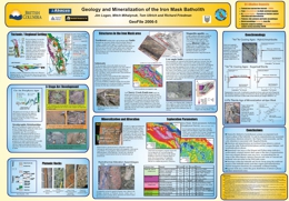
J. Logan, M.G. Mihalynuk, T. Ullrich and R. Friedman
This Geofile reviews the regional geological setting, tectonics, geochronology, geophysics, mineralization and alteration characteristics of the Iron Mask Batholith. Displayed are vein and porphyry related economic deposits associated with the batholith. It provides some exploration guidelines and conclusions on the characteristic geological features common to the batholith.
This poster was created for the KEG 2006 Conference. The Iron Mask survey was delivered through support from the Rocks to Riches (AMEBC) program and Geoscience Partnerships developed between Abacus Mining and Exploration, Imperial Metals Corporation and Nova Gold Corporation to study alkaline porphyry copper-gold deposits.
The 1995 Iron Mask Geophysical Survey completed by the Geological Survey of Canada and released as BCMEM Open File 2005-13 and GSC Open File 2817 includes re-contoured residual, vertical gradient and horizontal gradient magnetics and potassium, thorium, uranium, thorium/potassium, uranium/potassium and uranium/thorium plots. PDF theme files are also available in Open File 2006-12: Integrated Airborne Geophysical, Geology and Mineral Occurrence Data, Iron Mask Batholith. Geology of the Iron Mask Batholith is available as Open File Map 2006-11.
M.G. Mihalynuk, B. Grant and S.M.S. Mallory
Manifold® is a full-featured, inexpensive, commercial Geographic Information System (GIS). It costs one or two orders of magnitude less than other GIS software suites that have comparable functionality, and it operates under Windows XP, providing formidable GIS analytical and display capabilities to anybody with a modest budget.
For the production of geological maps, however, Manifold ®1 right out of the box, comes up short. It lacks a library of geological symbols, geological fault symbol line types and patterned fills.
Custom geological symbols can be created for Manifold through the pared-down implementation of Extensible Markup Language (XML). We have used XML to create a more than 180 symbols and two dozen fill patterns ("area styles" in Manifold), and six custom line types (thrust and normal faults) that are available as part of this publication: GeoFile 2006-6. Fifteen digital files comprise GeoFile 2006-6:
This report:
Version 1.7 XML coded symbols and fills for Manifold 6.0 or legacy maps: BCGSgeosymbolV1.7.3.xml
Manifold project file named BC Geological Survey symbols V1.7.3.map (hereafter referred to as V1.7). It includes drawings of version 1.7 (BCGS GeosymbolsV1.7) symbols and fills and tabulation of codes.
Version 1.7 Manifold point style theme: BCGSgeosymbolsV1.7Theme.xml
Version 2.0 XML coded symbols, fills and line styles for Manifold 6.5: BCGSgeosymbolV2.0.4.xml
Manifold project file named BC Geological Survey symbols V2.0.4.map (hereafter referred to as V2.0). It includes drawings and tabulations of the most up-to-date version of symbols, patterned fills and line-types publicly available from the BC Geological Survey (BCGS GeosymbolsV2.0).
Version 2.0 Manifold point style theme: BCGSgeosymbolsV2.0Theme.xml
Portable Network Graphics image files: 8 files, about 800 bytes each, which are shaded, 3-D representations of coloured dew drops. To use these files, they must be copied to a subdirectory of the “Manifold System\Config" directory named “images” i.e.: “…\Manifold System\Config\images”.
Users are urged to use version 2 symbols for best results.
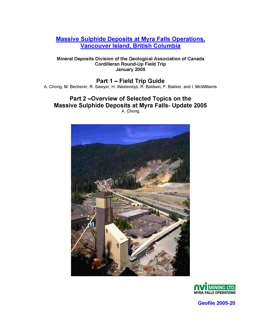
Mineral Deposits Division of the Geological Association of Canada Cordilleran Round-Up Field Trip January 2005
Part 1 – Field Trip Guide - A. Chong, M. Becherer, R. Sawyer, H. Wasteneys, R. Baldwin, F. Bakker, and I. McWilliams
Part 2 – Overview of Selected Topics on the Massive Sulphide Deposits at Myra Falls - Update 2005 - A. Chong
This paper is divided into two parts. The first part is a brief description of the location, infrastructure and general geology. Included in this section is the itinerary and guide for the underground tour.
The second part delves into selected geological aspects by both academic researchers and company geologists. Studies have focused on characterizing the volcanic stratigraphy, paleotopography, lithogeochemistry, structure, specific individual massive sulphide deposits, metal zoning and exploration strategy. Included in this paper is the rich exploration and mining history at Myra Falls, as well as summaries of research and observations describing the VHMS deposits at Myra Falls on a property scale. Topics include synvolcanic faults, footwall and hangingwall hydrothermal alteration, orebody geometries, ore reserves, and property scale metal zoning.
W.E. Kilby and C.E. Kilby
Geoscience BC Report 2006-3 Contribution #GBC 015
Remote sensing images have been continually added to the MapPlace since 2003. The Image Analysis Toolbox (IAT) was created to utilize this data. Making use of such image data is new for many clients of the website. This manual is provided as an introduction to ASTER imagery and to assist users in navigating the toolbox. Portions of this manual are derived from three B.C. Geological Survey papers in Fieldwork: Kilby et al. (2004), Kilby (2005) and Kilby and Kilby (2006), and many other sources noted in the text or under References at the end of the manual.
Advanced Spaceborne Thermal Emission and Reflection Radiometer (ASTER) is an imaging instrument flying on the Terra satellite, launched in late 1999. The instrument has 3 subsystems that capture readings from different portions of the electromagnetic spectrum at different resolutions. The three subsystems are referred to as VNIR (Visible and Near Infrared), SWIR (Shortwave Infrared) and TIR (Thermal Infrared). Reflectance values in the SWIR range are particularly useful in differentiating rock and soil mineralogy related to alteration zones.
An ASTER image contains 14 bands of information, 4 bands in the VNIR with 15 metre resolution, 6 bands in the SWIR with 30 metre resolution and 5 bands in the TIR with 90 metre resolution. Two of the VNIR bands sample the same wavelength range but one is back-looking providing the ability to generate a stereo view of the scene. A single ASTER scene covers an area of about 60 by 60 kilometres. The ASTER web site is an excellent source of information on the instrument, its mission, available imagery, usage examples and analysis tools.
R. Lett and B. Bluemel
Geofile 2006-09 reports new gold and trace metal data from the re-analysis of archived regional geochemical survey samples from the McLeod Lake (NTS 93J, RGS15) map sheet. This digital release consists of reports and appendices in PDF format, plus ZIP files with raw data files in XLS and DBF formats.
Past exploration in the McLeod Lake area has been hampered by a thick glacial sediment blanket. There are 25 reported mineral occurrences of which include 6 gold and 2 copper showings. Part of the map sheet is underlain by Triassic Takla Group rocks that can host significant porphyry gold-copper deposits, such as at Mount Milligan immediately west of the area. In 1985 a regional geochemical survey produced trace element data from the analysis of 1152 stream sediment and 940 water samples taken from 1088 sites over 14 500 km2. The sediment samples were originally analyzed for 19 trace elements including copper, lead, zinc, uranium, fluorine, barium, tin and tungsten. They were also analysed for loss on ignition (LOI). The samples were re-analyzed this year for 37 elements including gold by aqua regia digestion - inductively coupled plasma mass spectrometry (ICP/MS). Up to 147 ppb gold in sediment was detected from an area underlain by Takla rocks.
Geological Mapping References for this area:
Geology of the McLeod Lake map area (93J), British Columbia; Struik, L C. Geological Survey of Canada, Open File 2439, 1994; 18 pages
R. Lett and B. Bluemel
Stream sediment analyses, from several regional geochemical surveys, carried out by the BC Geological Survey in the Bella Coola area of coastal British Columbia have been compiled into a single file for convenience and to accompany recent geological map product releases from the Geological Survey of Canada and the BC Geological Survey. These multi-element data can assist geologists and mineral industry companies in identifying prospective exploration areas for new mines.
Geofile 2006-10 presents analytical data compiled from previous regional geochemical surveys in the Bella Coola (NTS 93D), Whitesail Lake (93E) and Anahim Lake (93C) map sheets, which were release previously. This digital release consists of reports and maps in PDF format, plus ZIP files with raw data files in XLS and DBF formats. The Geofile data product comprises analyses of 790 sample for 17 trace elements, loss on ignition (LOI) and stream water pH extracted from BC Regional Geochemical Survey reports RGS56 and RGS16. These data have been combined into a single file for convenience. Elements selected were determined by similar analytical methods in the two surveys. Element variations across the area are shown as symbol maps.
The Bella Coola-Whitesail Lake area is underlain by Mesozoic Hazelton Group, Coast Complex plutonic rocks and Cretaceous-Tertiary intrusive rock and has the potential for volcanogenic massive sulphide (VMS) mineralization, precious metal vein and Cu-Mo porphyry deposits. A compilation of geosciences information for the Bella Coola area will be published by the Geological Survey of Canada, in cooperation with the BC Geological Survey.
Geological Mapping References for this area:
Haggart, J.W., Diakow, L.J., Mahoney, J.B., Woodsworth, G.J., Struik, L.C., Gordee, S.M., Israel, S., Hooper, R., van der Heyden, P., Rusmore, M., Lett, R.E, Ceh, M., Hastings, N.L and Wagner, C. (2007): Bedrock Geology, Bella Coola Region, British Columbia (NTS 93D/01, /02, /03, /06, /07, /08, /09, /10, /11, 14, /15, /16, 92M/15, /16, 92N/13, 93C/04, /05, 93E/02, /03); Geological Survey of Canada Open File 5410 (CD download), British Columbia Geological Survey Geoscience Map 2006-7.
W. Jackaman
also published as Geoscience BC Report 2006-4
Geofile 2006-11 (Geoscience BC Report 2006-4) reports new regional geochemical drainage sediment – water survey data from the Anahim Lake (NTS 93C) and Nechako River (93F) map sheets. This digital release consists of a survey summary, data listings, statistics and maps in PDF format, plus ZIP files with raw data files in XLS and DBF formats and base data in GIS importable shape files.
There are over 60 base and precious metal occurrences in the Anahim Lake - Nechako River map sheets including several such as the 3T’s and Clisbako, which have extensive exploration history. However, exploration for new deposits has been hampered by widespread glacial sediment and Miocene lava cover. During 2005 a total of 2070 drainage sediment and water samples were collected from 1957 sites covering 19 500 square kilometres. Most of the samples were taken from lakes and analysed for trace and minor elements by instrumental neutron activation and by aqua regia digestion - inductively coupled plasma mass spectrometry (ICP/MS), for loss on ignition (LOI) and for fluorine. Water samples were analysed for pH, conductivity and fluoride. Survey data has been combined with the results of two previous lake sediment and water geochemical surveys (Open File 1994-19) completed near the Fawnie Range and around Ootsa Lake. Gold values up to 694 ppb and copper up to 1536 ppm have been detected in sediment samples.
The 2005 surveys were fully funded by Geoscience BC (Contribution Number GBC016).
C.O. Nass
Also published as Geoscience BC Report 2006-05
Geofile 2006-12 (Geoscience BC Report 2006-5) reports results of regional geochemical drainage sediment – water surveys in the Golden (NTS 82N), Brazeau River (83C), Canoe River (83D) and Mount Robson (83E) map sheets. This digital release consists of reports and maps in PDF format, and appendices in a ZIP format file. This digital release consists of a survey summary, data listings, statistics and maps in PDF format, plus a ZIP file with raw data files in XLS and DBF formats.
Most of the known base and precious metal occurrences are in the Golden map sheet although much of the remaining survey area has a higher potential for metallic and industrial mineral deposits. During 2005 stream sediment and water samples were collected from 1409 sites covering 21 560 square kilometres in southeastern BC. The samples were analysed for trace and minor elements by instrumental neutron activation and by aqua regia digestion - inductively coupled plasma mass spectrometry (ICP/MS), for loss on ignition (LOI) and for fluorine. Water samples were analysed for pH, conductivity and fluoride. Gold values up to 357 ppb and silver up to 1747 ppb were detected in sediment samples from the surveys.
The 2005 surveys were fully funded by Geoscience BC (Contribution Number GBC018).
2005
This publication has been superseded. Download the latest BC bedrock geology
N.W.D. Massey, D.G. MacIntyre, P.J. Desjardins and R.T. Cooney
Digital regional compilations of the geology of B.C. at 1:250 000 scale were made by staff of the BC Geological Survey (BCGS) in 1992-1996 in support of the Mineral Potential Project. These were released as Open Files and digital downloads from the BCGS website.
However, numerous errors and inconsistencies were noted within these data sets. The Digital Geology Map of British Columbia Project was designed to address these problems and, in the process, try to produce a seamless digital map of the Province with consistent geological tagging. Where feasible, updates to the geology have also been incorporated during the editing process. However, some “scratch lines” remain in the data reflecting problems due to unresolved differences in geological designations in original sources.
Release of the recompilation is based on the same tiles as the Cordilleran GIS Map Library (Journeay and Williams, 1995) which conforms to the International Map of the World standard used for indexing 1:1,000 000 scale topographic maps. This differs from the numbering convention used for the National Topographic System maps. Preliminary versions of the tiled data were released in 2003, with updates in 2004. This new province-wide version, and associated tiled data, supersedes the earlier files.
All data sets are in shape file format that should be readily usable by most GIS software. They are presented as either decimal degrees (suffix _ll) or BC Albers (suffix _alb). Tiled data are also available in UTM (suffix _utm) projections. All projections use NAD83 as the datum. The data sets are intended to be used at 1:250 000 scale and their use at greater scales is not recommended.
The shape files include .AVL files suitable for symbolization by ArcView 3.x users. A style sheet (BCDigitalMap.style) for ArcMap 8.x users is also available for download.
Download GeoFile 2005-01 (ZIP, 516 MB)
This publication has been superseded. Download the latest BC bedrock geology

This publication has been superseded. Download the latest BC bedrock geology
N.W.D. Massey, D.G. MacIntyre, P.J. Desjardins and R.T. Cooney
Digital regional compilations of the geology of B.C. at 1:250 000 scale were made by staff of the BC Geological Survey (BCGS) in 1992-1996 in support of the Mineral Potential Project. These were released as Open Files and digital downloads from the BCGS website.
However, numerous errors and inconsistencies were noted within these data sets. The Digital Geology Map of British Columbia Project was designed to address these problems and, in the process, try to produce a seamless digital map of the Province with consistent geological tagging. Where feasible, updates to the geology have also been incorporated during the editing process. However, some “scratch lines” remain in the data reflecting problems due to unresolved differences in geological designations in original sources.
Release of the recompilation is based on the same tiles as the Cordilleran GIS Map Library (Journeay and Williams, 1995) which conforms to the International Map of the World standard used for indexing 1:1,000 000 scale topographic maps. This differs from the numbering convention used for the National Topographic System maps. Preliminary versions of the tiled data were released in 2003, with updates in 2004. This new province-wide version, and associated tiled data, supersedes the earlier files.
All data sets are in shape file format that should be readily usable by most GIS software. They are presented as either decimal degrees (suffix _ll) or BC Albers (suffix _alb). Tiled data are also available in UTM (suffix _utm) projections. All projections use NAD83 as the datum. The data sets are intended to be used at 1:250 000 scale and their use at greater scales is not recommended.
The shape files include .AVL files suitable for symbolization by ArcView 3.x users. A style sheet (BCDigitalMap.style) for ArcMap 8.x users is also available for download.
Download GeoFile 2005-02 (ZIP, 38.3 MB)
This publication has been superseded. Download the latest BC bedrock geology

This publication has been superseded. Download the latest BC bedrock geology
N.W.D. Massey, D.G. MacIntyre, P.J. Desjardins and R.T. Cooney
Digital regional compilations of the geology of B.C. at 1:250 000 scale were made by staff of the BC Geological Survey (BCGS) in 1992-1996 in support of the Mineral Potential Project. These were released as Open Files and digital downloads from the BCGS website.
However, numerous errors and inconsistencies were noted within these data sets. The Digital Geology Map of British Columbia Project was designed to address these problems and, in the process, try to produce a seamless digital map of the Province with consistent geological tagging. Where feasible, updates to the geology have also been incorporated during the editing process. However, some “scratch lines” remain in the data reflecting problems due to unresolved differences in geological designations in original sources.
Release of the recompilation is based on the same tiles as the Cordilleran GIS Map Library (Journeay and Williams, 1995) which conforms to the International Map of the World standard used for indexing
1:1 000 000 scale topographic maps. This differs from the numbering convention used for the National Topographic System maps. NTS sheets contained within this tile are listed below. Preliminary versions of the tiled data were released in 2003, with updates in 2004. This new province-wide version, and associated tiled data, supersedes the earlier files.
Tile NM10 encompasses NTS 1:250,000 sheets 92B, 92C, 92F, 92G, 92H, 92I, 92J, 92K, 92N, 92O and 92P.
All data sets are in shape file format that should be readily usable by most GIS software. They are presented as either decimal degrees (suffix _ll) or BC Albers (suffix _alb). Tiled data are also available in UTM (suffix _utm) projections. All projections use NAD83 as the datum. The data sets are intended to be used at 1:250 000 scale and their use at greater scales is not recommended.
The shape files include .AVL files suitable for symbolization by ArcView 3.x users. A style sheet (BCDigitalMap.style) for ArcMap 8.x users is also available for download.
Download GeoFile 2005-03 (ZIP, 136 MB)
This publication has been superseded. Download the latest BC bedrock geology

This publication has been superseded. Download the latest BC bedrock geology
N.W.D. Massey, D.G. MacIntyre, P.J. Desjardins and R.T. Cooney
Digital regional compilations of the geology of B.C. at 1:250 000 scale were made by staff of the BC Geological Survey (BCGS) in 1992-1996 in support of the Mineral Potential Project. These were released as Open Files and digital downloads from the BCGS website.
However, numerous errors and inconsistencies were noted within these data sets. The Digital Geology Map of British Columbia Project was designed to address these problems and, in the process, try to produce a seamless digital map of the Province with consistent geological tagging. Where feasible, updates to the geology have also been incorporated during the editing process. However, some “scratch lines” remain in the data reflecting problems due to unresolved differences in geological designations in original sources.
Release of the recompilation is based on the same tiles as the Cordilleran GIS Map Library (Journeay and Williams, 1995) which conforms to the International Map of the World standard used for indexing 1:1 000 000 scale topographic maps. This differs from the numbering convention used for the National Topographic System maps. NTS sheets contained within this tile are listed below. Preliminary versions of the tiled data were released in 2003, with updates in 2004. This new province-wide version, and associated tiled data, supersedes the earlier files.
Tile NM11 encompasses NTS 1:250,000 sheets 82E, 82F, 82G, 82J, 82K, 82L, 82M, 82N and 82O.
All data sets are in shape file format that should be readily usable by most GIS software. They are presented as either decimal degrees (suffix _ll) or BC Albers (suffix _alb). Tiled data are also available in UTM (suffix _utm) projections. All projections use NAD83 as the datum. The data sets are intended to be used at 1:250 000 scale and their use at greater scales is not recommended.
The shape files include .AVL files suitable for symbolization by ArcView 3.x users. A style sheet (BCDigitalMap.style) for ArcMap 8.x users is also available for download.
Download GeoFile 2005-04 (ZIP, 96.2 MB)
This publication has been superseded. Download the latest BC bedrock geology

This publication has been superseded. Download the latest BC bedrock geology
N.W.D. Massey, D.G. MacIntyre, J.W. Haggart, P.J. Desjardins, C.L. Wagner and R.T. Cooney
Digital regional compilations of the geology of B.C. at 1:250 000 scale were made by staff of the BC Geological Survey (BCGS) in 1992-1996 in support of the Mineral Potential Project. These were released as Open Files and digital downloads from the BCGS website.
However, numerous errors and inconsistencies were noted within these data sets. The Digital Geology Map of British Columbia Project was designed to address these problems and, in the process, try to produce a seamless digital map of the Province with consistent geological tagging. Where feasible, updates to the geology have also been incorporated during the editing process. However, some “scratch lines” remain in the data reflecting problems due to unresolved differences in geological designations in original sources.
Release of the recompilation is based on the same tiles as the Cordilleran GIS Map Library (Journeay and Williams, 1995) which conforms to the International Map of the World standard used for indexing
1:1 000 000 scale topographic maps. This differs from the numbering convention used for the National Topographic System maps. NTS sheets contained within this tile are listed below. Preliminary versions of the tiled data were released in 2003, with updates in 2004. This new province-wide version, and associated tiled data, supersedes the earlier files.
Tile NN8-9 encompasses NTS 1:250,000 sheets 93D, 93E, 93L, 93M, 102O, 103A, 103B, 103C, 103F, 103G, 103H, 103I, 103J, 103K, 103O and 103P.
All data sets are in shape file format that should be readily usable by most GIS software. They are presented as either decimal degrees (suffix _ll) or BC Albers (suffix _alb). Tiled data are also available in UTM (suffix _utm) projections. All projections use NAD83 as the datum. The data sets are intended to be used at 1:250 000 scale and their use at greater scales is not recommended.
The shape files include .AVL files suitable for symbolization by ArcView 3.x users. A style sheet (BCDigitalMap.style) for ArcMap 8.x users is also available for download.
Download GeoFile 2005-05 (ZIP, 162 MB)
This publication has been superseded. Download the latest BC bedrock geology

This publication has been superseded. Download the latest BC bedrock geology
N.W.D. Massey, D.G. MacIntyre, P.J. Desjardins and R.T. Cooney
Digital regional compilations of the geology of B.C. at 1:250 000 scale were made by staff of the BC Geological Survey (BCGS) in 1992-1996 in support of the Mineral Potential Project. These were released as Open Files and digital downloads from the BCGS website.
However, numerous errors and inconsistencies were noted within these data sets. The Digital Geology Map of British Columbia Project was designed to address these problems and, in the process, try to produce a seamless digital map of the Province with consistent geological tagging. Where feasible, updates to the geology have also been incorporated during the editing process. However, some “scratch lines” remain in the data reflecting problems due to unresolved differences in geological designations in original sources.
Release of the recompilation is based on the same tiles as the Cordilleran GIS Map Library (Journeay and Williams, 1995) which conforms to the International Map of the World standard used for indexing
1:1 000 000 scale topographic maps. This differs from the numbering convention used for the National Topographic System maps. NTS sheets contained within this tile are listed below. Preliminary versions of the tiled data were released in 2003, with updates in 2004. This new province-wide version, and associated tiled data, supersedes the earlier files.
Tile NN10 encompasses NTS 1:250,000 sheets 93A, 93B, 93C, 93F, 93G, 93H, 93I, 93J, 93K, 93N and 93P.
All data sets are in shape file format that should be readily usable by most GIS software. They are presented as either decimal degrees (suffix _ll) or BC Albers (suffix _alb). Tiled data are also available in UTM (suffix _utm) projections. All projections use NAD83 as the datum. The data sets are intended to be used at 1:250 000 scale and their use at greater scales is not recommended.
The shape files include .AVL files suitable for symbolization by ArcView 3.x users. A style sheet (BCDigitalMap.style) for ArcMap 8.x users is also available for download.
Download GeoFile 2005-06 (ZIP, 134 MB)
This publication has been superseded. Download the latest BC bedrock geology

This publication has been superseded. Download the latest BC bedrock geology
N.W.D. Massey, D.G. MacIntyre, P.J. Desjardins and R.T. Cooney
Digital regional compilations of the geology of B.C. at 1:250 000 scale were made by staff of the BC Geological Survey (BCGS) in 1992-1996 in support of the Mineral Potential Project. These were released as Open Files and digital downloads from the BCGS website.
However, numerous errors and inconsistencies were noted within these data sets. The Digital Geology Map of British Columbia Project was designed to address these problems and, in the process, try to produce a seamless digital map of the Province with consistent geological tagging. Where feasible, updates to the geology have also been incorporated during the editing process. However, some “scratch lines” remain in the data reflecting problems due to unresolved differences in geological designations in original sources.
Release of the recompilation is based on the same tiles as the Cordilleran GIS Map Library (Journeay and Williams, 1995) which conforms to the International Map of the World standard used for indexing
1:1 000 000 scale topographic maps. This differs from the numbering convention used for the National Topographic System maps. NTS sheets contained within this tile are listed below. Preliminary versions of the tiled data were released in 2003, with updates in 2004. This new province-wide version, and associated tiled data, supersedes the earlier files.
Tile NN11 encompasses NTS 1:250 000 sheets 83C, 83D and 83E.
All data sets are in shape file format that should be readily usable by most GIS software. They are presented as either decimal degrees (suffix _ll) or BC Albers (suffix _alb). Tiled data are also available in UTM (suffix _utm) projections. All projections use NAD83 as the datum. The data sets are intended to be used at 1:250 000 scale and their use at greater scales is not recommended.
The shape files include .AVL files suitable for symbolization by ArcView 3.x users. A style sheet (BCDigitalMap.style) for ArcMap 8.x users is also available for download.
Download GeoFile 2005-07 (ZIP, 28.2 MB)
This publication has been superseded. Download the latest BC bedrock geology

This publication has been superseded. Download the latest BC bedrock geology
N.W.D. Massey, D.G. MacIntyre, P.J. Desjardins and R.T. Cooney
Digital regional compilations of the geology of B.C. at 1:250 000 scale were made by staff of the BC Geological Survey (BCGS) in 1992-1996 in support of the Mineral Potential Project. These were released as Open Files and digital downloads from the BCGS website.
However, numerous errors and inconsistencies were noted within these data sets. The Digital Geology Map of British Columbia Project was designed to address these problems and, in the process, try to produce a seamless digital map of the Province with consistent geological tagging. Where feasible, updates to the geology have also been incorporated during the editing process. However, some “scratch lines” remain in the data reflecting problems due to unresolved differences in geological designations in original sources.
Release of the recompilation is based on the same tiles as the Cordilleran GIS Map Library (Journeay and Williams, 1995) which conforms to the International Map of the World standard used for indexing 1:1 000 000 scale topographic maps. This differs from the numbering convention used for the National Topographic System maps. NTS sheets contained within this tile are listed below. Preliminary versions of the tiled data were released in 2003, with updates in 2004. This new province-wide version, and associated tiled data, supersedes the earlier files.
Tile NO8 encompasses NTS 1:250,000 sheets 104C, 104F, 104K, 104L, 104M, 104N, 114I, 114O and 114P.
All data sets are in shape file format that should be readily usable by most GIS software. They are presented as either decimal degrees (suffix _ll) or BC Albers (suffix _alb). Tiled data are also available in UTM (suffix _utm) projections. All projections use NAD83 as the datum. The data sets are intended to be used at 1:250 000 scale and their use at greater scales is not recommended.
The shape files include .AVL files suitable for symbolization by ArcView 3.x users. A style sheet (BCDigitalMap.style) for ArcMap 8.x users is also available for download.
Download GeoFile 2005-08 (ZIP, 83.3 MB)
This publication has been superseded. Download the latest BC bedrock geology

This publication has been superseded. Download the latest BC bedrock geology
N.W.D. Massey, D.G. MacIntyre, P.J. Desjardins and R.T. Cooney
Digital regional compilations of the geology of B.C. at 1:250 000 scale were made by staff of the BC Geological Survey (BCGS) in 1992-1996 in support of the Mineral Potential Project. These were released as Open Files and digital downloads from the BCGS website.
However, numerous errors and inconsistencies were noted within these data sets. The Digital Geology Map of British Columbia Project was designed to address these problems and, in the process, try to produce a seamless digital map of the Province with consistent geological tagging. Where feasible, updates to the geology have also been incorporated during the editing process. However, some “scratch lines” remain in the data reflecting problems due to unresolved differences in geological designations in original sources.
Release of the recompilation is based on the same tiles as the Cordilleran GIS Map Library (Journeay and Williams, 1995) which conforms to the International Map of the World standard used for indexing
1:1 000 000 scale topographic maps. This differs from the numbering convention used for the National Topographic System maps. NTS sheets contained within this tile are listed below. Preliminary versions of the tiled data were released in 2003, with updates in 2004. This new province-wide version, and associated tiled data, supersedes the earlier files.
Tile NO9 encompasses NTS 1:250,000 sheets 94D, 94E, 94L, 94M, 104A, 104B, 104G, 104H, 104I, 104J, 104O and 104P.
All data sets are in shape file format that should be readily usable by most GIS software. They are presented as either decimal degrees (suffix _ll) or BC Albers (suffix _alb). Tiled data are also available in UTM (suffix _utm) projections. All projections use NAD83 as the datum. The data sets are intended to be used at 1:250 000 scale and their use at greater scales is not recommended.
The shape files include .AVL files suitable for symbolization by ArcView 3.x users. A style sheet (BCDigitalMap.style) for ArcMap 8.x users is also available for download.
Download GeoFile 2005-09 (ZIP, 159 MB)
This publication has been superseded. Download the latest BC bedrock geology

This publication has been superseded. Download the latest BC bedrock geology
N.W.D. Massey, D.G. MacIntyre, P.J. Desjardins and R.T. Cooney
Digital regional compilations of the geology of B.C. at 1:250 000 scale were made by staff of the BC Geological Survey (BCGS) in 1992-1996 in support of the Mineral Potential Project. These were released as Open Files and digital downloads from the BCGS website.
However, numerous errors and inconsistencies were noted within these data sets. The Digital Geology Map of British Columbia Project was designed to address these problems and, in the process, try to produce a seamless digital map of the Province with consistent geological tagging. Where feasible, updates to the geology have also been incorporated during the editing process. However, some “scratch lines” remain in the data reflecting problems due to unresolved differences in geological designations in original sources.
Release of the recompilation is based on the same tiles as the Cordilleran GIS Map Library (Journeay and Williams, 1995) which conforms to the International Map of the World standard used for indexing 1:1 000 000scale topographic maps. This differs from the numbering convention used for the National Topographic System maps. NTS sheets contained within this tile are listed below. Preliminary versions of the tiled data were released in 2003, with updates in 2004. This new province-wide version, and associated tiled data, supersedes the earlier files.
Tile NO8 encompasses NTS 1:250,000 sheets 104C, 104F, 104K, 104L, 104M, 104N, 114I, 114O and 114P.
All data sets are in shape file format that should be readily usable by most GIS software. They are presented as either decimal degrees (suffix _ll) or BC Albers (suffix _alb). Tiled data are also available in UTM (suffix _utm) projections. All projections use NAD83 as the datum. The data sets are intended to be used at 1:250 000 scale and their use at greater scales is not recommended.
The shape files include .AVL files suitable for symbolization by ArcView 3.x users. A style sheet (BCDigitalMap.style) for ArcMap 8.x users is also available for download.
Download GeoFile 2005-10 (ZIP, 109 MB)
This publication has been superseded. Download the latest BC bedrock geology
R.C. Paulen, R.E. Lett, P. Schiarizza and P.T. Bobrowsky
GeoFile 2005-11 describes analytical data for 196 bedrock samples collected during previous geological mapping and till geochemical surveys in the Barriere Lakes-Adams Plateau area. The samples were analyzed for trace elements by neutron activation and aqua regia digestion-inductively coupled argon plasma emission spectrometry (ICPES) and major oxides by lithium metaborate fusion- ICPMS. Bedrock geology of the area and the methods used in the analysis are briefly described. Analytical results are listed with sample location coordinates and sample descriptions in Excel, text and dbase formats.
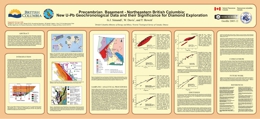
G.J. Simandl, W. Davis, and T. Hewett
GeoFile 2005-12 was proposed to enhance our understanding of crystalline basement in northeastern British Columbia. Seven new U-Pb zircon ages for this area are reported for samples of drill cuttings. Samples B5 (1854±6 Ma) and B25 (minimum age 1.75 Ga; inherited zircon 1.89 - 2.23 Ga) are located within but near the edge of Nova terrane as currently defined. Sample B2 plots within the Kiskatinaw terrane and samples B11 (1994±7 Ma), B12 (1993±7 Ma) and B14 (1993±7 Ma) plot within the Ksituan terrane. Sample B34 (1859±10 Ma), located near the British Columbia -Yukon Border, occurs within the Fort Simpson terrane. The samples from the Nova terrane returned Paleoproterozoic ages and thus did not confirm the popular interpretation that assigns Archean age to Nova terrane. The age indicated by the inherited zircon from sample B25 is similar to 2.0 and 2.3 Ga ages previously reported for the Buffalo Head terrane, which is believed to be reworked Archean basement. This finding is important from the exploration point of view since the Buffalo Head terrane in neighbouring Alberta hosts diamondiferous kimberlites.
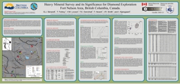
G.J. Simandl, T. Ferbey, V.M. Levson, T.E. Demchuk, T. Hewett, I.R. Smith, and I. Kjarsgaard
The objective of GeoFile 2005-13 was to collect and process glaciofluvial sands and gravels to analyze for the presence or absence of kimberlite indicator minerals (KIMs) in the Fort Nelson area. Of 20 samples collected and processed, 14 contain KIMs such as purple pyrope, yellowish eclogitic garnet, Cr-diopside, olivine, ilmenite, or spinel. It is possible that these minerals are derived from primary, secondary or tertiary sources within the Fort Nelson area. It is also possible, however, that they were brought intothe region from the Northwest Territories and Alberta by Late Pleistocene glacial and glaciofluvial systems.
R. Lett and C. Ronning
GeoFile 2005-14 describes the BC Rock Geochemical Database. Since the 1970’s an estimated 200,000 lithogeochemical determinations and mineral identifications have been produced from the analysis of rock samples collected by Geological Survey geologists. While much of these data have been reported in British Columbia Ministry of Energy and Mines publications the lithogeochemical data has, until now, never been collected into a single database. This project was initiated in 2004 by the BC Geological Survey (BCGS) to design and populate a geochemical database that will include all of the element analysis of rock samples carried out by the BCGS since the mid 1980’s. Currently most of the data used are captured from BCGS files and reports. GeoFile 2005-14 contains records for 9544 rock samples.
Geofile 2005-14 can be viewed through the BCGS Geology, Exploration Assistant and Mineral Titles maps of MapPlace. The layer group Rock Geochemistry contains layers representing these data. The Geochem Sample Location Lab ID Labels are viewable at a scale less than 1M. There are two reports available with these layers: Rock Excel Dump and Rock Sample Report. The Rock Sample Report can be sorted by the linked columns by clicking the heading.
View GeoFile 2005-14 (PDF, 162 KB)
Download GeoFile 2005-14 (ZIP, 5.9 MB)
Related publication GeoFile 2005-15: BC Rock Geochemical Database Manual
C. Ronning
GeoFile 2005-15 gives a brief background of the data that is compiled in this database and how the database itself is set up. Having a comprehensive knowledge of how a MS Access Database works is major advantage in using this database (Simpson and Robinson, “Mastering Access 2000").
View GeoFile 2005-15 (PDF, 572 KB)
Related publication GeoFile 2005-14: BC Rock Geochemical Database
Superseded by GeoFile 2006-6
M.G. Mihalynuk, M.S. Mallory and B. Grant
Manifold® is a full-featured, inexpensive, commercial Geographic Information System (GIS). It costs one or two orders of magnitude less than other GIS software suites that have comparable functionality, and it operates under Windows XP, providing formidable GIS analytical and display capabilities to anybody with a modest budget.
For the production of geological maps, however, Manifold ®1 right out of the box, comes up short. It lacks the ability to build custom line types (mostly an issue for thrust faults) and does not come with a library of geological symbols or patterned fills.
While not entirely an aesthetically pleasing solution, Manifold’s built-in triangle barb line type can be used as a proxy for the thrust fault line type (see the figure on the cover page which is adapted from Logan and Mihalynuk, 2005). Geological symbols are more work, but Manifold does provide a facility, through a pared-down implementation of Extensible Markup Language (XML), for the production of custom symbols and fills. We have used XML to create a more than 130 symbols and two dozen fill patterns ("area styles" in Manifold) that are available as part of this publication: GeoFile 2005-16. Four digital files comprise GeoFile 2005-16:
R. Lett
GeoFile 2005-17 gives a general outline of the regional geochemical survey program collection, preparation and analytical methods. The British Columbia Ministry of Energy and Mines has been involved in reconnaissance-scale stream sediment and water surveys since 1976. This program has generated high quality stream and lake sediment and surface water data from geochemical surveys carried out across Canada. In British Columbia the National Geochemical Reconnaissance (NGR) program, known as the Regional Geochemical Survey (RGS), has covered roughly 70 per cent of the province with stream sediment and stream water sampling at an average sample density of one sample per 13 square kilometres. In the process just over 45,000 samples have been collected and analyzed for up to 50 elements including gold, copper, molybdenum and zinc. As part of the NGR program, the BC RGS continues to maintain sample collection, preparation and analytical standards established by the Geological Survey of Canada.
R.C. Paulen and R.E. Lett
Between 1996 and 1998, the BC Geological Survey carried out regional till geochemical surveys in the Adams Plateau area of central British Columbia. More than 1500 samples of glacial till were collected and analysed for trace elements and major oxides. The data results were released previously as BC Geological Survey Open Files.
Geofile 2005-18 is an overview of the techniques used to collect and analyse the samples, the regional ice-flow history and the distribution of iron (Fe2O3), calcium (CaO), titanium (TiO2), chromium (Cr2O3), arsenic (As), gold (Au), nickel (Ni) and copper (Cu) in the till samples. There is a close relationship of tillCr2O3 and TiO2 to the underlying geology demonstrating that till geochemistry can be used to identify host rocks favourable for mineralization in drift covered areas. Numerous hill till Au, Cu and As values in the northwest part of the surveyed area may reflect concealed bedrock mineralization and potentially new exploration targets. With the Geofile text are digital files in Excel format containing all of the element data.
For Previous Till Geochemistry data releases:
Bobrowsky, P.T., Leboe, E.R., Dixon-Warren, A., Ledwon, A., MacDougall, D. & Sibbick, S.J. (1997b): Till geochemistry of the Adams Plateau-North Barriere Lake Area (82M/4 and 5). BC Ministry of Employment and Investment, Open File 1997-9, 263 p.
Bobrowsky, P.T., Paulen, R., Little, E., Prebble, A., Ledwon, A., and Lett, R. (1998): Till geochemistry of the Louis Creek - Chu Chua Creek area (NTS 92P/1E and 92P/8E); BC Ministry of Energy and Mines, 1998. Open File 1998-6, 253 p.
Paulen, R.C., Bobrowsky, P.T., Lett, R.E, Jackaman, W., Bichler, A.J. and Wingerter, C. (2000a): Till geochemistry of the Shuswap Highlands area, British Columbia (Parts of NTS 82M/3, 82L/13 and 82L/14). BC Ministry of Energy and Mines, Open File 2000-18, 239 p.
Paulen, R.C., Bobrowsky, P.T., Lett, R.E, Jackaman, W., Bichler, A.J. and Wingerter, C. (2000): Till geochemistry of the Chu Chua - Clearwater area, British Columbia (Parts of NTS 92P/8 and 92P/9); BC Ministry of Energy and Mines, Open File 2000-17, 233 p.

A.S. Legun
This article reviews the gem varieties of beryl, the associations of beryl with granitic rocks, and the particular association of emerald with ultramafic wallrocks affected by volatile-rich fluids. The article includes an emerald potential map for the province and a general description of areas of gem beryl potential. There has been little systematic work on transparent gemstones in British Columbia in spite of a number of gem discoveries in the last fifteen years.
D. Marshall, N. Podstawskyj, M. Lesiczka and A. Aichmeier
This study focuses on timing relationship between the late intrusive phases of the Zeballos stock, mafic dykes and gold mineralization at the Privateer Mine and lithological, geochemical and structural controls on gold mineralization. This work entails U-Pb chronology of the intrusive phases, geochemistry, detailed mapping, petrography, alteration, mineralogy, fluid inclusions, stable isotope and structure of the gold-bearing quartz-carbonate veins.
R. Lett
Geofile 2005-22 reports new analytical data for regional geochemical survey samples collected from the Toodoggone River (NTS 94E, RGS46) and McConnell Creek (NTS 94D, RGS45) map sheets in 1996. This digital release consists of a 132-page report in PDF format, and four appendices in a ZIP format file.
The original surveys were carried out in 1996, and generated about 2000 stream sediment samples from 1885 sites over a 25 000-square kilometre area. Initially, in 1996, the samples were analyzed for trace elements using aqua regia digestion-atomic absorption spectrometry and by instrumental neutron activation. These sediment samples were re-analyzed in 1997 for 30 elements using inductively coupled plasma emission spectrometry (ICP/ES) after extraction with separate hydroxylamine hydrochloride and sodium acetate leaches. This data was not previously reported.
Copper-molybdenum geochemical targets highlighted by the partial extraction results in the Toodoggone River map sheet include the area of the Kemess North deposit and the TK Cu-Mo prospect.
Recent Geological Mapping References for this area:
Open File Map 2005-3: Geology between the Finlay and Toodoggone Rivers, Toodoggone River Map Area, North-Central British Columbia (Parts of NTS 94E/2, 6 and 7) Scale 1:50,000. Geology by Larry J. Diakow, Graham T. Nixon, Ryan Rhodes and Bob Lane.
Open File 2005-4: Geology of the Johanson Lake Area (Parts of NTS 94D/8 and 9) 1:50,000-scale; Geology by Paul Schiarizza and Sen Huy Tan; U-Pb geochronology by R. Friedman; Conodont identifications by M. Orchard; Cartography by Ryan Rhodes.
T. Schroeter and A. Fulford
Fifteen significant porphyry molybdenum-bearing deposits and/or camps have yielded approximately 320 300 tonnes of molybdenum. The key current and past producers include: the Endako, Highland Valley Copper (including Highmont and Lornex), Brenda, Island Copper, Boss Mountain, Kitsault and Gibraltar mines. Undeveloped molybdenum resources identified in nearly sixty deposits such as the Davidson (formerly Yorke-Hardy), Ajax, Adanac, Kitsault, Schaft Creek,
Mac, Storie and Max (formerly Trout Lake) deposits total approximately 1.9 M tonnes.
Geofile 2005-23 is a table of British Columbia porphyry molybdenum resources. It includes information on the owner/operator of specific projects, MINFILE number, mine production, current resources, contained molybdenum, the deposit type and references. As well it includes a brief listing of active, significant exploration projects for porphyry molybdenum targets that currently do not have any published resource. Most of the resources were calculated more than 15 years ago and the reserve/resource figures do not conform to National Instrument 43-101 standards.
The table is presented in HTML, PDF and Excel formats. This compilation includes current and past producers for which significant resources remain (e.g. Endako, Boss Mountain, Gibraltar, Highland Valley Copper, Huckleberry and Kitsault). Additional information on these deposits is available in the MINFILE Database and in the Mineral Deposit Profiles. Regional offices of the British Columbia Ministry of Energy and Mines in Vancouver, Kamloops, Cranbrook, Prince George and Smithers also have photographs and rock specimens of principle deposits.
A Molybdenum in British Columbia pamphlet (Information Circular 2005-3) includes a location map for selected molybdenum deposits in British Columbia.
BC Geological Survey
GeoFile 2005-24 is an update of the tables in Open File 2000-15 MINFILE Reserves/Resource Inventory in BC 1999. These tables include a 106-page document of the known reserves and resources of 837 mineral deposits from the MINFILE database as of September 2005. Data for each deposit include name, MINFILE number, geographic location, NTS map, status, mining division, deposit type, zone name, year, reference, comments, tonnage, category, grade and commodity. The Reserve category is used only for an inventory in an operating mine or a mine near production. Ore reserves are reported as Proven, Probable and Possible. The Resource category is used for all other inventories. Resources are reported as Measured, Indicated and Inferred. A combination of categories is reported as Combined.
NOTE: Reserves/Resources are not compliant with National Instrument 43-101 unless specified in comments.Please quote original source, rather than MINFILE, when referencing reserve/resource estimates.
G.J. Simandl, T. Ferbey, V.M. Levson, N.D. Robinson, R. Lane, R. Smith, T.E., Demchuk, I.M. Raudsepp and A.S. Hickin
Northeast British Columbia is an under-explored portion of the North American continent with respect to diamonds, other gemstones, and non-energy minerals. It is characterized by low relief and has a rapidly developing infrastructure that supports of the oil and gas industry. High-quality diamonds are presently mined within the Slave Craton of the Northwest Territories (Carlson, et al, 1999 and Lockhart et al, 2004). Diamond deposits have also been discovered in the Buffalo Head Terrane in neighbouring Alberta (Eccles, 2004; Hood and McCandless, 2004), approximately 400 kilometres southeast of the Fort Nelson area. Several alluvial diamond occurrences have also been reported in the Northwest Territories and in Alberta (Simandl, 2004). There are reports of diamond occurrences within the British Columbia Alkaline Province (Allan, 1999, 2002; Anonymous, 1994; McCallum, 1994; Northcote, 1983a, b; Pell, 1994; and Roberts, 2002).
Recent age dating (Simandl and Davis, 2005) indicates that Precambrian crystalline basement similar in age to the Buffalo Head Terrane extends farther west than previously expected, supporting the hypothesis that northeast British Columbia may have been underlain by a thick cold lithosphere prior to rifting of the Rodinia Supercontinent. The "diamondiferous root", as described by Haggerty (1986), and Mitchell (1991), may have been destroyed after the diamonds were brought to the surface by kimberlites, lamproites, or other diamond elevators (Simandl, 2004). The results of this heavy mineral reconnaissance/orientation survey, when considered in conjunction with the findings of a previous KIM study (Simandl, et al, 2005), provide support for the use of the diamondiferous mantle root exploration model in Northeast British Columbia.
2004
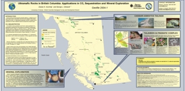
D.A. Voormeij and G.J. Simandl
A map of all major dunite and or serpentinite localities in BC has been compiled. This map is an essential tool in planning for CO2 sequestration in BC as well in some exploration plays and industrial mineral compilation. One form of CO2 sequestration involves trapping the CO2 in magnesium silicates to form silica and magnesite (magnesium carbonate).
Suitable targets should be near major CO2 point source, the resource should be large enough to sequester 10kT a day and the dunites should be free of serpentinite, and low in CaO, LOI, and CO2. One area under discussion is the Tulameen Complex in southern BC, another, at Cassiar in Northern BC, would utilize the sequestration in transformation of potentially harmful asbestiform magnesium silicates to magnesite and silica.
W.E. Kilby
A long document (some 330 pages long, and submitted as Bulletin 111) details the methodology used in performing a comprehensive mineral potential assessment of 948,596 square kilometres (total area of BC). It discusses the results and the reliability of the assessments. The province is divided into "homogeneous" tracts and the mineral potential of each tract is assessed with respect to each of the Mineral Deposit types applicable. Any past production is reported and an educated guess of how much more might be waiting to be found is reported in the form of probability statements. Composite maps are presented suggesting how prospective an area is considered to be. Of use to geologists, land planners, and ecological reserve managers alike.
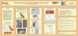
G.J. Simandl and N. Robinson
A northwest trending pre-Jurassic alkaline petrographic province straddles the Rocky Mountain Trench in Eastern British Columbia. Alkaline complexes such as carbonatites, kimberlites, lamproites, and syenite gneisses are found here.
Diamonds have been reported from these rocks at Jack (Lens Mountain), Mark (Valenciennes River), Xeno (Kechika Area) and from the Cranbrook Cluster (Bonus and Ram 5 and 6). Diamond potential of British Columbia should be evaluated according to the traditional Diamondiferous Mantle Root Model in the east, and possibly by the modified version of the Subduction Zone Diamond model in the west. The finding of diamond bearing volcanic beds alert geologists that they should keep an open mind and be ready to test unconventional hypotheses.
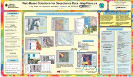
L. Jones, P. Desjardins, W. Kilby
Image Analysis Toolbox (IAT): This BC and Yukon Chamber of Mines’ Rocks to Riches program, delivered by Cal Data Ltd., provides image analysis capability for the MapPlace. The IAT is a framework to add, process and display a variety of multi and hyperspectral imagery. The IAT includes the Enhanced Satellite Imagery, a series of enhanced Landsat images which facilitate geological interpretation, such as for structure and alteration. These images, delivered by McElhanney Consulting Services Ltd., are integrated into the Exploration Assistant on MapPlace.ca so all existing information contained in the system may be referenced to this new set of imagery. A description of these projects and use of the IAT are available in Fieldwork 2003, pages 209 to 215.
G. Nixon, L. Cabri, G. LaFlamme, P. Sylvester, M. Tubrett
Alkali intrusions of Late Triassic to Early Jurassic age are important hosts to porphyry style Cu-Au-Ag+/-PGE mineralization in British Columbia. The main deposits are in Stikine and Quesnel terranes. Their economic potential is currently being explored as the PGE tenor and distribution are better understood. Seven samples from each of Afton, Lorraine, Copper Mountain, Friday Creek, Sappho, and Maple Leaf were analysed. It was found that much PGE is in solid solution in sulphides, that pyrite may be relatively enriched compared to copper sulphide mineral solid solutions (may carry up to 42 ppm Pd) and another part of the PGE budget is in discrete PGE telluride, antimonide, and arsenide minerals.
R. Lett and W. Jackaman
GeoFile 2004-7 describes the methods used by the British Columbia Geological Survey in the field to collect, prepare, store and ship sediment and water samples. It is intended as an illustrated “how to” guide for regional geochemical survey procedures and logistics. Individuals and companies working in British Columbia and similar terrains, will find this publication useful for planning their exploration programs and ensuring quality control.
D.G. MacIntyre, N.W.D. Massey, and W.E. Kilby
This report summarizes the methodology and results of a Level 2 Mineral Resource Assessment of the Coast Information Team's (CIT) project area which encompasses approximately 11 million hectares. A review of the original Level 1 MRA is also included because the Level 2 MRA is built on the results of the original assessment. The primary purpose of this assessment was to provide more detailed information on metallic and industrial mineral resource potential in support of a multi-disciplinary economic gain spatial analysis being done on contract to the CIT. The resource assessment was carried out in early October 2002 and final results delivered to the Ministry of Sustainable Resource Management and the CIT at the end of December 2002.
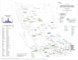
T.G. Schroeter and J.W. Pardy
Geofile 2004-10 provides a map containing all of the operating mines as well as the major exploration and development projects in British Columbia from 2004. The values on this map are all preliminary mineral exploration estimates.
T.G. Schroeter, J.W. Pardy, and Mike Cathro
The exploration for porphyry deposits during the 1960s and 1970s led to the discovery of numerous major deposits. A number of these were developed, particularly in the southern and central parts of the province. For example, the Lornex and Bethlehem mines, in the Highland Valley opened. Many of these mines were started to extract copper and molybdenum, but also have produced significant quantities of precious metals.
View GeoFile 2004-11 (PDF, 73.9 KB)
Download GeoFile 2004-11 (ZIP, 409 KB)
Superseded by GeoFile 2005-05
N.W.D. Massey, J.W. Haggart, C.L. Wagner, D.G. MacIntyre, and P.J. Desjardins
This release is the final tile of the digital regional compilation of the Geology of B.C. at 1:250 000 scale. Previous tiles were released as a series of GeoFiles during 2003.
This present compilation for the Queen Charlotte Islands/Haida Gwaii is adapted from recent studies undertaken by the Geological Survey of Canada that resulted in a compilation map by Haggart (2004). Tile numbering is similar to that used for the Cordilleran GIS Map Library (Journeay and Williams, 1995) which conforms to the International Map of the World standard used for indexing 1:1,000,000-scale topographic maps. This differs from the numbering convention used for the National Topographic System maps.
Tile NN8/9 encompasses NTS 1:250,000 sheets 102O (part), 103B, 103C, 103F, 103G (West half), 103J (West half) and 103K.
As with the previously released tiles, all data sets are in shapefile format that should be readily usable by most GIS software. They are presented in decimal degrees, BC Albers or UTM projections. All use NAD83 as the datum.
Haggart, J.W. 2004: Geology, Queen Charlotte Islands, British Columbia, Geological Survey of Canada, Open File 4681, scale 1:250 000.
2003
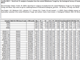
M. Fowler
An 'excel' file of raw data supporting the conclusions in Paper 15 in Geological Fieldwork 2002 p.187-202, by English and coworkers on a preliminary assessment of hydrocarbon potential of the Whitehorse Trough.
Superseded by GeoFile 2005-04
N.W.D. Massey, D.G. MacIntyre, and P.J. Desjardins
Digital regional compilations of the geology of B.C. at 1:250 000 scale were made by staff of the BC Geological Survey (BCGS) in 1992-1996 in support of the Mineral Potential Project. These were released as Open Files and digital downloads from the BCGS website.
However, numerous errors and inconsistencies were noted within these data sets. The Digital Geology Map of British Columbia Project was designed to address these problems and, in the process, try to produce a seamless digital map of the Province with consistent geological tagging. Where feasible, updates to the geology have also been incorporated during the editing process. However, some “scratch lines” remain in the data reflecting problems due to unresolved differences in geological designations in original sources.
The recompilation has been based on the same tiles as the Cordilleran GIS Map Library (Journeay and Williams, 1995) which conforms to the International Map of the World standard used for indexing 1:1 000 000 scale topographic maps. This differs from the numbering convention used for the National Topographic System maps: Tile NM11 encompasses NTS 1:250,000 sheets 82E, 82F, 82G, 82J, 82K, 82L, 82M, 82N and 82O.
The datasets released here are a preliminary step towards the final goal. All linework within the tile is now as seamless as possible, but joins with adjacent tiles have not yet been made. Final versions were released in 2005. All data sets are in shapefile format that should be readily usable by most GIS software. They are presented in either decimal degrees or BC Albers projections. Both use NAD83 as the datum.
Superseded by GeoFile 2005-03
N.W.D. Massey, D.G. MacIntyre, and P.J. Desjardins
Digital regional compilations of the geology of B.C. at 1:250 000 scale were made by staff of the BC Geological Survey (BCGS) in 1992-1996 in support of the Mineral Potential Project. These were released as Open Files and digital downloads from the BCGS website.
However, numerous errors and inconsistencies were noted within these data sets. The Digital Geology Map of British Columbia Project was designed to address these problems and, in the process, try to produce a seamless digital map of the Province with consistent geological tagging. Where feasible, updates to the geology have also been incorporated during the editing process. However, some “scratch lines” remain in the data reflecting problems due to unresolved differences in geological designations in original sources.
The recompilation has been based on the same tiles as the Cordilleran GIS Map Library (Journeay and Williams, 1995) which conforms to the International Map of the World standard used for indexing 1:1 000 000 scale topographic maps. This differs from the numbering convention used for the National Topographic System maps: Tile NM10 encompasses NTS 1:250,000 sheets 92B, 92C, 92F, 92G, 92H, 92I, 92J, 92K, 92N, 92O and 92P.
The datasets released here are a preliminary step towards the final goal. All linework within the tile is now as seamless as possible, but joins with adjacent tiles have not yet been made. Final versions were released in 2005. All data sets are in shapefile format that should be readily usable by most GIS software. They are presented in either decimal degrees or BC Albers projections. Both use NAD83 as the datum.
Superseded by GeoFile 2005-02
N.W.D. Massey, D.G. MacIntyre, and P.J. Desjardins
Digital regional compilations of the geology of B.C. at 1:250 000 scale were made by staff of the BC Geological Survey (BCGS) in 1992-1996 in support of the Mineral Potential Project. These were released as Open Files and digital downloads from the BCGS website.
However, numerous errors and inconsistencies were noted within these data sets. The Digital Geology Map of British Columbia Project was designed to address these problems and, in the process, try to produce a seamless digital map of the Province with consistent geological tagging. Where feasible, updates to the geology have also been incorporated during the editing process. However, some “scratch lines” remain in the data reflecting problems due to unresolved differences in geological designations in original sources.
The recompilation has been based on the same tiles as the Cordilleran GIS Map Library (Journeay and Williams, 1995) which conforms to the International Map of the World standard used for indexing
1:1 000 000 scale topographic maps. This differs from the numbering convention used for the National Topographic System maps: Tile NM9 encompasses NTS 1:250,000 sheets 92E, 92L, 92M, 102I and 102P.
The datasets released here are a preliminary step towards the final goal. All linework within the tile is now as seamless as possible, but joins with adjacent tiles have not yet been made. Final versions will be released late in 2003. All data sets are in shapefile format that should be readily usable by most GIS software. They are presented in either decimal degrees or BC Albers projections. Both use NAD83 as the datum.
G.T. Nixon
New mapping at Lorraine Cu-Au Prospect in central BC has distinguished two intrusive suites in the Duck Creek Complex with differing characteristics. The earlier phase consists of pyroxenite and melasyenites with cumulate textures and primary laminar flow textures, which apparently "youngs" to the west and has gradational contacts with the enclosing Hogem Batholith, and contrasts markedly with a second phase of intrusion with sharp intrusive contacts and leucosyenite compostion. Oscillatory zoning, special mineralogy and textures suggest crystallization in a subvolcanic environment. The Cu-Au mineralization is associated with the leucosyenites in time and place. Layered migmatites are now thought to represent metasomatic textures variably accentuated by ductile strain.
J. Logan, G. Laflamme and L. Dandy
The Kena Gold project is a private-public partnership developed between the Ministry of Energy & Mines, Sultan Minerals Inc. and CANMET-MMSL to study and report on the new gold mineralization discovered 5 kilometres south of Nelson.

M. Mihalynuk
The Targeted Geologic Initiative at Atlin provides evidence that the Nakina Transect contains geological environments that are prospective for a variety of mineral deposit types as well as raising possibility of hydrocarbon accumulations. Of key importance has been the discovery of submarine felsic volcanic rocks of Late Permian to Middle Triassic age; coeval with those hosting the volcanogenic massive sulphide accumulations at Kutcho Creek. Volcanic quartz in detrital sediments located in various parts of mapped region attest to the abundance of felsic volcanism in this part of the Cache Creek Terrane. The region around Thunder Alley is prospective for exhalites. The origin of the newly discovered Joss'alun concordant massive copper sulphide in submarine volcanic rocks also focuses on the increased prospectivity of the region.
The geological framework has been updated with new stratigraphic assignments, fossil collections and age dates.

M. Mihalynuk
Massive copper sulphide mineralization has been discovered 75 kilometres southwest of Atlin by members of the Atlin TGI. The discovery is best displayed in a 30 metre by 10 metre area where several stacked 3 metre by 1 metre lenses occur. Copper assays up to 9.77 per cent copper are reported from grabs and a 90 centimetre chip sample returned 3.35 per cent copper. The mineralization is massive chalcopyrite with lesser pyrite. The host is mafic submarine volcaniclastics interbedded with ferruginous cherts of Permian age. Overlying the beds are quartz bearing clastic rocks with blocks of chert with Middle Triassic fossils and Latest Permian-Early Triassic detrital zircons. The mineralization is similar to the Kutcho deposits to the southeast.
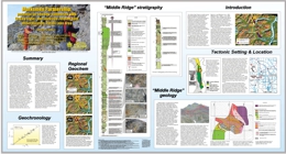
M. Mihalynuk
In the Tutshi Lake area, felsic volcanics overlie, in a gradational manner, sediments, marking the transition from shallow submarine to subaerial depositional environment. A new zircon date of 124.9 Ma dates the Middle Ridge sequence as young middle Early Cretaceous in age. The sedimentary environment is similar to that at Eskay Creek in the much older Hazelton Group, but possibility of shallow VMS suggested by similarity in geologic setting may be enhanced by regional geochemical anomalies in Au-Sb-As. A dyke has yielded an assay of 18 ppm gold from a gold stibnite arsenopyrite vein in a dyke in the Middle Ridge Intrusion. The possibility of "intrusion related" gold is noted.
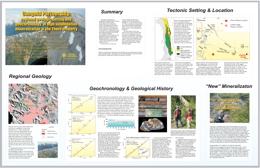
M. Mihalynuk
The regional geological and temporal framework of the Thorn Property in the Stuhini Group of the Stikine Terrane has yielded new insights. In particular, the Thorn high sulphidation mineralization appears related to a quartz - feldspar porphyry, the Thorn Stock. Newly released age data for samples of mineralization yielded 91.1 Ma (Ar/Ar date on white mica) and 93.3 Ma (U/Pb on Zircon) on the stock. Plutons along strike are 83 and 87 Ma.
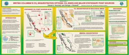
G.J. Simandl
New and affordable ways to trap CO2 gas in a permanent way are currently being investigated as a result of Kyoto commitments. BC currently emits 65.9 Mt/tear CO2, of which some 82.4 per cent are the result of burning fuels for energy.
CO2 can be trapped in deep saline aquifers or hydrocarbon reservoirs which are found within sedimentary basins in NE and central BC as well as Vancouver Island. Coal beds that can trap CO2 gas are near some point source emitters in southeast and south-central British Columbia as well as Vancouver Island. Ultramafic rocks can trap CO2 by converting magnesium silicates to magnesite and quartz. Cost factors are poorly known but include the concentration of CO2 in the emitted gas, the distance from source to sink, the infrastructure in place to transport and deliver CO2 gas, and the actual cost of sequestering the CO2 gas.
Superseded by GeoFile 2005-7
N.W.D. Massey, D.G. MacIntyre, and P.J. Desjardins
Digital regional compilations of the geology of B.C. at 1:250 000 scale were made by staff of the BC Geological Survey (BCGS) in 1992-1996 in support of the Mineral Potential Project. These were released as Open Files and digital downloads from the BCGS website.
However, numerous errors and inconsistencies were noted within these data sets. The Digital Geology Map of British Columbia Project was designed to address these problems and, in the process, try to produce a seamless digital map of the Province with consistent geological tagging. Where feasible, updates to the geology have also been incorporated during the editing process. However, some “scratch lines” remain in the data reflecting problems due to unresolved differences in geological designations in original sources.
The recompilation has been based on the same tiles as the Cordilleran GIS Map Library (Journeay and Williams, 1995) which conforms to the International Map of the World standard used for indexing
1:1 000 000 scale topographic maps. This differs from the numbering convention used for the National Topographic System maps: Tile NN11 encompasses NTS 1:250 000 sheets 83C, 83D and 83E.
The datasets released here are a preliminary step towards the final goal. All linework within the tile is now as seamless as possible, but joins with adjacent tiles have not yet been made. Final versions were released in 2005. All data sets are in shapefile format that should be readily usable by most GIS software. They are presented in decimal degrees, BC Albers or UTM projections. All use NAD83 as the datum.
Superseded by GeoFile 2005-5
N.W.D. Massey, D.G. MacIntyre, and P.J. Desjardins
Digital regional compilations of the geology of B.C. at 1:250 000 scale were made by staff of the BC Geological Survey (BCGS) in 1992-1996 in support of the Mineral Potential Project. These were released as Open Files and digital downloads from the BCGS website.
However, numerous errors and inconsistencies were noted within these data sets. The Digital Geology Map of British Columbia Project was designed to address these problems and, in the process, try to produce a seamless digital map of the Province with consistent geological tagging. Where feasible, updates to the geology have also been incorporated during the editing process. However, some “scratch lines” remain in the data reflecting problems due to unresolved differences in geological designations in original sources.
The recompilation has been based on the same tiles as the Cordilleran GIS Map Library (Journeay and Williams, 1995) which conforms to the International Map of the World standard used for indexing 1:1 000 000 scale topographic maps. This differs from the numbering convention used for the National Topographic System maps: Tile NN9 encompasses NTS 1:250,000 sheets 93D, 93E, 93L, 93M, 103A, 103B, 103G, 103H, 103I, 103J, 103O and 103P.
The datasets released here are a preliminary step towards the final goal. All linework within the tile is now as seamless as possible, but joins with adjacent tiles have not yet been made. Final versions will be released late in 2003. All data sets are in shapefile format that should be readily usable by most GIS software. They are presented in decimal degrees, BC Albers or UTM projections. All use NAD83 as the datum.
Superseded by GeoFile 2005-10
N.W.D. Massey, D.G. MacIntyre, and P.J. Desjardins
Digital regional compilations of the geology of B.C. at 1:250 000 scale were made by staff of the BC Geological Survey (BCGS) in 1992-1996 in support of the Mineral Potential Project. These were released as Open Files and digital downloads from the BCGS website.
However, numerous errors and inconsistencies were noted within these data sets. The Digital Geology Map of British Columbia Project was designed to address these problems and, in the process, try to produce a seamless digital map of the Province with consistent geological tagging. Where feasible, updates to the geology have also been incorporated during the editing process. However, some “scratch lines” remain in the data reflecting problems due to unresolved differences in geological designations in original sources.
The recompilation has been based on the same tiles as the Cordilleran GIS Map Library (Journeay and Williams, 1995) which conforms to the International Map of the World standard used for indexing
1:1 000 000 scale topographic maps. This differs from the numbering convention used for the National Topographic System maps: Tile NO10 encompasses NTS 1:250,000 sheets 94A, 94B, 94C, 94F, 94G, 94H, 94I, 94J, 94K, 94N, 94O and 94P.
The datasets released here are a preliminary step towards the final goal. All linework within the tile is now as seamless as possible, but joins with adjacent tiles have not yet been made. Final versions were released in 2005. All data sets are in shapefile format that should be readily usable by most GIS software. They are presented in decimal degrees, BC Albers or UTM projections. All use NAD83 as the datum.
G.J. Simandl, B. Grant, D. Terry, M. Cathro, B. Lane, P. Wodjak, J. Houle, T. Schroeter
Currently forty mines and twenty major sites where industrial minerals have value added, are working in the province. The following industrial minerals are currently being worked in BC: Gypsum, Magnesite, Silica, Limestone, White Calcium Carbonate, Dolomite, Crushed stone and aggregate, Roofing Granules, Industrial clay and clay/sandstone, Medical Clays, Diatomite, Zeolite, and Bentonite, Dimension Stone, Jade, Pumice, Tephra, Lava Rock, Mineral Wool, Slag, Magnetite, Graphite, Sulphur, High Tech Minerals, Gemstones, Wollastonite/Garnet, Barite, Perlite. New markets will be found in "green" Minerals such as zeolite, bentonite, pozzolans, and specialty lightweight aggregate. Special needs will be filled by "niche" quarries.
J.M. English, S.T. Johnston and M.G. Mihalynuk
Preliminary geochemical data from volcanic rocks in the Nakina Region show the volcanics to be dominated by two different petrogenetic components. Alkaline mafic volcanic rocks include Augite Porphyries of Laughing Moose Creek, and volcanogenis sediments of the Horsefeed Formation. Subalkaline mafic rocks include "magmatic knockers" of the Nimbus Melange and basaltic tuffs of Blackcaps Mountain.
Superseded by GeoFile 2005-8
N.W.D. Massey, D.G. MacIntyre, and P.J. Desjardins
Digital regional compilations of the geology of B.C. at 1:250 000 scale were made by staff of the BC Geological Survey (BCGS) in 1992-1996 in support of the Mineral Potential Project. These were released as Open Files and digital downloads from the BCGS website.
However, numerous errors and inconsistencies have been noted with these datasets. The Digital Geology Map of British Columbia Project was designed to address these problems and, in the process, produce a seamless digital map of the Province with consistent geological tagging. Updates to the geology have also been made where feasible. However, some "map boundary" problems remain reflecting differences in original sources.
The recompilation has been based on the same tiles as the Cordilleran GIS Map Library (Journeay and Williams, 1995) which conforms to the International Map of the World standard used for indexing
1:1 000 000-scale topographic maps. This differs from the numbering convention used for the National Topographic System maps: Tile NO8 encompasses NTS 1:250,000 sheets 104F, 104K, 104L, 104M, 104N, 114I, 114O and 114P.
The datasets released here are a preliminary step towards the final goal. All line work within the tile is now as seamless as possible, but joins with adjacent tiles have not yet been made. Final versions were released in 2005. All data sets are in shapefile format that should be readily usable by most GIS software. They are presented in decimal degrees, BC Albers or UTM projections. All use NAD83 as the datum.
Superseded by GeoFile 2005-9
N.W.D. Massey, D.G. MacIntyre, and P.J. Desjardins
Digital regional compilations of the geology of B.C. at 1:250 000 scale were made by staff of the BC Geological Survey (BCGS) in 1992-1996 in support of the Mineral Potential Project. These were released as Open Files and digital downloads from the BCGS website.
However, numerous errors and inconsistencies have been noted with these datasets. The Digital Geology Map of British Columbia Project was designed to address these problems and, in the process, produce a seamless digital map of the Province with consistent geological tagging. Updates to the geology have also been made where feasible. However, some "map boundary" problems remain reflecting differences in original sources.
The recompilation has been based on the same tiles as the Cordilleran GIS Map Library (Journeay and Williams, 1995) which conforms to the International Map of the World standard used for indexing 1:1 000 000 scale topographic maps. This differs from the numbering convention used for the National Topographic System maps: Tile NO9 encompasses NTS 1:250,000 sheets 94D, 94E, 94L, 94M, 104A, 104B, 104G, 104H, 104I, 104J, 104O and 104P.
The datasets released here are a preliminary step towards the final goal. All line work within the tile is now as seamless as possible, but joins with adjacent tiles have not yet been made. Final versions were released in 2005. All data sets are in shapefile format that should be readily usable by most GIS software. They are presented in decimal degrees, BC Albers or UTM projections. All use NAD83 as the datum.
R. Lett
New analytical data for 37 new elements. Silver data from previous survey is not comparable to results in this survey because the newer method is more sensitive to silver. The Queen Charlotte samples show a number of clusterings which suggest the presence of epithermal gold (Ag-Hg-Sb), others show a VMS signature and a Cu-Mo-Au cluster. A large cluster of drainage basins show elevated values near a Ag-Au-Zn-Cu-Ba-Pb VMS showing (the Cimadoro showing, MINFILE 103F 052).
R. Lett
This GeoFile describes the re-analysis of RGS data from the Iskut River region. Selected elements are grouped into mineral deposit types and three associations are found in this area: As-Sb-Hg-Ag clusters for epithermal sub-aqueous hot spring massive sulphides, Cu-Mo-Ag-Au for Cu-Mo Porphyries and Ni-Co-Mg for Cu-Ni intrusive deposits.
N.W.D. Massey, D.G. MacIntyre, and P.J. Desjardins
Digital regional compilations of the geology of B.C. at 1:250 000 scale were made by staff of the BC Geological Survey (BCGS) in 1992-1996 in support of the Mineral Potential Project. These were released as Open Files and digital downloads from the BCGS website.
However, numerous errors and inconsistencies have been noted with these datasets. The Digital Geology Map of British Columbia Project was designed to address these problems and, in the process, produce a seamless digital map of the Province with consistent geological tagging. Updates to the geology have also been made where feasible. However, some "map boundary" problems remain reflecting differences in original sources.
The recompilation has been based on the same tiles as the Cordilleran GIS Map Library (Journeay and Williams, 1995) which conforms to the International Map of the World standard used for indexing 1:1 000 000 scale topographic maps. This differs from the numbering convention used for the National Topographic System maps: Tile NN10 encompasses NTS 1:250,000 sheets 93A, 93B, 93C, 93F, 93G, 93H, 93I, 93J, 93K, 93N, 93O and 93P.
The datasets released here are a preliminary step towards the final goal. All line work within the tile is now as seamless as possible, but joins with adjacent tiles have not yet been made. All data sets are in shapefile format that should be readily usable by most GIS software. They are presented in decimal degrees, BC Albers or UTM projections. All use NAD83 as the datum.
J. Pell and O. Ijewliw
Kimberlite, ultramafic and alkaline lamprophyres and other alkaline ultrabasic rocks occur within a broad belt that parallels the Rocky Mountain Trench. Most occur east of the trench, only a few are found west of it. They predate the JuraCretaceous Columbian Orogeny. Complexes in the Kechika River area, Ospika Pipe area, Golden-Columbia Ice fields area, Cross Kimberlite, Purcell breccia Pipes, and the Bull River area are discussed in paper.
See GeoFile 2007-11 and GeoFile 2010-12 for updated versions.
T. Schroeter and J. Pardy
Contact links with the mineral industry in BC, up to date in 2003, after the shifting about of GSB staff.
2002
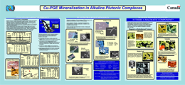
G.T. Nixon and J.H.G. Laflamme
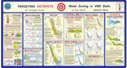
D. Alldrick

I. Webster
G.J. Simandl, D. Terry, M. Cathro, B. Lane, P. Wojdak, J. Houle, B. Grant, and T. Schroeter
British Columbia’s industrial mineral production for 2001 is estimated at $54 million, and mineral exploration expenditures are estimated at $2.6 million, which was about 8% of the province’s exploration investment. Production is expected to increase this year, even while exploration expenditures declined.
2001
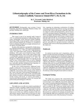
C.G. Cathyl-Bickford
This report is part of an ongoing study, begun in 1987, to establish the distribution, sedimentology and resource stratigraphy of the Vancouver Island coalfields. Knowledge of the extent and quality of the coal deposits and associated natural gas resources is essential to land-use planning along the increasingly-urbanised western shores of Georgia Strait.
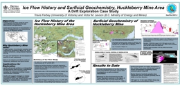
T. Ferbey and V.M. Levson
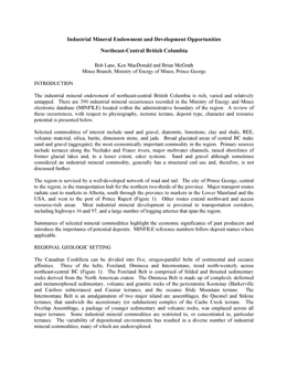
B. Lane, K. MacDonald and B. McGrath
The industrial mineral endowment of northeast-central British Columbia is rich, varied and relatively untapped. There are 390 industrial mineral occurrences recorded in the Ministry of Energy and Mines electronic database (MINFILE) located within the administrative boundary of the region. A review of these occurrences, with respect to physiography, tectonic terrane, deposit type, character and resource potential is presented
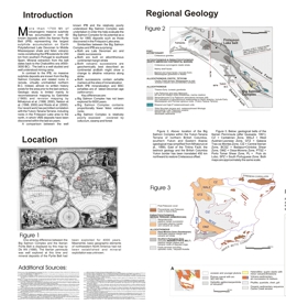
M.G. Mihalynuk, J. Nelson, C. Roots, T. Gleeson, M. deKeljzer, R. Friedman
A comparison between the well known IPB and the relatively poorly understood Big Salmon Complex was undertaken in order the help evaluate the Big Salmon Complex for its potential as a host for VMS deposits such as those discovered in the Finlayson Lake area.
P. Hannigan, P.J. Lee and K.G. Osadetz
Please Note: Since the time these reports were generated much new work has been done in the area. Therefore, the oil and gas volumes and conclusions reached in these reports may be impacted significantly in the light of this new information. These reports are provided for the convenience of clients and recent information should also be researched.
P. Hannigan, P.J. Lee, K.G. Osadetz, J.R. Dietrich and K. Olsen-Heise
Also published as Petroleum Geology Open File 2002-3
Please Note: Since the time these reports were generated much new work has been done in the area. Therefore, the oil and gas volumes and conclusions reached in these reports may be impacted significantly in the light of this new information. These reports are provided for the convenience of clients and recent information should also be researched.
P. Hannigan, P.J. Lee, K.G. Osadetz, and K. Olsen-Heise
Please Note: Since the time these reports were generated much new work has been done in the area. Therefore, the oil and gas volumes and conclusions reached in these reports may be impacted significantly in the light of this new information. These reports are provided for the convenience of clients and recent information should also be researched.
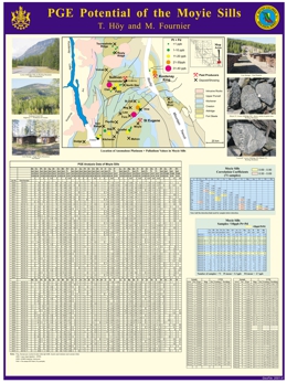
T. Höy and M. Fournier
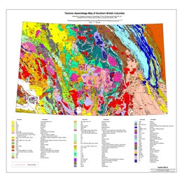
M.A. Fournier and D.V. Lefebure
2000
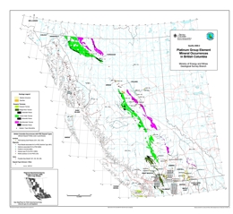
This map shows the locations of about 100 platinum group element (PGE) occurrences for British Columbia as currently listed in the provincial mineral database (MINFILE). Included are representatives of 7 different modes of occurrence for PGE's: surficial, magmatic (flood basalt-associated, gabbroic-associated, podiform chromite, Alaskan-type, and alkalic intrusion related) and veins.
Two related PGE studies were conducted during the 2000 field program by the BC Geological Survey. The alkaline intrusion-related systems in southern BC was studied by Graham Nixon and will be released as Open File 2001-14, Open File 2002-7 and were released as GeoFile 2002-2 and GeoFile 2004-6.
P.B. Read
This publication provides the first comprehensive description of the Eocene stratigraphy of the Tertiary basins in south-central British Columbia and documents the numerous, related mineral occurrences. These basins are highly prospective for a variety of industrial minerals, including diatomite, zeolite, perlite, bentonite and kaolin. The field work on which this publication is based was conducted from 1986 to 1989. Progress reports were published in seven Open File maps and led to the discovery of a number of new occurrences, including an economic zeolite deposit. This compendium was written in 1991 and does not describe any of the recent industrial mineral discoveries in these basins. The reader is referred to the provincial MINFILE records for detailed descriptions of these new occurrences.
R. Lett and S. Earle
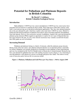
D.V. Lefebure
R. Lett and R. Smyth
G. Owsiacki and G. Payie
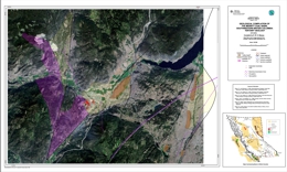
N.W.D. Massey
GeoFile 2000-9 is a geological compilation of the Merritt Coal Basin located in southwestern British Columbia. This covers tertiary geology (NTS 92I/2) at a 1:50 000 scale.
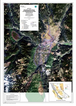
N.W.D. Massey
N.W.D. Massey
GeoFile 2000-11 is a series of 1:3 000 000-scale compilation maps of mineral and energy resources in the Hecate Strait and Queen Charlotte Sound.
R. Lett and W. Jackaman
British Columbia has abundant and widely varied, untapped mineral and coal resources. The provincial government is committed to developing these resources — the goal is to make British Columbia the most attractive jurisdiction in Canada for exploration and mining.
R.T. Walker
View GeoFile 2000-13 (PDF, 30 KB)
This report was originally published by the author on the East Kootenay Chamber of Mines (EKCM) website in 1999. Archival reference to the original paper is available through on The WayBack Machine website.
1999
B.N. Church and L.D. Jones
The Bridge River mining camp is known principally for gold-quartz mineralization. The ore veins occur on major fault zones in belts of elongated serpentinite bodies flanked by granitic plutons. The Bridge River camp encompasses five former mines including two large gold producers, Bralorne and Pioneer; three small producers, Wayside, Minto and Congress and more than 60 surrounding mineral prospects. This report outlines the geology of the region, gives synoptic descriptions of the main mineral deposits and provides production and resource tables.
Originally created as a web article in 1999, this document was re-released, with slight modifications, as a GeoFile in 2019.
1998
Beginning in the mid-1800s, with the coal mines on Vancouver Island and the placer gold camps of the Cariboo, British Columbia (BC) has become one of the world's major mining regions. Today, BC is known for its high quality metallurgical coal, its giant open pit copper-molybdenum and copper-gold porphyry deposits, the world-class Sullivan lead-zinc mine, and the more recently discovered spectacular Eskay Creek silver-gold deposit.
G.E. Ray
1997
B.N. Church and L.D. Jones
The Greenwood mining camp comprises more than 25 former mines, including the Phoenix mine, an open pit copper-gold skarn deposit, and similar smaller producers such as Mother Lode, Oro Denoro, and Greyhound, several significant polymetallic vein deposits, and more than 120 surrounding mineral prospects. The region is underlain principally by large Mesozoic and Tertiary granitic plutons that were intruded into the Proterozoic pericratonic Monashee complex, and accreted Paleozoic and Mesozoic oceanic and arc rocks of the Slide Mountain and Quesnel terranes. These terranes were delaminated from the oceanic lithosphere and stacked against the continental margin of the North America craton by the mid-Jurassic. Overprinting by Cretaceous Laramide and post-Laramide Tertiary transtensional structures has complicated the geology. The combination of igneous intrusion, limestone strata, and mineralization is repeated frequently throughout the camp, and there is little question that intrusion of the Jurassic and Cretaceous granitic plutons provided not only the thermal engine driving circulation of mineralizing solutions to produce pyrometasomatic and porphyry-type deposits but that these intrusions also provided the structural setting for the development of many vein fissures. A linear lead isotope relationship that connects diverse deposit-types in the area appears to be the result of fluid mixing within a well-connected hydrothermal plumbing system. Current exploration is focused on some of the oldest and youngest assemblages in the Greenwood area. Units of the Slide Mountain terrane, such as the Paleozoic Knob Hill and Attwood groups, hold promise for the discovery of stratiform polymetallic VMS-type deposits. Tertiary mineralization includes epithermal Au-Ag veins, sulphur-poor silica sinter deposits, and Carlin-type deposits with bulk tonnage potential. The Phoenix ore body is locallized by faulting, the footwall argillite and impurity of the overlying limestone. Lode mineralization was first recorded near Greenwood in 1884 and major deposits of copper and gold have been mined here since the turn of the century. Most of the mineral production from the Greenwood mining camp is from copper-bearing skarn deposits and, to a lesser extent, polymetallic quartz veins and, less commonly, copper-gold porphyry deposits. Production to date from the 26 principal mines in the area stands at 32,044,173 tonnes of ore consisting of 38,278 kilograms of gold, 183,102 kilograms of silver, 270,945 tonnes of copper, 966 tonnes of lead, and 329 tonnes of zinc.
Originally created as a web article in 1997, this document was re-released, with slight modifications, as a GeoFile in 2019.
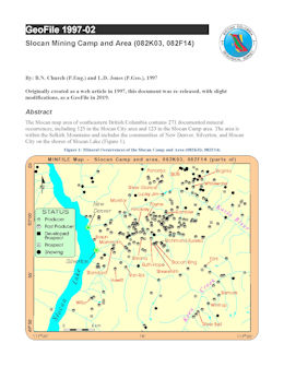
B.N. Church and L.D. Jones
The Slocan map area of southeastern British Columbia is one of the oldest mining camps in the province. Containing 271 documented mineral occurrences, the camp flourished in the early 1900s, and has continued to produce intermittently ever since. Silver-lead-zinc ores are predominant and can be characterized as gold-silver or silver-gold with minor lead-zinc mineralization. Slocan is one of the areas in British Columbia where small-scale mining remained viable for many years because of the richness of the ores. In the Slocan City area, more than half of the 125 occurrences were mineral producers, and 13 mines produced more than 1 million grams of silver. The Ottawa, Enterprise, Arlington, and Molly Gibson mines have each produced more than 30 million grams of silver plus significant amounts of lead and zinc.
Originally created as a web article in 1997, this document was re-released, with slight modifications, as a GeoFile in 2019.
1996
Abstracts for presentation at the 1996 Cordilleran Roundup Short Course.
- Making Models Matter - Mike Etheridge, Etheridge, Henley & Williams
- British Columbia Mineral Deposit Profiles - David Lefebure, British Columbia Geological Survey
- Characteristics of Gold Skarns - Gerry Ray, British Columbia Geological Survey
- Recent Refractory Gold Discoveries on the Carlin Trend, Nevada - David Groves, Newmont Exploration Limited
- Carlin-type Gold Deposits: Canadian Potential? - Howard Poulsen, Geological Survey of Canada
- Sediment-hosted Stratiform Copper - Rod Kirkham, Geological Survey of Canada
- Sedex Pb-Zn Deposits: Creating a Framework for Understanding and Using Hydrothermal Alteration as an Exploration Guide - Bob Turner, Geological Survey of Canada
- Genesis of Carbonaceous Shale-hosted Ni-Mo-PGE Deposits - Wayne Goodfellow, Geological Survey of Canada, Helmut Geldsetzer, Geological Survey of Canada, Ken Pride, Cominco Exploration, Tom T.Uyeno, Geological Survey of Canada and D. Conrad Gregoire, Geological Survey of Canada
- Irish-type Carbonate-hosted Pb-Zn Deposits - Godfrey Walton, Hemlo Gold Mines Inc.
- Prairie-type, Sedimentary Au-Ag-Cu - Hugh Abercrombie, Geological Survey of Canada
- The Dublin Gulch Intrusive-Hosted Gold Deposit - Hans Smit, Consultant
- Intrusion-related Gold and Base Metal Mineralization Associated with the Early Cretaceous Tombstone Plutonic Suite, Yukon and East-Central Alaska - Jim Mortensen, University of British Columbia
- Porphyry Copper and Related Gold Mineralization in the Sulphurets District of Northwestern British Columbia - Implications for Intrusion-related Gold Exploration - Jake Margolis, Homestake Mining Company
- Red Mountain, Northwestern British Columbia: Auriferous Pyrite Stockworks in a Zoned Subvolcanic Porphyry-Like System - David Rhys, Consultant and former Lac Minerals staf
- Mesothermal Gold-Quartz Vein Deposits in Oceanic Terranes of the British Columbia Cordillera - Chris Ash, British Columbia Geological Survey, R.W.J. Macdonald, MDRU, University of British Columbia and P.R. Reynolds, Dalhousie University
- The Snip and Johnny Mountain Gold Mines: Early Jurassic Intrusive-related Vein Deposits, Iskut River Area, Northwestern British Columbia - David Rhys, Consultant
- Intrusion-related Au-(Ag-Cu) Pyrrhotite Veins - Dani Alldrick, British Columbia Geological Survey
- The Eskay Creek Mine: A Precious Metal-rich Clastic Sulphide-Sulphosalt Deposit - Tina Roth, MDRU, University of British Columbia/Homestake Canada Inc.
- Shallow Submarine Hot Spring Deposits - Mark Hannington, Geological Survey of Canada
- Magmatic Contributions to Seafloor Deposits: Exploration Implications of a High Sulphidation VMS Environment - John F.H. Thompson, MDRU, University of British Columbia, R.H. Sillitoe, Consulting Geologist and M.D. Hannington, Geological Survey of Canada
- Subvolcanic Au-Ag-Cu Mineralization: Transitions Between Porphyry Copper and Epithermal Environments - Andre Panteleyev, British Columbia Geological Survey
- Wrangellia - a New Ni-Cu Metallogenetic Terrane - Larry Hulbert, Geological Survey of Canada and Rob Carne, Archer, Cathro and Associates
- Sediment-hosted Magnesite Deposits - George Simandl, British Columbia Geological Survey
- Ernest Henry-Type Cu-Au-Magnetite Deposits in the Proterozoic - Mike Etheridge, Etheridge, Henley & Williams
- Olympic Dam-type Fe-Cu-Au-U-LREE Deposits - Murray Hitzman, White House Office of Science and Technology Policy
- Selected Deposit Profiles - Dani Alldrick, David Lefebure and Don MacIntyre, British Columbia Geological Survey

